The instrument's own words
page 1
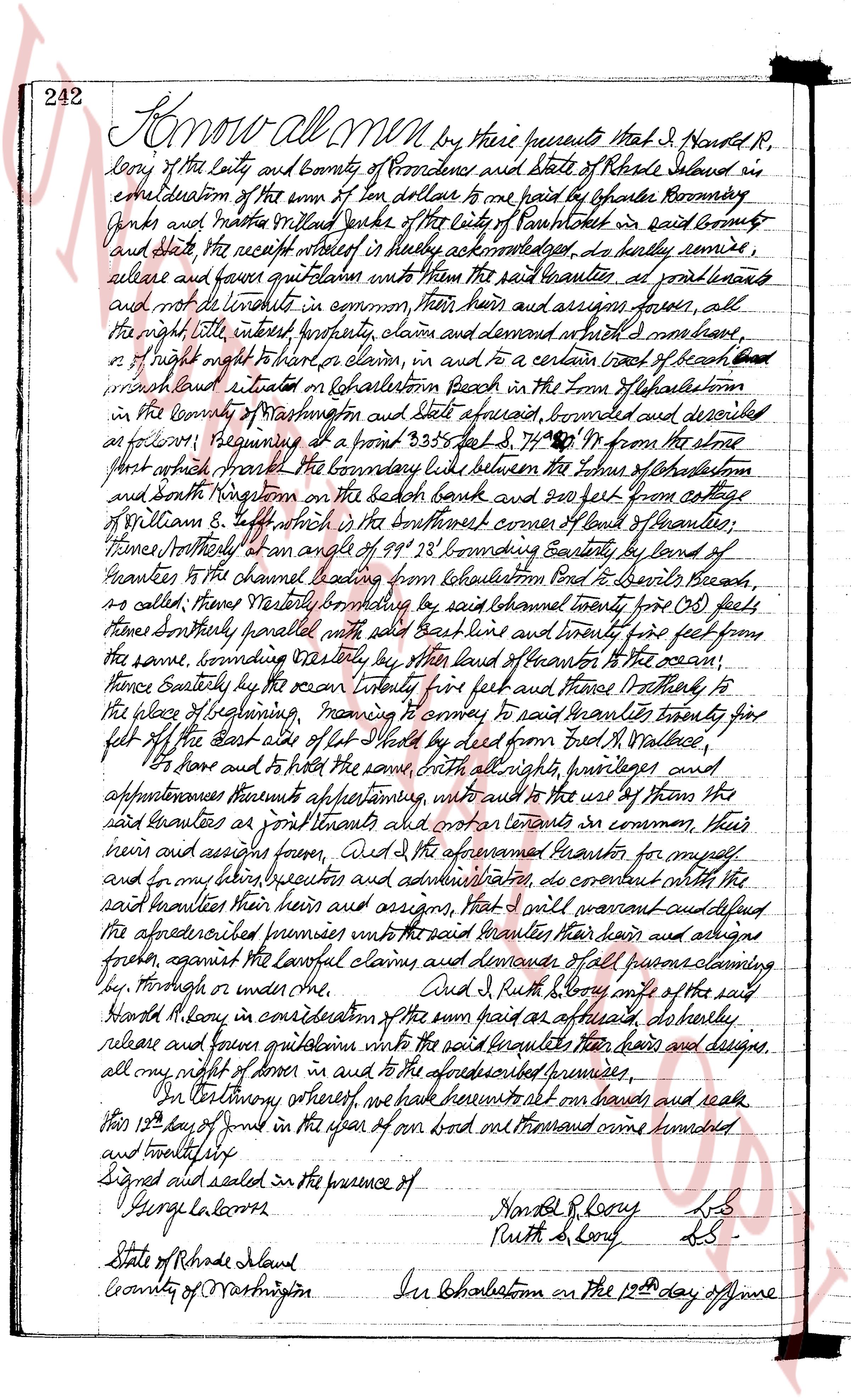
242 Know all men by these presents that I, Harold R,
levy of the City and County of Providence and State of Rhode Island in
consideration of the sum of ten dollars to me paid by Chapter Rommery
Funds and Martha Willard Burke of the City of Pawtucket in said County
and State the receipt whereof is hereby acknowledged, do hereby remise,
release and forever quitclaim unto them the said Grantees at present and
forever and not to hold in common, their heirs and assigns forever, all
the right title interest property claim and demand in and their heirs,
or right might or right to claim, in and to a certain tract of beach land
which land situated on Kealshalton Beach in the Town of Kealshalton
in the County of Washington and State aforesaid, bounded and described
as follows: beginning at a point 9.335 feet S 74° 19' W from the stone
post which marks the boundary line between the Town of Kealshalton
and South Kingstown on the beach bank and 200 feet from cottage
of William S. Bennett south by the northwest corner of land of Grantees,
thence Northerly on an angle of 99° 33' bounding Eastly by land of
Grantees to the channel beating from Kealshalton Point to Beards beach,
so called; thence Westerly bounding by said channel twenty five (25) feet
thence Southerly parallel with said beach line and twenty five feet from
the same, bounding Easterly by the land of Beards to the ocean;
thence Easterly by the ocean twenty five feet and thence Northerly to
the place of beginning meaning to convey to said Grantees twenty five
feet off the east side of lot sheet 2 dead from Reed R. Wallace,
to have and to hold the same with all rights privileges and
appurtenances thereunto appertaining, without any use by them the
said Grantees as joint tenants and not as tenants in common, their
heirs and assigns forever, and I the aforesaid Grantor for myself
and in my heirs executors and administrators, do covenant with the
said Grantees their heirs and assigns, that I will warrant quietland
the aforesaid premises unto the said Grantees their heirs and
heirs, against the lawful claims and demands of all persons claiming
by, through or under me.
Signed, sealed and delivered in the presence of
George L. Lanoise
State of Rhode Island
County of Washington
Harold R. Lanoise L.S.
Ruth B. Lanoise L.S.
In Kealshalton on the 10th day of June
page 2
243
AD 1924 before me personally appeared Harold R. Lory and Ruth J. Lory
to me known, and known by me to be the parties executing the foregoing
instrument, and they acknowledged said instrument be their free act and deed.
George G. Coons
Notary Public
Received for record June 19, 1924 at 9-20 o'clock am
and recorded by George G. Coons Town Clerk
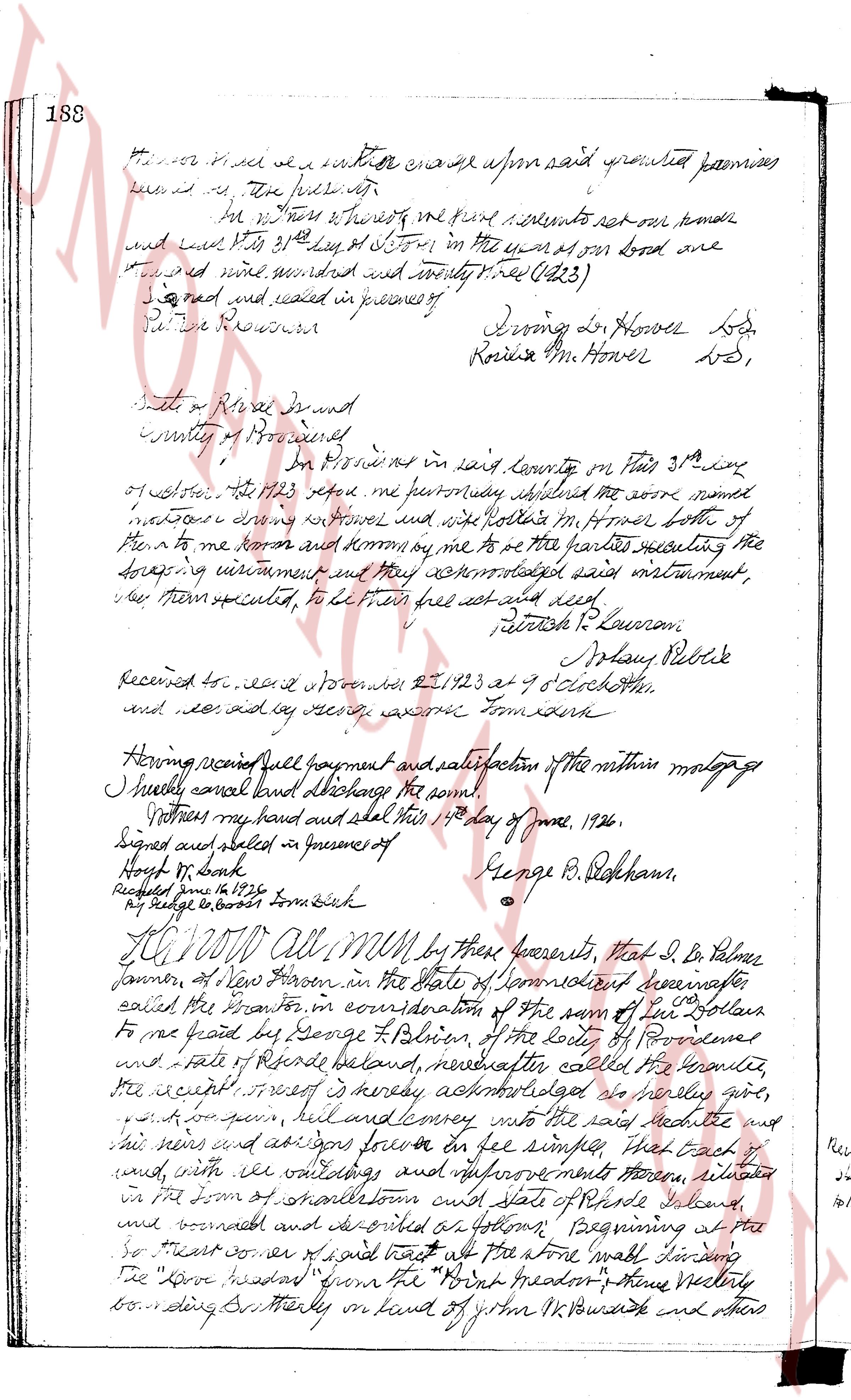
Know all men by these presents, that J. Irving L.
Atves, of Providence, in the county of Providence, in the State of Rhode
Island hereinafter called the grantor in consideration of ten ($10) dollars
and other considerations to me paid by Elmer N. Darling of Pawtucket,
in the county of Washington in said state, hereinafter called the
grantee the receipt of which is hereby acknowledged, do hereby give
grant bargain sell and convey unto the said grantee all his
heirs and assignses forever, Three lots of parcels of land, with
any buildings all improvements thereon, situated in Enumerating
in the town of Johnston, in the State of Rhode Island, bounded and
described as follows: 1. That lot of land set out and
delineated as lot No 17 (seven) on that plat entitled "Plat of cottages
sites on H.N. Poundridge Property Johnston, East Beach, 875" surveyed
surveyor may 1911 and recorded in the records of land Evidence in
said town before Oct 18 at page 46, said lot bounds
Northerly on a road on which it measure one hundred (100) feet,
and bounding that with other bounds Easterly to cobblestone Pond so called,
bounding northerly on lot no 18 (eighteen) of said plat five hundred
twenty (520) feet more or less, and Northerly on lot no 4 (four) of
said plat two hundred fourteen (214) feet more or less, and bounds
otherwise formerly described but describe the same premises conveyed to
Irving L. Atves by deed from H. N. Poundridge dated May 16, 1914 and
recorded in said records on Oct 18 at page 49. 2. Commencing
at the north easter corner of the lot of land herein described, adjoining land
of the states North east on the North side of the highway bounding, trace
Northerly on land and with land of Israel S. Lyly (50) feet Thence Easterly by
and with land now or then of R. B. Oldnight fifty (50) feet Thence West
Southerly by and with other land of said Israel S. Lyly (50) feet to a point
which is on the Northerly side of said highway, thence westerly by and with the
Southerly side of said highway fifty (50) feet to the point and place of
The page as recorded