The instrument's own words
page 1
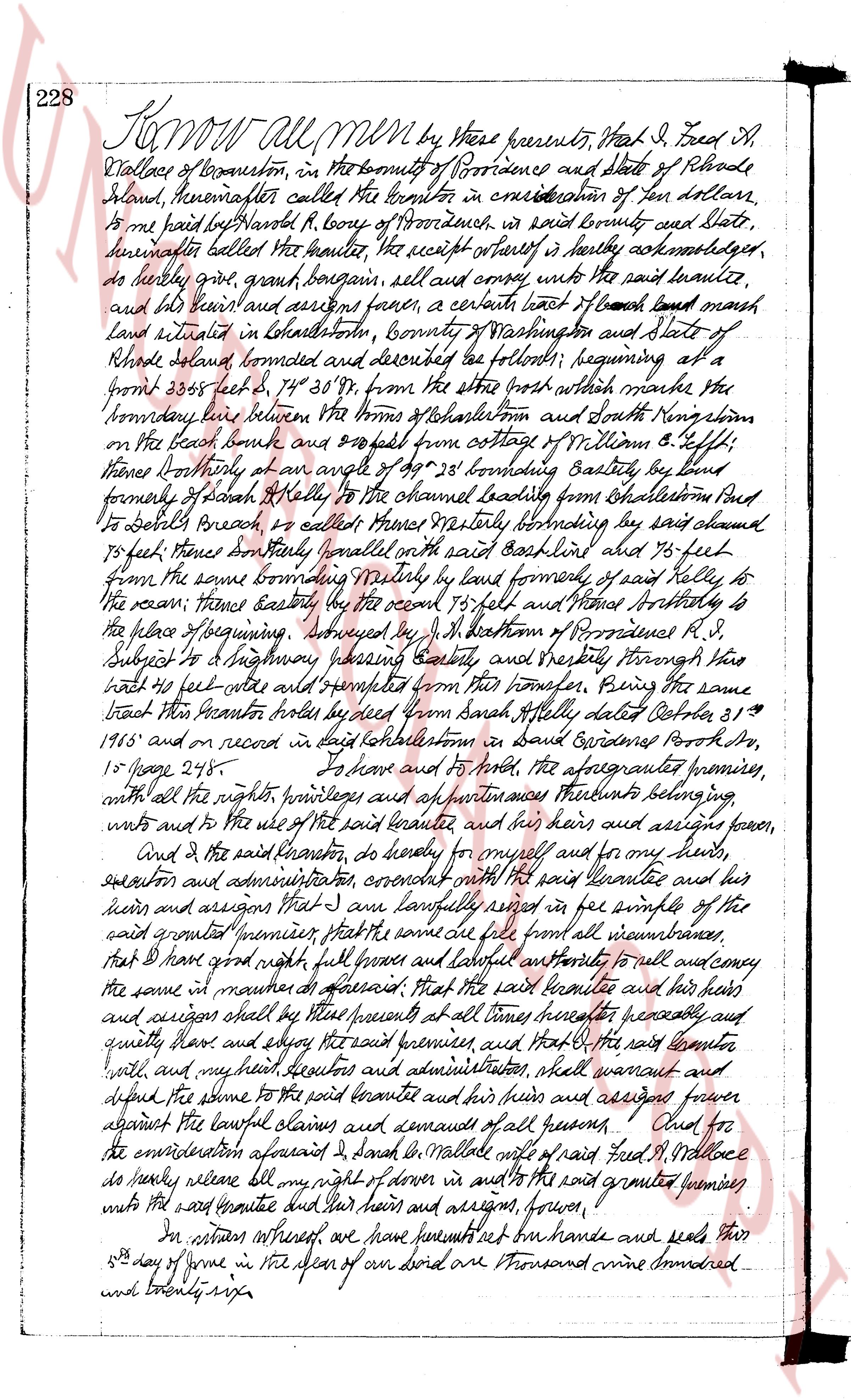
228 Know all men by these presents, that I, Fred H.
Wallace of Westerly, in the county of Providence and state of Rhode
Island, hereinafter called the grantor in consideration of ten dollars,
to me paid by Harold R. Lovey of Providence, in said county and state,
hereinafter called the grantee, the receipt whereof is hereby acknowledged,
do hereby grant, bargain sell and convey unto the said grantee,
and his heirs and assigns forever, a certain tract of beach land marsh
land situated in Westerly, county of Providence and state of
Rhode Island, bounded and described as follows: beginning at a
stone bound 355 feet S 74° 30' W from the shore beach which marks the
boundary line between the towns of Westerly and North Kingstown
on the beach brook and 200 feet from cottage of William G. Effie
thence southeasterly at an angle of 49° 28' bounding Eastly by land
formerly of Sarah A. Kelly to the channel boundary from Westerly bound
to South Beach brook as added thence Northeasterly bounding by said channel
to 50 feet thence southeasterly parallel with the said baseline and 76 feet
from the same bounding Northly by land formerly of said Kelly to
the ocean thence easterly by the ocean 153 feet and Northly easterly to
the place of beginning. Surveyed by J. H. Bottom of Providence R.I.
subject to a highway passing easterly and Northeasterly through said
tract 40 feet wide and exempted from this transfer. Being the same
tract that the Grantor holds by deed from Sarah Kelly dated October 21st
1865 and on record in said Westerly town in said Providence Prov No.
15 page 245. To have and to hold the aforementioned premises,
with all the rights, privileges and all appurtenances thereunto belonging
unto and to the use of the said grantee and his heirs and assigns forever.
And I the said grantor, do hereby for myself and for my heirs,
executors and administrators covenant with the said grantee and his
heirs and assigns that I am lawfully seized in fee simple of the said
grant aforesaid premises, that the same are free from all incumbrances
that I have good right full power and lawful authority to sell and convey
the same in manner aforesaid That the said grantee and his heirs and
assigns shall by these presents at any time hereafter peaceably and
quietly have and enjoy the said premises and that I the said grantor
will and my heirs executors and administrators, shall warrant and
defend the same to the said grantee and his heirs and assigns forever
against the lawful claims and demands of all persons. First for
the consideration aforesaid I, Harold R. Lovey with said Fred H. Wallace
do hereby release all my right of dower in and to the said granted premises
unto the said grantee and his heirs and assigns, forever.
In witness whereof we have set our hands and seals this
23 day of June in the year of our Lord one thousand nine hundred
and twenty six.
page 2
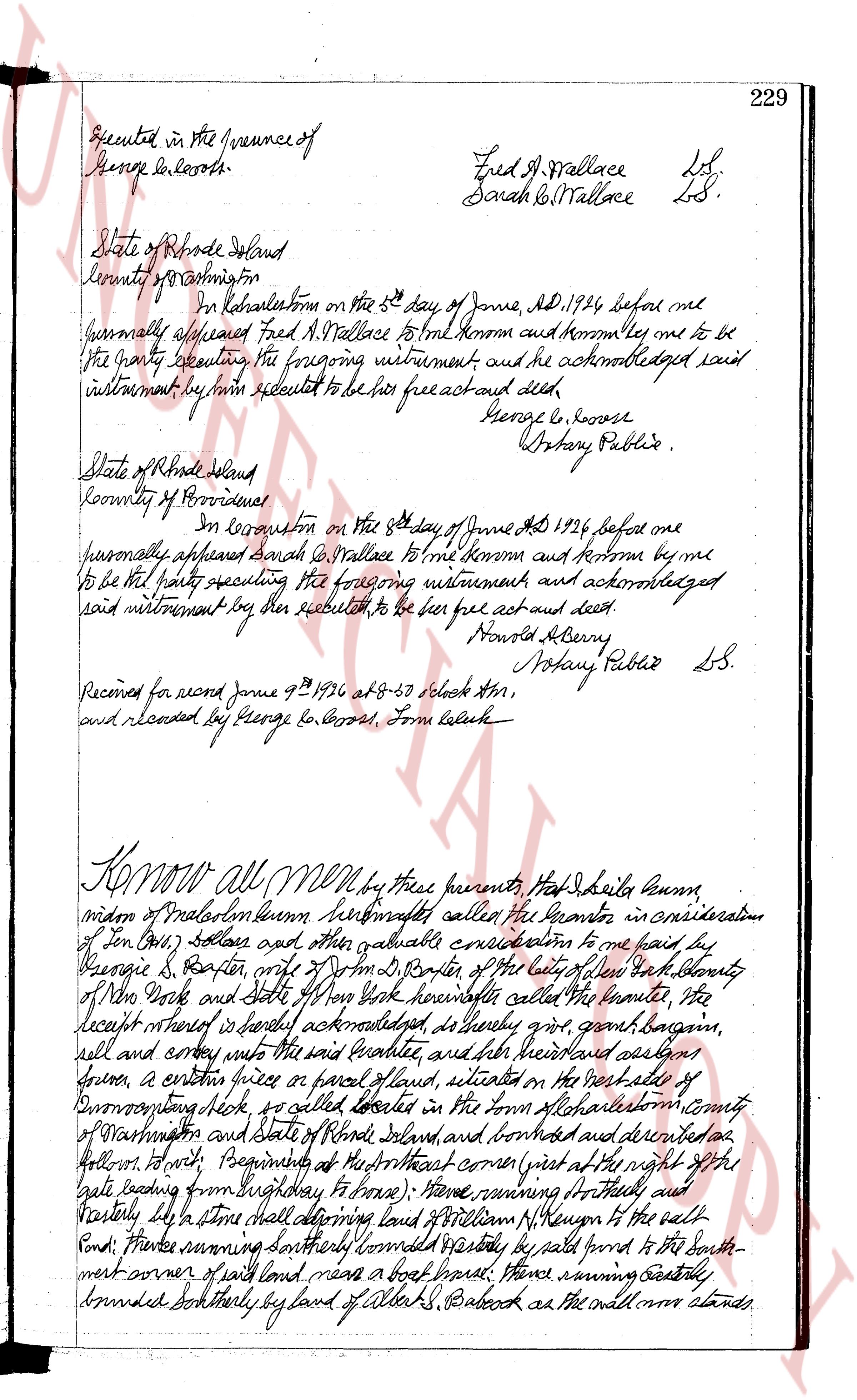
Executed in the presence of
George E. Cozart.
Fred W. Wallace L.S.
Sarah B. Wallace L.S.
State of Rhode Island
County of Washington
In Narragansett on the 5th day of June AD 1926 before me
personally appeared Fred W. Wallace to me known and known by me to be
the party executing the foregoing instrument and he acknowledged said
instrument by him executed to be his free act and deed.
George E. Cozart
Notary Public.
State of Rhode Island
County of Providence
In Providence on the 6th day of June AD 1926 before me
personally appeared Sarah B. Wallace to me known and known by me
to be the party executing the foregoing instrument and acknowledged
said instrument by her executed to be her free act and deed.
Harold Berry
Notary Public L.S.
Received for record June 9 1926 at 8-30 o'clock AM,
and recorded by George E. Cozart, Tom Clerk.
KNOW ALL MEN by these presents that I Ida Idella Bunn,
widow of Malcolm Bunn, hereinafter called the Grantor in consideration
of 1.00 dollar and other valuable consideration to me paid by
George S. Baxter, wife of John D. Baxter of the city of New York identity
of New York State and State of New York hereinafter called the Grantee, the
receipt whereof is hereby acknowledged, do hereby grant, convey, bargain,
sell and convey unto the said Grantee, and her heirs and assigns forever,
a certain piece or parcel of land, situated on the east side of
Cummings highway, so called located in the Town of Charlestown county
of Washington and State of Rhode Island, and bounded and described as
follows. North Beginning at the northeast corner first at the right the
said boundary running Southeastly to fence; then running Straight and
Easterly to a stone that defines land of William P. Kenyon to the salt
Pond; thence running southerly bounded easterly by said pond to the south-
west corner of said land meas a boat road; thence running easterly
bounded southerly by land of Albert S. Babcock as the entire map shows.
The page as recorded