The instrument's own words
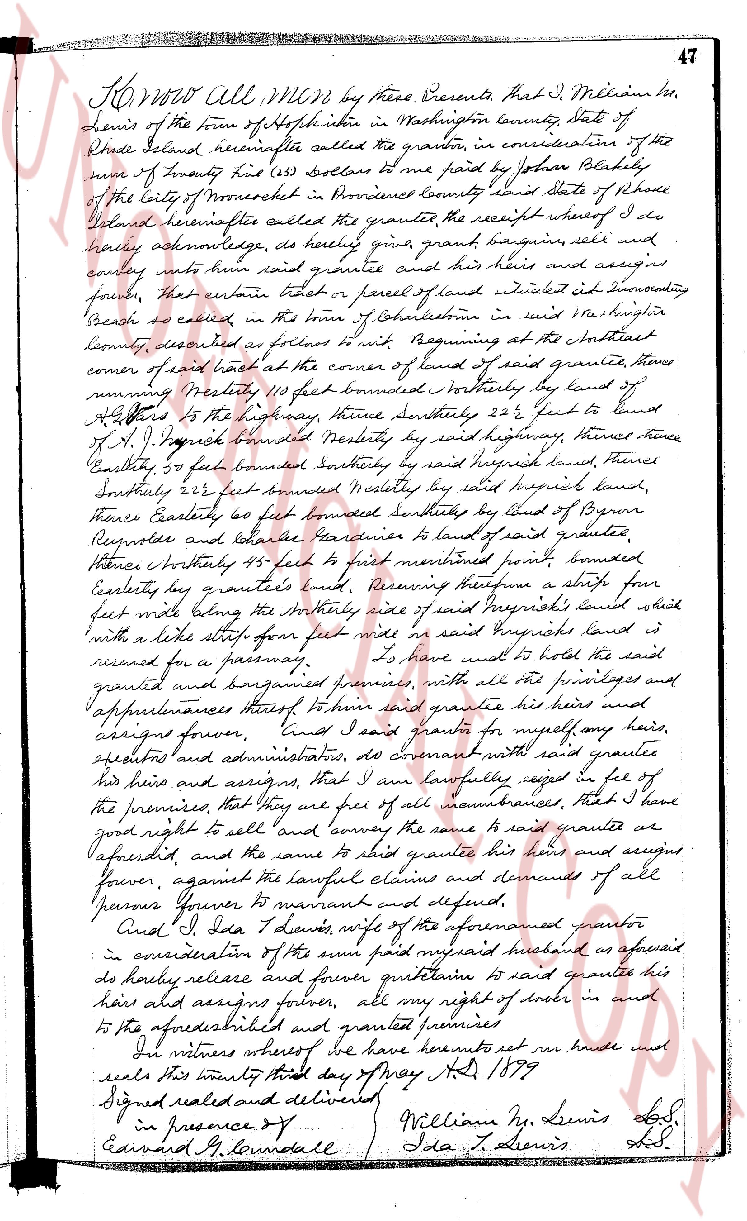
page 1
KNOW ALL Men by these Presents, that I J. Millian hr,
Lewis of the town of Hopkinton in Washington County State of
Rhode Island hereinafter called the grantor, in consideration of the
sum of twenty five (25) dollars to me paid by John Blackley
of the city of Providence in Providence County in this State of Rhode
Island hereinafter called the grantee receipt whereof I do
hereby acknowledge, do hereby give, grant, bargain, sell and
convey unto him said grantee and his heirs and assigns
forever, that certain tract or parcel of land situated at IEnumerator
Beach as called, in the town of Colchester in said Washington
County, described as follows: Beginning at the Northeast
corner of said beach at the corner of land of said grantee, thence
running Northerly 110 feet bounded Northerly by land of
S. [illegible] to the highway, thence Southeasterly 22 1/2 feet to land of
S. J. [illegible] bounded Southeastly by said highway, thence thence
Easterly 30 feet bounded Southeasterly by said [illegible] land, thence
Southerly 212 feet bounded Westerly by said [illegible] land, thence
Easterly 60 feet bounded Southeasterly by land of B. [illegible]
Reynolds and [illegible] boundaries to land of said grantee,
thence Northerly 115 feet to feet mentioned point bounded
Easterly by said grantee's land, Reserving therefrom a strip four
feet wide along the Northerly side of said [illegible] land which
is with a like strip of four feet wide in said [illegible] land which is
reserved for a passway. TO have and to hold the said land
granted and bargained premises, with all the privileges and
appurtenances thereof to him said grantee his heirs and
assigns forever. And I said grantor for myself any heirs,
executors and administrators, do covenant with said grantee
his heirs and assigns, that I am lawfully seized in fee of
the premises, that they are free of all incumbrances, that I have
good right to sell and convey the same to said grantee as
aforesaid, and the same to said grantee his heirs and assigns
forever, against the lawful claims and demands of all
persons forever to warrant and defend.
And I, Ida L. Lewis, wife of the aforementioned grantor
in consideration of the sum paid my said husband as aforesaid
do hereby release and forever quitclaim to said grantee his
heirs and assigns forever, all my right of dower in and
to the aforesaid described and granted premises.
In witness whereof we have hereunto set our hands and
seals this twenty third day of May AD 1899
Signed sealed and delivered
in presence of
Edward G. Roundale
William N. Lewis L.S.
Ida L. Lewis L.S.
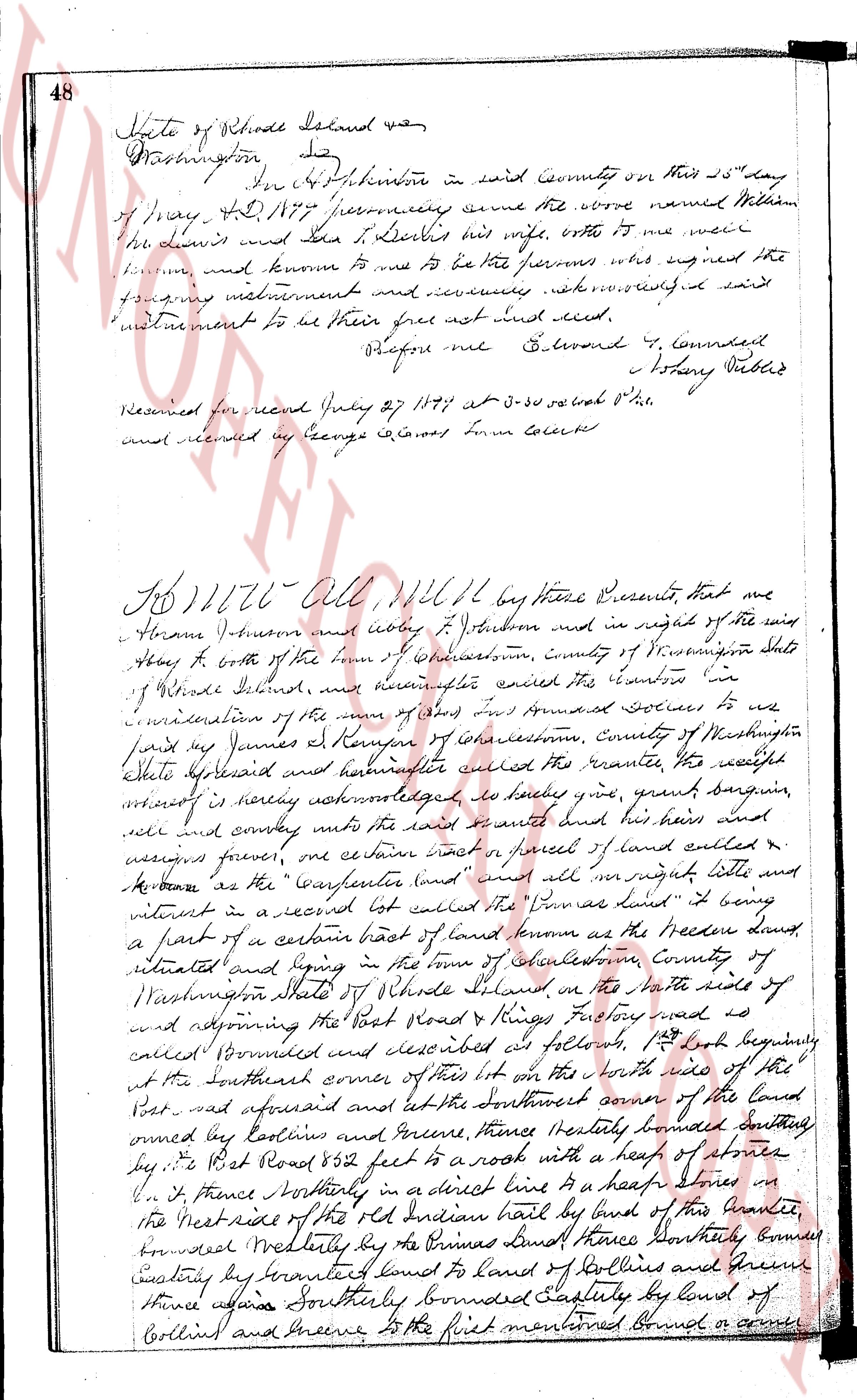
page 2
48 State of Rhode Island and
Washington
In Chulskimore in said County on this 23d day
of May AD 1777 personally came before me William
le Lewis and Jane L. Lewis his wife, who it me were
known and known to me to be the persons who signed the
following instrument and declared acknowledging said
instrument to be their free act and deed.
Before me G. Durand & Connoll
Notary Public
Received for record July 29 1777 at 3-30 o clock P.M.
and entered by George S. Cloves Town Clerk
No 1176—All of All by these Presents, that we
Abram Johnson and obey J. Johnson and in right of the said
Obey it both of the town of Chulskimore, County of Washington State
of Rhode Island, and hereinafter called the Grantors for
consideration of the sum of five hundred dollars to us
paid by James R. Kenyon of Chulskimore, County of Washington
State aforesaid and hereinafter called the Grantee, the receipt
whereof is hereby acknowledged do sell give grant bargain
sell and convey unto the said or some of aunt and heir and
assigns forever, one certain tract or parcel of land called &
known as the Carterhouse (and must all navigate little and
virtuous in a record book called the Townes land book) being
a part of a certain east of land known as the Heeder land,
situated and lying in the town of Chulskimore, County of
Washington State of Rhode Island on the North side of
and opposing the East Road & Kings Factory road as
called Boundred and described as follows, 1st book beginnly
at the southeast corner of this lot on the north side of the
Road said aforesaid and at the southeast corner of the land
owned by Collins and Greene, thence easterly bounded southerly
by the East Road 882 feet to a rock with a heap of stones
on, thence southerly in a direct line to a heap of stones on
the West side of the old Indian path by land of this family,
bounded westerly by the Primes Land thence southerly boundy
easterly by branched Land to land of Collins and Greene
thence again southerly bounded easterly by land of
Collins and Greene to the first mentioned Bound or corner
The page as recorded