The instrument's own words
page 1 · read by Gemma vision
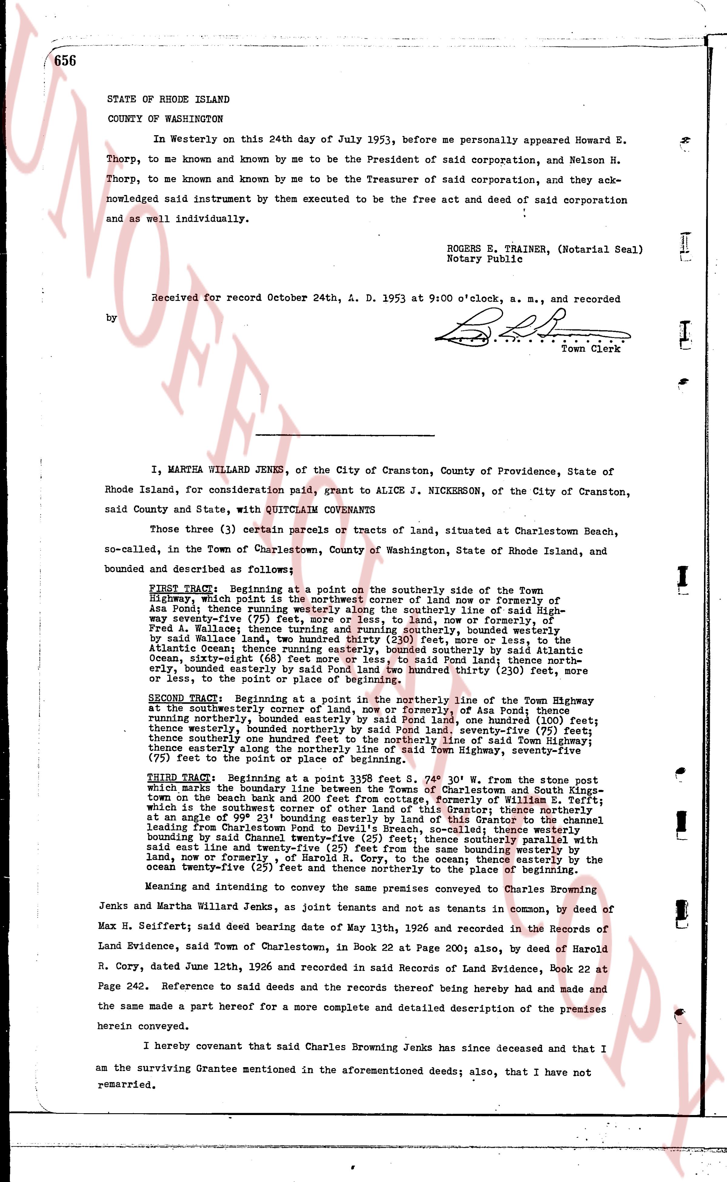
656
STATE OF RHODE ISLAND
COUNTY OF WASHINGTON
In Westerly on this 24th day of July 1953, before me personally appeared Howard E. Thorp, to me known and known by me to be the President of said corporation, and Nelson H. Thorp, to me known and known by me to be the Treasurer of said corporation, and they acknowledged said instrument by them executed to be the free act and deed of said corporation and as well individually.
ROGERS E. TRAINER, (Notarial Seal)
Notary Public
Received for record October 24th, A. D. 1953 at 9:00 o'clock, a. m., and recorded
by [Signature]
Town Clerk
I, MARTHA WILLARD JENKS, of the City of Cranston, County of Providence, State of Rhode Island, for consideration paid, grant to ALICE J. NICKERSON, of the City of Cranston, said County and State, with QUITCLAIM COVENANTS
Those three (3) certain parcels or tracts of land, situated at Charlestown Beach, so-called, in the Town of Charlestown, County of Washington, State of Rhode Island, and bounded and described as follows:
FIRST TRACT: Beginning at a point on the southerly side of the Town Highway, which point is the northeast corner of land now or formerly of Asa Pond; thence running westerly along the southerly line of said Highway seventy-five (75) feet; thence turning northerly into said land, now or formerly of Asa Pond; thence running northerly, bounded easterly by said Highway line, [?] feet more or less, to land, now or formerly of Fred A. Wallace; thence turning and running southerly, bounded westerly by said Wallace land, [?] feet more or less, to said Highway line, [?] feet more or less, to the Atlantic Ocean; thence running easterly, bounded southerly by said Atlantic Ocean, sixty-eight (68) feet more or less, to said Highway line; thence running northerly, bounded easterly by said Highway line, one hundred thirty (130) feet more or less, to the point of beginning of this tract.
SECOND TRACT: Beginning at a point in the northerly line of the Town Highway at the northeasterly corner of land now or formerly of Asa Pond; thence running northerly, bounded easterly by said Pond land, one hundred (100) feet; thence running northerly, bounded easterly by said Pond land, seventy-five (75) feet; thence turning westerly one hundred feet to the northerly line of said Town Highway; seventy-five (75) feet to the point of place or beginning.
THIRD TRACT: Beginning at a point in said 139.5 feet S 0° 30' W line from the stone post which marks the boundary line between the farms of Charlestown and South Kingstown on the beach bank and 200 feet from cottage, formerly of William E. Tefft; which is the northeast corner of the land now owned by the Grantor; thence northerly at an angle of 99° 21' bounding easterly by the land of said Tefft; thence running westerly from the Charlestown Pond to Devlin's Breach, so called; thence westerly bounding by said Chaunestown Pond, [?] feet; thence northerly part of the same bounding by said east line and twenty-five (25) feet from the same bounding westerly by land, now or formerly of Asa Pond, to the Atlantic Ocean; thence easterly by the ocean twenty-five (25) feet and thence northerly to the place of beginning.
Meaning and intending to convey the same premises conveyed to Charles Browning Jenks and Martha Willard Jenks, as joint tenants and not as tenants in common, by deed of Max H. Seiffert; said deed bearing date of May 13th, 1926 and recorded in the Records of Land Evidence, said Town of Charlestown, in Book 22 at Page 200; also, by deed of Harold R. Cory, dated June 12th, 1926 and recorded in said Records of Land Evidence, Book 22 at Page 242. Reference to said deeds and the records thereof being hereby made and had and the same made a part hereof for a more complete and detailed description of the premises herein conveyed.
I hereby covenant that said Charles Browning Jenks has since deceased and that I am the surviving Grantee mentioned in the aforementioned deeds; also, that I have not remarried.
page 2 · read by Gemma vision
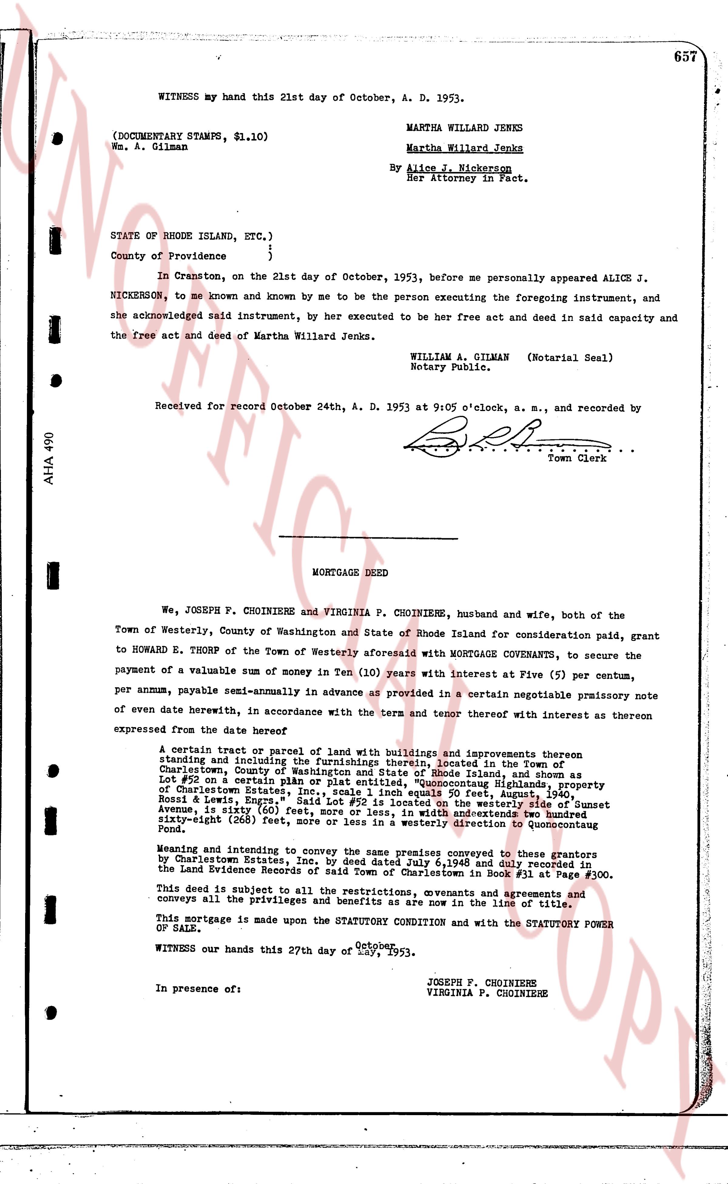
WITNESS my hand this 21st day of October, A. D. 1953.
(DOCUMENTARY STAMPS, $1.10)
Ms. A. Gilman
MARTHA WILLARD JENKS
Martha Willard Jenks
By Alice J. Nickerson
Her Attorney in Fact.
STATE OF RHODE ISLAND, ETC.)
County of Providence }
In Cranston, on the 21st day of October, 1953, before me personally appeared ALICE J. NICKERSON, to me known and known by me to be the person executing the foregoing instrument, and she acknowledged said and deed instrument, by her executed to be her free act and deed in said capacity and the free act and deed of Martha Willard Jenks.
WILLIAM A. GILMAN (Notarial Seal)
Notary Public.
Received for record October 24th, A. D. 1953 at 9:05 o'clock, a. m., and recorded by
[Signature]
Town Clerk
----
MORTGAGE DEED
We, JOSEPH F. CHOINIERE and VIRGINIA P. CHOINIERE, husband and wife, both of the Town of Westerly, County of Washington and State of Rhode Island consideration paid, grant to HOWARD E. THORP of the Town of Westerly aforesaid with MORTGAGE COVENANTS, to secure the payment of a valuable sum of money in Ten (10) years with interest at Five (5) per centum, per annum, payable semi-annually in advance as provided in a certain negotiable promissory note of even date herewith, in accordance with the term and tenor thereof with interest as thereon expressed from the date hereof
A certain tract or parcel of land with buildings and improvements thereon standing and including the furnishings thereon, located in the Town of Charlestown, County of Washington and State of Rhode Island and described as Lot #29 on a certain plan or plat, entitled "Quoonocutaug Highlands, property of Charlestown Estates, Inc., scale 1 inch equals 50 feet, August, 1940", said lot being bounded on the north by Lot #28, on the west by Sunset Avenue, is sixty (60) feet, more or less, in width and westwards two hundred sixty-eight (268) feet, more or less, in length, generally easterly direction to Quoonocutaug Pond.
Meeting and intending to convey the same premises conveyed to us by Charlestown Estates, Inc. by deed dated July 6,1948 and duly recorded in the Land Evidence Records of said Town of Charlestown in Book #31 at Page #300.
This deed is subject to all the restrictions, covenants and agreements and conveys all the privileges and benefits as are now in the line of title.
This mortgage is made upon the STATUTORY CONDITION and with the STATUTORY POWER OF SALE.
WITNESS our hands this 27th day of October, 1953.
JOSEPH F. CHOINIERE
VIRGINIA F. CHOINIERE
In presence of:
The page as recorded