The Deed Walker · From Ninigret · Charlestown, Rhode Island land evidence, 1738 to today
Trail: 13214 › 13214

11/10/1760 · SURVEY · book 2 page 36 doc 13214

From STANTON JOSEPH JR life
To ?
Premises 234, 244, 236 Acres · Lots 1, 2, and 3 laid out by Joseph Wanton (Wood River, Pawtucket River, Great Swamp land, Charlestown)
Also on this page: RELEASE HAZARD HANNAH M EST · RELEASE MUNRO ARTHUR E EST

Back — where this land came from

This instrument states no source of title that we have read yet.

Forward — where this land went

⛔ The record we hold stops here: no later instrument we have read cites this one, and no later conveyance by the grantee is linked by name. Colonial deeds rarely cite book and page; the land is followed by its bounds and its abutters from here. The index is complete to 1987, so the gap is in the words: deeds of this era seldom cite book and page, and only about half the instruments of 1936-1965 have been transcribed (some 6,000 were never imaged), so a citation to this deed may sit in a page not yet read.

The instrument's own words

page 1
(36) Wood River Pawtucket River the Great Swamp land 234 Acres John Trye's Lott No. 2 No. 3 George Wantons Lott 244 Acres No. 1 Joseph Wantons Lott 236 Acres The above described Piece of Land was Layd out on the 18th day of December in the Year 1745 of the Common Era of the Majesty of King George the Second King of Great Britain Americae Domini 1745 by me Joseph Wanton Surveyr The above is a True Copy of a Draught of Land laid out by Joseph Wanton Survayr and now entered in the Book of Records for the Town of Charlestown November the 16th 1765 py Joseph Corndall Surveyor of the Colony 200 This Scale is in Hundred Rods Length

The page as recorded
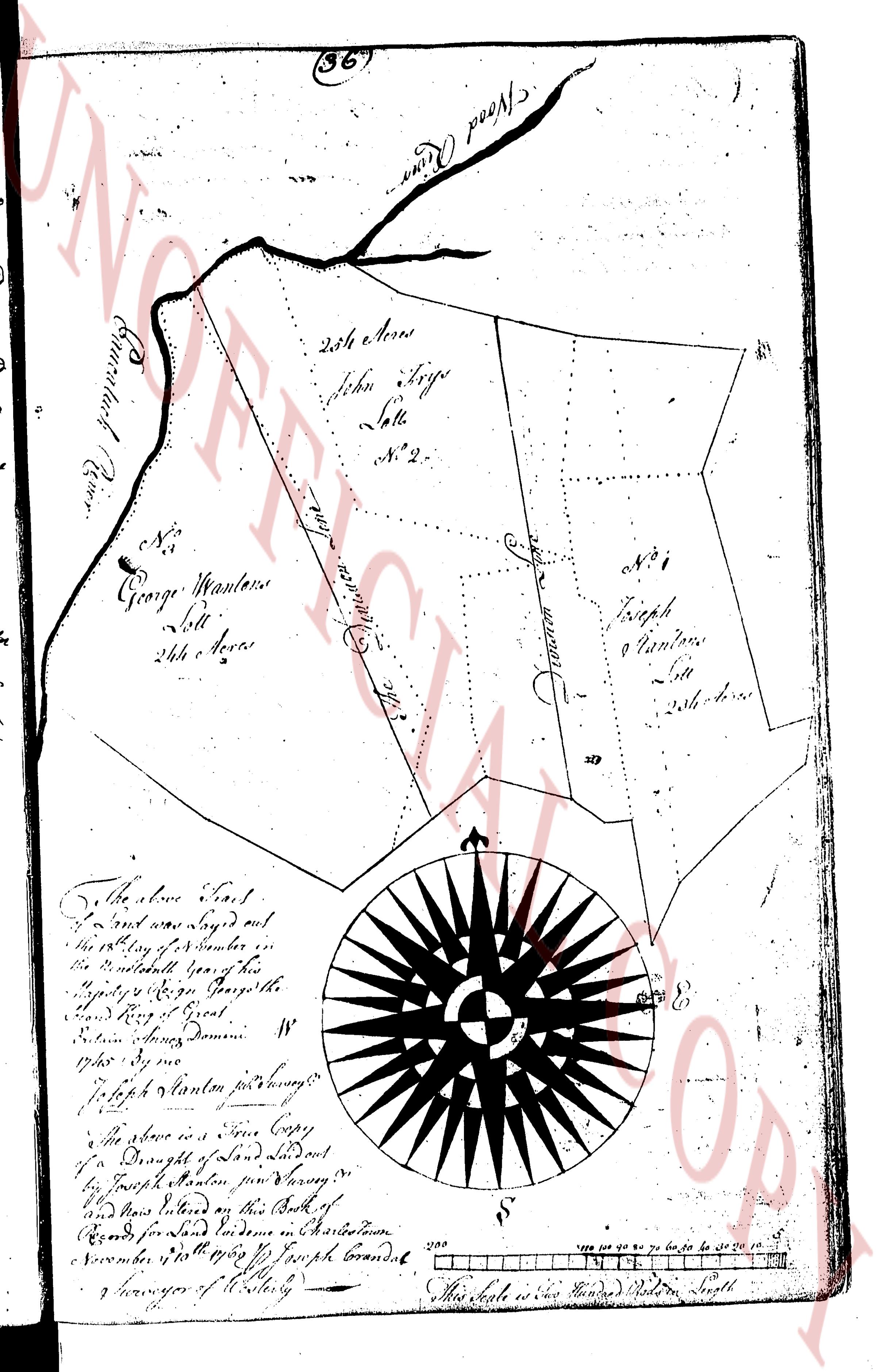
page 1

deed_walker_v1.9_2026-10-10 · the index is the town's own (i2l.uslandrecords.com); transcripts, chains and the assessor's cards are the Perry Machine's reading of it. Where the record we hold runs out, the page says so.