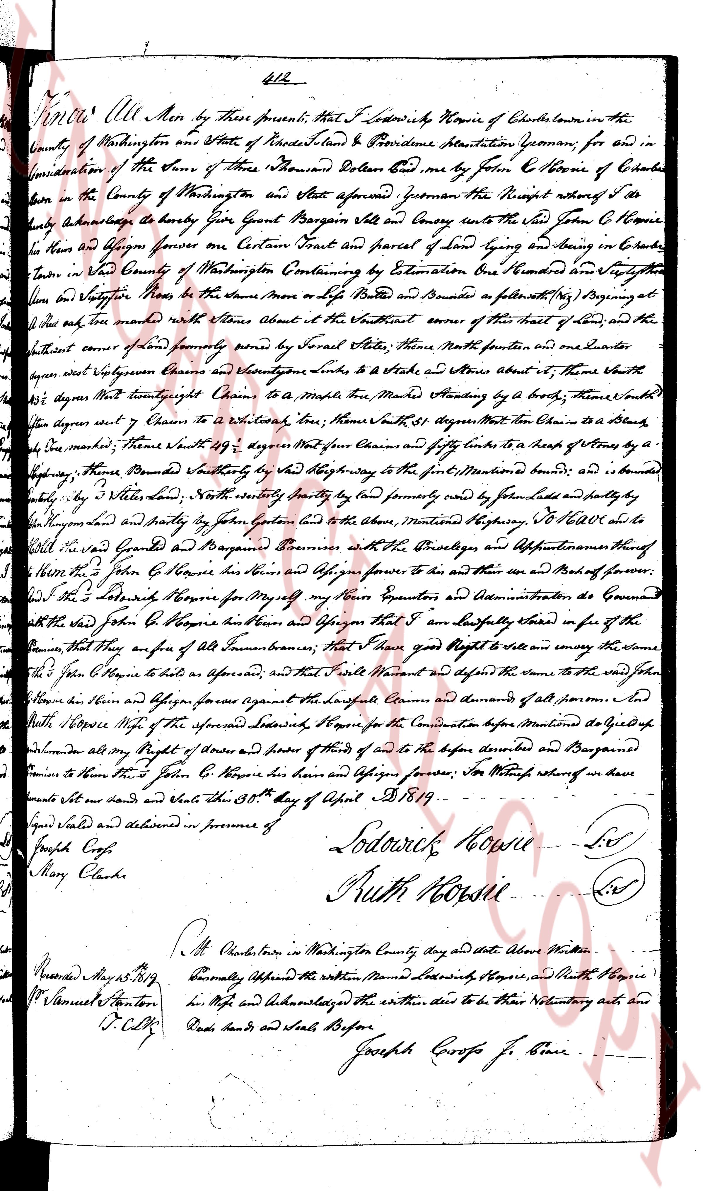
The instrument's own words
page 1
612
Know All Men by these presents, that I Lodowick Howes of Charlestown in the
County of Washington and State of Rhode Island & Providence Plantations Geoman; for and in
Consideration of the Sum of Three Thousand Dollars paid one by me John C. Howes of Charlestown
born in the County of Washington and State aforesaid Geoman the Receipt whereof I do
Hereby acknowledge to have Given Quite General Bargain Sale and Convey unto the said John C. Howes
the heir and Assigns forever one Certain Tract and parcel of land lying and situated in Charlestown
Town in the County of Washington Containing by Estimation One Hundred and Seventy five
Acres more or less (by the same more or less by Perches) and Bounded as follows (viz) Beginning at the
[illegible] mark tree made with the Stones about it at the Northeast corner of this tract of land, and the
thence Southeast course of land formed partly some by Several Stones, thence North posterior and easterly
upon West Vaughan's Corner and Seventy nine Links to a Stone and Stone about it, thence South
42 degrees West north east right Chain to a Maple tree Marked Heading by a bork, thence South
71 degrees west eight Chain to a White oak tree, thence South 31 degrees West four Chain to a Blea
by dead maple, thence South 71 degrees West four Chains and fifty Links to the North West corner of a
by [illegible], thence Northeast boundedly by the said Way leading to the point, bounded north and is bounded
by [illegible] by Water Land, thence Southeasterly by land formerly owned by John Hall and partly by
the Highway and partly by land former’s and the Above Mentioned Highway, to the [illegible] to be
all the said Grant and Bargain Premises with the Privileges, and Appurtenances thereof
to the said John C. Howes his heirs and Assigns forever to his and their use and behalf of forever.
I now the said Lodowick Howes for myself my heirs Executors and Administrators, do Covenant
that the said John C. Howes his heirs and Assigns that I am Seised lawfully and in fee of the
premises, that they are free of All Incumbrances burthens, that I have good Right to Sell and convey the same
to the said John C. Howes as aforesaid, and that I shall Warrant and defend the same to the said John
Howes his heirs and Assigns forever against the Lawful Claims and demands of all persons And
furthermore do release all my Right of Entry and claims of dower of heirs of and to before described and Bargained
to him the said John C. Howes his heirs and Assigns forever; In Witness whereof we have
hereunto set our Hands and Seals this 30th day of April 1819.
Signed Sealed and delivered in presence of
Lodowick Howes (L.S)
Ruth Howes (L.S)
Joseph Coose
Mary Clarke
At Charlestown in Washington County day and date Above Written
formally Appeared the within Named Lodowick Howes, and Ruth Howes
his Wife and Acknowledged the within deed to be their Voluntary acts and
Deeds hands and Seals Before
Joseph Coose J.P. Peace
Recorded May 15. 1819
by Samuel Stanton
D.C.C.C.
The page as recorded