The instrument's own words
page 1 · read by Gemma vision
682
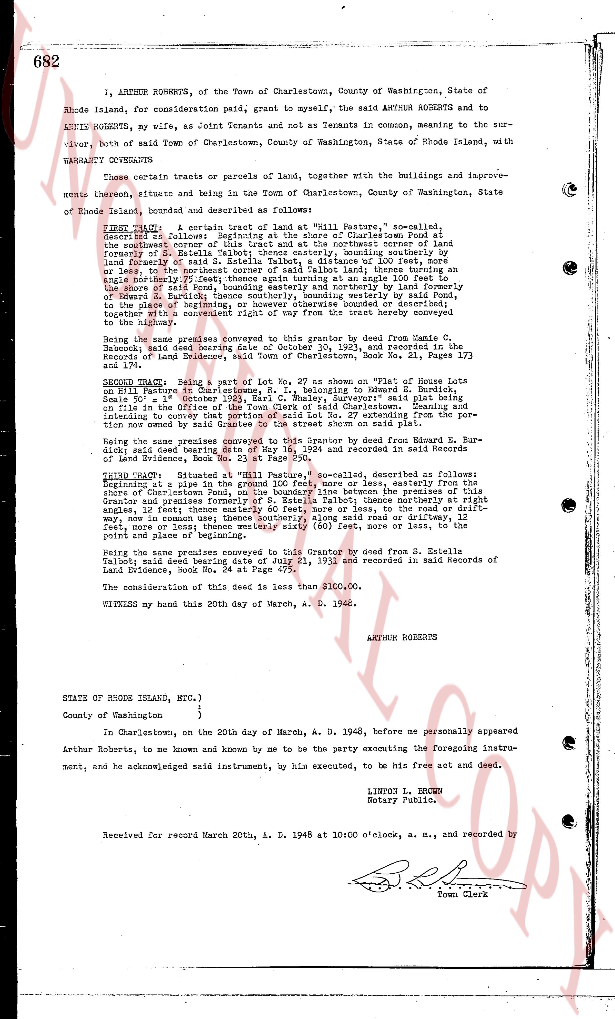
I, ARTHUR ROBERTS, of the Town of Charlestown, County of Washington, State of Rhode Island, for consideration paid, grant to myself, the said ARTHUR ROBERTS and to ANNIE ROBERTS, my wife, as Joint Tenants and not as Tenants in common, meaning to the survivor, both of said Town of Charlestown, County of Washington, State of Rhode Island, with WARRANTY COVENANTS
certain tracts or parcels of Lands, together with the buildings and improvements thereon, situate and lying in the Town of Charlestown, County of Washington, State of Rhode Island, bounded and described as follows:
FIRST TRACT: A certain tract of land at "Hill Pasture," so called, described as follows: Beginning at the shore of Charlestown Pond at the southeast corner of a lot conveyed to the northeast corner of land formerly of said S. Estella Talbot, thence easterly, easterly bounding sotherly on land formerly of said S. Estella Talbot, thence a distance of 100 feet, more or less to the northwest corner of a lot conveyed to said Talbot, thence turning an angle northerly 77 1/2 degrees, thence running an angle at the 100 feet to the northwest corner of a lot conveyed to said Talbot northerly by land formerly of Edward Z. Burdick, thence southerly, bounding westerly by said Pond, to the beginning of the premises, containing [?] acres, more or less, bounded or described, together with a convenient right of way from the road to the tract hereby conveyed to the highway.
Being the same premises conveyed to this grantor by deed from Jamie C. Babcock; said deed bearing date of October 30, 1923, and recorded in the Records of Land Evidence, said Town, volume Book No. 21, Pages 173 and 174.
SECOND TRACT: Being part of Lot No. 1, shown on Plat No. 1 House lots on the western side of Main Street, i. e., belonging to Edward Z. Burdick, Scale 50' = 1" October 1923, Earl C. Whaley, Surveyor' said plat being on file in the Office of the Town Clerk of said Charlestown. Meaning and intending to convey a certain strip of land 50' x 57' extending from the plat line now owned by said Grantee to the street shown on said plat.
Being the same premises conveyed to this Grantor by deed from Edward E. Burdick said deed bearing date of May 1, 1934 and recorded in said Records of Land Evidence, Book No. 23 at Page 250.
THIRD TRACT: Situated at "Hill Pasture," so called, described as follows: Beginning at a pole in the road, thence south 40 west, more or less, easterly along the shore of Charlestown Pond, on the boundary line between the premises of this Grantor and premises of S. Estella Talbot, thence northerly, thence northerly at right angles, 12 feet; thence easterly 60 feet, more or less, to the road or driftway, more or less; thence northerly 12 feet, to said road or driftway, thence easterly 12 feet, more or less; thence westerly sixty (60) feet, more or less, to the point and place of beginning.
Being the same premises conveyed to this Grantor by deed from S. Estella Talbot, said deed bearing date of July 21, 1911 and recorded in said Records of Land Evidence, Book No. 24 at Page 475.
The consideration of this deed is less than $100.00.
WITNESS my hand this 20th day of March, A. D. 1946.
ARTHUR ROBERTS
STATE OF RHODE ISLAND, ETC.)
)
)
County of Washington
)
In Charlestown, on the 20th day of March, A. D. 1948, before me personally appeared Arthur Roberts, to me known and known by me to be the party executing the foregoing instrument, and he acknowledged said instrument, by his executed, to be his free act and deed.
LINTON L. BROWN
Notary Public.
Received for record March 20th, A. D. 1948 at 10:00 o'clock, a. m., and recorded by
[Signature]
Town Clerk
The page as recorded