The instrument's own words
page 1
169.
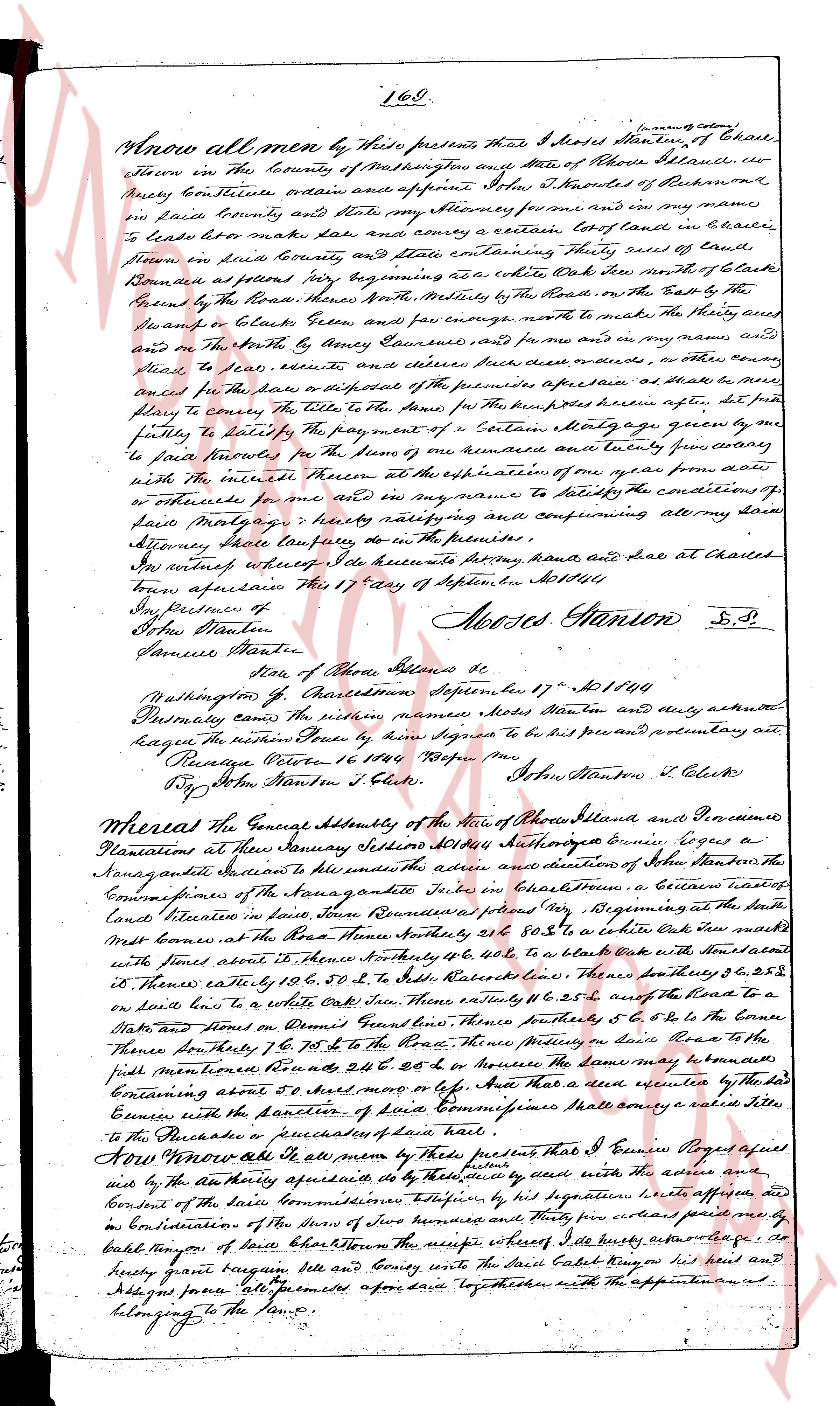
Know all men by these presents, that I Moses Stanton, of Charl-
town in the County of Washington and State of Rhode Island, do
hereby remise release ordain and appoint John T. Knowles of Pawtucket
in said County and State my Attorney for me and in my name
to lease make lease and convey a certain lot of land in Charl-
town in said County and State containing Three third of said
Township as a whole white Oak tree North of Clark
Boundaries as follows viz beginning at a white Oak tree Seven hundred
feet from the Road North Westly by the Road North Eastly on the East by the
Swamp and Clark's Town, and five rods North to meet the North line and
on the North by Henry Lawrence and for me and in my name,
to lease to lease, execute and deliver such deed or indenture, as
entitling the said or the specified premises aforesaid as a free
slave to convey the Title to the same for the Money here upon agreed, aft-
er fully satisfying the payment of a certain Mortgage ago, of a sum
of five hundred and twenty five and some odd sum from
to said Knowles for the use and benefit of some lady from away
with the interest thereon at the expiration of one year and
or otherwise for me and in my name to satisfy the conditions of
said Mortgage ratifying and confirming all my said
Attorney since Lawrence to do in the premises.
In witness whereof I do execute my writing, seal, hand and seal at Charles
town aforesaid this 17 day of September AD 1844.
Say Delivred in
Of Moses Stanton
Moses Stanton L.S.
Lawrence Witness
State of Rhode Island &c
Washington Co. Charlestown September 17th AD 1844
Personally came before subtilis witnesses Niels Stanton and duly acknowledged the present Instrument to be his sign Signature to be his present preliminary act.
Rebecca Potter 16 October 1844
By John Stanton J. Clerk John Stanton J. Clerk
Whereas the General Assembly of the State of Rhode Island and Providence
Plantations at their January Session 1844 authorized Eunice Rogers a
nonage resident of Jamestown to adhere and directions of Mr. John Stanton the
Commissioner of the Sara park estate John in Charlestown a certain parcel of
land situated in town Ravenous providence city viz Beginning at the south
Corners of the Road North Westly 28 & 80 s to a white Oak mark with some
notches at the base of the Road North Westly 40 & 60 s to a stone block with some notches
on the North eastly by 13 & 60 s, 50 & 2 s to India Road Westly, then Southly 28 & 28 s
on the Road to a law stone with a 40 & 28 s, then Eastly by 26 & 65 s, 28 & 65 s to the Road to a
Stake and turned on Daniel Grout line, then Southly 5 & 6 s to the Bound
Boundary of the town, then Southly 5 & 6 s to the Bound line South to the
pill monument then Southly 28 & 28 s, or however the same may be bounded
containing about 5 acres more or less. And that a deed executed by the said
Eunice with the sanction of Court Commissioner shall convey a valid Title
to the Purchaser or purchasers of said land.
Now therefore be it known by this deed presents that I Eunice Rogers aged
and by the Authority aforesaid as per the deed’s will read with the above
consented by the said Commissioner witnessed by his signature hereby convey
and in Consideration of the Sum of two hundred and fifty five dollars paid me by
said buyer of said Borden Town the receipt whereof I do hereby acknowledge
as delivered’s her by’s herby grant bargain sell and convey with the said Cabell being on her head and
a legacy from her all foremost aforesaid said together with the appurtenances
belonging to the same.
page 2
170
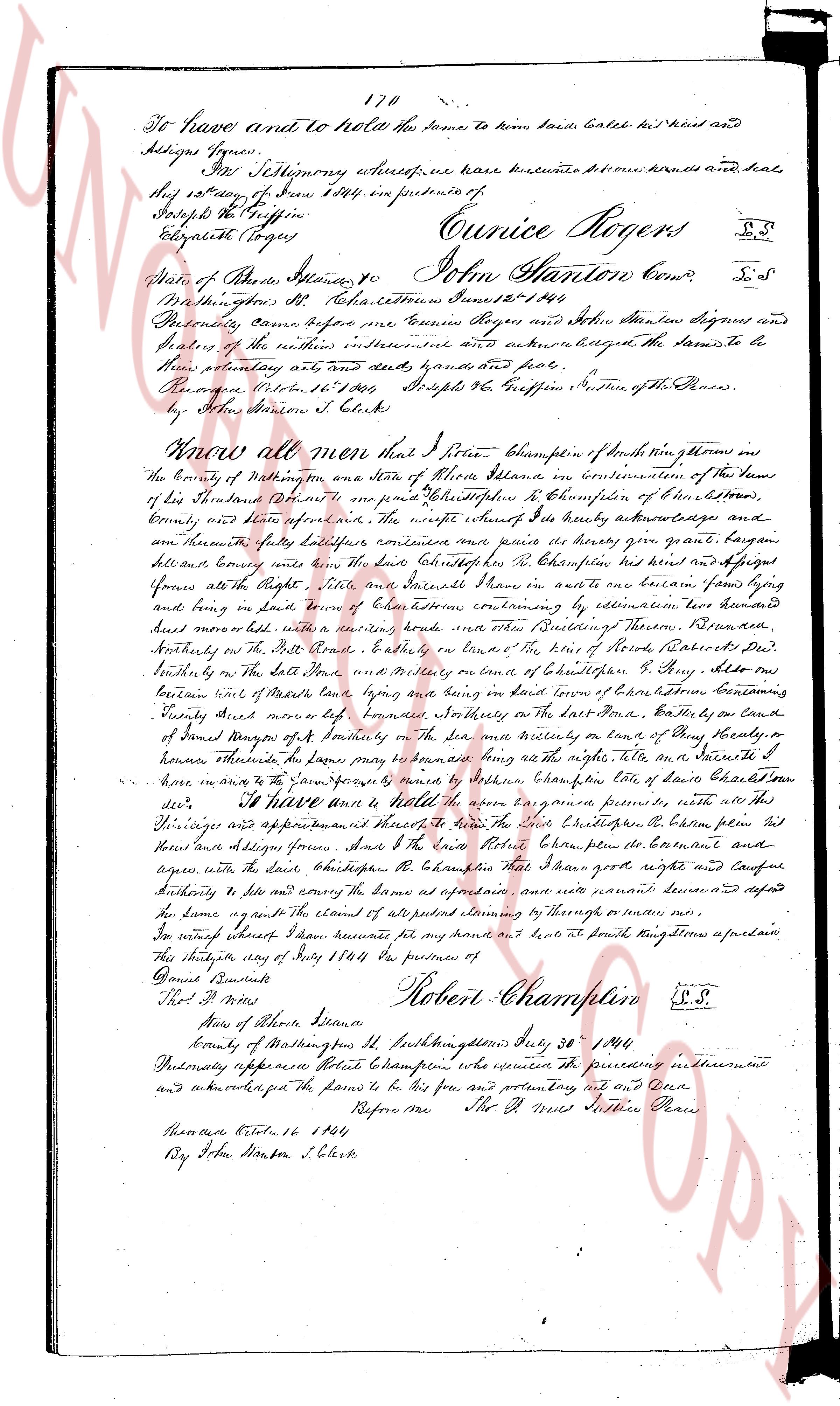
To have and to hold the same to kome said Caleb his heirs his assigns forever.
In Testimony whereof, we have hereunto set our hands and seals
this 12th day of June 1844 in presence of
Joseph the Griffin
Elizabeth Rogers
Eunice Rogers L.S.
John Hanlon Comr L.S.
State of Rhode Island
County of Washington SS.
North Kingston Court town June 12th 1844
Personally came before me Eunice Rogers and John Hanlon Signers and
sealers of the within instrument and acknowledged the same to be
their voluntary act and deed granted and paid free.
Return on Octob 18th 1844 Joseph the Griffin Justice of the Peace.
By John Hanlon C. Clerk
Know all men that I Robert Thompson of North Kingston in the
County of Washington in the State of Rhode Island in consideration of the Sum
of ten dollars to me paid by Christopher R Thompson of North Kingston,
County and state aforesaid, the receipt whereof I hereby acknowledge and
confirm fully satisfactory and sufficient and more as payment for my grant bargain
sell and convey unto the said Christopher R Thompson his heirs and assigns
forever all the Right Title and Interest I have in and unto one acre and one rood lying
and being in said town of North Kingston extending by illumination towards east
and bounding south with a certain stone wall and stone boundary of Thomas Rowell’s
North boundary on the East line of the heirs of Robert Richardson’s
North boundary on the West line and boundary on the East boundary of Philip Allen’s
boundary on the South line and the North line of boundary of Christopher R Thompson
being marked with maple trees lying and being in said town of North Kingston
County said more or less boundary witnesses on the North boundary of
said Thomas Rowell’s on the South boundary on the East boundary of
said Philip Allen’s on the West boundary on the North line of boundary of
honorable witnesses to have and to hold the same to the said Christopher R Thompson his
heirs and assigns forever in the above named title etc etc etc etc etc
To have and to hold the same to be enjoyed premises with all the
privileges and appurtenances thereof to the said Christopher R Thompson his
heirs and assigns forever And to the said Robert Thompson be granted and
assigned with the said Christopher R Thompson all those rights and privileges
Authority to use and carry the same as aforesaid once more reserved defined and
defended for himself against the claims of all persons whomsoever or none
In witness whereof I said Robert Thompson set my hand and seal at North Kingston a aforesaid
this twelfth day of June 1844 in presence of
Daniel Rowell
Thos P Newes
Robert Thompson L.S.
State of Rhode Island
County of Washington SS. North Kingston July 30th 1844
Personally appeared Robert Thompson who executed the preceding instrument
and acknowledged the same to be his free and voluntary act and deed
Before me Thos P Newes Justice Peace
Recorded Octob 18th 1844
By John Hanlon C. Clerk
The page as recorded