The instrument's own words
page 1
654
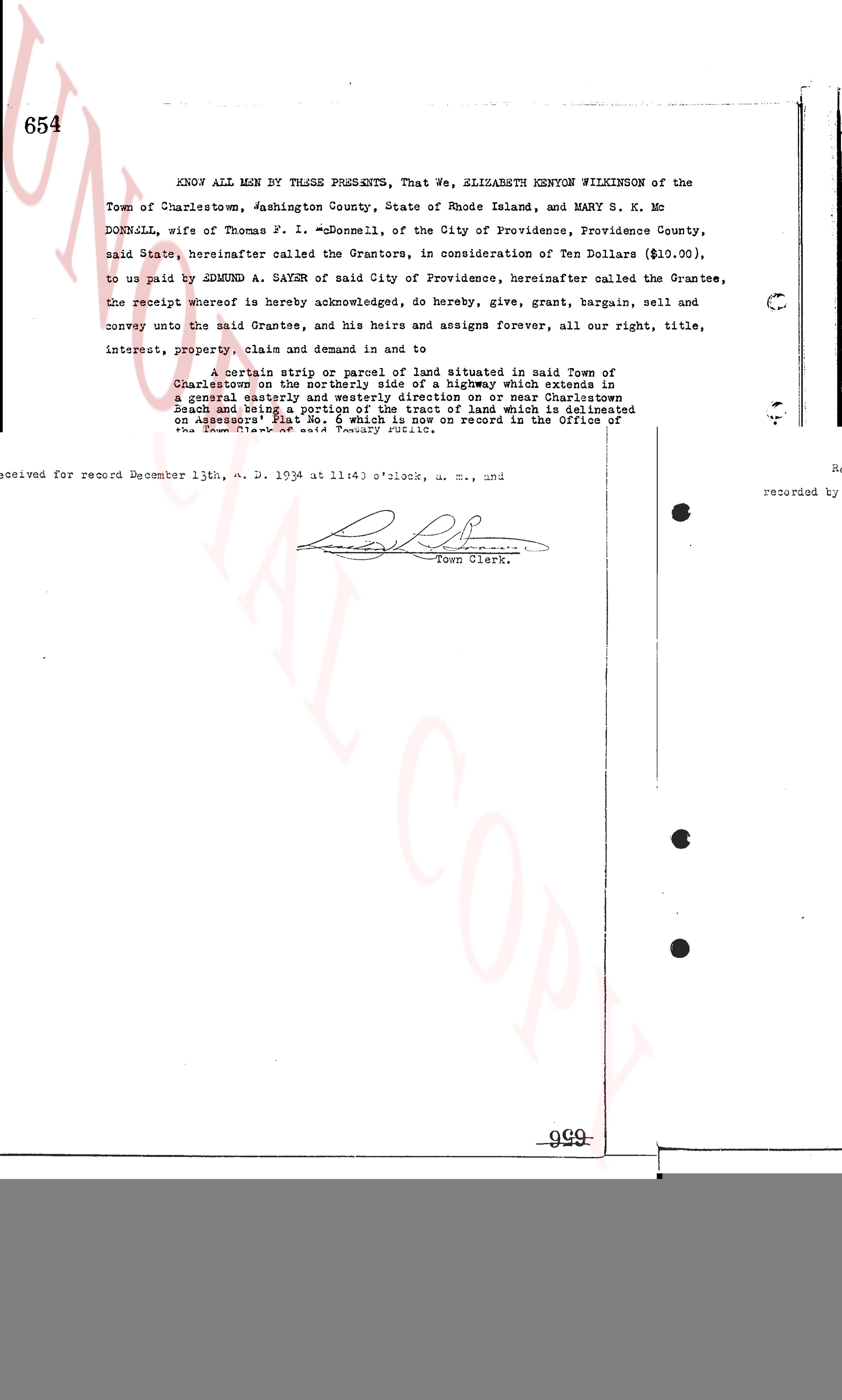
KNOW ALL MEN By THESE PRESENTS, That We, ELIZABETH KENYON WILKINSON of the
Town of Charlestown, Washington County, State of Rhode Island, and Mary S. K. Mc
DONNELL, wife of Thomas P. I. McDonnell, of the City of Providence, Providence County,
said State, hereinafter called the Grantors, in consideration of Ten Dollars ($10.00),
to us paid by EDMUND A. SAYRE of said City of Providence, hereinafter called the Grantee,
the receipt whereof is hereby acknowledged, do hereby, give, grant, bargain, sell and
convey unto the said Grantee, and his heirs and assigns forever, all our right, title,
interest, property, claim and demand in and to
a Certain strip or parcel of land situated in said Town of
Charlestown on the westerly side of a highway which extends in
a general easterly and westerly direction on or near Charlestown
Beach and being a portion of the tract of land which is delineated
on Assessor's Plat No. 6, said Plat being on record in the office of
the Town Clerk of said Town of Charlestown, said tract of land being
situated in said town, bounded on the northwest and north by tide
waters and marshes (16.9)
acres, more or less, and as bounding southerly by said highway and
northerly by Charlestown Pond; the strip or parcel of land hereby
conveyed being more particularly described and delineated as follows:
beginning at a point located in the northerly line of said highway,
highway, which point is located seven hundred (700) feet westerly
from the southeasterly corner of said highway which delineates on
said Plat No. 6, and said point is further described similarly although
also the southeasterly corner of land now or formerly owned by Jesse
and being indicated on the assessor's map by a dot and line and
in the stone bound set at an angle in said highway (11) thence northerly
a straight line to the northeasterly corner of said delineated tract (400) feet,
more or less, bounding easterly on other land of the these listed
Grantors, in the most northerly part of that tract which is delineated
on said Assessors' Plat No. 6 (said northerly line being also the south-
easterly line of land now or formerly owned by "R. Brown" (11)
now or formerly owned by Dharmendra Sabock), thence westerly in the
northerly line of said tract a distance of twenty (20) feet, more or less
bounding northerly on other land of the these Grantors, thence southerly
a line parallel with and twenty (20) feet westerly from the course first
above described, a distance of four hundred (400) feet, more or less
on other land of the these Grantors, to the northerly line of said highway,
thence easterly in the northerly line of said highway by measurement
feet to the point of beginning; being a portion of premises of which
Jesse R. Dempsey (late of this town) had previously purchased and
possessed and which the Grantors inherited as his only heirs at law.
page 2
655
(INTERNAL REVENUE STAMP, 50¢)
STATE OF RHODE ISLAND)
County of Providence }
)
In the City of Providence on the 10th day of December A. D. 1934 before me personally
appeared the above named grantors Mary S. K. McDonnell and Thomas F. I. McDonnell, each to
me known and known by me to be parties grantor named in and who executed the foregoing instru-
ment, and they severally acknowledged said instrument, by them executed, to be their free act
and deed.
OWEN P. REIN
Notary Public.
STATE OF RHODE ISLAND)
County of Washington }
)
In Westerly on the 8th day of December A. D. 1934 before me personally appeared
the above named grantor Elizabeth Kenyon Wilkinson to me known and known by me to be one of
the parties grantor named in and who executed the foregoing instrument, and acknowledged
said instrument, by her executed, to be her free act and deed.
DAVID ROBERTSON
Notary Public.
Received for record December 13th, A. D. 1934 at 11:40 o'clock, a. m., and
recorded by [Signature]
Town Clerk.
999
The page as recorded