The instrument's own words
page 1 · read by Gemma vision
672
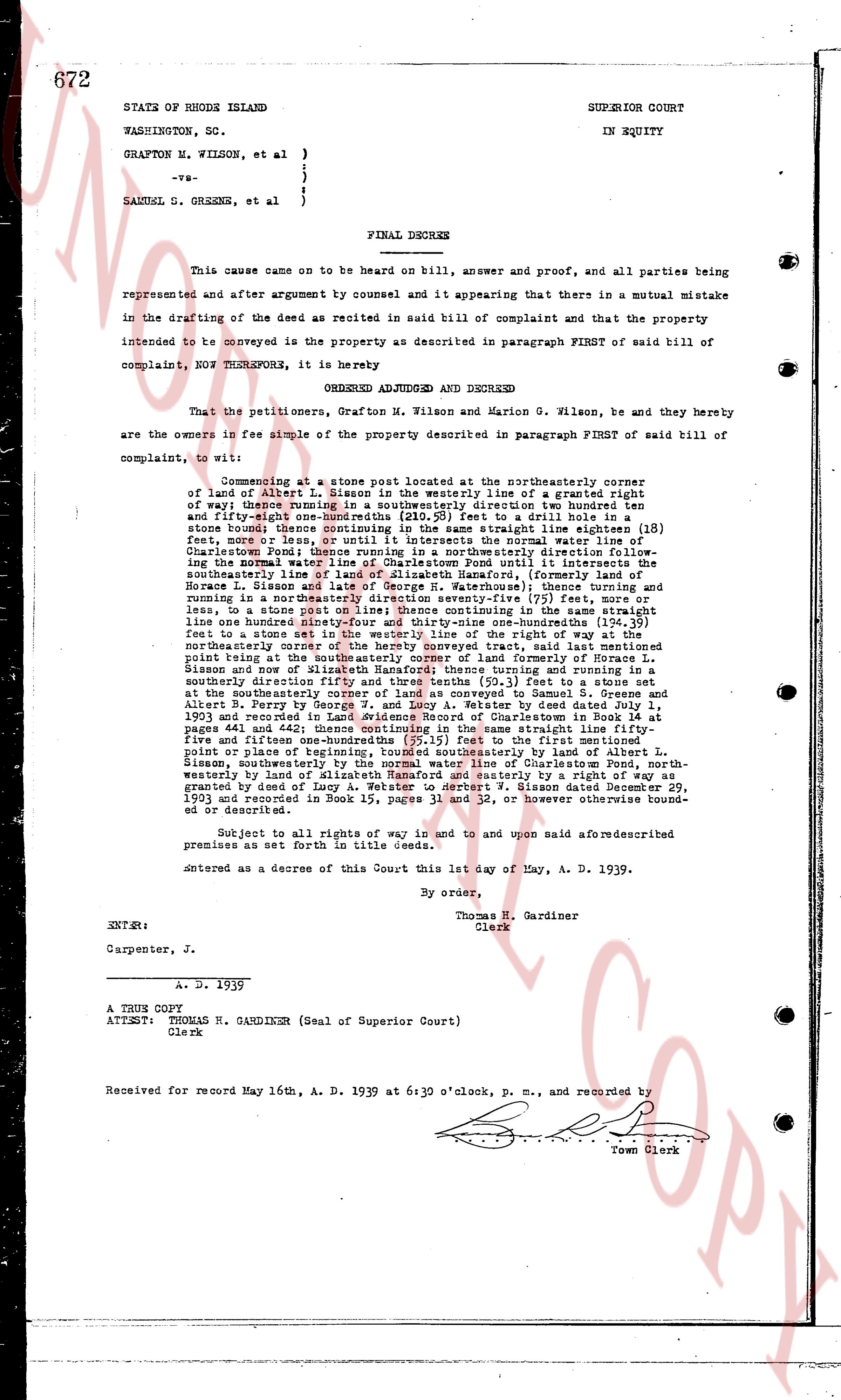
STATE OF RHODE ISLAND SUPERIOR COURT
WASHINGTON, SC. IN EQUITY
GRAFTON H. WILSON, et al }
}
-vs- }
}
SAMUEL G. GREENES, et al }
FINAL DECREE
This cause came on to be heard on bill, answer and proof, and all parties being represented and after argument by counsel and it appearing that there in a mutual mistake in the drafting of the deed as recited in said bill of complaint and that the property intended to be conveyed is the property as described in paragraph FIRST of said bill of complaint, NOW THEREFORE, it is hereby
ORDERED ADJUDGED AND DECREED
That the petitioners, Grafton H. Wilson and Marion G. Wilson, be and they hereby are the owners in fee simple of the property described in paragraph FIRST of said bill of complaint, to wit:
Commencing at the stone post located at the southeasterly corner of land of Albert L. Sisson in the westerly line of a granted right of way thence running in a southeasterly direction two hundred twenty and fifty-one hundredths (220.51) feet to draw a hole in one stone boundary there thence continuing in the same straight line eighteen (18) feet, more or less, or until it intersects the normal water line of Charlestown Pond thence running in a northeasterly direction ninety-three (93) feet, crossing the normal water line of Charlestown Pond until it intersects the southeasterly line of land of Horace L. Sisson and late of George R. Warehouse) thence turning and running in a northeasterly direction forty-seven (47) feet, more or less, or until it reaches, to a stone post on line point; thence continuing in the same straight line one hundred eighty-four (184) feet, more or less, or until it reaches a stone post to a set stone in the westerly line of the right of way at the northeasterly corner of land of Albert L. Sisson and late of George R. Warehouse) said point being at the southeasterly line of farm of formerly Horace L. Sisson and late of Randolph Sanford thence turning and running in a southeasterly direction fifty-four (54) feet to a stone post at the southeasterly corner of land as conveyed to Samuel G. Greenes and Albert L. Terry by deed dated December 29, 1901 and recorded in Land Evidence Record of Charlestown in Book 14 at page 641 and page 642 thence continuing in the same straight line one hundred fifty five and fifty-one hundredths (155.51) feet to the first mentioned point or place of beginning thence northeasterly 141 feet in land of Albert L. Sisson, southeasterly by the normal water line of Charlestown Pond, north-westerly by land of Albert L. Sisson, southeasterly by a deed granted by deed granted by deed of Lucy A. Webster to own W. Sisson dated December 29, 1901 and recorded in Book 15, pages 11 and 32, or otherwise otherwise bound- ed or described.
Subject to all rights of way in and to and upon said aforementioned premises as set forth in title deeds.
Entered as a decree of this Court this 1st day of May, A. D. 1939.
By order,
Thomas H. Gardiner
Clerk
ENTER:
Carpenter, J. A. D. 1939
A TRUE COPY
ATTEST: THOMAS H. GARDINER (Seal of Superior Court)
Clerk
Received for record May 16th, A. D. 1939 at 6:30 o'clock, P. M., and recorded by [Signature]
Town Clerk
The page as recorded