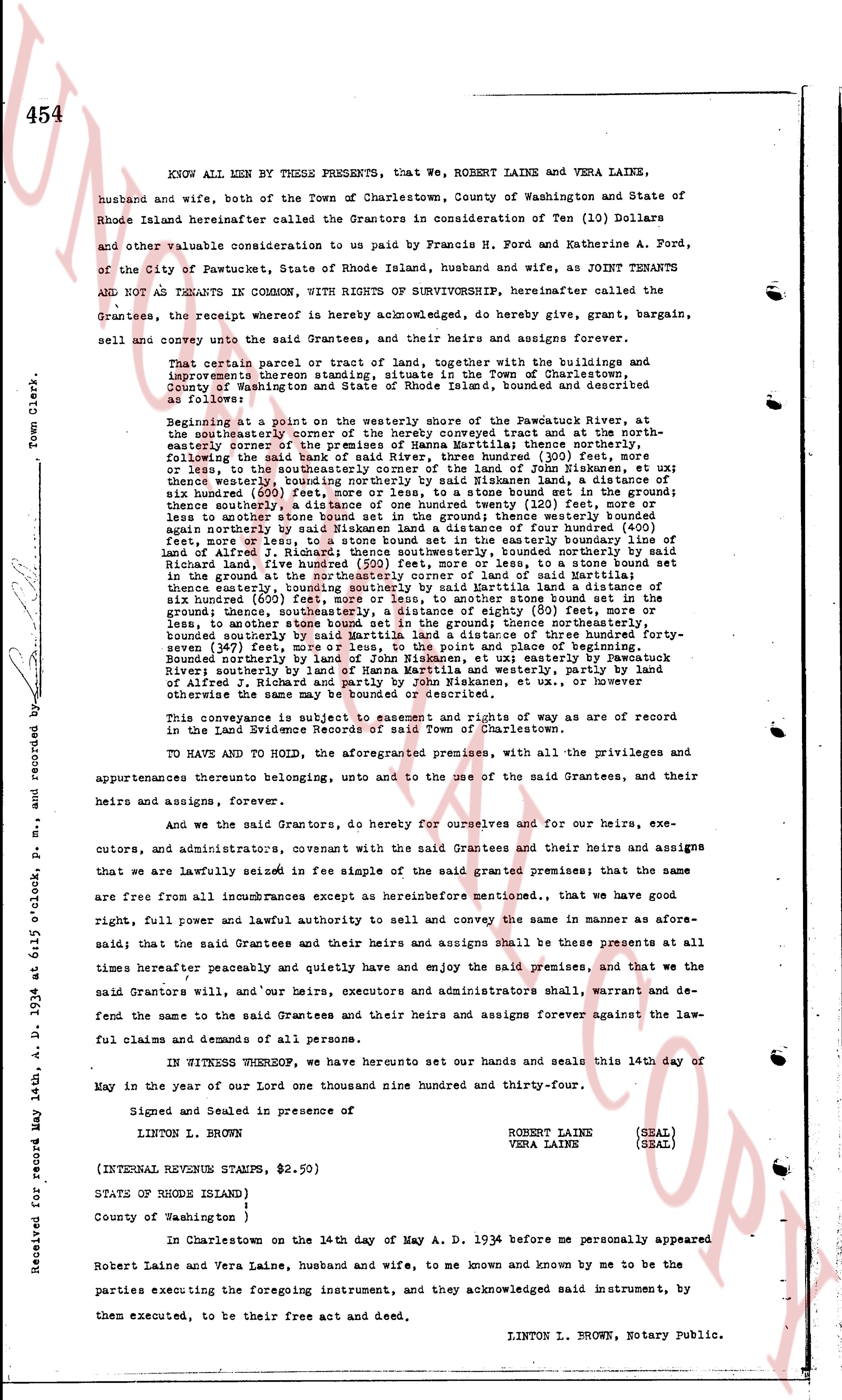
The instrument's own words
page 1
454
Town Clerk's
KNOW ALL MEN BY THESE PRESENTS, that WE, ROBERT LAINE and VERA LAINE,
husband and wife, both of the Town of Charlestown, County of Washington and State of
Rhode Island hereinafter called the Grantors in consideration of Ten (10) Dollars
and other valuable consideration to us paid by Francis H. Ford and Katherine A. Ford,
of the City of Pawtucket, State of Rhode Island, husband and wife, as JOINT TENANTS
AND NOT AS TENANTS IN COMMON, WITH RIGHTS OF SURVIVORSHIP, hereinafter called the
Grantees, the receipt whereof is hereby acknowledged, do hereby give, grant, bargain,
sell and convey unto the said Grantees, and their heirs and assigns forever,
That certain parcel or tract of land, together with the buildings and
improvements thereon situated in the Town of Charlestown, County of Washington
County of Washington and State of Rhode Island furnished, bound and described as
follows:
Beginning at a point in the westerly shore of the Pawtucket River, and
at the northeasterly corner of the Henry Converse tract and at the north-
easterly corner of the tract of land of Sarah Martin thence running north
following the said bank of said River, three hundred (300) feet, more
or less to the north easterly corner of the said land of Sarah Martin thence east
three hundred seventy (370) feet, westerly boundary nor southing by Miskensand, a distance of
three hundred seventy (370) feet, more or less, to a stone bound set in the ground;
thence southerly a distance of three hundred (300) feet, more or less, to a stone bound set
in the ground; thence westerly a distance of two hundred (200) feet more or less,
to another stone bound set in the ground; thence westerly bound
again westerly by the bank of the river a distance of four hundred (400) feet,
no feet, more or less, to a stone bound set in the easterly boundary line of
said Alfred I. Richards tract, thence southerly, bound northerly by said
Richard land, five hundred (500) feet, more or less, to a stone bound set in the
ground at the northerly corner of the land of Sarah Martin thence easterly
thence easterly, bounding southerly by said Martin land a distance of six
hundred seventy (670) feet, more or less, easterly by Pawtucket River
ground thence easterly, a distance of eighty (80) feet, more or
less, to another stone bound set in the ground, thence northerly a distance of three hundred forty-
seven (347) feet, more or less, to the corner of land of Eugene G.
bounded southerly by said Martin land a distance of three hundred forty-
seven (347) feet, more or less, to the corner of land of Eugene G.
bounded northerly by land of John Miskensand, etc; ux easterly by Pawtucket
River; southerly by land of Henry Martin and Westerly, and partly by land
of Alfred I. Richards and partly by the river and Plancon, etc. or however
otherwise the same may be bounded or described.
This conveyance is subject to easement and rights of way as are of record
in the Town Land Evidence Records of Charlestown.
TO HAVE AND TO HOLD, the aforementioned premises, with all the privileges and
appurtenances thereunto belonging, unto and to the use of the said Grantees, and their
heirs and assigns, forever.
And we the said Grantors, do hereby for ourselves and for our heirs, exe-
cutors, and administrators, covenant with the said Grantees and their heirs and assigns
that we are lawfully seized in fee simple of the said granted premises; that the same
are free from all incumbrances except as hereinbefore mentioned., that we have good
right, full power and lawful authority to sell and convey the same in manner as afore-
said; that the said Grantees and their heirs and assigns shall be these presents at all
times hereafter peaceably and quietly have and enjoy the said premises, and that we the
said Grantors will, and our heirs, executors and administrators shall, warrant and de-
fend the same to the said Grantees and their heirs and assigns forever against the law-
ful claims and demands of all persons.
IN WITNESS WHEREOF, we have hereunto set our hands and seals this 14th day of
May in the year of our lord one thousand nine hundred and thirty four.
Signed and Sealed in presence of
LINTON L. BROWN.
ROBERT LAINE (SEAL)
VERA LAINE (SEAL)
(INTERNAL REVENUE STAMPS, $2.50)
STATE OF RHODE ISLAND )
County of Washington )
In Charlestown on the 14th day of May A. D. 1934 before me personally appeared
Robert Laine and Vera Laine, husband and wife, to me known and known by me to be the
parties executing the foregoing instrument, and they acknowledged said instrument, by
them executed, to be their free act and deed.
LINTON L. BROWN, Notary Public.
Received for record May 14th, A. D. 1934 at 6:12 o'clock p.m., and recorded by
The page as recorded