The instrument's own words
page 1
445
TO ALL PEOPLE WHOM THESE PRESENTS SHALL COME:
WHEREAS, Thurman F. Eldridge and Elizabeth Maud Eldridge, husband and wife, both
of the Town of Charlestown, County of Washington, State and State of Rhode Island, (hereinafter
called the Mortgagors) did on the 17th, day of May, A. D., 1920, make and execute a mortgage
deed of real estate situated in said Town of Charlestown to Peter P. Palmer of the Town of
Hopkinton, County of Washington, State and State of Rhode Island, (hereinafter called the Mortgagee)
to secure the payment of a certain promissory note, as will more fully appear by reference to
said deed, which is recorded in the Land Records of said Town of Charlestown, for recording
Mortgages of Real Estate in Book No 19 at Page 254; and
WHEREAS, said Mortgagors by deed of mortgage fully authorized and empowered the
said Mortgagee, his executors, administrators and assigns, to sell and convey the property de-
scribed in and conveyed by said deed of mortgage, under the conditions and in the manner spe-
ified in the same; and
WHEREAS, in said deed of mortgage Elizabeth Maud Eldridge, wife of said Thurman
F. Eldridge did release her dowry, and join in the power of the sale aforesaid; and
WHEREAS, said Peter P. Palmer deceased on tw-wit, the 24th day of December, 1920,
and that the Washington Trust Company, a corporation created by act of the General Assembly
of the State of Rhode Island and located in the Town of Westerly, County of Washington, and
State of Rhode Island, was appointed executor of the last will and testament of Peter P. Palmer,
late of said Hopkinton, deceased, on tw-wit, the 7th, day of February, 1921, by the Probate
Court of the Town of Hopkinton exercising probate jurisdiction in said Town of Hopkinton, County
of Washington, State and State of Rhode Island, and has duly qualified to act in said capacity and
capacity; and
WHEREAS, said the Washington Trust Company, executor of said last will and testament
of Peter P. Palmer, deceased, by deed dated May 27th, A. D., 1924, and recorded in Book No. 21
at Page 261 of the Records of Mortgages in said Town of Charlestown, did assign to Ernest W.
Tinkham, of said Charlestown, County of Washington, State and State of Rhode Island, his heirs, ex-
ecutors, administrators and assigns forever all, all his right, title and interest in and to said
deed of mortgage and to the premises therein described, and the debt thereby secured and did
substitute and appoint said Ernest W. Tinkham, his executors, administrators and assigns to
be the attorneys of said Thurman F. Eldridge and Elizabeth Maud Eldridge, husband and wife under
said deed; and
WHEREAS, the aforesaid deed of mortgage was made and given on the condition that if
the promissory note mentioned and described therein, and the interest thereon, and the debts
and claims thereby secured, should be paid according to the tenor thereof, then said deed to be
void, otherwise to remain in full force and effect; and
WHEREAS, default was made in the condition of said deed, in this: The interest on
said promissory note and the said promissory note became due and payable and remained unpaid for
more than ten (10) days from the maturity date and before the giving of the notice of sale by
advertisement hereinafter mentioned; and
WHEREAS, the said Ernest W. Tinkham did, after the said default had continued for
more than ten (10) days, advertise the premises described in said deed, for sale at public
auction in the "Westerly Sun," the newspaper printed in the Town of Westerly, at least
once each week for three (3) consecutive weeks before the day of sale named therein, as set forth
in the affidavit and notice of sale hereto attached and made a part hereof; and
WHEREAS, at a public auction held upon the premises described in said deed of mortgage
on the 14th, day of April, A. D., 1934, at ten o'clock A. M., in pursuance of and in accordance
with said advertisement and notice of sale, said default still continuing; the premises were
purchased by Ernest W. Tinkham of Providence, County of Providence, and State of Rhode Island,
page 2
446
being the highest bidder therefore, for the total sum of Twenty seven Hundred ($2700.00)
being the highest bidder therefore, for the total sum of Twenty seven Hundred ($2700.00)
Dollars. Said first tract was purchased by said Ernest W. Tinkham for the sum of Five
Hundred ($500.00) Dollars, said second tract was purchased by said Ernest W. Tinkham for
the sum of Five Hundred ($500.00) Dollars, said third tract was purchased by said Ernest
W. Tinkham for the sum of Five Hundred ($500.00) Dollars, and said fourth tract was pur-
chased by said Ernest W. Tinkham for the sum of Twelve Hundred ($1200.00) Dollars, and all
for the total sum of Twenty-seven Hundred ($2700.00) Dollars.
NOW THEREFORE -- KNOW ALL MEN BY THESE PRESENTS:
That I, the said Ernest W. Tinkham, in the exercise of the powers mentioned in
said deed of mortgage, and for and in consideration of the said sum of Twenty-seven Hun-
dred ($2700.00) Dollars to me paid by said Ernest W. Tinkham of said Providence, the re-
ceipt whereof is hereby acknowledged, have given, granted, bargained, sold and conveyed,
and by these presents do give, grant, bargain, sell, convey and confirm unto the said
Ernest W. Tinkham, his heirs and assigns forever.
First Tract. Beginning at the southwest corner of the tract
hereby conveyed, thence running southeasterly to the southeast corner of land formerly of
William and Charles Wilson, on the highway leading from quoosnoc
taug beach, thence running northerly and westerly along the line of the
said beach and land line to the point where said northerly and easterly for-
teen, thence southeasterly and enterly in a line parallel with the first or
west bound, thence a line running south forty feet east from the first
bound, thence westerly along the line of the highway bounded on the
south by the highway and on the north by land of beginning.
Second Tract. Beginning at the southeast corner of this tract
and at the northeast corner of the first tract above described, thence running
south fourteen feet to the southeast corner of land formerly of William and
Charles Wilson and land formerly of D. F. & C. H. Babcock and of
James L. Pizer, thence to a point on the east side of Paul First lane at the
southeast corner along the easterly old beach front fourteen feet, thence south-
easterly on first land formerly of Albert Bakely to the northeast corner of the
first bound, thence running south forty feet east from the place of
beginning, or however otherwise either of said tracts of land may be
bounded, described or located, including the buildings and improvements
thereon standing or, that may be built or erected in the future on the said
above described tracts.
Third Tract. A certain piece of tract of land with the buildings and im-
provements thereon standing, situated at quoosnocoutaug Beach, in the town
of Charlestown, County of Washington, as above written and described
as follows, to-wit: Beginning at the northwest corner of said lot, thence running
easterly fourteen feet to the northeast corner of said lot, thence running southerly to the southeast
corner of said lot, thence running easterly four feet then running westerly
to the northwest corner to the northwest corner of said lot then running westerly
thence running easterly bound northerly bounded by Samuel Peckham to
bounded southerly by Daniel Palmer to the first mentioned bound. This
land is part of the larger lot which was bought from Thos. D. H. Rob-
bington.
Fourth Tract. A certain piece of land with the buildings and im-
provements thereon standing, situated at quoosnocoutaug Beach, in the town
of Charlestown, County and State as above written, and bounded as follows, to-
wit: Beginning at the northwest corner of said lot, running westerly ten feet
of Daniel Palmer at the Breach thence running easterly bounded by land of said
Palmer and others, thence running southerly bounded by Samuel Peckham to
bounded easterly by land now or formerly of David Heox, forty feet to land of
neighboring owners, thence running northerly on said lot then running westerly
thence southerly, bounded westerly by the Breach to the first mentioned
bounds. Being the west half of the Breach lot bought by David Heox from
John Dickinson.
TO HAVE AND TO HOLD the same, with all the rights, privileges and appurtenances
thereunto belonging unto the said Ernest W. Tinkham, his heirs and assigns, to them and
their use, benefit, and behoof forever.
IN WITNESS WHEREOF, I have hereunto set my hand and seal this 21st day of April,
in the year of our Lord one thousand nine hundred and thirty-four.
ERNEST W. TINKHAM (SEAL)
Signed and delivered in
presence of
CLARENCE E. ROCHE.
page 3
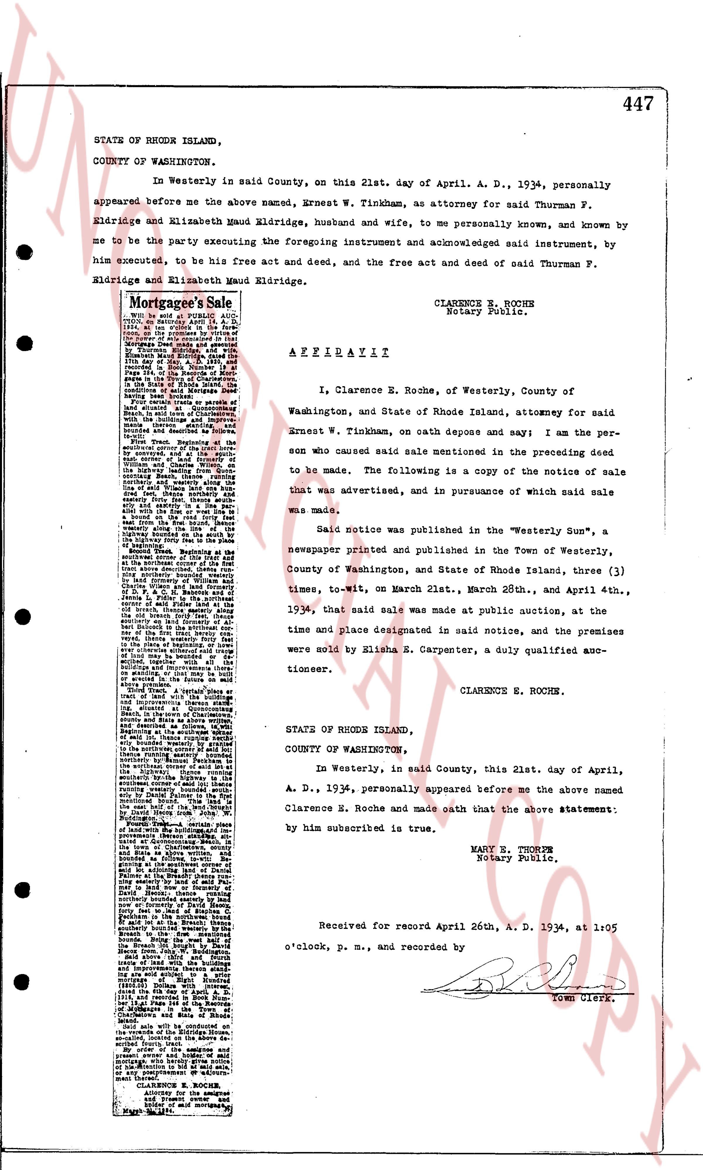
447
STATE OF RHODE ISLAND,
COUNTY OF WASHINGTON.
In Westerly in said County, on this 21st. day of April. A. D., 1934, personally
appeared before me the above named, Ernest W. Tinkham, as attorney for said Thurman F.
Eldridge and Elizabeth Maud Eldridge, husband and wife, to me personally known, and known by
me to be the party executing the foregoing instrument and acknowledged said instrument, by
him executed, to be his free act and deed, and the free act and deed of said Thurman F.
Eldridge and Elizabeth Maud Eldridge.
CLARENCE E. ROCHE
Notary Public.
Mortgagee's Sale
With notice.
Held on Tuesday the 21st day of
April, A. D., 1934, at 1:00 o'clock p.m.
at the office of Clarence E. Roche,
Notary Public, No. 10 Main Street,
Westerly, R. I., under a power of
Mortgagee Deed made and executed
by Thurman F. Eldridge and Elizabeth
Maud Eldridge, husband and wife,
on the 15th day of Oct. A. D., 1928,
and assigned to the Mortgagee,
the Rhode Island Hospital Trust
Company, a trust company organized
under the laws of the State of
Rhode Island and having its principal
office in Providence, R. I.,
The premises sold are as follows:
All that certain piece of land in the
town of Westerly, situated in said
town, together with the buildings and
improvements thereon.
Bounded on the north by land of
the heirs of Samuel and Sarah
brownell and described as follows:
Beginning at a point on the east side
of the highway leading from the
northwest corner of the town of
Westerly by curvature, and at the spoke
north 45 degrees west 12 1/2 poles
from the highway leading from the
northwest corner of the town of
Westerly, thence south 45 degrees
east 12 1/2 poles to the highway leading
from the northwest corner of the town
of Westerly, thence south 45 degrees
east 12 1/2 poles to the highway leading
from the northwest corner of the town
of Westerly, thence south 45 degrees
east 12 1/2 poles to the highway leading
from the northwest corner of the town
of Westerly, thence south 45 degrees
east 12 1/2 poles to the highway leading
from the northwest corner of the town
of Westerly, thence south 45 degrees
east 12 1/2 poles to the highway leading
from the northwest corner of the town
of Westerly, thence south 45 degrees
east 12 1/2 poles to the highway leading
from the northwest corner of the town
of Westerly, thence south 45 degrees
east 12 1/2 poles to the highway leading
from the northwest corner of the town
of Westerly, thence south 45 degrees
east 12 1/2 poles to the highway leading
from the northwest corner of the town
of Westerly, thence south 45 degrees
east 12 1/2 poles to the highway leading
from the northwest corner of the town
of Westerly, thence south 45 degrees
east 12 1/2 poles to the highway leading
from the northwest corner of the town
of Westerly, thence south 45 degrees
east 12 1/2 poles to the highway leading
from the northwest corner of the town
of Westerly, thence south 45 degrees
east 12 1/2 poles to the highway leading
from the northwest corner of the town
of Westerly, thence south 45 degrees
east 12 1/2 poles to the highway leading
from the northwest corner of the town
of Westerly, thence south 45 degrees
east 12 1/2 poles to the highway leading
from the northwest corner of the town
of Westerly, thence south 45 degrees
east 12 1/2 poles to the highway leading
from the northwest corner of the town
of Westerly, thence south 45 degrees
east 12 1/2 poles to the highway leading
from the northwest corner of the town
of Westerly, thence south 45 degrees
east 12 1/2 poles to the highway leading
from the northwest corner of the town
of Westerly, thence south 45 degrees
east 12 1/2 poles to the highway leading
from the northwest corner of the town
of Westerly, thence south 45 degrees
east 12 1/2 poles to the highway leading
from the northwest corner of the town
of Westerly, thence south 45 degrees
east 12 1/2 poles to the highway leading
from the northwest corner of the town
of Westerly, thence south 45 degrees
east 12 1/2 poles to the highway leading
from the northwest corner of the town
of Westerly, thence south 45 degrees
east 12 1/2 poles to the highway leading
from the northwest corner of the town
of Westerly, thence south 45 degrees
east 12 1/2 poles to the highway leading
from the northwest corner of the town
of Westerly, thence south 45 degrees
east 12 1/2 poles to the highway leading
from the northwest corner of the town
of Westerly, thence south 45 degrees
east 12 1/2 poles to the highway leading
from the northwest corner of the town
of Westerly, thence south 45 degrees
east 12 1/2 poles to the highway leading
from the northwest corner of the town
of Westerly, thence south 45 degrees
east 12 1/2 poles to the highway leading
from the northwest corner of the town
of Westerly, thence south 45 degrees
east 12 1/2 poles to the highway leading
from the northwest corner of the town
of Westerly, thence south 45 degrees
east 12 1/2 poles to the highway leading
from the northwest corner of the town
of Westerly, thence south 45 degrees
east 12 1/2 poles to the highway leading
from the northwest corner of the town
of Westerly, thence south 45 degrees
east 12 1/2 poles to the highway leading
from the northwest corner of the town
of Westerly, thence south 45 degrees
east 12 1/2 poles to the highway leading
from the northwest corner of the town
of Westerly, thence south 45 degrees
east 12 1/2 poles to the highway leading
from the northwest corner of the town
of Westerly, thence south 45 degrees
east 12 1/2 poles to the highway leading
from the northwest corner of the town
of Westerly, thence south 45 degrees
east 12 1/2 poles to the highway leading
from the northwest corner of the town
of Westerly, thence south 45 degrees
east 12 1/2 poles to the highway leading
from the northwest corner of the town
of Westerly, thence south 45 degrees
east 12 1/2 poles to the highway leading
from the northwest corner of the town
of Westerly, thence south 45 degrees
east 12 1/2 poles to the highway leading
from the northwest corner of the town
of Westerly, thence south 45 degrees
east 12 1/2 poles to the highway leading
from the northwest corner of the town
of Westerly, thence south 45 degrees
east 12 1/2 poles to the highway leading
from the northwest corner of the town
of Westerly, thence south 45 degrees
east 12 1/2 poles to the highway leading
from the northwest corner of the town
of Westerly, thence south 45 degrees
east 12 1/2 poles to the highway leading
from the northwest corner of the town
of Westerly, thence south 45 degrees
east 12 1/2 poles to the highway leading
from the northwest corner of the town
of Westerly, thence south 45 degrees
east 12 1/2 poles to the highway leading
from the northwest corner of the town
of Westerly, thence south 45 degrees
east 12 1/2 poles to the highway leading
from the northwest corner of the town
of Westerly, thence south 45 degrees
east 12 1/2 poles to the highway leading
from the northwest corner of the town
of Westerly, thence south 45 degrees
east 12 1/2 poles to the highway leading
from the northwest corner of the town
of Westerly, thence south 45 degrees
east 12 1/2 poles to the highway leading
from the northwest corner of the town
of Westerly, thence south 45 degrees
east 12 1/2 poles to the highway leading
from the northwest corner of the town
of Westerly, thence south 45 degrees
east 12 1/2 poles to the highway leading
from the northwest corner of the town
of Westerly, thence south 45 degrees
east 12 1/2 poles to the highway leading
from the northwest corner of the town
of Westerly, thence south 45 degrees
east 12 1/2 poles to the highway leading
from the northwest corner of the town
of Westerly, thence south 45 degrees
east 12 1/2 poles to the highway leading
from the northwest corner of the town
of Westerly, thence south 45 degrees
east 12 1/2 poles to the highway leading
from the northwest corner of the town
of Westerly, thence south 45 degrees
east 12 1/2 poles to the highway leading
from the northwest corner of the town
of Westerly, thence south 45 degrees
east 12 1/2 poles to the highway leading
from the northwest corner of the town
of Westerly, thence south 45 degrees
east 12 1/2 poles to the highway leading
from the northwest corner of the town
of Westerly, thence south 45 degrees
east 12 1/2 poles to the highway leading
from the northwest corner of the town
of Westerly, thence south 45 degrees
east 12 1/2 poles to the highway leading
from the northwest corner of the town
of Westerly, thence south 45 degrees
east 12 1/2 poles to the highway leading
from the northwest corner of the town
of Westerly, thence south 45 degrees
east 12 1/2 poles to the highway leading
from the northwest corner of the town
of Westerly, thence south 45 degrees
east 12 1/2 poles to the highway leading
from the northwest corner of the town
of Westerly, thence south 45 degrees
east 12 1/2 poles to the highway leading
from the northwest corner of the town
of Westerly, thence south 45 degrees
east 12 1/2 poles to the highway leading
from the northwest corner of the town
of Westerly, thence south 45 degrees
east 12 1/2 poles to the highway leading
from the northwest corner of the town
of Westerly, thence south 45 degrees
east 12 1/2 poles to the highway leading
from the northwest corner of the town
of Westerly, thence south 45 degrees
east 12 1/2 poles to the highway leading
from the northwest corner of the town
of Westerly, thence south 45 degrees
east 12 1/2 poles to the highway leading
from the northwest corner of the town
of Westerly, thence south 45 degrees
east 12 1/2 poles to the highway leading
from the northwest corner of the town
of Westerly, thence south 45 degrees
east 12 1/2 poles to the highway leading
from the northwest corner of the town
of Westerly, thence south 45 degrees
east 12 1/2 poles to the highway leading
from the northwest corner of the town
of Westerly, thence south 45 degrees
east 12 1/2 poles to the highway leading
from the northwest corner of the town
of Westerly, thence south 45 degrees
east 12 1/2 poles to the highway leading
from the northwest corner of the town
of Westerly, thence south 45 degrees
east 12 1/2 poles to the highway leading
from the northwest corner of the town
of Westerly, thence south 45 degrees
east 12 1/2 poles to the highway leading
from the northwest corner of the town
of Westerly, thence south 45 degrees
east 12 1/2 poles to the highway leading
from the northwest corner of the town
of Westerly, thence south 45 degrees
east 12 1/2 poles to the highway leading
from the northwest corner of the town
of Westerly, thence south 45 degrees
east 12 1/2 poles to the highway leading
from the northwest corner of the town
of Westerly, thence south 45 degrees
east 12 1/2 poles to the highway leading
from the northwest corner of the town
of Westerly, thence south 45 degrees
east 12 1/2 poles to the highway leading
from the northwest corner of the town
of Westerly, thence south 45 degrees
east 12 1/2 poles to the highway leading
from
The page as recorded