The instrument's own words
page 1
381
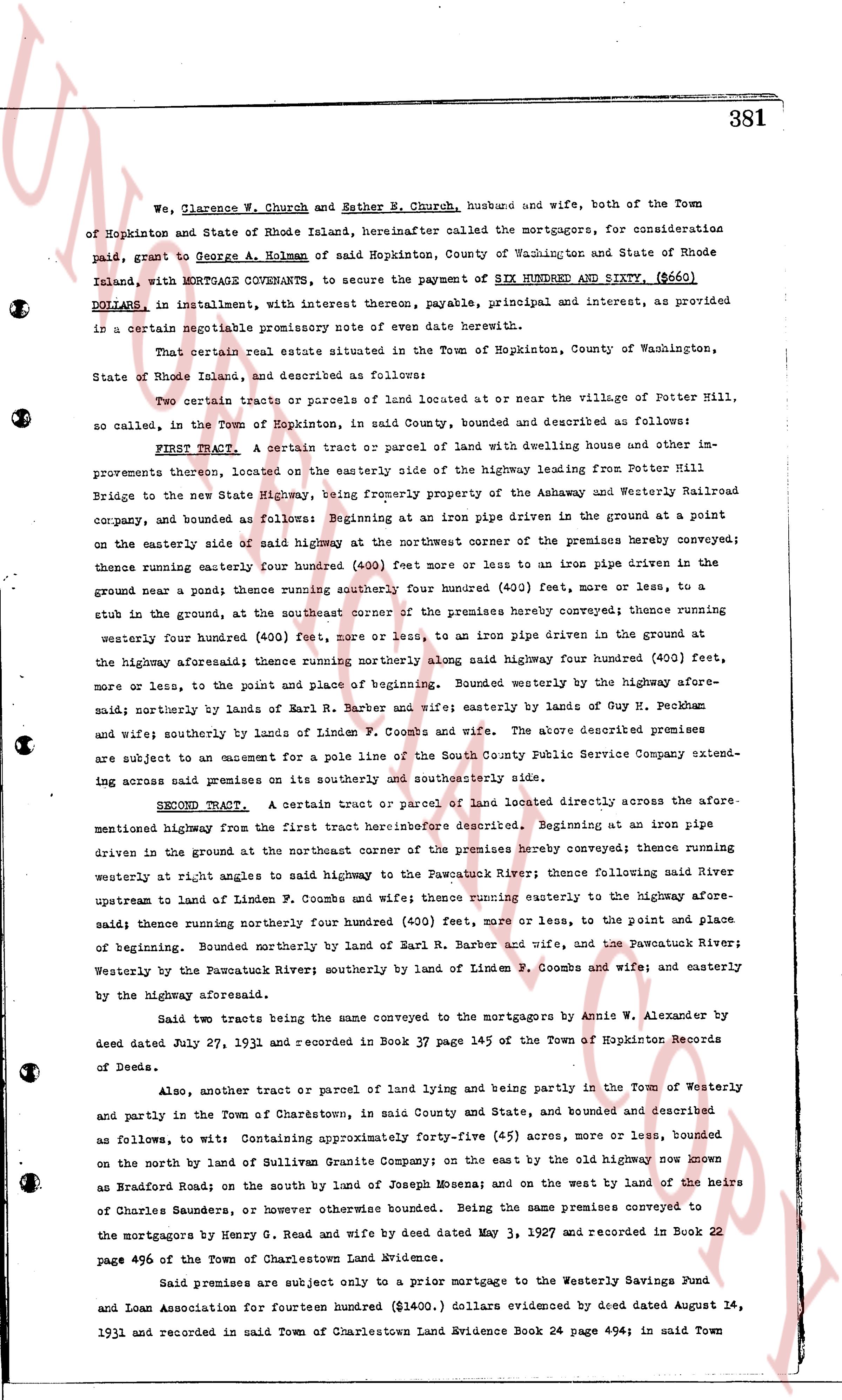
We, Clarence W. Church and Esther E. Church, husband and wife, both of the Town
of Hopkinton and State of Rhode Island, hereinafter called the mortgagors, for consideration
paid, grant to George A. Holman of said Hopkinton, County of Washington and State of Rhode
Island, with MORTGAGE CONVEYANCE, to secure the payment of SIX HUNDRED AND SIXTY ($660)
DOLLARS, in installment, with interest thereon, payment, principal and interest, as provided
in a certain separable promissory note of even date herewith.
That certain real estate situate situated in the Town of Hopkinton, County of Washington,
State of Rhode Island, and described as follows:
Two certain tracts or parcels of land located at or near the village of Potter Hill,
so called, in the Town of Hopkinton, in said County, bounded and described as follows:
FIRST TRACT. A certain tract or parcel of land with dwelling house and other im-
provements thereon, located on the easterly side of the highway leading from Potter Hill
Bridge to the new State Highway, being formerly property of the Ashaway and Westerly Railroad
company, and bounded as follows: Beginning at an iron pipe driven in the ground at a point
on the easterly side sail of the highway at the northwest corner of the premises hereby conveyed; thence
running easterly four hundred (400) feet more or less to an iron pipe driven in the
ground near a pond; thence running southerly four hundred (400) feet, more or less, to a
stub in the ground, at the southeast corner of the premises hereby conveyed; thence running
westerly four hundred (400) feet, more or less, to an iron pipe driven in the ground at
the highway aforesaid; thence running northerly along said highway four hundred (400) feet,
more or less, to the point and place of beginning. Bounded westerly by the highway afore-
said; northerly by lands of Earl R. Barber and wife; easterly by lands of Guy H. Peckham
and wife; southerly by lands of Linden F. Coombs and wife. The above described premises
are subject to an easement for a pole line of the South County Public Service Company extend-
ing across said premises on its southerly and southeasterly side.
SECOND TRACT. A certain tract or parcel of land located directly across the afore-
mentioned highway from the first tract hereinbefore described. Beginning at an iron pipe
driven in the ground at the northeast corner of the premises hereby conveyed; thence running
westerly at right angles to said highway to the Pawcatuck River; thence following said River
upstream to land of Linden F. Coombs and wife; thence running easterly to the highway afore-
said; thence running northerly four hundred (400) feet, more or less, to the point and place
of beginning. Bounded northerly by land of Earl R. Barber and wife, and the Pawcatuck River;
westerly by the Pawcatuck River; southerly by land of Linden F. Coombs and wife; and easterly
by the highway aforesaid.
Said two tracts being the same conveyed to the mortgagors by Annie W. Alexander by
deed dated July 27, 1931 and recorded in Book 37 page 145 of the Town of Hopkinton Records
of Deeds.
Also, another tract or parcel of land lying and being partly in the Town of Westerly
and partly in the Town of Charlestown, in said County and State, bounded and described
as follows, to wit: Containing approximately Forty-five (45) acres, more or less, bounded
on the north by land of Sullivan Graphite Company; on the east by the old highway now known
as Bradford Road on the south by land of Joseph Monahan; and on the west by land of the heirs
of Charles Saunders, or whoever otherwise bound. Being the same premises conveyed to
the mortgagors by Henry G. Read and wife by deed dated May 3, 1927 and recorded in Book 22
page 496 of the Town of Charlestown Land Evidence.
Said premises are subject only to a prior mortgage to the Westerly Savings Fund
and Loan Association for fourteen hundred ($1400.) dollars evidenced by deed dated August 14,
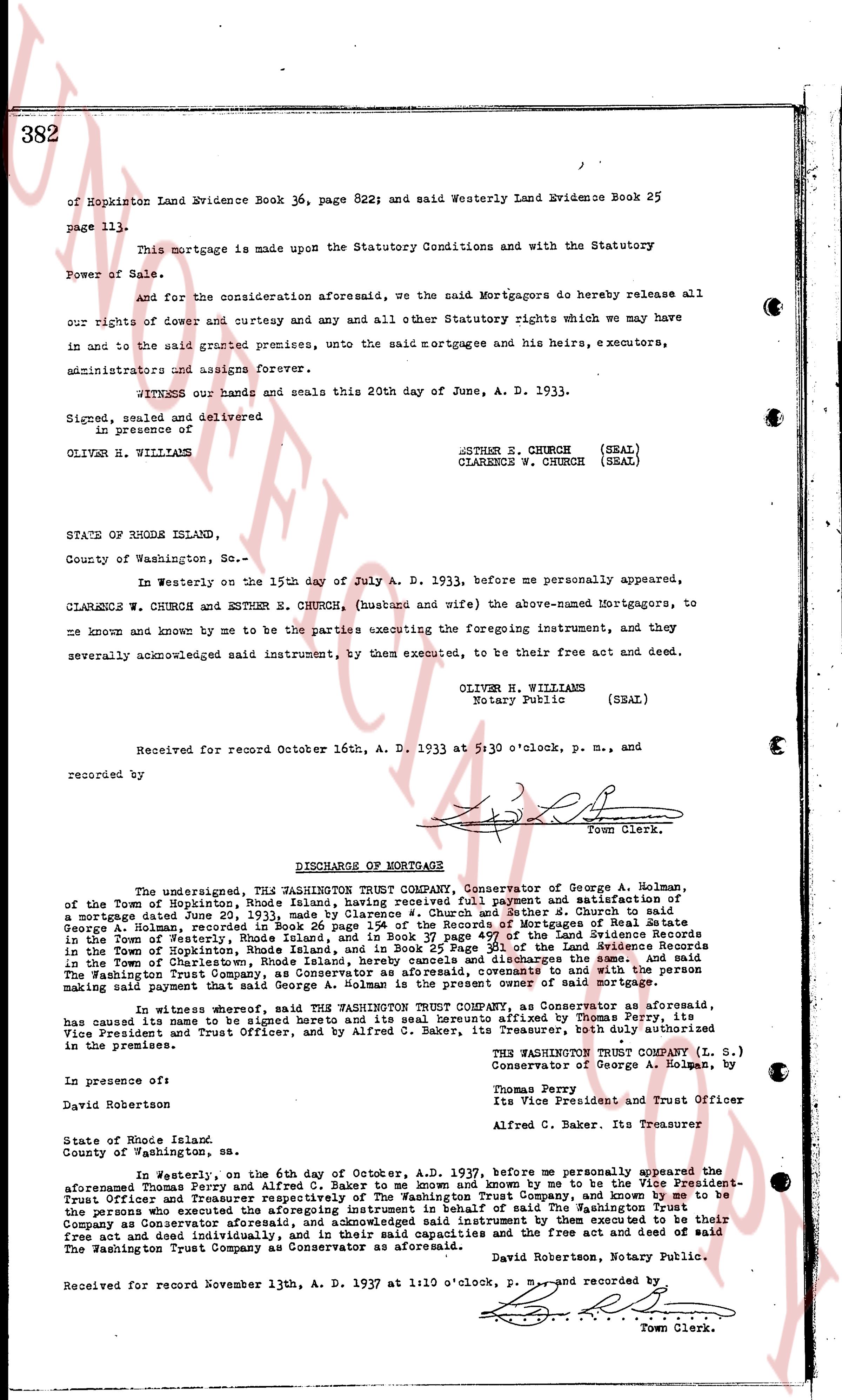
1931 and recorded in said Town of Charlestown Land Evidence Book 24 page 494; in said Town
The page as recorded