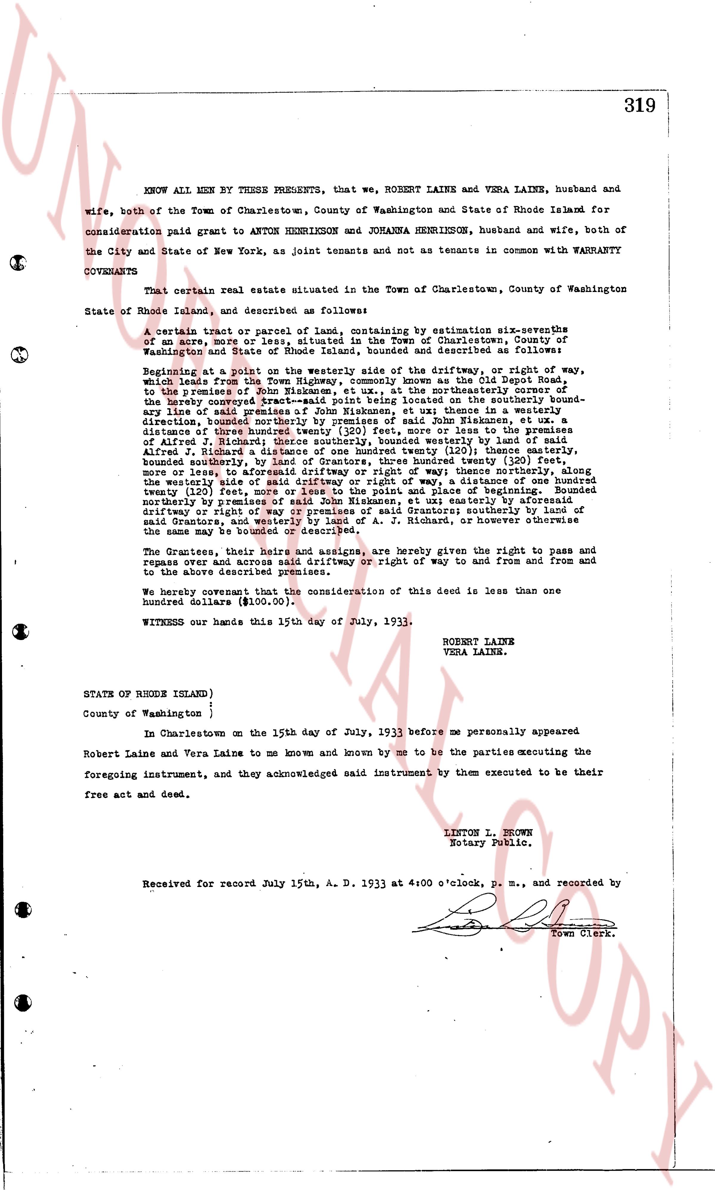
The instrument's own words
page 1
319
KNOW ALL MEN BY THESE PRESENTS, that we, ROBERT LAINE and VERA LAINE, husband and
wife, both of the Town of Charlestown, County of Washington and State of Rhode Island for
consideration paid grant to ANTON HENRIKSON and JORANKA HENRIKSON, husband and wife, both of
the City and State of New York, as joint tenants and not as tenants in common with WARRANTY
COVENANTS
That certain real estate situated in the Town of Charlestown, County of Washington
State of Rhode Island, and described as follows:
A certain tract or parcel of land containing by estimation sixteen-sevenths
of an acre more or less, situated in the Town of Charlestown, County of
Washington and State of Rhode Island, bounded and described as follows:
Beginning at a point on the westerly side of the driftway, or right of way,
which leads from the Town highway, commonly known as the Old Digges Road,
to the premises of Obadiah Digges, and being at the northeasterly corner of
the hereby conveyed tract-said point being located on the southerly bound-
ary line of said premises of Obadiah Digges; thence in a southeasterly
direction, bounded northerly by premises of said John Nikkanen, et ux
a distance of Three hundred (300) feet more or less to the southeasterly
corner of Alfred J. Richard; thence southerly, bounded westerly by land of
said Alfred J. Richard, a distance of Three hundred (300) feet more or less,
bounded southerly, by land of Grantors, three hundred (300) feet more
or less, to intersect the westerly side of said driftway or right of way; thence along
the westerly side of said driftway or right of way, a distance of one hundred
twenty (120) feet, south westerly to the point of beginning; bounded
northerly by premises of said John Nikkanen, et ux; easterly by aforesaid
driftway, or right of way, bounded easterly by said Grantors; southerly either
said Grantors, and westerly by land of A. J. Richard, or however otherwise
the same may be bounded or described.
The Grantees, their Heirs and assigns, are hereby given the right to pass and
repass free and across said driftway or right of way to and fro from and
to the above described premises.
We hereby covenant that the consideration of this deed is less than one
hundred dollars ($100.00).
WITNESS our hands this 15th day of July, 1933.
ROBERT LAINE
VERA LAINE.
STATE OF RHODE ISLAND )
)
County of Washington )
In Charlestown on the 15th day of July, 1933 before me personally appeared
Robert Laine and Vera Laine to me known and known by me to be the parties executing the
foregoing instrument, and they acknowledged said instrument by them executed to be their
free act and deed.
LINTON L. BROWN
Notary Public.
Received for record July 15th, A. D. 1933 at 4:00 o'clock, p. m., and recorded by
[Signature]
Town Clerk.
The page as recorded