The Deed Walker · From Ninigret · Charlestown, Rhode Island land evidence, 1738 to today
Trail: 9187

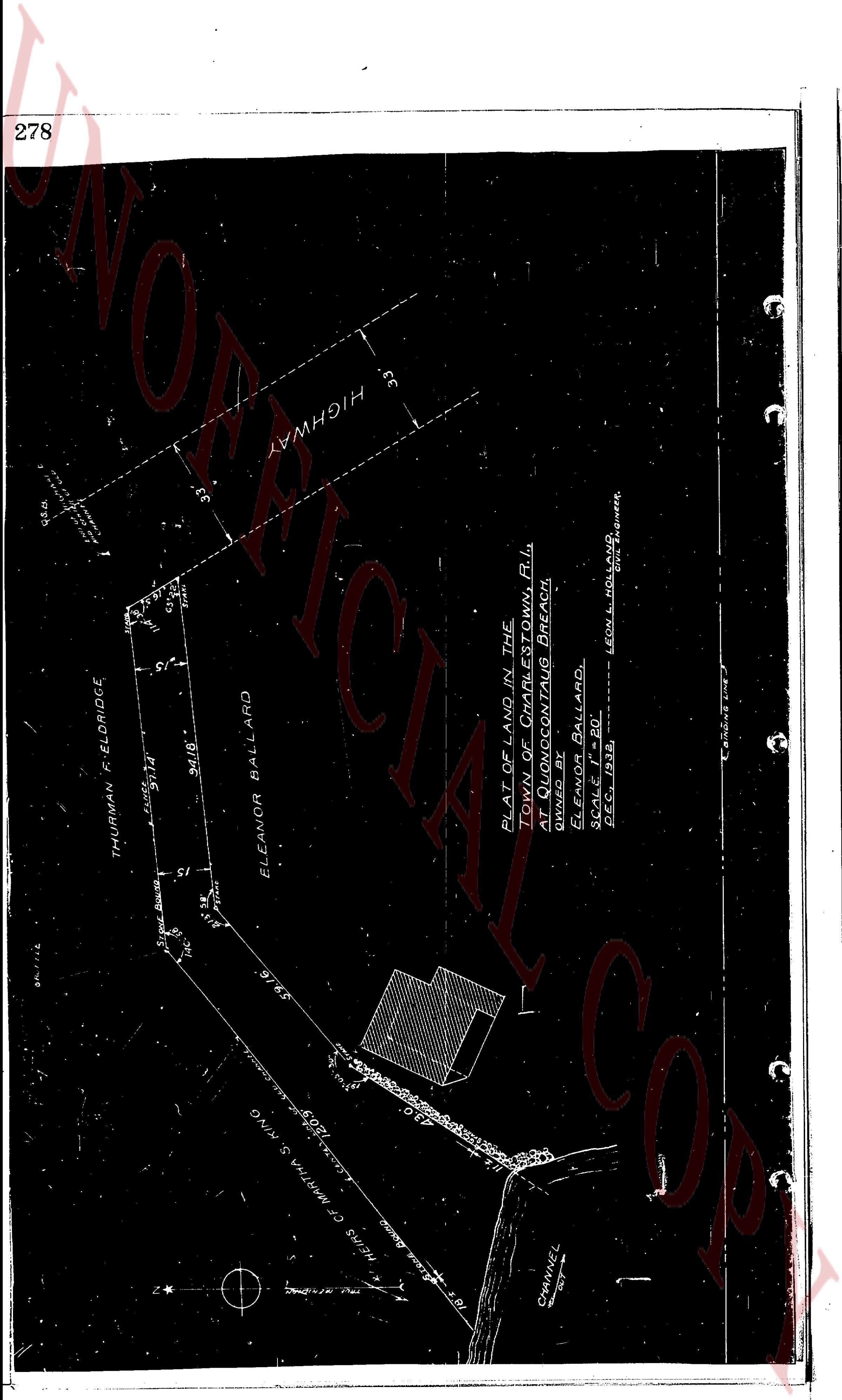
3/31/1933 · SURVEY · book 25 page 278 doc 9187

From BALLARD ELEANOR, QUONOCONTAUG BREACH
To ?
Premises none · Plat of land at Quonnocontaug Beach (Charlestown, Quonnocontaug Beach)

Back — where this land came from

This instrument states no source of title that we have read yet.

The grantor's earlier acquisitions, by name — the man, not necessarily this land

◀ 1929 · DEED · LEARNED ELIZABETH H; LEARNED HERMAN E → BALLARD ELEANOR · book 23 p 503

Forward — where this land went

⛔ The record we hold stops here: no later instrument we have read cites this one, and no later conveyance by the grantee is linked by name. The index is complete to 1987, so the gap is in the words: deeds of this era seldom cite book and page, and only about half the instruments of 1936-1965 have been transcribed (some 6,000 were never imaged), so a citation to this deed may sit in a page not yet read.

The instrument's own words

page 1
278 THURMAN F. ELDRIDGE 91.14 34.18 ELEANOR BALLARD 59.16 HEIRS OF MARTHA S. KING 120.5 CHANNEL HIGHWAY 33 33 PLAT OF LAND IN THE TOWN OF CHARLESTOWN, R.I. AT QUONNOCONTOUG BEACH, ELEANOR BALLARD, SCALE 1" = 80' DEC. 1, 1938. EDWIN L. HOLLAND CIVIL ENGINEER

The page as recorded
page 1

deed_walker_v1.9_2026-10-10 · the index is the town's own (i2l.uslandrecords.com); transcripts, chains and the assessor's cards are the Perry Machine's reading of it. Where the record we hold runs out, the page says so.