The instrument's own words
page 1
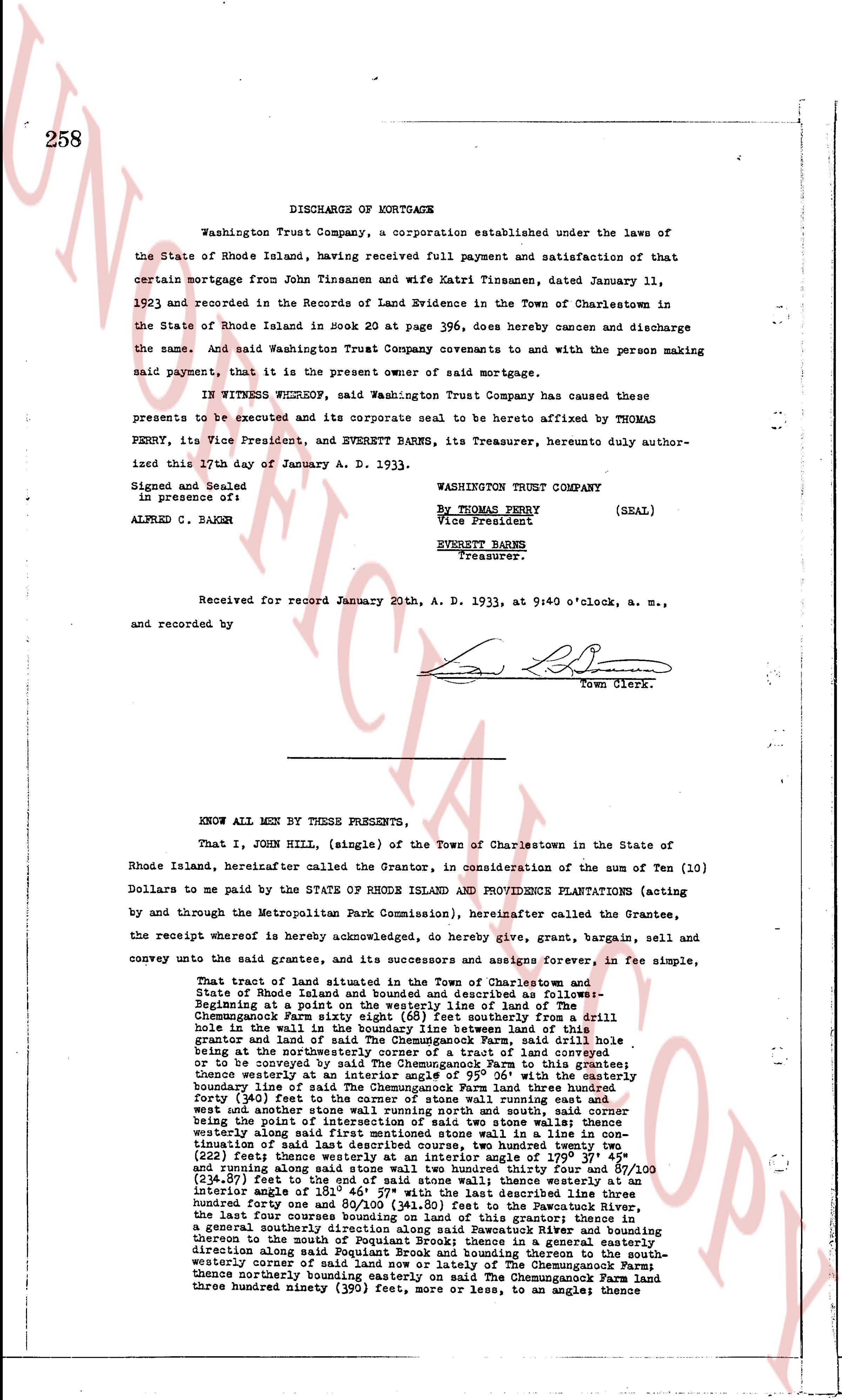
258
DISCHARGE OF MORTGAGE
Washington Trust Company, a corporation established under the laws of
the State of Rhode Island, having received full payment and satisfaction of that
certain mortgage from John Tinsanen and wife Katri Tinsanen, dated January 11,
1923 and recorded in the Records of Land Evidence in the Town of Charlestown in
the State of Rhode Island in Book 20 at page 396, does hereby release and discharge
the same. And said Washington Trust Company covenants to and with the person making
said payment, that it is the present owner of said mortgage.
IN WITNESS WHEREOF, said Washington Trust Company has caused these
presents to be executed and its corporate seal to be hereto affixed by THOMAS
PERRY, its Vice President, and EVERETT BARNES, its Treasurer, hereunto duly author-
ized this 17th day of January A. D. 1933.
WASHINGTON TRUST COMPANY
(SEAL)
By THOMAS PERRY
Vice President
EVERETT BARNES
Treasurer.
Signed and Sealed
in presence of:
ALFRED C. BAGLIN
Received for record January 20th, A. D. 1933, at 9:40 o'clock, a. m.,
and recorded by
[Signature]
Town Clerk.
KNOW ALL MEN BY THESE PRESENTS,
That I, JOHN HILL, (single) of the Town of Charlestown in the State of
Rhode Island, hereinafter called the Grantor, in consideration of the sum of Ten (10)
Dollars to me paid by the STATE OF RHODE ISLAND AND PROVIDENCE PLANTATIONS (acting
by and through the Metropolitan Park Commission), hereinafter called the Grantee,
the receipt whereof is hereby acknowledged, do hereby give, grant, bargain, sell and
convey unto the said Grantee, and its successors and assigns forever, in fee simple,
That tract of land situated in the Town of Charlestown and State
of Rhode Island, more or less 12.50 acres, described as follows:
Beginning at a point on the westerly line of land of The
Chemungcock Farm estate belonging to [Signature] from a drill
hole in the wall in the boundary line between this land and the
Chemungcock Farm estate running thence S 61° east southerly for a drill
hole in the wall in the boundary between Chemungcock Farm said drill hole
being at the northeasterly corner of a tract of land conveyed or
to be conveyed by said Alfred C. Baglin to the grantee;
thence westerly at an interior angle of 95° 06' with the easterly
boundary line of said Alfred C. Baglin land hereinafter called
forty (40) feet to the corner of stone wall running east and
west and northeast stone wall running northeast and south
west thence along said stone wall in a line to a drill hole in
continuation of said last described course, two hundred twenty
two (222) feet, thence turning at an interior angle of 99° 57' 34"
and running along said stone wall two hundred thirty four 87/100
(234.87) feet to the corner of said stone wall; thence westerly at an
interior angle of 181° 46' 57" with the last described course, one
hundred forty one 80/100 (141.80) feet to the Pawcatuck River,
the last hundred four courses being’s [sic] roughly parallel to
a general southerly direction along said Pawcatuck River and bounding
thence to the mouth of a small stream which tends to a general
direction along said Pougat Brook and running thereon to the south-
westerly corner of said land and the boundary of The Chemungcock
thence northerly bounding easterly on said Chemungcock Farm land
three hundred ninety three (393) feet, more or less, to an angle; thence
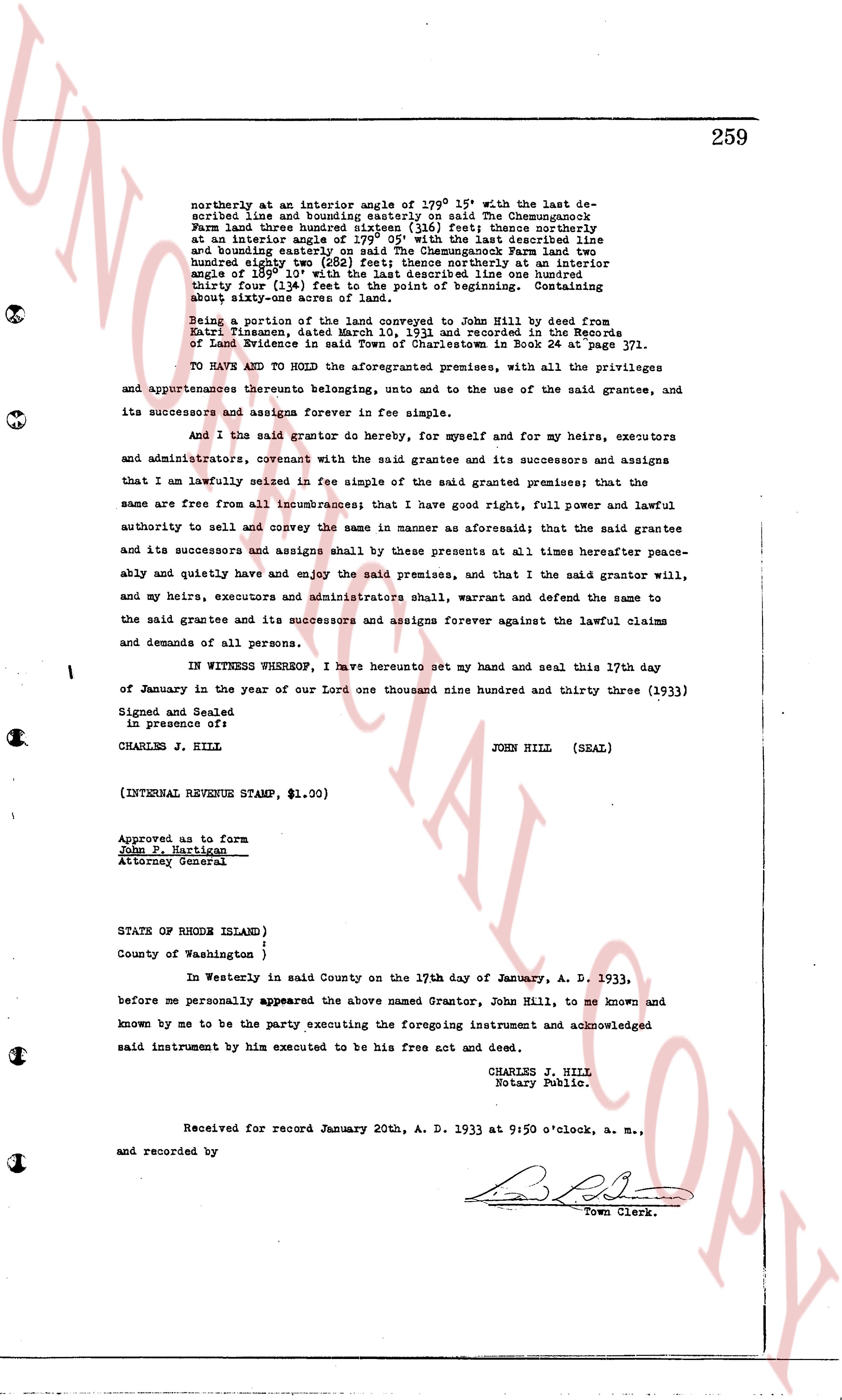
page 2
361
STATE OF RHODE ISLAND )
) ss
County of Washington)
In Richmond on the 22nd, day of September, 1933 before me personally appeared
Charles H. Dyson to me known and known by me to be the party executing the foregoing instru-
ment, and he acknowledged said instrument, by him executed, to be his free act and deed.
OSCAR E. BARBER
Notary Public.
Received for record September 22nd, A. D. 1933 at 3:30 o'clock, p. m., and
recorded by
[Signature]
Town Clerk.
KNOW ALL MEN BY THESE PRESENTS, That we, Elvin J. Baker and Marguerite S. Baker,
of North Eastern, County of Bristol and State of Mass. (Joint tenants and not as tenants in
common) for consideration paid, grant to Joseph P. Cybulski and Nellie M. Cybulski, of the
Town of Charlestown, County of Washington and State of Rhode Island, as Joint tenants and
not as tenants in common, or to the survivor thereof with WARRANTY CONVEYANTS
That certain real estate situated in Charlestown, County of Washington in the
State of Rhode Island, and described as follows:
That certain parcel or part of land situated in the Town of Charles-
town, County of Washington and State of Rhode Island and bounded and
described as follows:
Starting at the northwest corner of said tract of land at john J.
Burdick and running westerly southerly along the State Highway a distance of
900 feet, thence easterly a piece of land lies a distance of 300 feet,
thence northerly to a road, thence westerly along said road a distance
of 375 feet to land of john J. Burdick, thence southerly along said
Burdick land a distance of 376 feet, thence westerly along said
Burdick land a distance of 133 feet to corner first mentioned.
Bounded on the north by the road, east by land of these grantors, west
by the State Highway and Burdick land and on the south by lands of
these grantors.
And we, Elvin J. Baker and Marguerite S. Baker release to said grantee all our
right of courtesy dower and all other interest in the aforesaid premises.
WITNESS our hands this 22nd, day of September, 1933.
ELVIN J. BAKER
MARGUERITE S. BAKER
(INTERNAL REVENUE STAMP, $1.00)
STATE OF RHODE ISLAND )
) ss
County of Washington )
In Richmond on the 22nd, day of September, 1933 before me personally appeared
Elvin J. Baker and Marguerite S. Baker, both to me known and known by me to be the parties
executing the foregoing instrument, and they each acknowledged said instrument, by them
executed, to be their free act and deed.
OSCAR E. BARBER
Notary Public
Received for record September 22nd, A. D. 1933, at 3:45 o'clock, p. m., and
recorded by
[Signature]
Town Clerk.
The page as recorded