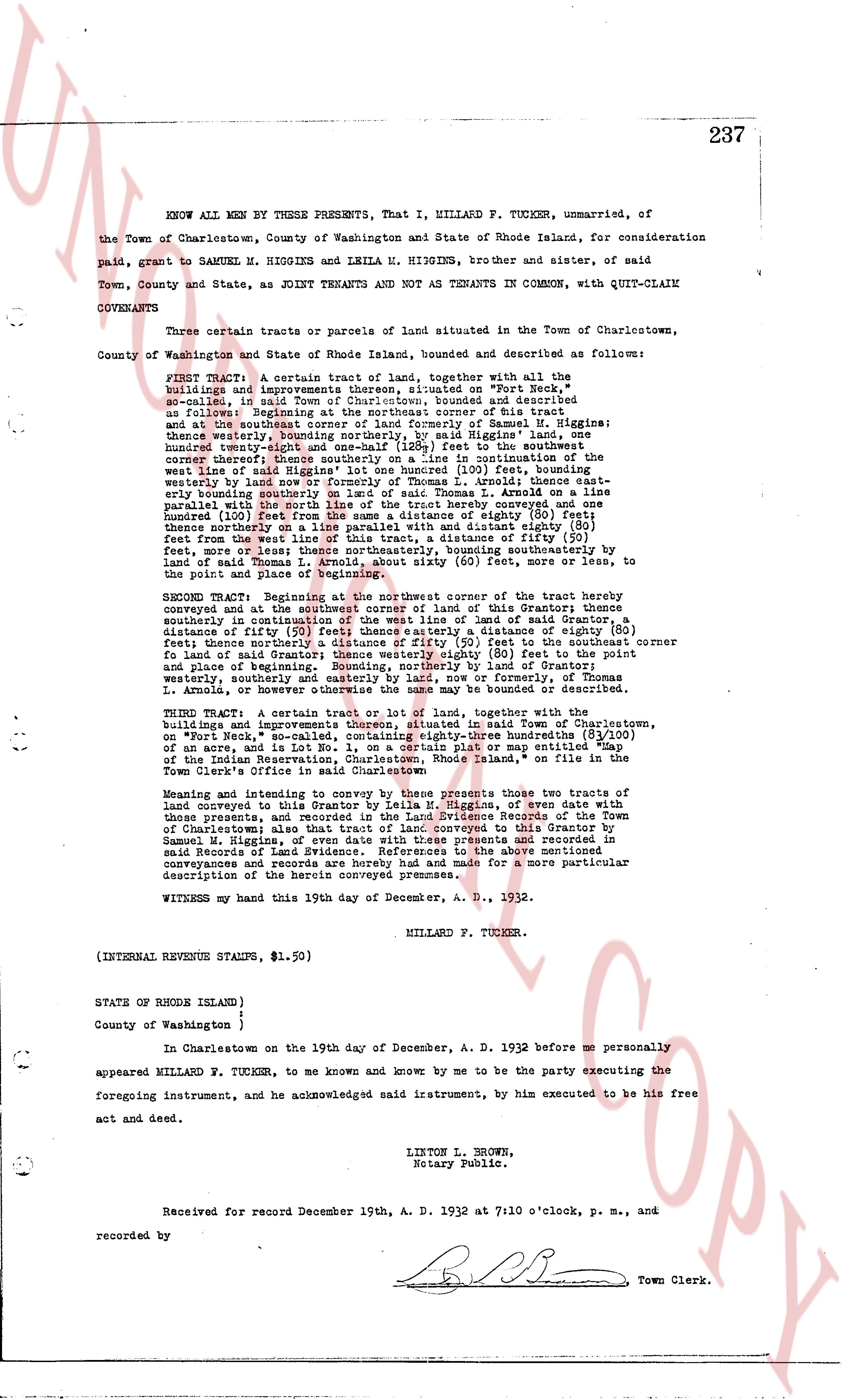
The instrument's own words
page 1
237
KNOW ALL MEN BY THESE PRESENTS, That I, MILLARD P. TUCKER, unmarried, of
the Town of Charlestown, County of Washington and State of Rhode Island, for consideration
paid, grant to SAMUEL M. HIGGINS and LELIA M. HIGGINS, brother and sister, of said
Town, County and State, as joint TENANTS AND not as TENANTS IN COMMON, with QUIT-CLAIM
COVENANTS
Certain tracts or parcels of land situated in the Town of Charlestown,
County of Washington and State of Rhode Island, bounded and described as follow:
FIRST TRACT: A certain tract of land, together with all the
buildings and improvements thereon situated on "Fort Neck,"
so called, in said Town, bounded and described, numbered and described as
follows: Beginning at the northeast corner of this tract and
thence southeasterly to the southeast corner of formerly or Thomas M. Higgins;
thence westerly, bounding northerly, by said Higgins' land, one
hundred (100) feet to a point marked by a stone at the southwest
corner thereof; thence southerly on a line intersecting (105) feet, bounding
westly by land of Samuel M. Higgins and thence westerly eighty (80) feet
of the said line of Higgins' lot one hundred (100) feet, bounding
northwesterly by land of Samuel M. Higgins and thence easterly eighty (80)
feet from the west line of this tract, a distance of ninety (90) feet,
thence southeasterly on a line, bounding southeasterly by land
of said Thomas L. Arnold, about sixty (60) feet, more or less, to
the point of beginning of this tract hereby conveyed and one
hundred (100) feet from the same a distance of eighty (80) feet;
thence northerly on a line, with a distance eighty (80) feet
feet from the west line of this tract, a distance of ninety (90) feet,
thence southeasterly on a line, bounding southeasterly by land
of said Thomas L. Arnold, about sixty (60) feet, more or less, to
the point of beginning of this tract.
SECOND TRACT: Beginning at the northeast corner of the tract hereby conveyed and
thence southeasterly at the southwest corner of land of Grantor this Grantee,
thence southerly on a line intersecting (105) feet, bounding
distance of ninety (90) feet thence easterly a distance of eighty (80) feet;
thence northerly on a line, with a distance eighty (80) feet to the southern corner
fo land of Grantor; thence westerly eighty (80) feet to the point
and place of beginning, bounding northerly by land of Grantor;
westerly, southerly and easterly be bounded by land, now or formerly of Thomas
L. Arnold, or otherwise the same may be bounded or described.
THIRD TRACT: A certain piece of land, together with the
buildings and improvements thereon situated in said Town of Charlestown,
known as "Pigeon Neck," bounded and described as follows: A triangle of (3/4)
of an acre and is Lot No. 1, on a certain plat or map entitled "Map
of the Indian Reservation, Charlestown, Rhode Island," on file in the
Town Clerk's office in said Town.
Meaning and intent to convey by these presents those two tracts of
land conveyed to this Grantor by Lelia M. Higgins, of even date with
this present instrument and subsequent Release of the above mentioned
property also that tract of land conveyed to this Grantor by
Samuel M. Higgins, of even date with these presents and recorded in
said Records of Land Evidence. References to the above mentioned
conveyances and records are hereunto made for a more particular
description of the herein conveyed premnses.
WITNESS my hand this 19th day of December, A. D., 1932.
MILLARD P. TUCKER.
(INTERNAL REVENUE STAMPS, $1.50)
STATE OF RHODE ISLAND )
i
County of Washington )
In Charlestown on the 19th day of December, A. D. 1932 before me personally
appeared MILLARD P. TUCKER, to me known and know by me to be the party executing the
foregoing instrument, and he acknowledged said instrument, by him executed to be his free
act and deed.
LIBTON L. BROWN,
Notary Public.
Received for record December 19th, A. D. 1932 at 7:10 o'clock, p. m., and
recorded by [Signature] Town Clerk.
The page as recorded