The instrument's own words
page 1
221
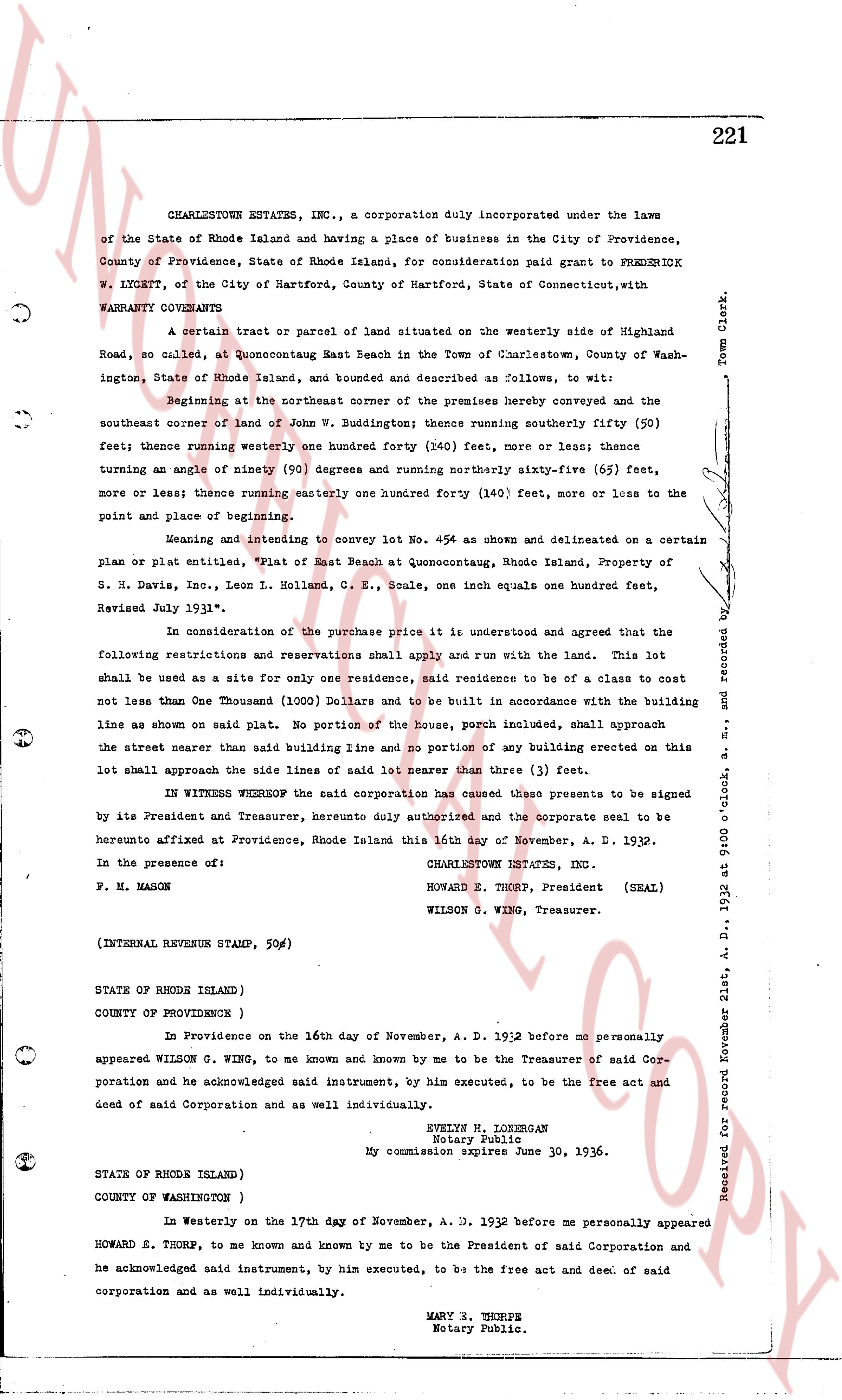
CHARLESTONE ESTATES, INC., a corporation duly incorporated under the laws
of the State of Rhode Island and having a place of business in the City of Providence,
County of Providence, State of Rhode Island, for consideration paid grant to FREDERICK
W. LYKETT, of the City of Hartford, County of Hartford, State of Connecticut, with
WARRANTY CONVEYS
A certain tract or parcel of Land situated on the westerly side of Highland
Road, so called, at Quonsetconquut Beach East in the Town of Charlestown, County of Wash-
ington, State of Rhode Island, and bounded and described as follows, to wit:
Beginning at the northeast corner of the premises hereby conveyed and the
southeast corner of land of John W. Buddington; thence running southerly fifty (50)
feet; thence running westerly one hundred forty (140) feet, more or less; thence
turning an angle of ninety (90) degrees and running northerly sixty-five (65) feet,
more or less; thence running easterly one hundred forty (140) feet, more or less to the
point of place and beginning.
Meaning and intending to convey lot No. 454 as shown and delineated on a certain
plan or plat entitled, "Plat of East Beach at Quonsetconquut, Rhode Island, Property of
S. H. Davis, Inc., Leon L. Holland, G. R. Scale, one inch equals one hundred feet,
Revised July 1931".
In consideration of the purchase price it is understood and agreed that the
following restrictions and reservations shall apply and run with the land. This lot
shall be used as a site for only one residence, said residence to be of a class to cost
not less than One Thousand (1000) Dollars and to be built in accordance with the building
line as shown on said plat. No portion of the House, porch included, shall approach
the street nearer than said building line and no portion of any building erected on this
lot shall approach the side lines of said lot nearer than three (3) feet.
IN WITNESS WHEREOF the said corporation has caused these presents to be signed
by its President and Treasurer, hereunto duly authorized and the corporate seal to be
herunto affixed at Providence, Rhode Island this 16th day of November, A. D. 1932.
CHARLESTONE ESTATES, INC.
HOWARD E. THURP, President (SEAL)
WILSON S. WING, Treasurer.
In the presence of:
F. M. HASON
(INTERNAL REVENUE STAMP, 50c)
STATE OF RHODE ISLAND)
COUNTY OF PROVIDENCE )
In Providence on the 16th day of November, A. D. 1932 before me personally
appeared WILSON G. WING, to me known and by me known to be the Treasurer of said Cor-
poration and he acknowledged said instrument, by him executed, to be the free act and
deed of said Corporation and as well individually.
EVELYN H. LOGERMAN
Notary Public.
My commission expires June 30, 1936.
STATE OF RHODE ISLAND)
COUNTY OF WASHINGTON )
In Westerly on the 17th day of November, A. D. 1932 before me personally appeared
HOWARD E. THURP, to me known and by me known to be the President of said Corporation and
he acknowledged said instrument, by him executed, to be the free act and deed of said
corporation and as well individually.
MARY S. THURP
Notary Public.
Received for record November 21st, A. D. 1932 at 9:00 o'clock, a. m. and recorded by
Town Clerk.
The page as recorded