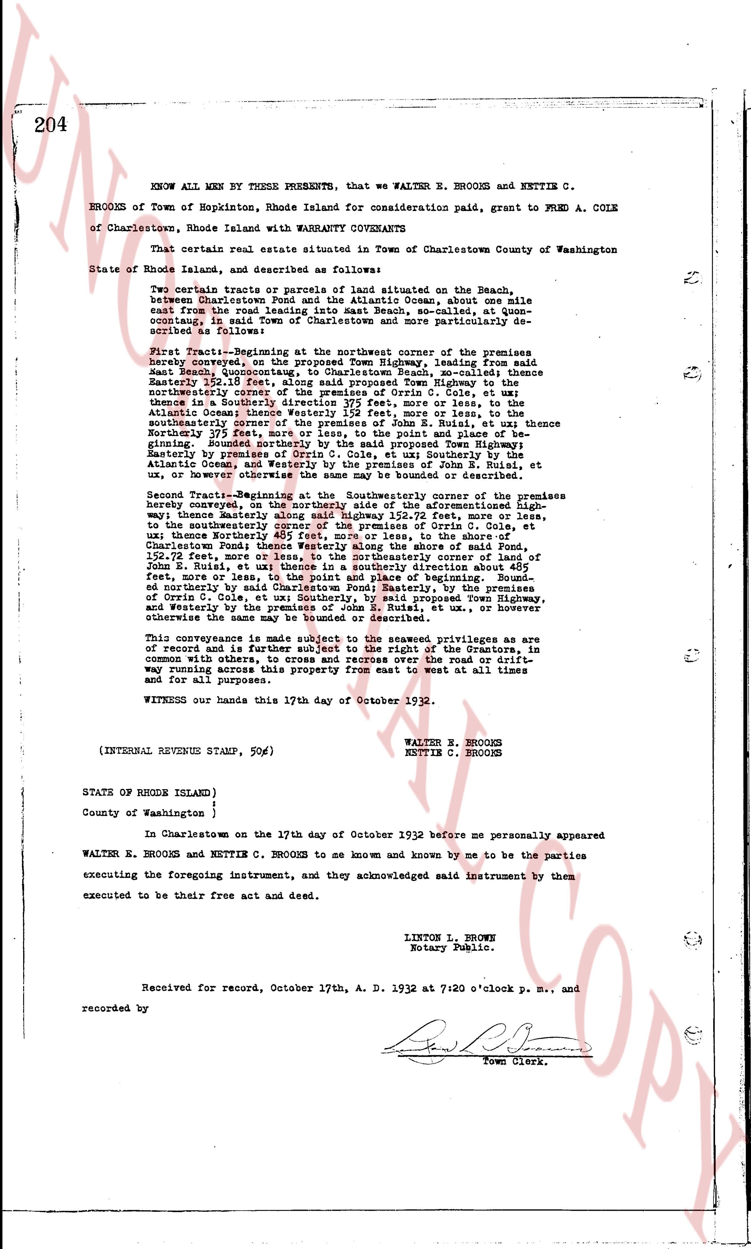
The instrument's own words
page 1
204
KNOW ALL MEN BY THESE PRESENTS, that we WALTER E. BROOKS and NETTIE C.
BROOKS of Town of Hopkinton, Rhode Island for consideration paid, grant to FRED A. COLE
of Charlestown, Rhode Island with WARRANTY COVENANTS
That certain real estate situated in Town of Charlestown County of Washington
State of Rhode Island, and described as follows:
Two certain tracts or parcels of land situated on the Beach,
between Charlestown Pond and the Atlantic Ocean, about one mile
east from the road leading into East Beach, so-called, at quen-
coutang, in said Town of Charlestown and more particularly des-
cribed as follows:
First Tract--Beginning at the northwest corner of the premises
hereby conveyed, on the proposed Town Highway, leading from said
East Beach, known as the road to East Beach, thence East
Easterly 252.19 feet, along said proposed Town Highway to the
northwesterly corner of the premises of Peter Cox, thence East
thence in a Southerly direction 375 feet, more or less, to the
southeasterly corner of the premises of Peter Cox, thence to the
southeasterly corner of the premises of John E. Ruiz, et ux thence
Northerly 375 feet, thence easterly to the Gulf and Atlantic O-
cean, bounded Northerly by the said proposed Town Highway;
Easterly, by premises of Peter Cox, et ux Southerly by the
Atlantic Ocean, and Westerly by the premises of John E. Ruiz, et
ux, or however otherwise the same may be bounded or described.
Second Tract--Beginning at the Southeasterly corner of the premises
hereby conveyed, on the northerly side of the aforementioned High-
way thence Easterly said highway 252.19 feet more or less,
to the northwesterly corner of the premises of Cris C. Cole, et
ux thence Northerly 400 feet, more or less, to the shores of
Charlestown Pond thence Westerly along the shore of said Pond,
152.52 feet, thence North 45 degrees West, southerly corner of land of
John E. Ruiz, et ux thence in a southerly direction about 400
feet, to the northwesterly corner and place of beginning. Bounded
Northerly by the shores of Charlestown Pond, Southerly, by the premises
of Cris C. Cole, et ux southerly, by said proposed Town Highway,
and Westerly by the premises of John E. Ruiz, et ux or however
otherwise the same may be bounded or described.
This conveyance is made subject to the seawall privileges as are
of record and is further subject to the right of the Grantors, in
common with others, to cross and recross over the road or drift-
way running across this property from east to west at all times
and for all purposes.
WITNESS our hands this 17th day of October 1932.
WALTER E. BROOKS
NETTIE C. BROOKS
(INTERNAL REVENUE STAMP, 50¢)
STATE OF RHODE ISLAND)
County of Washington )
In Charlestown on the 17th day of October 1932 before me personally appeared
WALTER E. BROOKS and NETTIE C. BROOKS to me known and known by me to be the parties
executing the foregoing instrument, and they acknowledged said instrument by them
executed to be their free act and deed.
LINTON L. BROWNE
Notary Public.
Received for record, October 17th, A. D. 1932 at 7:20 o'clock p. M., and
recorded by
[Signature]
Town Clerk.
The page as recorded