The instrument's own words
page 1 · read by Gemma vision
48
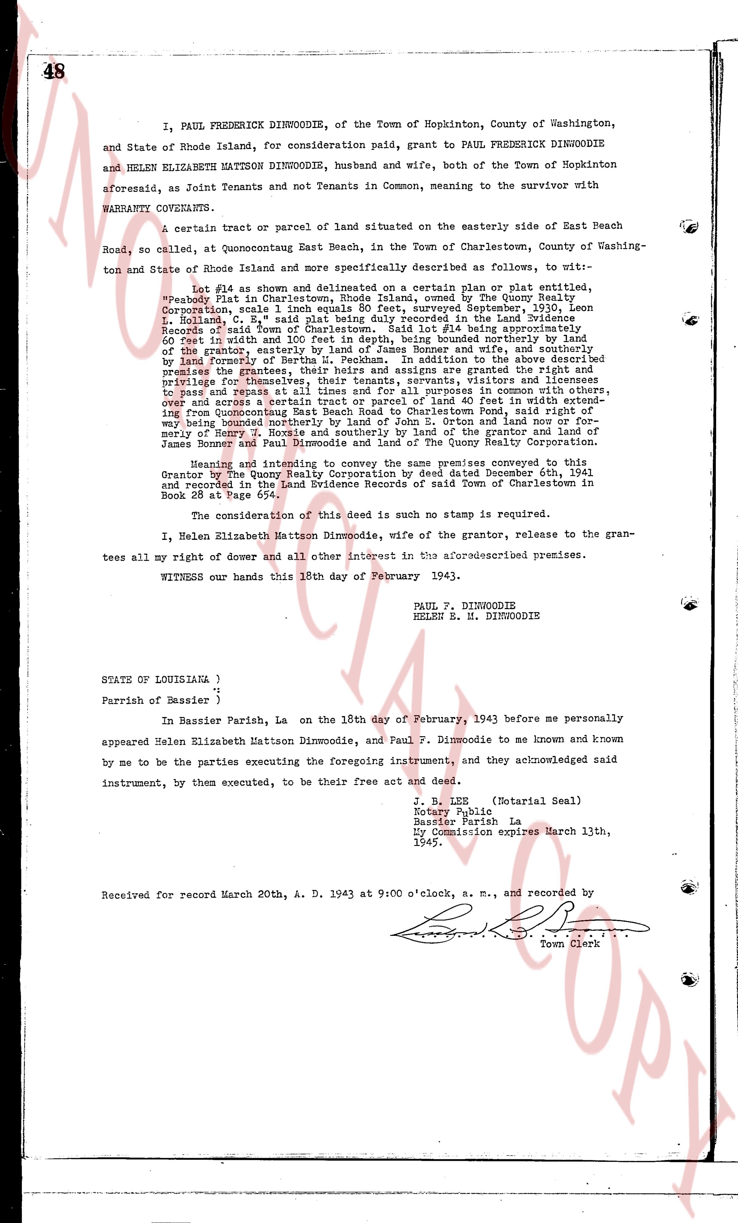
I, PAUL FREDERICK DINWOODIE, of the Town of Hopkinton, County of Washington, and State of Rhode Island, for consideration paid, grant to PAUL FREDERICK DINWOODIE and HELEN ELIZABETH MATTSON DINWOODIE, husband and wife, both of the Town of Hopkinton aforesaid, as Joint Tenants and not Tenants in Common, meaning to the survivor with WARRANTY COVENANTS.
A certain tract or parcel of land situated on the easterly side of East Beach Road, so called, at Quonochontaug East Beach, in the Town of Charlestown, County of Washington and State of Rhode Island and more specifically described as follows, to wit:—
Lot #14 as shown and delimited on a certain plan or plat entitled, "Property Plat in Charlestown, Rhode Island owned by the Quony Sails Corporation," said plan 1 inch equals 80 feet, surveyed September 1935, Leon L. Rohland, C. E., said plat being duly recorded in the Land Evidence Records of said town, Book 23, page 111, said Lot #14 being approximately rectangular 60 feet in width and 100 feet in depth, being bounded northerly by the land of the grantor, easterly by the land of the grantee's wife and her family, and westerly by land formerly of Bertha M. Peckham. In addition to the above described premises the Grantor reserves unto himself, his heirs, assigns and grantees the right and privilege for themselves, their tenants, servants, visitors and licensees to pass and repass at all times and turns for a purpose convenient to the Grantor, and across a strip of land 40 feet in width extending from Quonochontaug East Beach Road to Charlestown Pond, said right of way being bounded southerly by the land of the Grantor, easterly and northerly by land formerly of Henry R. Nozis and southerly by land of the grantor and land of James B. Dunphy and northerly by land of Quony Sails Corporation.
Having intended and intending to convey the same premises conveyed to this Grantor by the Quony Sails Corporation by deed dated December 6th, 1941 and recorded in the Land Evidence Records of said Town of Charlestown in Book 28 at Page 674.
The consideration of this deed is such no stamp is required.
I, Helen Elizabeth Mattson Dinwoodie, wife of the grantor, release to the grantees all my right of dower and all other interest in the aforesaid described premises.
WITNESS our hands this 18th day of February 1943.
PAUL F. DINWOODIE
HELEN E. R. DINWOODIE
STATE OF LOUISIANA }
"
Parish of Bassier }
In Bassier Parish, La on the 18th day of February, 1943 before me personally appeared Helen Elizabeth Mattson Dinwoodie, and Paul F. Dinwoodie to me known and known by me to be the parties executing the foregoing instrument, and they acknowledged said instrument, by them executed, to be their free act and deed.
J. B. LEE (Notarial Seal)
Notary Public
Bassier Parish La
My Commission expires March 13th, 1945.
Received for record March 20th, A. D. 1943 at 9:00 o'clock, a. m., and recorded by
[Signature]
Town Clerk
The page as recorded