The instrument's own words
page 1
188
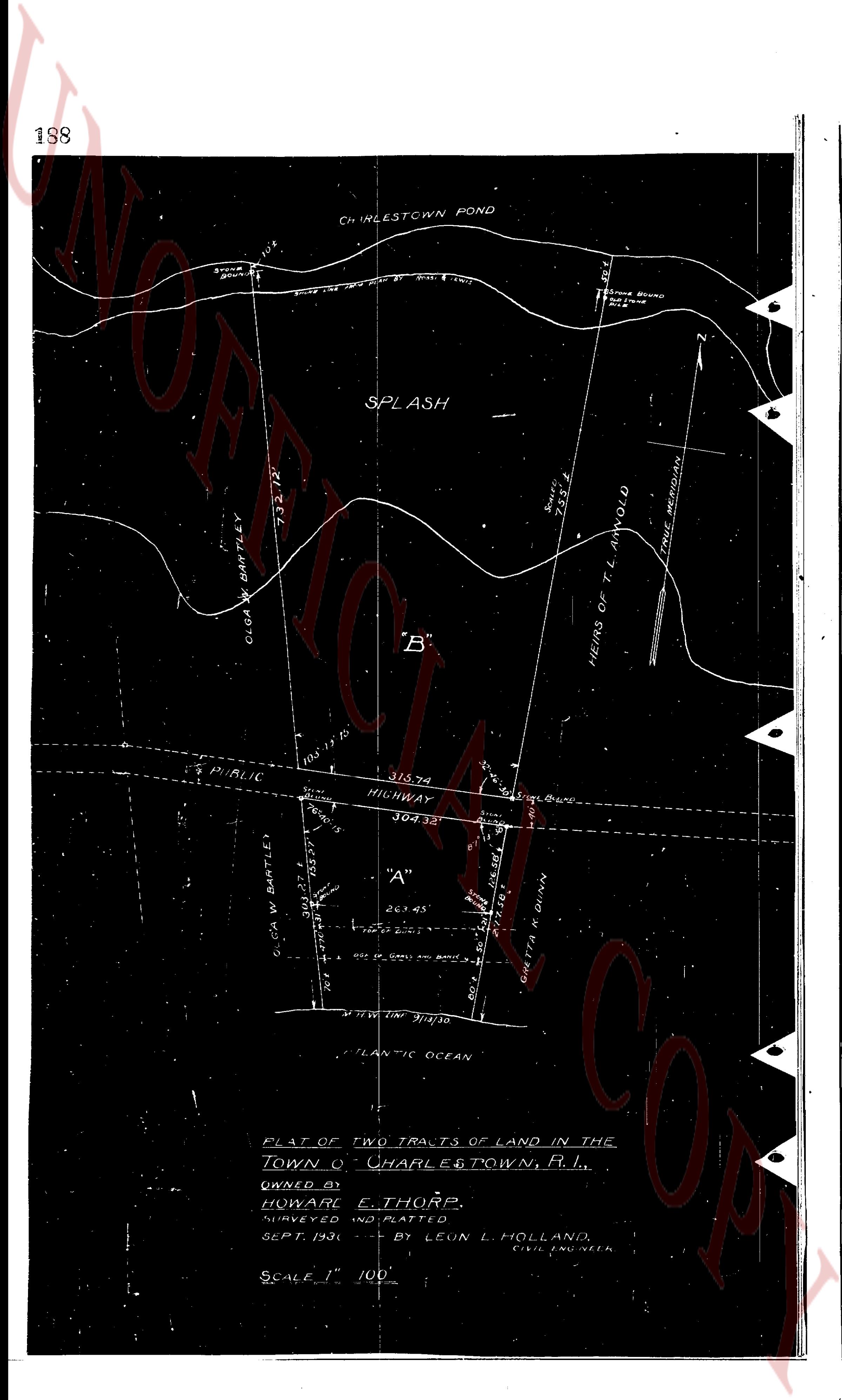
CHINLESTOWN POND
Stone Wall
106'
Stone Wall 18x2' Wide 20' Dist. 1' West
Stone Wall
SPLASH
732.72'
CLUA W. BARTLEY
"B"
755.1'
HEIRS OF T. L. ARNOLD
TRUE MERIDIAN
103' 13' 70"
PUBLIC HIGHWAY
315.74'
304.32'
"A"
CLUA W. BARTLEY
193.27'
261.45'
Stone Wall
Stone Wall 18x2' Wide 20' Dist. 1' West
CLUA W. BARTLEY
S 7° W 1' 31/100
ATLANTIC OCEAN
FLAT OF TWO TRACTS OF LAND IN THE
TOWN OF CHARLESTOWN, R. I.,
OWNED BY
HOWARD E. THORP.
SURVEYED AND PLATTED
SEPT. 1930 - BY LEON L. HOLLAND,
CIVIL ENGINEER
SCALE 1" = 100'
page 2
189
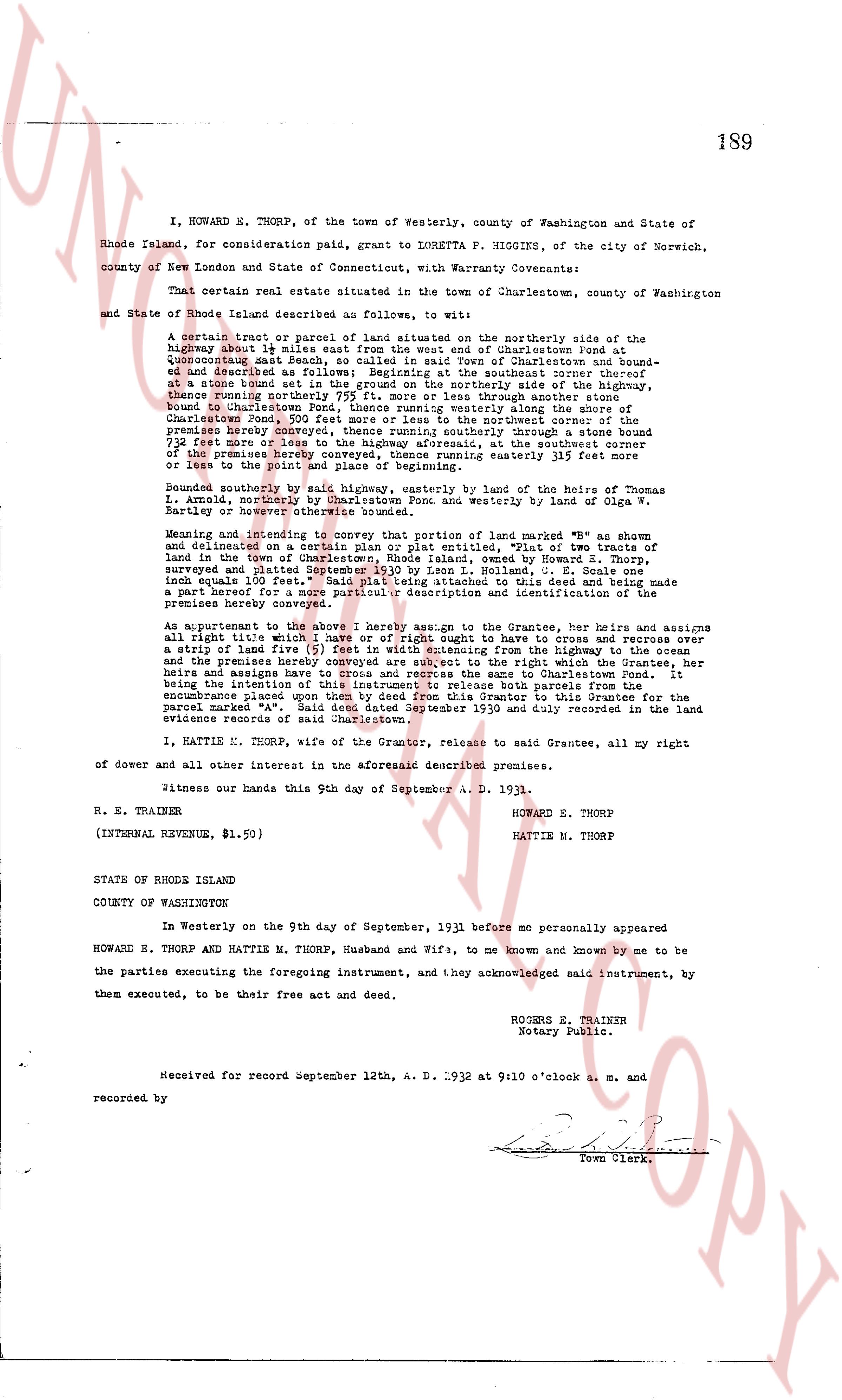
I, HOWARD N. THORP, of the town of Westerly, county of Washington and State of
Rhode Island, for consideration paid, grant to LORETTA P. HIGGINS, of the city of Norwich,
county of New London and State of Connecticut, with Warranty Covenants:
That certain real estate situated in the town of Charlestown, county of Washington
and State of Rhode Island described as follows, to wit:
a certain tract of land or parcel of land situated on the northerly side of the
highway about 1/2 mile east from the west end of Charlestown Pond at
Quonochonticut beach South, so called and said town of Charlestown and bound-
ed on the north by the land of the said Howard Thorp and bounded
at a stone bound set in the ground on the northerly side of the highway,
thence running northerly about 150 feet through another stone bound
Bound to Charlestown Pond, thence running southerly along the shore of
Charlestown Pond 200 feet to a stone bound set in the mudwater shore of the
premises hereby conveyed, thence running southerly through another stone bound
172 feet (or more or less) to a stone bound set in the mudwater shore of the
of the premises hereby conveyed, thence running easterly 115 feet more
or less to the point of beginning.
Bounded easterly by said highway, northerly by the land of heires of Thomas
L. Arnold, northerly by Charlestown Pond and westerly by land of Olga W.
Bartlett and however the title thereabouts may stand.
Meaning and intending to convey that portion of land marked "B" as shown
and delineated on a certain plan or plot entitled, "Plot of two tracts of
land in the town of Charlestown, State of Rhode Island, owned by Howard E. Thorp,
surveyed and plotted September 1930 by A. Rogers T. Trainer, L. S." and
lands equals 100 feet. Said plot being attached to this deed and being made a
part hereof by a reference thereto, for the purpose of identifying and delineating the
premises hereby conveyed.
As appurtenant to the above I hereby assign to the Grantee, her heirs and assigns
all Right title and what it may have in right of however dught to cross and recross over
a strip of land five (5) feet in width extending from the Highway to the cross,
and the premises hereby conveyed, together with the right which the Grantee, her
heirs and assigns have to cross and recross the same to Charlestown Pond. It
being the intention of the Grantor to reserve the easement for the purpose of an
encumbrance placed upon them by deed from this Grantor to this Grantee for the
parcel marked "A", dated the 12th day of September 1930 and duly recorded in the land
evidence records of said Charlestown.
I, MATTIE M. THORP, wife of the Grantor, release to said Grantee, all my right
of dower and all other interest in the aforesaid described premises.
Witness our hands this 9th day of September A. D. 1931.
R. E. TRAINER HOWARD E. THORP
MATTIE M. THORP
(INTERNAL REVENUE, $1.50)
STATE OF RHODE ISLAND
COUNTY OF WASHINGTON
In Westerly on the 9th day of September, 1931 before me personally appeared
HOWARD E. THORP and MATTIE M. THORP, Husband and Wife, to me known and known by me to be
the parties executing the foregoing instrument, and they acknowledged said instrument, by
them executed, to be their free act and deed.
ROGERS E. TRAINER
Notary Public.
Received for record September 12th, A. D. 1932 at 9:00 o'clock a. m. and
recorded by Town Clerk.
The page as recorded