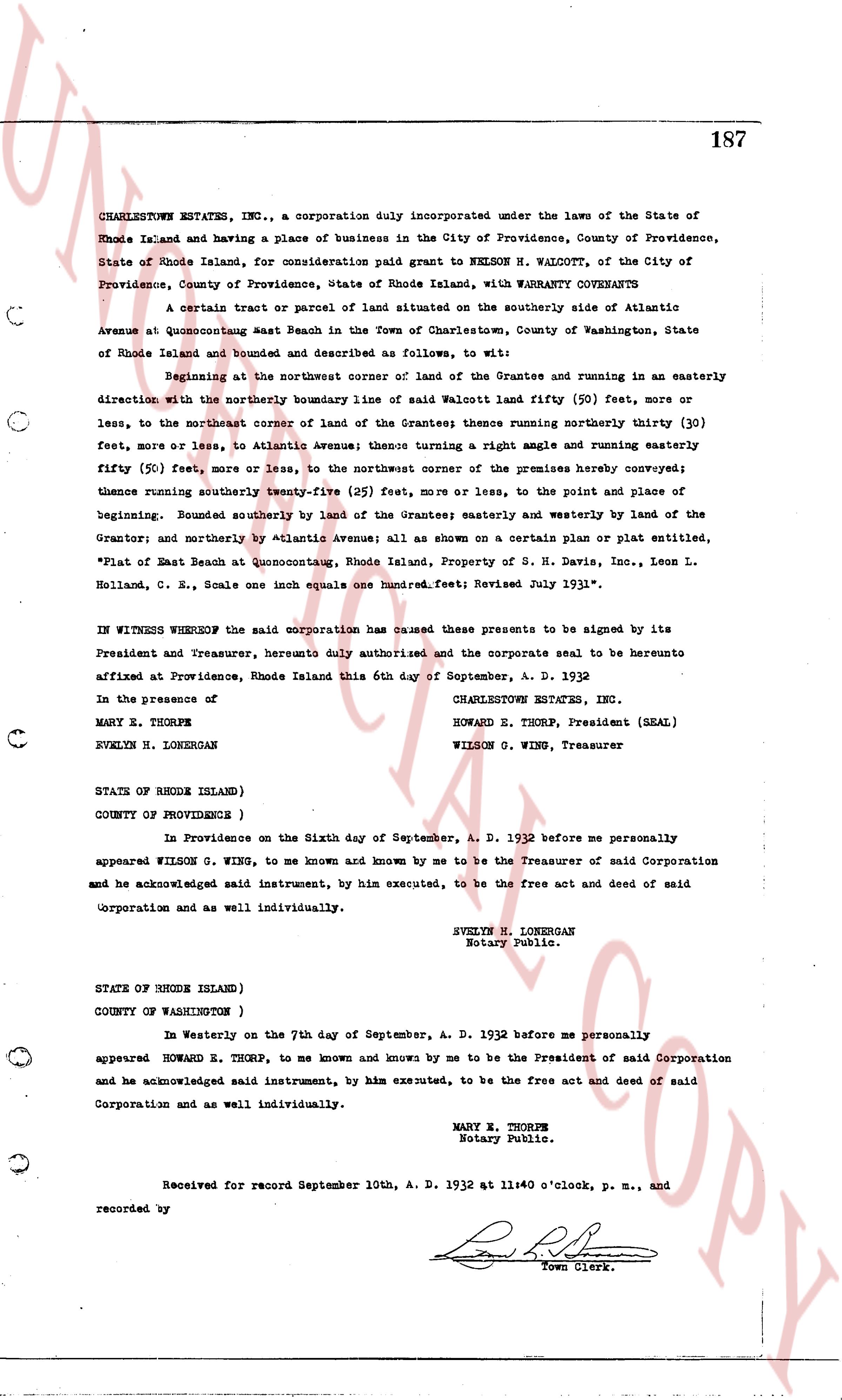
The instrument's own words
page 1
187
CHARLESTOWN ESTATES, INC., a corporation duly incorporated under the laws of the State of
Rhode Island and having a place of business in the City of Providence, County of Providence,
State of Rhode Island, for consideration paid grant to NELSON H. WALCOTT, of the City of
Providence, County of Providence, State of Rhode Island, with WARRANTY COVENANTS
A certain tract or parcel of land situated on the southerly side of Atlantic
Avenue at Quonsetpoint east Beach in the Town of Charlestown, County of Washington, State
of Rhode Island and bounded and described as follows, to wit:
Beginning at the northeast corner of land of the Grantee and running in an easterly
direction with the northerly boundary line of said Walcott land fifty (50) feet, more or
less, to the northeast corner of land of the Grantee; thence running northerly thirty (30)
fifty feet, more or less, to Atlantic Avenue; thence turning a right angle and running easterly
fifty (50) feet, more or less, to the northwest corner of the premises hereby conveyed;
thence running southerly twenty-five (25) feet, more or less, to the point and place of
beginning. Bounded southerly by land of the Grantee; easterly and westerly by land of the
Grantor; and northerly by Atlantic Avenue; all as shown on a certain plan or plat entitled,
"Plat of East Beach at Quonsetpoint, Rhode Island, Property of S. H. Davis, Inc., Leon L.
Holland, Conn. R. E., Scale one inch equals one hundred feet; Revised July 1931".
IN WITNESS WHEREOF the said corporation has caused these presents to be signed by its
President and Treasurer, hereby duly authorized and the corporate seal to be hereunto
affixed at Providence, Rhode Island this 6th day of September, A. D. 1932
In the presence of CHARLESTOWN ESTATES, INC.
MARY E. THORPE HOWARD E. THORP, President (SEAL)
WILSON G. WING, Treasurer
EVELYN H. LONGERGAN
STATE OF RHODE ISLAND)
COUNTY OF PROVIDENCE )
In Providence on the Sixth day of September, A. D. 1932 before me personally
appeared WILSON G. WING, to me known and known by me to be the Treasurer of said Corporation
and he acknowledged said instrument, by him executed, to be the free act and deed of said
Corporation and as well individually.
EVELYN H. LONGERGAN
Notary Public.
STATE OF RHODE ISLAND)
COUNTY OF WASHINGTON )
In Westerly on the 7th day of September, A. D. 1932 before me personally
appeared HOWARD E. THORP, to me known and known by me to be the President of said Corporation
and he acknowledged said instrument, by him executed, to be the free act and deed of said
Corporation and as well individually.
MARY E. THORPE
Notary Public.
Received for record September 10th, A. D. 1932 at 11:40 o'clock, p. m., and
recorded by [Signature]
Town Clerk.
The page as recorded