The instrument's own words
page 1
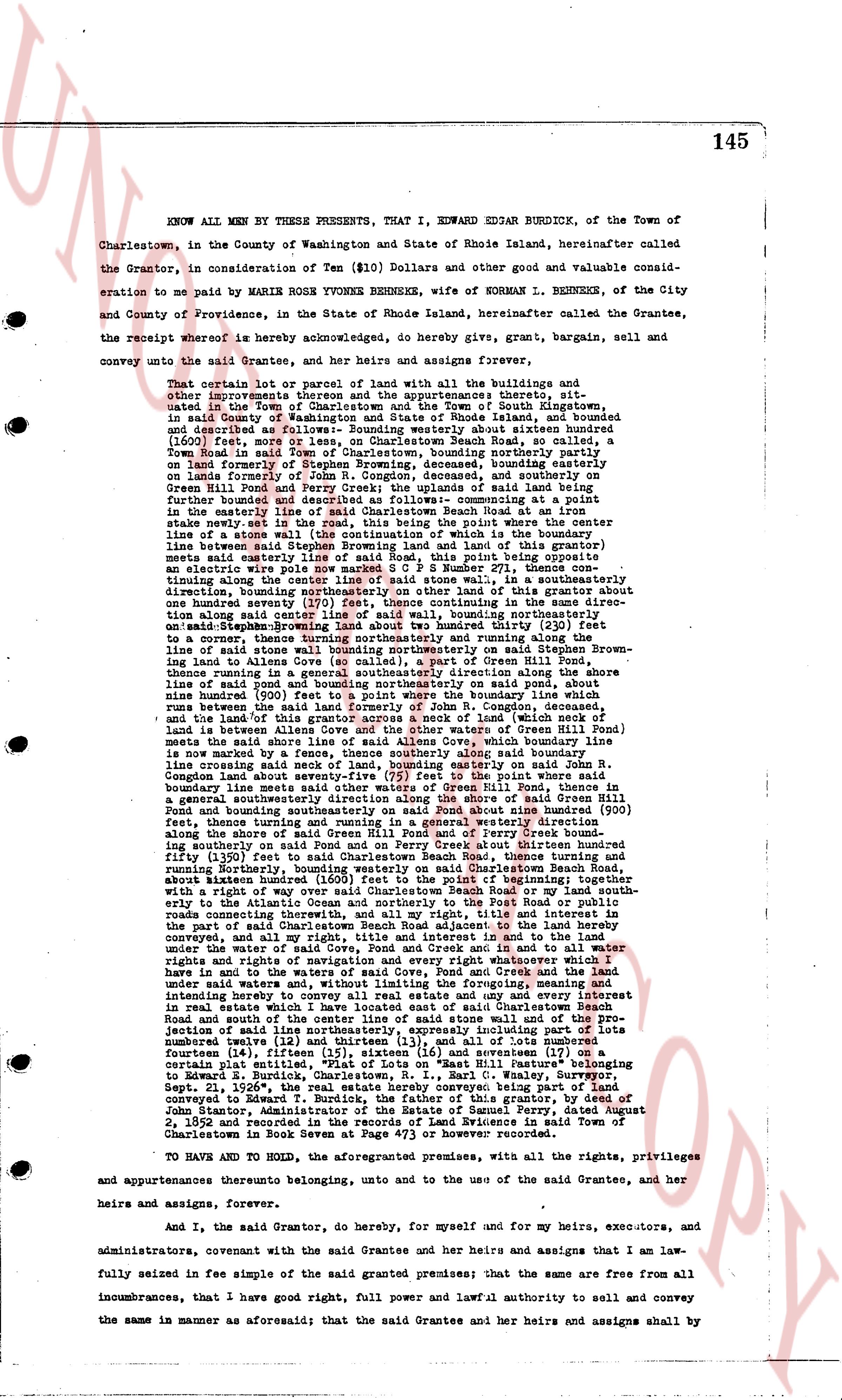
145
KNOW ALL MEN BY THESE PRESENTS, that I, EDWARD EDGAR BURDICK, of the Town of
Charlestown, in the County of Washington and State of Rhode Island, hereinafter called
the Grantor, in consideration of Ten ($10) Dollars and other good and valuable consid-
eration to me paid by MARILE ROSLYN TYSONS BERKEKE, wife of NORMAN L. BERKEKE, of the City
and County of Providence, in the State of Rhode Island, hereinafter called the Grantee,
the receipt whereof is hereby acknowledged, do hereby give, grant, bargain, sell and
convey unto the said Grantee, and her heirs and assigns forever,
That certain lot or parcel of land with all the buildings and
other improvements on the same and all appurtenances thereto, sit-
uated in the Town of Charlestown and the Town of South Kingstown,
in said County of Washington and State of Rhode Island, and bounded
and described as follows: Bounding westerly about sixteen hundred
(1600) feet, more or less, on the shoreline of Charlestown Beach Road, be called, a
Town Road in said Town of Charlestown, bounding northerly partly on
land formerly of Eli Pond, deceased, bounding easterly partly on
lands formerly of John R. Congdon, deceased, and southerly on
lands formerly of Eli Pond, deceased; the said lot being further
further bounded and described as follows: commencing at a point
in the westerly line of said lot on the shoreline of Beach Road the line runs
stake northeast evt in the east, this being the point where the corner
line between a residential lot of land is intersected by the boundary
line between said Stephens Browning land and land of this grantor
runs south southeast to a stone bound, said point being opposite
an electric wire pole way number SCPS H number 271, thence con-
tinuing south southeast to another stone bound, thence northwesterly
direction, bounding northwesterly on other line of this grantor about
one hundred seventy (170) feet to another stone bound, thence di-
agonally along center line of said street, wall bounding northerly on
said Stephens Browning land about two hundred thirty (230) feet
to a concrete fence thence running south and running along the
line of stone walls bounding northerly on said Stephens Browning land
about two hundred seventy (270) feet to a stone bound on the line
of said Pond among other stone walls on Perry Brook Hill Pond
thence running in a general southeasterly direction along the shore
line of said pond among other stone walls on said pond, about three
nine hundred (900) feet to a point where the boundary line which
runs between said land of this grantor and land of John R. Congdon, deceased
and the land of this grantor across a neck of land (which neck of land
is bounded by a general southeasterly direction on waters of Green Hill Pond
meets the said shore line of said Allens Cove, which boundary line
is now marked by a stone bound, said boundary line runs northwest
line crossing said neck of land, bounding easterly on said John R.
Congdon land to a stone bound, said boundary line runs northwest
boundary line meets other said waters of Green Hill Pond, thence in a
general northwesterly direction along the shore line of said Green
Hill Pond and bounding southeasterly on said Pond about three nine hundred (900)
feet, thence running in a general northwesterly direction and
along the shores of said Green Hill Pond and of Perry Brook and
bounding northeasterly on said Perry Brook about three hundred
fifty five (355) feet to land formerly of Eli Pond, thence running
northwesterly to the point of beginning on Beach Road, thence running
about sixteen hundred (1600) feet to the point of beginning; together
with the right of way for ingress and egress over and across the shore
line to the Atlantic Ocean and northerly to the Post Road or public
roads connecting said lot to the highway, said title and right of way
on said Charlestown Beach Road appurtenant to the land hereby
conveyed, and all my right, title and interest in and to said land
and all waters of Green Hill Pond, Perry Brook and Cove and to all water
rights and rights of water and navigation over and across the shore
line and in the waters of said Green Hill Pond, Perry Brook and the
under water lands and waters, without limiting the foremost, meaning
and appurtenances thereunto belonging, and together with every
interest in real estate which I have located out of said Charlestown Beach
Road and south of the above described said stone wall and of the pro-
jection of said line northwesterly, expressly including any part of lots
number one (1) and two (2) and three (3) and four (4) and five (5) and
Fourteen (14), fifteen (15), sixteen (16) and seventeen (17) on a
certain map, said land having been conveyed to Edward S. Burdick,
Charlestown, R. I., by Carl C. Waley, Surveyor, Sept. 8, 1932, said land having been previously conveyed to him and
conveyed to Edward T. Burdick, the father of this grantor, by deed of
John S. Sloane, Administrator of the estate of Eli Pond, dated August
2, 1852 and recorded in the records of Land Evidence in said Town of
Charlestown in the Book Server at Page #73 or others however recorded.
TO HAVE AND TO HOLD, the aforementioned premises, with all the rights, privileges
and appurtenances thereunto belonging, unto and to the use of the said Grantee, and her
heirs and assigns, forever.
And I, the said Grantor, do hereby, for myself and for my heirs, executors, and
administrators, covenant with the said Grantee and her heirs and assigns that I am law-
fully seized in fee simple of the said granted premises; that the same are free from all
incumbrances, that I have good right, full power and lawful authority to sell and convey
the same in the manner as aforesaid; that the said Grantee and her heirs and assigns shall by
page 2
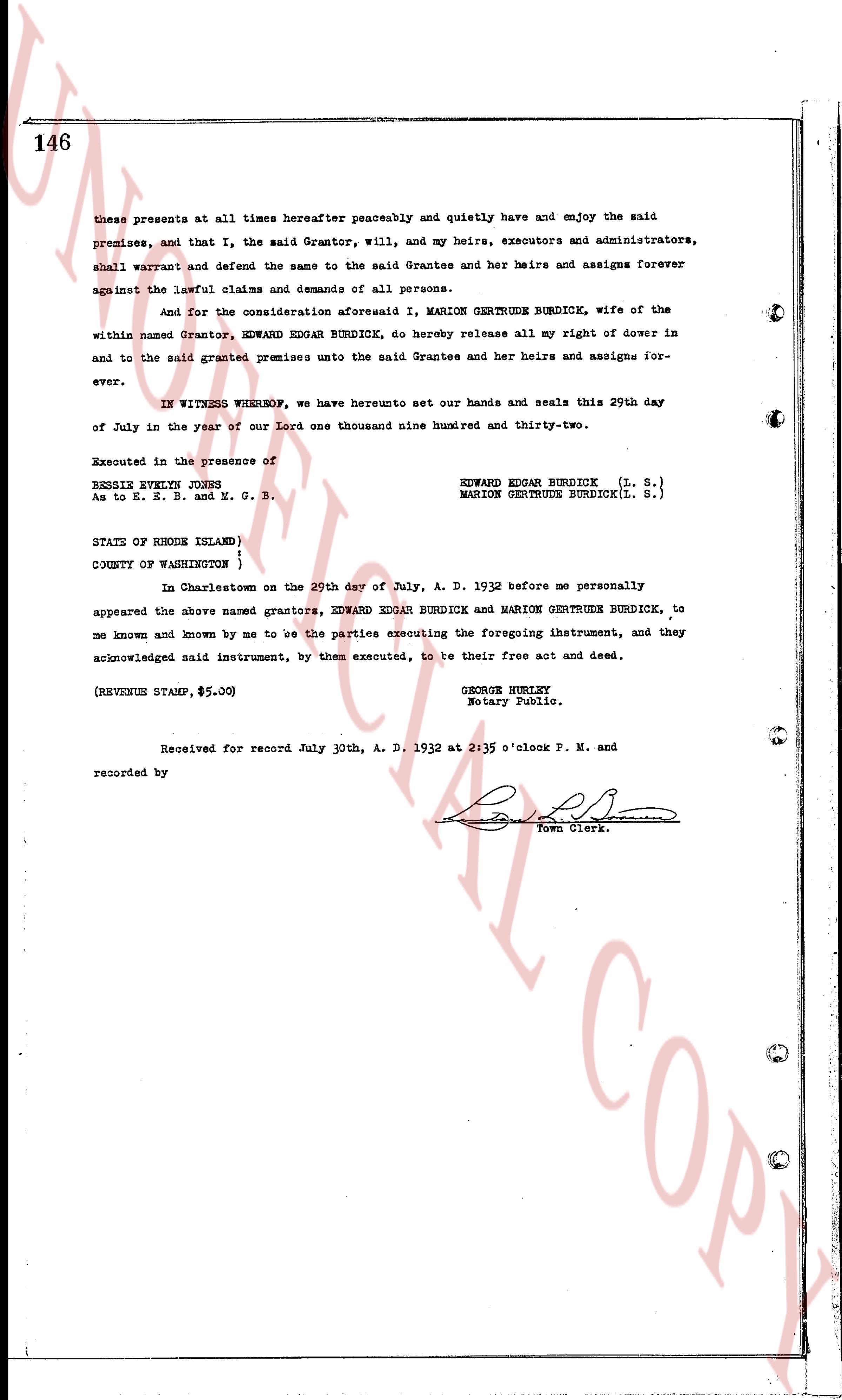
146
these presents at all times hereafter peaceubly and quietly have and enjoy the said
premises, and that I, the said Grantor, will, and my heirs, executors and administrators,
shall warrant and defend the same to the said Grantee and his heirs and assigns forever
against the lawful claims and demands of all persons.
And for the consideration aforesaid I, MARION GERTRUDE BURDICK, wife of the
within named Grantor, EDWARD EDGAR BURDICK, do hereby release all my right of dower in
and to the said granted premises unto the said Grantee and her heirs and assigns for-
ever.
IN WITNESS WHEREOF, we have hereunto set our hands and seals this 29th day
of July in the year of our Lord one thousand nine hundred and thirty-two.
Executed in the presence of
BENSIS SYLVIA JONES
As to E. E. B. and M. G. B.
EDWARD EDGAR BURDICK (L. S.)
MARION GERTRUDE BURDICK(L. S.)
STATE OF RHODE ISLAND)
COUNTY OF WASHINGTON )
In Charlestown on the 29th day of July, A. D. 1932 before me personally
appeared the above named grantors, EDWARD EDGAR BURDICK and MARION GERTRUDE BURDICK, to
me known and known by me to be the parties executing the foregoing ihstrument, and they
acknowledged said instrument, by them executed, to be their free act and deed.
(REVENUE STAMP, $5.00)
GEORGE HURLEY
Notary Public.
Received for record July 30th, A. D. 1932 at 2:35 o'clock P. M. and
recorded by [Signature]
Town Clerk.
The page as recorded