The instrument's own words
page 1
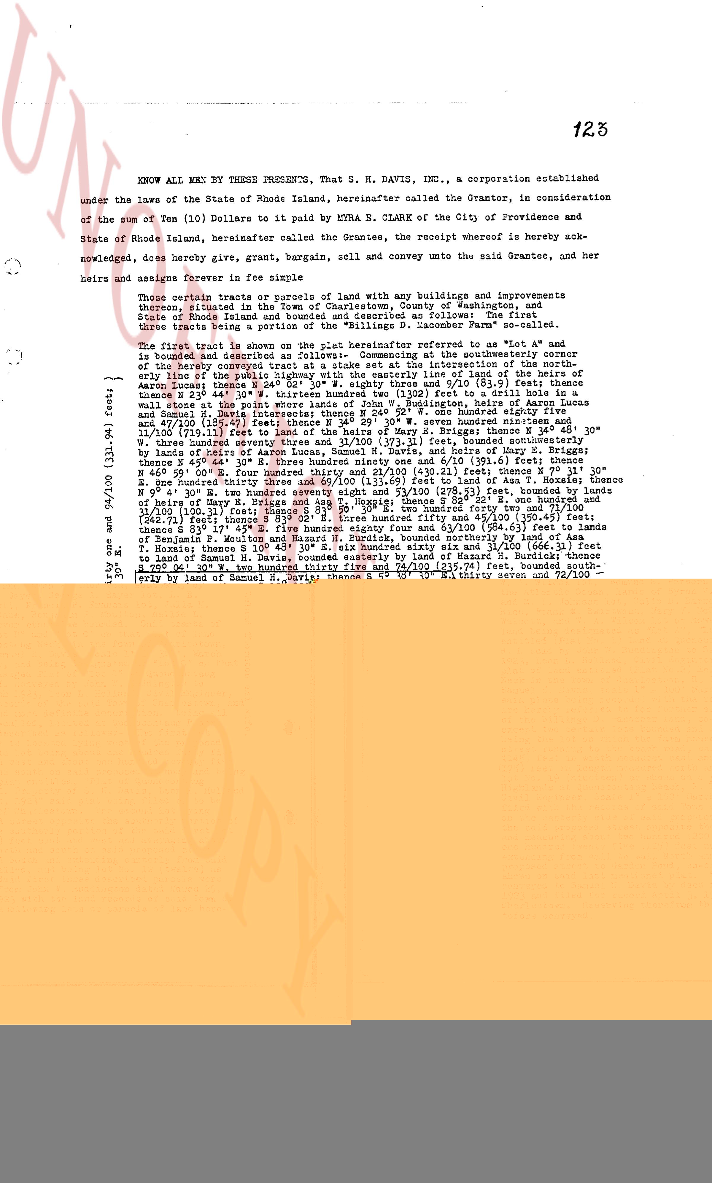
123
KNOW ALL MEN BY THESE PRESENTS, That S. H. DAVIS, INC., a corporation established
under the laws of the State of Rhode Island, hereinafter called the Grantor, in consideration
of the sum of Ten (10) Dollars to be paid by MYRNA R. CLARK of the City of Providence and
State of Rhode Island, hereinafter called the Grantee, the receipt whereof is hereby ack-
nowledged, does hereby give, grant, bargain, sell and convey unto the said Grantee, and her
heirs and assigns forever in fee simple
those certain tracts or parcels of land with any buildings and improvements
thereon, situated in the Town of East Greenwich, County of Washington, and
State of Rhode Island, hereinafter called the Premises, comprised as follows: The Premises,
three tracts being a portion of the "Billings D. Jacobson Farm" so called,
The first tract is shown on the plat marked reference to "Lot A" and
thusly described as starting at a point being the southeasterly corner at the southeasterly corner
of the hereby conveyed tract at a state set at the intersection of the north-
westerly corner of Lot B and the southeasterly corner of the tract of land of
Aaron Eunice; thence N 24° 02' 30" W. eighty three and 8/10 (83.8) feet; thence
east thirty seven and 1/10 (37.1) feet to a stone wall; thence N 24° 02' 30" W. to
a wall stone at the point where lands of John W. Budington, heirs of Aaron Lucas
and (13.1) feet; thence N 24° 02' 30" W. seven hundred nineteen and 1/10 (719.1) feet;
and 47/100 (148.57) feet; thence N 24° 02' 30" W. seven hundred nineteen and 1/10 (719.1) feet;
thence N 81° 10' 30" E. one hundred twenty four and 6/10 (124.6) feet; thence N 24° 02' 30" W.
N three hundred seventy three and 1/100 (373.01) feet; thence bounded southeasterly
by the public highway; thence N 45° 44' 0" E. three hundred ninety one and 1/10 (391.1) feet; thence
N 45° 44' 0" E. three hundred ninety one and 1/10 (391.1) feet; thence bounded northeasterly
by the public highway; thence N 81° 10' 30" E. four hundred ninety six and 6/10 (496.6) feet;
thence N 81° 10' 30" E. four hundred ninety six and 6/10 (496.6) feet; thence bounded easterly
by the lands of Sarah and Henry 69 and 13/100 (69.13) feet to land of T. A. Hoxie; thence E
59° 45' 0" N. two hundred seventy eight and 69/100 (278.69) feet; bounded by lands of
T. A. Hoxie; thence N 24° 02' 30" W. one hundred twenty four and 6/10 (124.6) feet; thence
N 81° 10' 30" E. three hundred fifty three and 1/100 (353.01) feet; thence bounded easterly
by the lands of T. A. Hoxie; thence N 24° 02' 30" W. three hundred fifty three and 1/100 (353.01)
feet; thence N 81° 10' 30" E. three hundred fifty three and 1/100 (353.01) feet; thence bounded
easterly by the lands of T. A. Hoxie; thence N 24° 02' 30" W. three hundred fifty three and 45/100 (353.45) feet;
thence N 81° 10' 30" E. three hundred fifty three and 1/100 (353.01) feet; thence bounded easterly
by the lands of T. A. Hoxie; thence N 24° 02' 30" W. three hundred fifty three and 1/100 (353.01) feet;
thence bounded easterly by the lands of Harold P. Burdick, bounded northerly by land of Ama
T. Hoxie; thence N 24° 02' 30" W. one hundred twenty four and 6/10 (124.6) feet; thence bounded
easterly by the lands of Harold P. Burdick, bounded easterly by land of Harold P. Burdick; thence
T. Hoxie; thence N 24° 02' 30" W. two hundred thirty three and 1/100 (233.01) feet; thence bounded
easterly by the lands of Harold P. Burdick, bounded easterly by land of Harold P. Burdick; thence
S 59° 45' 0" W. two hundred thirty three and 1/100 (233.01) feet; thence N 24° 02' 30" W. thirty two and 72/100
(32.72) feet; bounded easterly by lands of Harold P. Burdick; thence N 24° 02' 30" W. thirty two and 72/100
(32.72) feet; bounded easterly by lands of Harold P. Burdick; thence S 33° 0" W. two hundred thirty two and 1/100
(232.01) feet; thence bounded southerly by the lands of Harold P. Burdick; thence S 33° 0" W. two hundred thirty
two and 1/100 (232.01) feet; thence bounded southerly by the lands of Harold P. Burdick; thence S 46° 26' E.
eight hundred sixty seven and 5/100 (867.05) feet; bounded easterly by lands of Aaron Lucas;
thence S 24° 02' 30" W. one hundred twenty four and 6/10 (124.6) feet; thence S 24° 02' 30" W. one hundred
seven and 6/100 (107.06) feet; thence S 24° 02' 30" W. one hundred twenty four and 54/100 (124.54) feet;
thence S 24° 02' 30" W. one hundred twenty four and 6/10 (124.6) feet; thence bounded southerly by the
lands of Harold P. Burdick; thence S 24° 02' 30" W. three and 5/100 (3.05) feet; thence N 24° 02' 30" W.
one hundred twenty four and 6/10 (124.6) feet; thence S 24° 02' 30" W. one hundred twenty four and 6/10
(124.6) feet; thence bounded southerly by the lands of Harold P. Burdick; thence S 24° 02' 30" W. one hundred
(136.8) feet to the southeasterly corner of the herein described tract, bounded southerly by the
lands of Harold P. Burdick. The second tract is thusly described as starting at a point (69.33)
feet to land of Nelson W. Wolcott, bounded southerly by the public highway thence 180
feet to the public highway; thence N 24° 02' 30" W. one hundred twenty four and 6/10 (124.6) feet; thence
S 74° 22' 30" W. fifty (50) feet, bounded southerly by the public highway thence 180
feet to the public highway; thence N 24° 02' 30" W. one hundred twenty four and 6/10 (124.6) feet; thence
S 74° 22' 30" W. fifty (50) feet, bounded southerly by the lands of Nelson W. Wolcott; thence
S 74° 22' 30" W. one hundred seventy seven and 28/100 (177.28) feet; thence bounded southerly by the
lands of Nelson W. Wolcott; thence S 74° 22' 30" W. one hundred seven and 28/100 (107.28) feet
bounded southerly by the lands of Nelson W. Wolcott; thence S 74° 22' 30" W. one hundred
twenty one and 39/100 (121.39) feet; thence bounded southerly by the public highway;
thence N 159° 37' 30" W. thirty (30) feet, bounded westerly by land of Nelson W. Wolcott and
twelve and 1/100 (12.01) feet; thence bounded southerly by the public highway; thence N 159° 37' 30" W.
fifty (50) feet, bounded southerly by the lands of Nelson W. Wolcott and twelve and 1/100 (12.01) feet;
thence bounded southerly by the public highway; thence N 159° 37' 30" W. one hundred
thirty five and 1/100 (135.01) feet; thence bounded southerly by the lands of G. Waldo Parrott and wife,
with southerly boundary by lands of Nelson W. Wolcott and wife and twelwe and 1/100 (12.01) feet;
thence bounded southerly by the public highway; thence N 159° 37' 30" W. one hundred
thirty five and 1/100 (135.01) feet; thence bounded southerly by the lands of G. Waldo Parrott and wife;
with southerly boundary by lands of Nelson W. Wolcott and wife and twelwe and 1/100 (12.01) feet;
thence bounded southerly by the public highway; thence S 74° 22' 30" W. one hundred twenty six and
71/100 (126.71) feet; thence bounded southerly by the lands of G. Waldo Parrott and wife; thence
Frederick Ewerty; thence N 159° 37' 30" W. one (1) foot; thence to land of Leonard Thurston and
wife; thence N 159° 37' 30" W. one hundred thirty five and 1/100 (135.01) feet; thence bounded southerly
one hundred thirty three and 3/100 (133.03) feet, bounded southerly by lands of
Leonard Thurston and wife; thence N 159° 37' 30" W. one hundred thirty five and 1/100 (135.01) feet;
thence S 74° 22' 30" W. one hundred twenty six and 71/100 (126.71) feet; thence bounded southerly
feet to the public highway, bounded easterly by land of S. Litten; thence J 72° 30'
west forty (40) feet, bounded southerly by the public highway; thence N 159° 37' 30" W. one hundred
thirty five and 1/100 (135.01) feet; thence bounded southerly by the lands of S. Litten; thence
S 69° 59' 30" W. forty (40) feet, bounded southerly by the public highway; thence N 159° 37' 30" W.
one hundred thirty five and 1/100 (135.01) feet; thence bounded southerly by the lands of S. Litten;
thence S 69° 59' 30" W. forty (40) feet and 45/100 (40.45) feet, more or less, to land of
Mabel S. Pickup; thence bounded southerly by the public highway; thence N 159° 37' 30" W. one hundred
fifty (150) feet, bounded westerly by land of Mabel S. Pickup; thence S 69° 59' 30" W. two
hundred thirteen and 1/100 (213.01) feet; thence bounded southerly by the public highway; thence N 159° 37'
30" W. one hundred fifty (150) feet, bounded westerly by land of Mabel S. Pickup; thence S 69° 59' 30" W. two
hundred thirteen and 1/100 (21
page 2
124
Lucy J. Labrue, James P. Furator and Waltery W. Bunce; thence S 25°
44' 30" SE thirty (30) feet to the public highway, bounded easterly by
land of Waltery W. Bunce thence N 25° 44' 30" W one hundred and
66/100 (100.66) feet to the point of beginning, bounded southerly by the
public highway, or however otherwise bounded.
The second tract shown on the plat hereinafter referred to as "Lot B"
is bounded and described as follows:— Commencing at a drill hole in a
stone set at the angle in the public highway at a point where said highway
line of said highway intersects the northerly line of land of Hazard W.
Burdick; thence N 59° 40' 30" SE eighty nine and 19/100 [89.19] feet;
thence N 15° 45' 30" E one hundred ninety four and 71/100 [194.71] feet;
thence N 15° 45' 30" E one hundred thirty five (135) feet, more or less, until it comes to mean
high water line in the Atlantic Ocean, then northerly along the mean high
water line in the Atlantic Ocean until it comes to mean high water line of
Hazard W. Burdick; thence following the mean high water line of Charleston
Point southerly, then easterly along the mean high water line of the Atlantic
Ocean until it comes to the point of beginning, bounded northerly by the
easterly line of the herein described tract, bounded northeasterly westerly,
thence S 15° 45' 30" W one hundred thirty five (135) feet, more or less,
forty three (43) feet, more or less, to a drill hole in a stone on line between
S 25° 44' 30" W forty three (43) feet, more or less, to a drill hole in a stone on line between
S 25° 44' 30" W forty three (43) feet, more or less, to a drill hole in a stone on line between
Josephine Collins, bounded easterly by land of Everett S. Warner; thence
S 25° 44' 30" W forty three (43) feet, more or less, to a drill hole in a stone on line between
Hamming, bounded southerly by lands of Josephine Collins and James S.
Warner; thence S 25° 44' 30" W forty three (43) feet, more or less, to a drill hole in a
stone on line between Josephine Collins and James S. Warner; thence S 25°
44' 30" W forty three (43) feet, more or less, to a drill hole in a stone on line between
fifty (50) feet, bounded westerly by land of Maud Warner; thence N 79°
11' 0" E one hundred sixty one and 28/100 [161.28] feet, more or less, thence
S 10° 53' 45" E one hundred sixteen (116) feet; thence S 22° 21' W one
hundred (100) feet; thence S 10° 53' 45" E one hundred sixty one and 28/100 [161.28] feet
11° 0" E one hundred sixty one and 28/100 [161.28] feet to land of Everett
S. Warner, bounded northerly by the public highway, or however otherwise
bounded. The third tract shown on the plat hereinafter referred to as "Lot C" is
S 22° 21' W thirty (30) feet, more or less, until
it intersects the mean high water line of the Atlantic Ocean, bounded easterly
by the public highway, or however otherwise bounded. The fourth tract is
following the mean high water line of the ocean until it intersects a line which
intersects the mean high water line of the Atlantic Ocean, then southerly along
by the Atlantic Ocean thence N 19° 38' 30" SW five hundred ten (510) feet,
more or less, to the point of beginning, bounded northerly by the public highway,
the public highway, or however otherwise bounded. Excepting from the above
described tracts of land any and all rights of way, easements and reservations
conveyed by John W. Burdick to Mary C. Phillips as more fully shown on
plat referenced during this deed.
The third tract shown on plat hereinafter referred to as "Lot C" is bound-
ed and described as follows:— Commencing at a stake set at the north-
easterly corner of Lot B, as described above; bounded northerly and easterly
by the public highway and land of Nelson H. Walcott, said highway, lands of
Nelson H. Walcott, said highway, lands of Nelson H. Walcott, said highway,
and S. Lillian Jewett, said highway, lands of Mabel S. Pickup, William
L. Moore, Sylvia Moore, and S. Lillian Jewett, said highway, lands of Mabel S.
Pickup, John Walcott, said highway, lands of Colin S. Barrett, Francis P. Francis
I. Moore, Sylvia Moore, and S. Lillian Jewett, said highway, lands of Mabel S.
P. Foulton, Nellie H. Walcott, A. P. Walcott, and lands of Jesse E.
Foulton, Walter L. Mason, A. P. Walcott, and lands of Jesse E.
Foulton, Walter L. Mason, A. P. Walcott, and lands of Jesse E.
Hanna and public highway, bounded southerly by the public highway, bounded
westerly by land of the heirs of Aaron Lucas, Edmund S. Varones, Jessie
S. Varones, and the public highway, bounded northerly by the public highway,
Pickup, Nelson H. Walcott and wife, Nelson H. Walcott, easterly by the
public highway, northerly by the public highway, northerly by the public highway,
William T. Macfarlane, L. S. E., and J. H. Johnson lot, Frank M. Stewart,
W. A. Robinson, lot 109, and the public highway, then northerly along the
the Atlantic Ocean lands, until it crosses by Don V. Sayre, George A. Sayre lot 1,
W. A. Robinson, lot 109, and the public highway, then northerly along the
Rice, Frank M. Stewart, W. Y. Mockbecker, Benjamin P. Foulton, Nellie L.
Walcott, and the public highway, then northerly along the public highway to the
land of being designated as "Lot A", "Lot B" and "Lot C" on that plot of land
entitled "Plat of the Whole of the Land of Hazard W. Burdick" recorded in
R. L. rol by John W. Burdick to Samuel H. Davis, scale 1" = 30', March
1923, in the land evidence records of the town of Jamestown, R. I. This
plat of land entitled [Plat No. 2] Enlarged "Plot of Lot C" at Quonocutunk
Beach, Jamestown, R. I. scale 1" = 100' March 1923, in the land evidence
Samuel H. Davis, scale 1" = 100' March 1923, Leon L. Holland, Civil Engineer,
signed by Leon L. Holland, Civil Engineer, and recorded in the land evidence
and herefore referred to for further and more definite description. Being all of
the Billings's land.
The fourth tract lots bounded and described as follows:— The first
lot being the one on which the farm house and folding house is located lying
between the public highway and the mean high water line of the ocean one hundred forty five
(145) feet in width on measured east and west and about one hundred ninety
(190) feet in width on measured east and west and about one hundred ninety
(190) feet in width on measured east and west and about one hundred ninety
(190) feet in width on measured east and west and about one hundred ninety
(190) feet in width on measured east and west and about one hundred ninety
(190) feet in width on measured east and west and about one hundred ninety
(190) feet in width on measured east and west and about one hundred ninety
(190) feet in width on measured east and west and about one hundred ninety
(190) feet in width on measured east and west and about one hundred ninety
(190) feet in width on measured east and west and about one hundred ninety
(190) feet in width on measured east and west and about one hundred ninety
(190) feet in width on measured east and west and about one hundred ninety
(190) feet in width on measured east and west and about one hundred ninety
(190) feet in width on measured east and west and about one hundred ninety
(190) feet in width on measured east and west and about one hundred ninety
(190) feet in width on measured east and west and about one hundred ninety
(190) feet in width on measured east and west and about one hundred ninety
(190) feet in width on measured east and west and about one hundred ninety
(190) feet in width on measured east and west and about one hundred ninety
(190) feet in width on measured east and west and about one hundred ninety
(190) feet in width on measured east and west and about one hundred ninety
(190) feet in width on measured east and west and about one hundred ninety
(190) feet in width on measured east and west and about one hundred ninety
(190) feet in width on measured east and west and about one hundred ninety
(190) feet in width on measured east and west and about one hundred ninety
(190) feet in width on measured east and west and about one hundred ninety
(190) feet in width on measured east and west and about one hundred ninety
(190) feet in width on measured east and west and about one hundred ninety
(190) feet in width on measured east and west and about one hundred ninety
(190) feet in width on measured east and west and about one hundred ninety
(190) feet in width on measured east and west and about one hundred ninety
(190) feet in width on measured east and west and about one hundred ninety
(190) feet in width on measured east and west and about one hundred ninety
(190) feet in width on measured east and west and about one hundred ninety
(190) feet in width on measured east and west and about one hundred ninety
(190) feet in width on measured east and west and about one hundred ninety
(190) feet in width on measured east and west and about one hundred ninety
(190) feet in width on measured east and west and about one hundred ninety
(190) feet in width on measured east and west and about one hundred ninety
(190) feet in width on measured east and west and about one hundred ninety
(190) feet in width on measured east and west and about one hundred ninety
(190) feet in width on measured east and west and about one hundred ninety
(190) feet in width on measured east and west and about one hundred ninety
(190) feet in width on measured east and west and about one hundred ninety
(190) feet in width on measured east and west and about one hundred ninety
(190) feet in width on measured east and west and about one hundred ninety
(190) feet in width on measured east and west and about one hundred ninety
(190) feet in width on measured east and west and about one hundred ninety
(190) feet in width on measured east and west and about one hundred ninety
(190) feet in width on measured east and west and about one hundred ninety
(190) feet in width on measured east and west and about one hundred ninety
(190) feet in width on measured east and west and about one hundred ninety
(190) feet in width on measured east and west and about one hundred ninety
(190) feet in width on measured east and west and about one hundred ninety
(190) feet in width on measured east and west and about one hundred ninety
(190) feet in width on measured east and west and about one hundred ninety
(190) feet in width on measured east and west and about one hundred ninety
(190) feet in width on measured east and west and about one hundred ninety
(190) feet in width on measured east and west and about one hundred ninety
(190) feet in width on measured east and west and about one hundred ninety
(190) feet in width on measured east and west and about one hundred ninety
(190) feet in width on measured east and west and about one hundred ninety
(190) feet in width on measured east and west and about one hundred ninety
(190) feet in width on measured east and west and about one hundred ninety
(190) feet in width on measured east and west and about one hundred ninety
(190) feet in width on measured east and west and about one hundred ninety
(190) feet in width on measured east and west and about one hundred ninety
(190) feet in width on measured east and west and about one hundred ninety
(190) feet in width on measured east and west and about one hundred ninety
(190) feet in width on measured east and west and about one hundred ninety
(190) feet in width on measured east and west and about one hundred ninety
(190) feet in width on measured east and west and
page 3
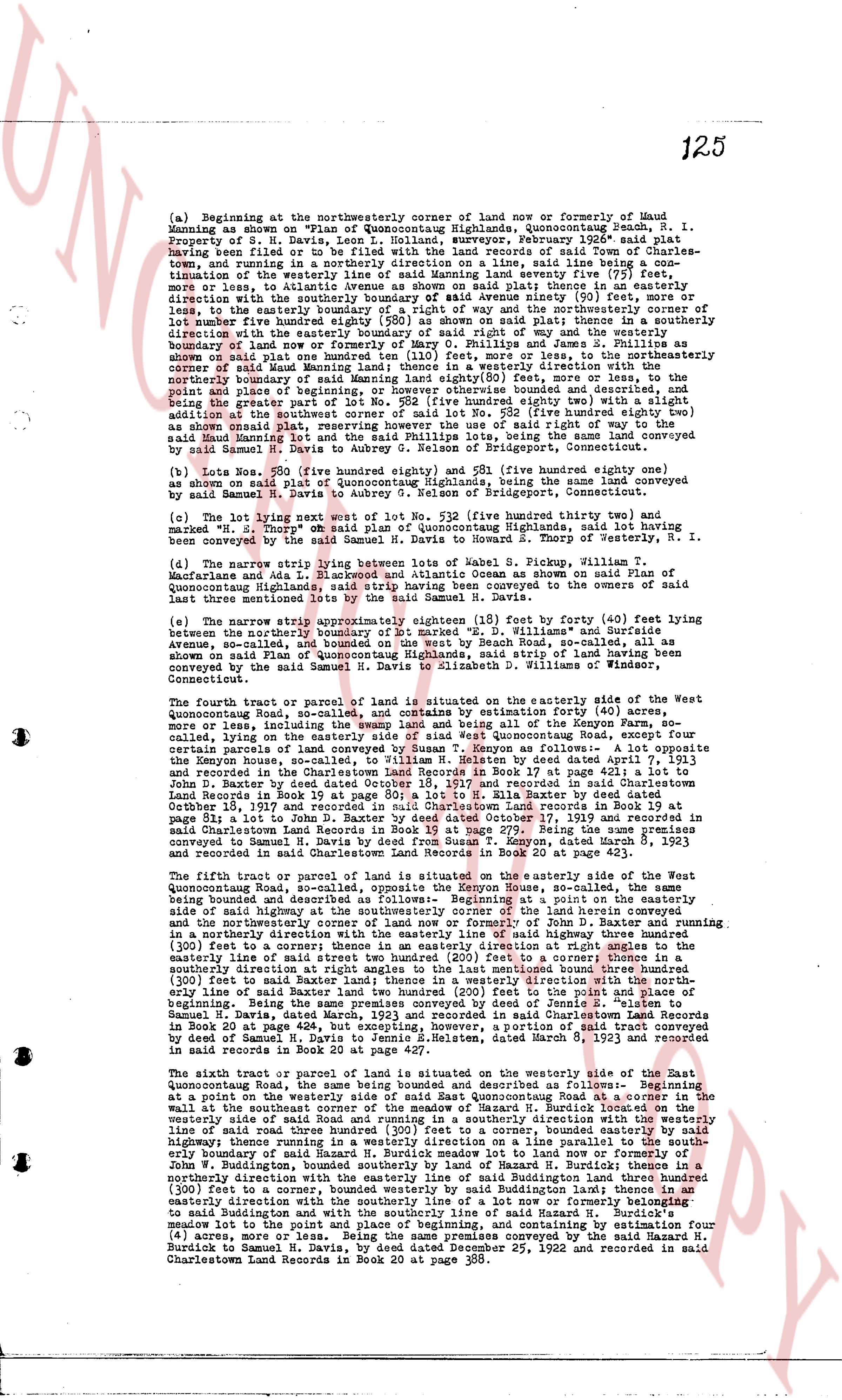
125
(a) Beginning at the northeasterly corner of land of now or formerly of Maud
Manning as shown on Plan of Former Highlands, Quonsetuntuch Beach, R. I.
Having been filed or to be filed with the land records of said Town of Charles-
town, Rhode Island, by H. N. Davis, Leon L. Holland, surveyor, February 1926* said plat
Property of H. N. Davis, Leon L. Holland, surveyor, February 1926* said plat
Having been filed or to be filed with the land records of said Town of Charles-
town, Rhode Island, by H. N. Davis, Leon L. Holland, surveyor, February 1926* said plat
timation of the westerly line of said Manning land seventy five (75) feet,
more or less, to intersect the southerly line of said plat thence in a southeasterly
direction with the southerly boundary of said Manning avenue 91 (91) feet, more or
less, to the westerly line of said plat thence in a southeasterly direction to the
lot number five hundred eighty one (581) as shown on said plat; thence in a southerly
direction with the westerly line of said plat 140 (140) feet to the southeasterly
corner of lot number five hundred eighty (580) as shown on said plat; thence in a southerly
direction with the westerly line of said plat 130 (130) feet to the southeasterly
boundary of land now or formerly of Mary O. Phillips and James S. Phillips where
said boundary of land now or formerly of said Phillips lines, said land being conveyed
by said Maud Manning land; thence in a westerly direction with the southwester-
ly boundary of land now or formerly of said Phillips 200 (200) feet more or less to the
point and place of beginning, or otherwise otherwise bounded and described, and
the being a portion of lot number five hundred eighty two (582) more or less with
option addition at the southwest corner of said lot No 582 (five hundred eighty two)
as shown on said plat, reserving however for the use of said right of way of the pub-
lic said Maud Manning lot no 582 and said Phillips lots, being the same land conveyed
by said Samuel M. Davis to Aubrey G. Nelson of Bridgeport, Connecticut.
(b) Lots Nos. 520 (five hundred eighty one) and 521 (five hundred eighty one) gage
as shown on said plat of Former Highlands, Quonsetuntuch Beach, being the same land conveyed
by said Samuel M. Davis to Aubrey G. Nelson of Bridgeport, Connecticut.
(c) The lot lying west of lot No 582 (five hundred eighty two) and
marked as "Lot 583" of the Plan of Former Highlands, Quonsetuntuch Beach, said land having
been conveyed by the said Samuel M. Davis to Howard E. Thorpe of Westerly, R. I.
(d) The narrow strip lying between lots of Robert S. Pickg, William T.
Macfarlane and lot no 582 of the Plan of Former Highlands, Quonsetuntuch Beach, said land
of Quonsetuntuch Highlands, said strip of land having been conveyed to the owners of
the said lots by the said Samuel M. N. Davis.
(e) The narrow strip approximately eighteen (18) feet (by forty (40) feet) lying
between the northerly boundary of lot marked "B" D. Williams" and Burridge
avenue, as shown on Plan of Former Highlands, Quonsetuntuch Beach, said strip of land
as shown on Plan of Quonsetuntuch Highlands, said strip of land having been conveyed
by the said Samuel M. N. Davis to Aubrey G. Nelson of Bridgeport, Connecticut.
The fourth tract or piece of land situated on the westerly side of the West
Quonsetuntuch Beach, Rhode Island, known as Coyon, containing by estimation four (4) acres,
more or less, including the swamp land and being all of the Keyon Farm, so
called, lying on the easterly side of said road, as shown on Plan of Quonsetuntuch Beach
filed in the town records of Charlestown as follows: - A lot approximate
the Keyon house, called on the site, to William H. Relton by deed dated April 7, 1913
and recorded in the Charlestown Land Records Book 20 at page 43; then to
John B. Dexter by deed dated October 10, 1917 and recorded in said Charlestown
Land Records Book 20 at page 43; then to said Charlestown Land records in Book 19 at
page 279; then to said Charlestown Land records in Book 19 at page 279; Being the same premises
conveyed to Samuel M. Davis by deed dated December 23, 1925 and recorded in said
said Charlestown Land Records in Book 20 at page 423;
The fifth tract or piece of land situated on the easterly side of the East
Quonsetuntuch Beach, Rhode Island, known as West-Rock-well, called on the site as
the same being bounded and described as follows: - Beginning at a point on the easterly
side of said highway called West-Rock-well, called on the site as the same being bounded and
(the northwesterly corner of land now or formerly of John D. Baxter and running in a
southeasterly direction with the easterly line of said highway 150 (150) feet to a corner;
(300) feet to a corner; thence in an easterly direction at right angles to the westerly line
of said highway 300 (300) feet to a corner; thence in a southerly direction to a
southeasterly direction at right angles to the last mentioned bound three hundred
(300) feet to a corner; thence in a westerly direction 300 (300) feet to a corner on the easter-
ly line of said Baxter land 200 hundred two (200) feet to the point and place of
beginning. Being the same premises conveyed by deed of Jennie S.
Samuel M. Davis, dated December 23, 1925 and recorded in said Charlestown Land Records
in Book 20 at page 424, but excepting, however, a portion of said tract conveyed
by deed of Samuel M. Davis to Aubrey G. Nelson of Bridgeport, Connecticut, recorded
in said Book 20 at page 427.
The sixth tract or piece of land situated on the westerly side of the East
Quonsetuntuch Beach, Rhode Island, known and described as follows: - Beginning
at a point on the westerly side of said East Quonsetuntuch road at a corner in the
wall at the southeast corner of land now or formerly of John D. Burdick; thence running in a
westerly side of said road running in a southerly direction with the westerly line
of said road three hundred (300) feet to a corner; thence in a westerly direction 300 (300)
highway; thence running in a westerly direction on a line parallel to the southerly the
south westerly boundary of said road 300 (300) feet to a corner on the land now or formerly of
John W. Buddington, bounded southerly side by land of Hazard R. Burdick; thence in a
southeasterly direction with the southerly boundary of said Buddington, running three hundred
(300) feet to a corner, bounded westerly by said Buddington land; thence in a
westerly direction with the southerly boundary of said road 300 (300) feet to a corner
to said Buddington and with the southerly line of said Hazard R. Burdick's
narrow lot to the point and place of beginning, and containing by estimation four (4)
acres, more or less, known as Keyon as follows: - Conveyed by deed of Hazard R.
Burdick to Samuel M. Davis, by deed dated December 25, 1922 and recorded in said
said Charlestown Land Records in Book 20 at page 388.
page 4
126
Excepting, however, the portions of the above described land conveyed by the
following deeds:
Deed from S. H. Davis, Inc. to John T. McGlone and wife,
dated September 30, 1930 and recorded in said Charles-
town Land Records in Book 24 at page 221.
Deed from S. H. Davis, Inc. to Wesley N. Bunce, dated
September 30, 1930 and recorded in said records in Book
24 at page 232.
Deed from S. H. Davis, Inc. to John T. McGlone and wife,
dated April 28, 1931 and recorded in said records in
Book 24 at page 401.
Deed from S. H. Davis, Inc. to M. Lillian Jewett, dated
September 10, 1931 and recorded in said records in Book
25 at page 10.
Deed from S. H. Davis, Inc. to August Kruck, dated September
16, 1931 and recorded in said records in Book 25 at page 19.
Deed from S. H. Davis, Inc. to Howard S. Thorp, dated
September 30, 1931 and recorded in said records in Book
25 at page 20.
Deed from S. H. Davis, Inc. to Frederick W. Lysett, dated
October 2, 1931 and recorded in said records in Book 25
at page 20.
Deed from S. H. Davis, Inc. to George W. Austin, trustee for
Louise G. Austin, dated September 30, 1931 and recorded
in said records in Book 25 at page 30.
Being the same premises conveyed by deed of Samuel H.
Davis, Inc. dated June 24, 1924 and recorded in said
records in Book 21 at page 439, with the exception of the
portions thereof conveyed by the deeds last above men-
tioned and exempted from this conveyance.
Said premises are conveyed subject to such rights of way
as are of record and further subject to the unpaid balance of
such mortgages as are of record.
TO HAVE AND TO HOLD the aforementioned premises, with all the privileges
and appurtenances thereto belonging unto, and to the use of the said Grantees, and
her heirs and assigns forever in fee simple.
And it that the said Grantor does hereby, for itself and its successors,
covenant with the said Grantees and her heirs and assigns that it is lawfully seized
in fee simple of the said granted premises; that the same are free from all incum-
brances, excepting as aforesaid; that it has good right, full power and lawful autho-
rity to sell and convey the same in manner as aforesaid; that the said Grantees and her
heirs and assigns shall by these presents at all times hereafter peaceably and quietly
have and enjoy the said premises, and that it the said Grantor, will, and its successors
shall, warrant and defend the same to the said Grantees and her heirs and assigns for-
ever against the lawful claims and demands of all persons, excepting as aforesaid.
IN WITNESS WHEREOF, said S. H. Davis, Inc. has caused these presents to be
executed and its corporate seal to be hereto affixed by its officer herunto duly
authorized this 24th day of June in the year of our Lord one thousand nine hundred
and thirty two (1932).
Signed and Sealed S. H. DAVIS, INC. (L. S.)
By Samuel H. Davis
in presence of President.
HOWARD E. THORP
REVENUE STAMP $1.00
page 5
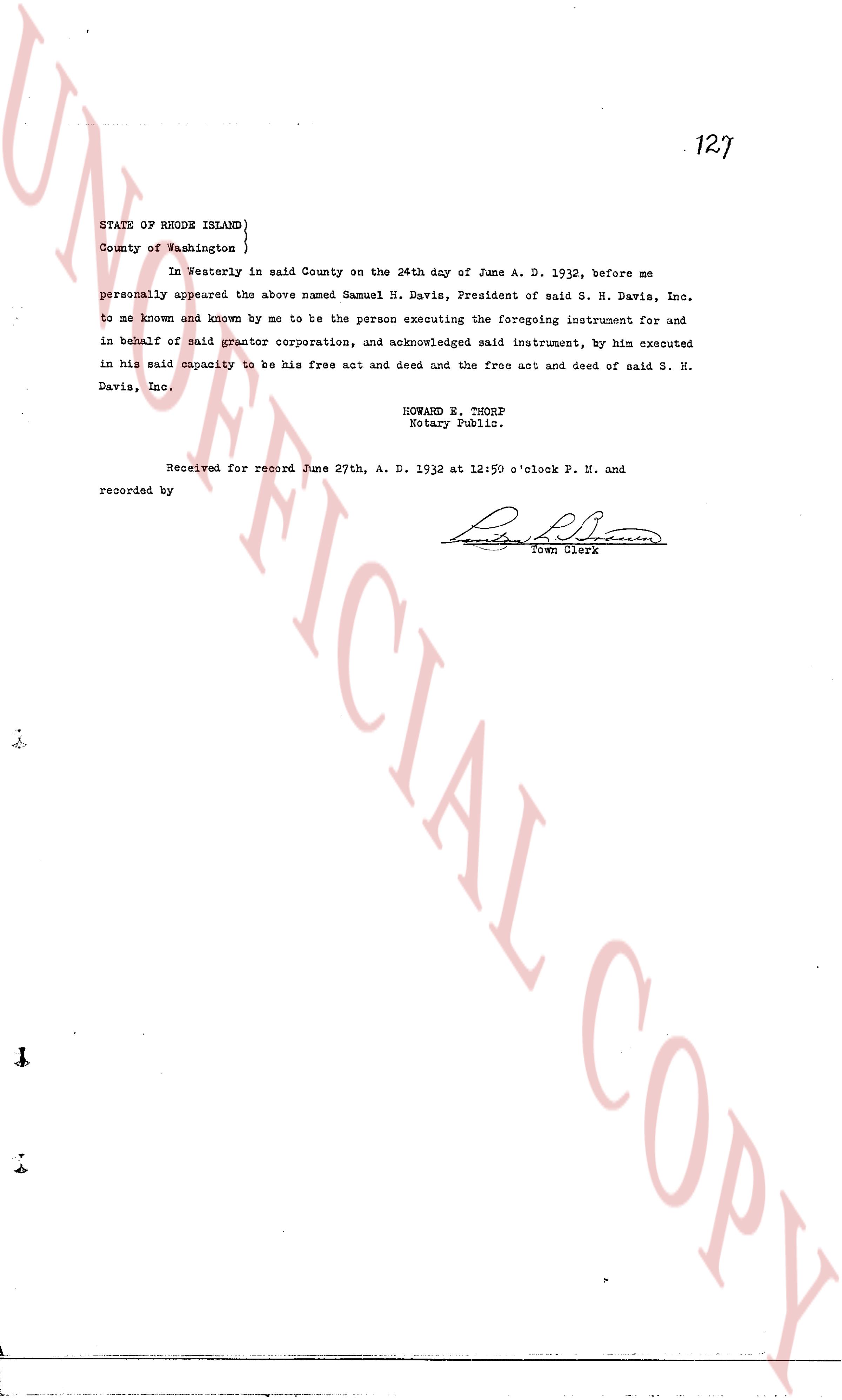
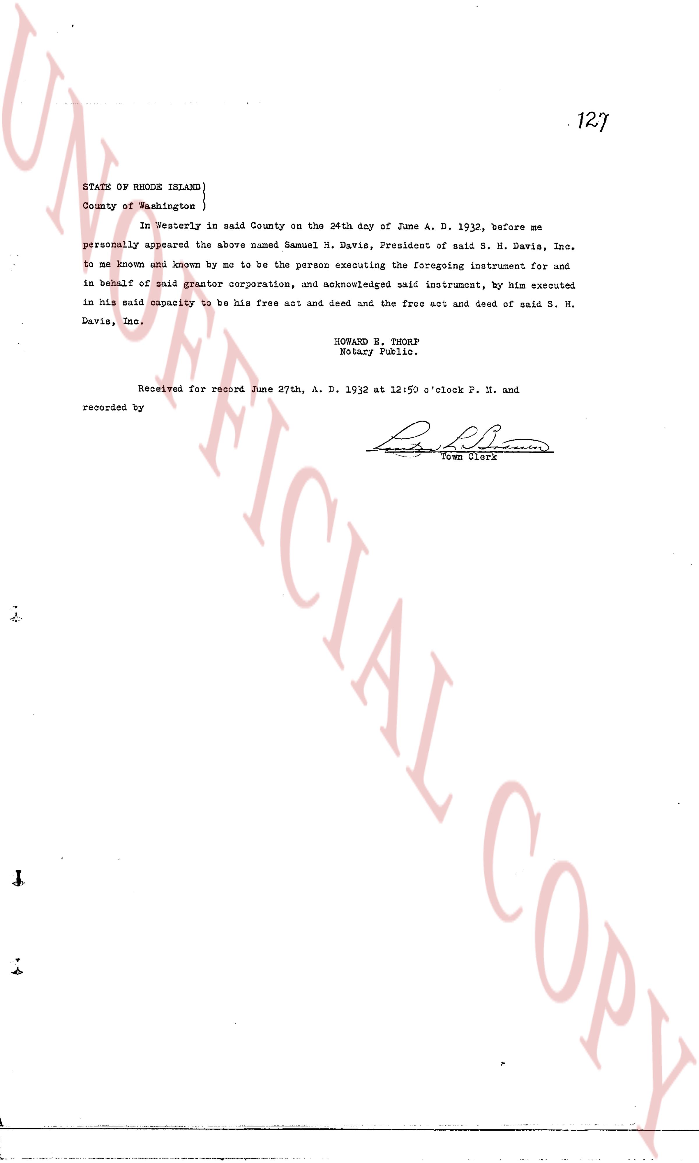
127
STATE OF RHODE ISLAND}
County of Washington}
In Westerly in said County on the 24th dny of June A. D. 1932, before me
personally appeared the above named Samuel N. Davis, President of said S. H. Davis, Inc.
to me known and known by me to be the person executing the foregoing instrument for and
in behalf of said grantor corporation, and acknowledged said instrument, by him executed
in his said capacity to be his free act and deed and the free act and deed of said S. H.
Davis, Inc.
HOWARD E. THORP
Notary Public.
Received for record June 27th, A. D. 1932 at 12:59 o'clock P. M. and
recorded by [Signature]
Town Clerk
The page as recorded