The instrument's own words
page 1 · read by Gemma vision
370
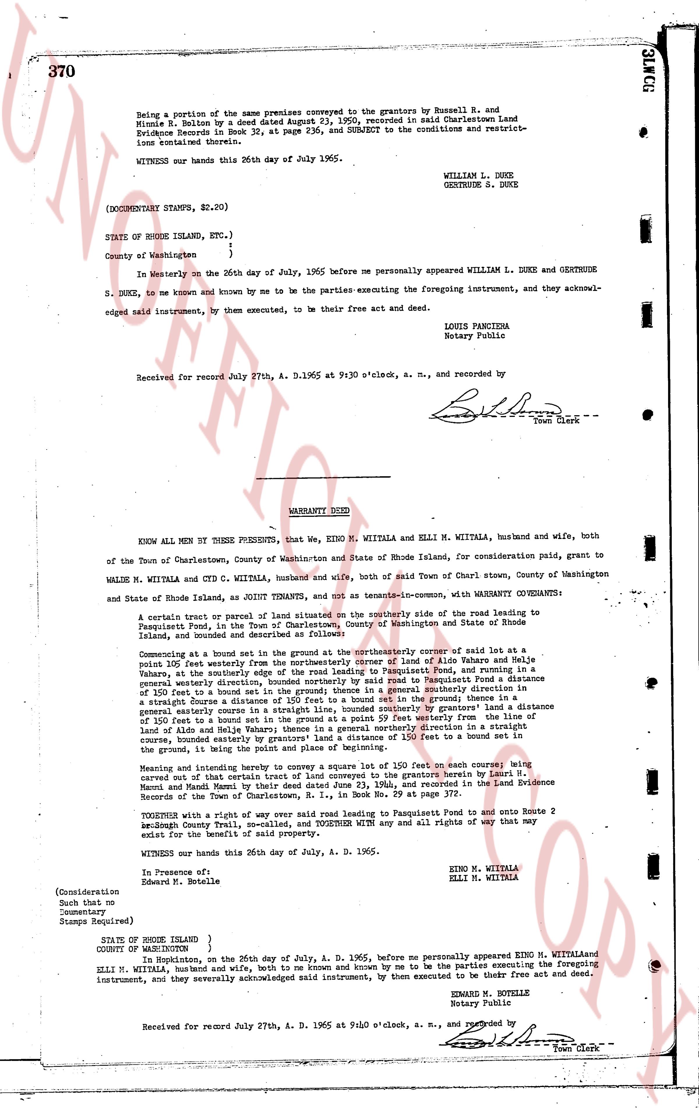
being a portion of the same premises conveyed to the grantors by Russell R. and
Minnie R. Balton by a deed dated August 23, 1960, recorded in said Charlestown Land
Evidence Books in Book 35, at page 236, and SUBJECT to the conditions and restrict-
ions contained therein.
WITNESS our hands this 26th day of July, 1965.
WILLIAM L. DUKE
GENC THRUDE S. DUKE
(DOCUMENTARY STAMPS, $2.20)
STATE OF RHODE ISLAND, ETC.)
)
)
County of Washington
In Westerly on the 26th day of July, 1965 before me personally appeared WILLIAM L. DUKE and GENC THRUDE
S. DUKE, to me known and known by me to be the parties executing the foregoing instrument, and they acknow-
ledged said instrument, by them executed, to be their free act and deed.
LOUIS PANCIENA
Notary Public
Received for record July 27th, A. D. 1965 at 9:30 o'clock, a. m., and recorded by
[Signature]
Town Clerk
----
WARRANTY DEED
KNOW ALL MEN BY THESE PRESENTS, that We, EINO M. WIITALA and ELLI M. WIITALA, husband and wife, both
of the Town of Charlestown, County of Washington and State of Rhode Island, for consideration paid, grant to
WALDE M. WIITALA and CYD C. WIITALA, husband and wife, both of said Town of Charln stown, County of Washington
and State of Rhode Island, as JOINT TENANTS, and not as tenants-in-common, WITH WARRANTY COVENANTS:
A certain tract or parcel of land situated on the southerly side of the road leading to
Pasquisset Pond, in the Town of Charlestown, County of Washington and State of Rhode
Island, and bounded and described as follows:
Commencing at a bound set in a stone wall at the northeasterly corner of said lot at a
point 100 feet westerly from the northeasterly corner of lot A of Aldo Wahare and Helga
Wahare, at the southerly edge of the road leading to Pasquisset Pond, and running in a
southeasterly direction 150 feet to a bound set in the ground; thence in a generally southern direction in
a straight line 150 feet to a bound set in the ground; thence in a generally southwesterly direction
of 150 feet to a bound set in the ground; thence in a generally southerly direction
a straight line 150 feet to a bound set in the ground; thence in a generally southwesterly direction
a general easterly course in a straight line, bounded southerly by grantors' land a distance
of 150 feet to a bound set in the ground; thence in a generally west direction for a line 150
feet from the land of Aldo and Helga Wahare; thence in a generally northern direction in a straight
line, bounded northerly by the road leading to Pasquisset Pond for 150 feet to a bound set in a
corner, the beginning point and place of beginning.
Meaning and intending hereby to convey a square lot of the size of 150 feet on each course being
carved out of that certain tract of land conveyed to the grantors herein by Lori M.
Nacori and Maud Macon by that deed dated March 23, 1964, and recorded in the Land Evidence
Records of the Town of Charlestown, R. I., in Book No. 59 at page 372.
TOGETHER with a right of way over said road leading to Pasquisset Pond and onto Route 2
Beach road County Trail, Rhode Island, TOGETHER WITH any and all rights of way that may
exist for the benefit of the said property.
WITNESS our hands this 26th day of July, A. D. 1965.
EINO M. WIITALA
ELLI M. WIITALA
In Presence of:
Edward M. Hotelle
(Consideration
Such that no
Documentary
Stamps Required)
STATE OF RHODE ISLAND )
COUNTY OF WASHINGTON )
In Hopkinton, on the 26th day of July, A. D. 1965 before me personally appeared EINO M. WIITALA and
ELLI M. WIITALA, husband and wife, both to me known and known by me to be the parties executing the foregoing
instrument, and they severally acknowledged said instrument, by them executed to be their free act and deed.
EDWARD M. HOTELLE
Notary Public
Received for record July 27th, A. D. 1965 at 9:30 o'clock a. m., and recorded by
[Signature]
Town Clerk
The page as recorded