The instrument's own words
page 1 · read by Gemma vision
/69
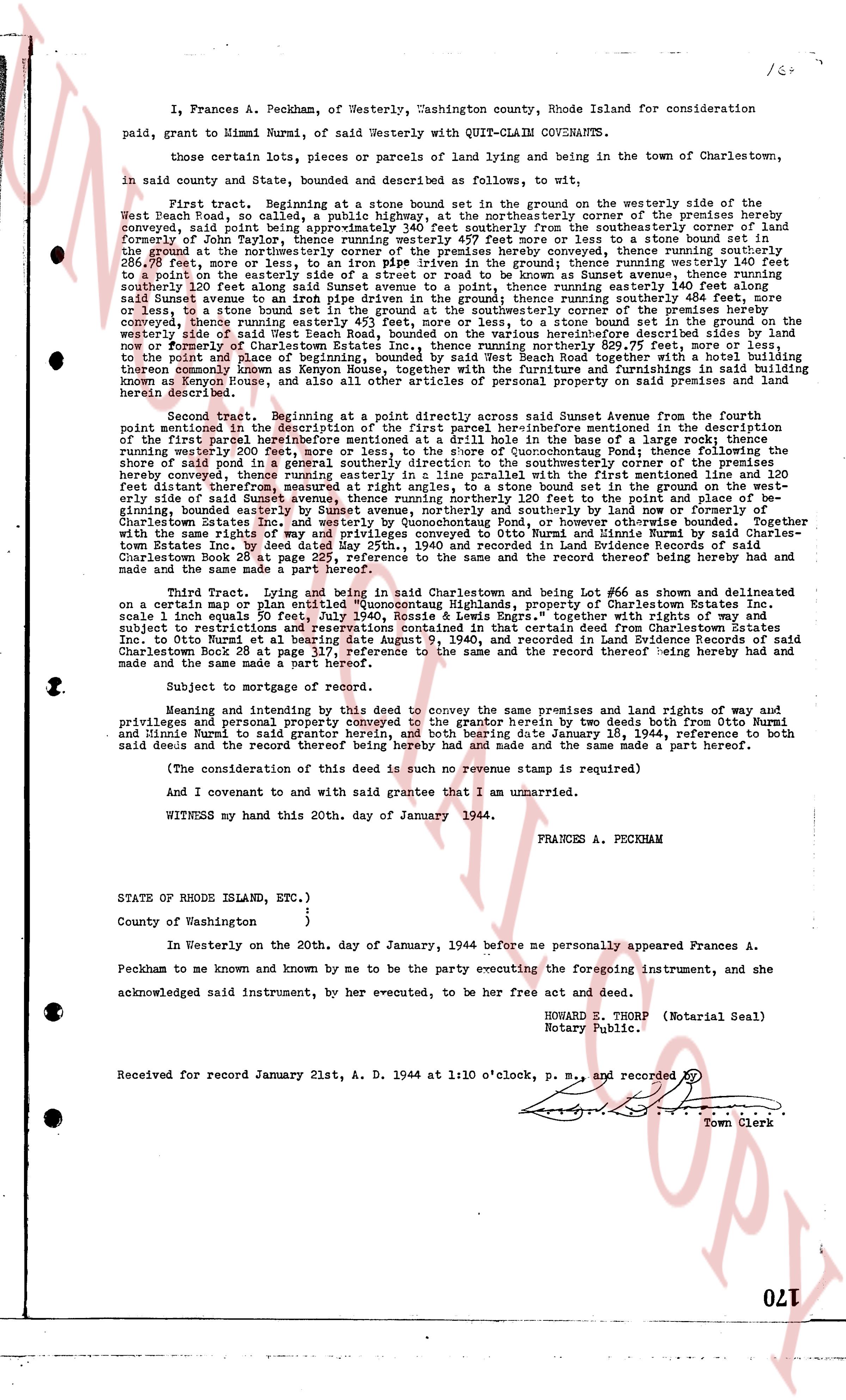
I, Frances A. Peckham, of Westerly, Washington county, Rhode Island for consideration
paid, grant to Mimmi Nurmi, of said Westerly with QUIT-CLAIM COVENANTS,
Those certain lots, pieces or parcels of land lying and being in the town of Charlestown,
in said county and State, bounded and described as follows, to wit:
First tract. Beginning at a stone bound set in the grounnd on the westerly side of the
West Beach Road, so called, a public highway, at the northeasterly corner of the premises hereby
conveyed, said point being approximately 340 feet southerly from the southeasterly corner of land
formerly of John Potter, as appears in Book 24 page 169, then running southerly to a stone bound
the ground at the northeasterly corner of the premises hereby conveyed, thence running southerly
200 feet, more or less, to a stone bound set in the ground, thence running easterly 200 feet, more or
less, to a point on the easterly side of a road or street to be known as Sunset avenue, thence running
said Sunset avenue to an iron pipe driven in the ground; thence running southerly 484 feet, more
or less, to a stone bound set in the ground on the westerly side of a road or street to be known as
said Sunset avenue to an iron pipe driven in the ground; thence running southerly 451 feet, more or
less, to a stone bound set in the ground on the westerly side of a road or street to be known as
now and formerly of Charlestown Estates Inc., thence running northerly 829.75 feet, more or less,
to the point of beginning. Containing 2.15 acres, more or less. Together with the building
thereby commonly known as Kenyon House, together with the furnishing and furnishings in said building
known as Kenyon House, and all other articles of personal property on said premises and land
hereby conveyed.
Second tract. Beginning at a point described as roughly direct across said Sunset avenue from the
fourth point mentioned in the description of the first parcel hereinbefore mentioned in the description
of the first tract hereby conveyed, thence running easterly 110 feet, more or less, to a stone bound
running westerly 200 feet, more or less, to the shore of Quonochontaug Pond; thence following the
shore, said pond in a southeasterly direction to a point on the shore of said pond, from which point
hereby conveyed, thence running easterly in a line parallel with the first mentioned line and 120
feet distant, 200 feet, more or less, to a stone bound set in the ground on the westerly side of the
easterly side of said Sunset avenue, thence running northerly 120 feet to the point and place of be-
ginning. Containing about one acre. Together with the building thereon, now and formerly of
Charlestown Estates Inc. and westerly by Quonochontaug Pond, or however otherwise bounded. Together
with those said lots of said land as are more fully described in a certain deed from Charlestown Es-
tates Inc. by deed dated May 25th, 1940 and recorded in Land Evidence Records of said Charles-
town Book 28 at page 222, reference to the same and the record thereof being hereby had and
made and the same made a part hereof.
Third Tract. Lying and being in said land and being Lot #66 as shown and delineated
on a certain map or plan entitled "Quonochontaug Highlands, property of Charlestown Estates Inc.
scale 1" = 200 feet" and bounded as follows: Northerly by Lot #65, southerly by Lot #67, together with
subject to restrictions and reservations contained in that certain deed from Charlestown Estates Inc.
said land in Book 28 at page 222, reference to the same and the record thereof being hereby had and
said Charlestown Book 28 at page 317, reference to the same and the record thereof being hereby had and
made and the same made a part hereof.
Subject to mortgage of record.
Meaning and intending by this deed to convey the same premises and land rights of way and
privileges and personal property conveyed to the grantor herein by two deeds both from Otto Nurmi
and his niece, Mimmi Nurmi to said grantor dated the 20th day of January, 1944, reference to both
said deeds and the record thereof being hereby had and made the same made a part hereof.
(The consideration of this deed is such no revenue stamp is required)
And I covenant and to said grantee with said grantee that I am unmarried.
WITNESS my hand of this 20th day of January 1944.
FRANCES A. PECKHAM
STATE OF RHODE ISLAND, ETC.)
)
County of Washington )
In Westerly on the 20th day of January, 1944 before me personally appeared Frances A.
Peckham to me known and by me to be the party executing the foregoing instrument, and she
acknowledged said instrument, by her executed, to be her free act and deed.
HOWARD E. THORP (Notarial Seal)
Notary Public.
Received for record January 21st, A. D. 1944 at 1:10 o'clock, P. M., and recorded by [?]
Town Clerk
The page as recorded