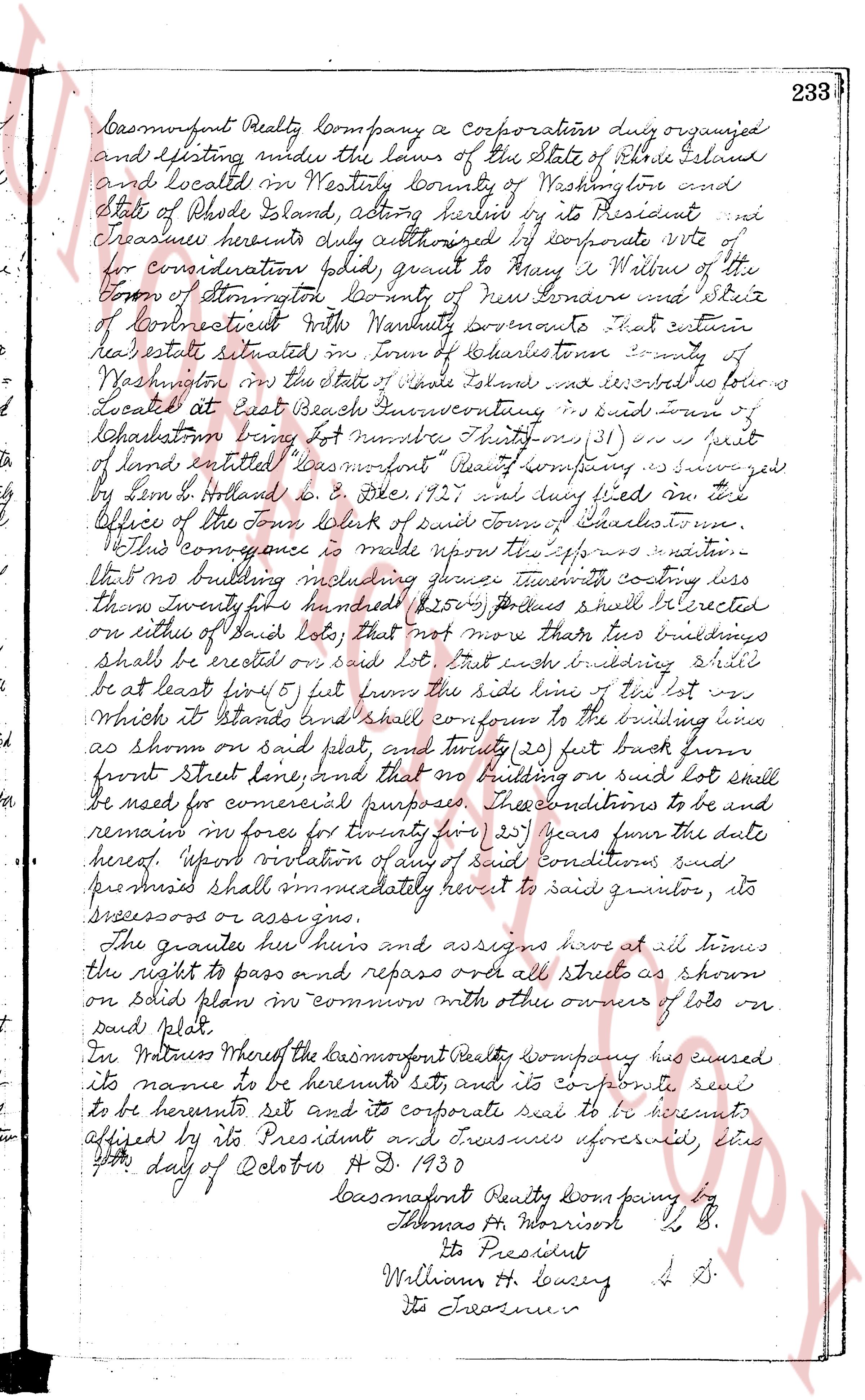
The instrument's own words
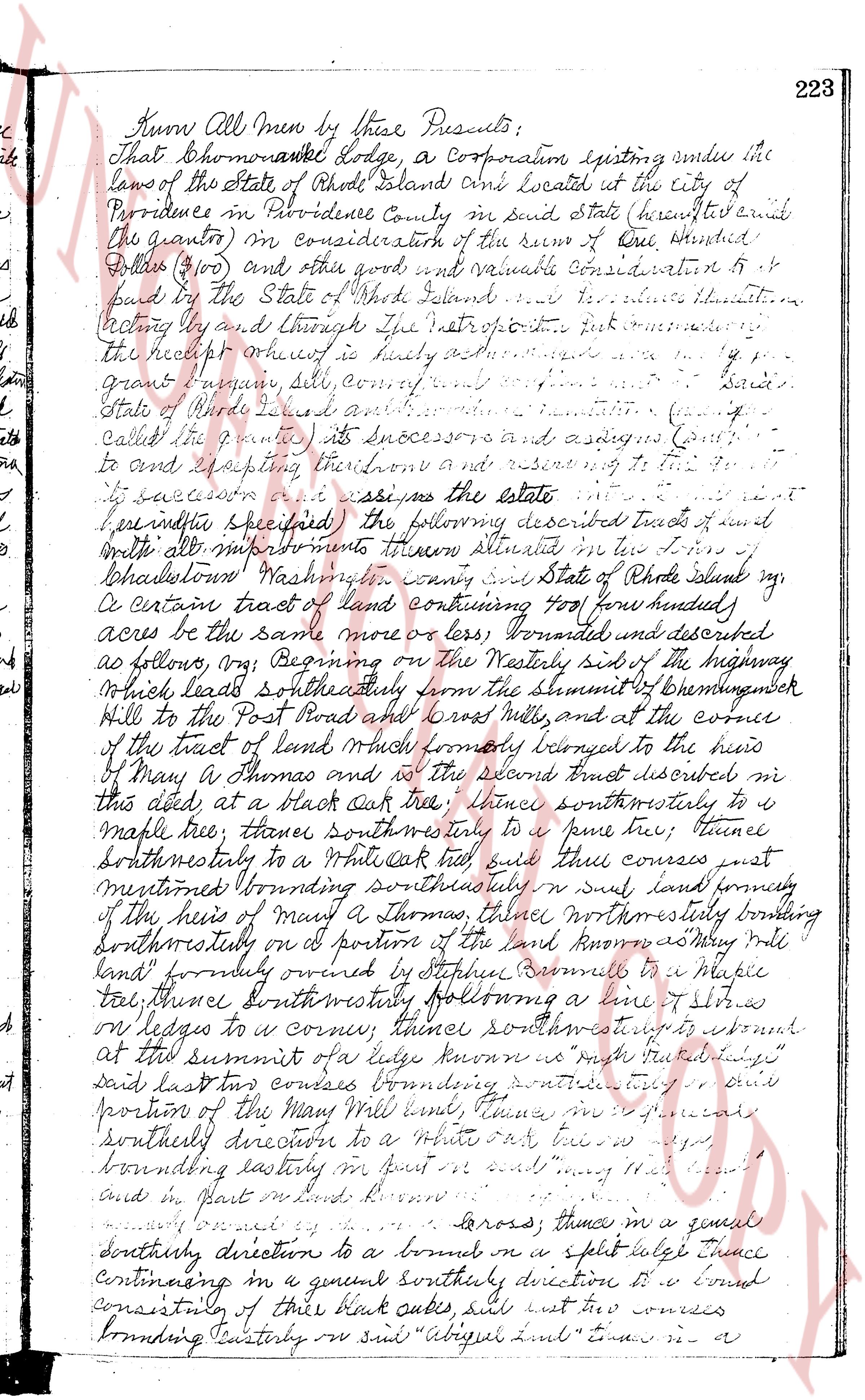
page 1
Know All Men by these Presents:
That Shomoawake Lodge, a Corporation existing under the
laws of the State of Rhode Island and located at the city of
Providence in Providence County in said state (hereinafter
the grantor) in consideration of the sum of One Hundred
Dollars ($100) and other good and valuable consideration to
paid by the State of Rhode Island and its successors and assigns
acknowledging and through the introduction further mentioned
the receipt whereof is hereby acknowledged
said
Grand Lodge, Solf commanding
State of Rhode Island and its successors and assigns
called the grantee its successors and assigns (grant
to and excepting their own and reserving to it
its successors and assigns as the estate
hereinafter specified) the following described tract of land
with all its improvements thereon situated in the Town of
Charlestown Washington County and State of Rhode Island vg
a certain tract of land containing Two hundred (200) acres
acres be the same more or less bounded and described
as follows namely (1) Beginning on the westerly side of the highway
which leads southeasterly from the summit of Chemingwock
Hill to the Post Road and crosses Mill river, and at the corner
of the tract of land which formerly belonged to the heirs
of Mary A Thomas and is the second tract described in
this deed at a black oak tree; thence southwesterly to a
maple tree; thence southwesterly to a pine tree; thence
southeasterly to a white oak tree said three courses just
mentioned bounding southwesterly on said land formerly
of the heirs of Mary A Thomas thence northwesterly bounding
southeasterly on a portion of the land known as May Mill
land formerly owned by Stephen Russell to a maple
tail, thence southwesterly following a line 7 chains
on ledges to a corner; thence southwest to a stone
at the summit of a ridge known as right tributary
said last two courses bounding southwesterly on said
portion of the May Mill land, thence in a general
southerly direction to a brook or a split ledge thence
continuing in a general southerly direction to a bound
consisting of three black oaks said last two courses
bounding easterly on said "Abigail land" thence in a
page 2
224 General southerly direction in a straight line to a
point marked the southerly line of land known as "West Cove"
said point is situated thirteen hundred twenty five / 1325
feet from the southeasterly corner of said West
Cove at the highway above mentioned thence
thirteen hundred twenty four / 1324 feet in the south
line of said "West Cove" to the southwesterly corner
of said "West Cove" at a white oak tree thence in a
course a little to the west of south through a boundary wall
to a black oak tree to Matchang Hook at the southeasterly
corner of a parcel of land known as "Cove Land (Public land)"
and a point on a course bounding easterly on land now or formerly
of George S. Kendrick thence westerly on said Matchang Hook
to the line now or formerly of William S. Kendrick
of George S. Kendrick thence northerly bounding owners
of George S. Kendrick thence to the highway which leads
southwesterly from the summit of Beaman's Hill to and
across Degroot Brook and toward North scuttulet;
thence northeasterly running northwesterly on said
highway above mentioned 820 (eight hundred and
two hundred more or less) feet to a point on the easterly
side of said last mentioned highway which point at
measured along the southeasterly side of said highway
is result 2384 twenty three hundred and fifty four) feet
more or less, southwesterly from a large boulder which
rests on a ledge near the summit of said Beaman's Hill
and at the juncture of two old roads which marks the
southeasterly line of said highway first above mentioned;
thence easterly at an interior angle of 135° 50' (One hundred
thirty five degrees and fifty minutes) 857 (eight hundred and
eighty seven feet) the first 31 (thirty one) feet of
of said course being the line of a stone wall to a corner
thence northeasterly at an interior angle of 181° 02' (One hundred
eighty one degrees and two minutes) and along the line of said wall
219 (two hundred and nineteen) feet to an angle on said wall;
thence continuing along the line of said wall and at an
interior angle of 176° 38' (One hundred seventy six degrees and
thirty seven minutes) a distance of 115 (One hundred fifteen)
feet to an angle on said wall; thence continuing along the
line of said wall at an interior angle of 158° 29' (One
hundred fifty eight degrees and twenty nine minutes) a distance
of 200 (two hundred) feet to an angle on said wall;
thence continuing along the line of said wall and at an
interior angle of 205° 57' (Two hundred four degrees and thirty four)
page 3
minutes,) a distance of 377 (three hundred seventy seven) feet
to an angle in said wall; thence continuing along the
line of said wall and at an interior angle of 183° 05' 35"
one hundred eighty degree five minutes & 35 seconds
a distance of 292 (two hundred ninety two) feet to an
angle in said wall; thence continuing along the line
of said wall and at an interior angle of 183° 11' 16"
one hundred eighty degrees eleven minutes & 16 seconds
of 253 (two hundred fifty three) feet to an angle in said
wall; thence continuing along the line of said wall and at an
interior angle of 102° (one hundred eighty two degrees) a distance
of 51 (fifty one) feet to a point in the southerly side of the
highway first above mentioned (which point as measured
along the southerly side of said highway, is located 371
(three hundred seventy one) feet north easterly from the
large boulder on the ledge as above mentioned) (the last nine courses
bounding on other lado of this quadlet) thence east and southerly
on the highway first above mentioned to the place of beginning,
being and comprising by horno boundary and described all
of the land conveyed to this grantor by said sum percy & Burnick
Shadock Burnick and Sarah B Burnick dated the first day of
November AD 1876 and recorded in the town records
of said town of Pawtucket in Book 1215 at page 422 otherwise
excepting a portion thereof containing approximately 3.7
(three and one half) acres more or less located at the
Northwesterly corner thence reference is made to said land
record theseof is sufficiently much for a particular of the
location and description of said lot as to the above described
land
Also all of the right title and interest of the
grantor in and to the Mills of said Hatchery including
the land under the same.
Also another certain tract of land containing 23 twenty
three) acres be the same more or less located on the easterly
side of the highway first mentioned the description
of the west of said land first described in that deed but excepting
the tract of land reserved 71 in said description as belonging
belonging to the heirs of Henry J Thomas and further described
as describable as follows, viz:
Beginning at a Black Oak on the easterly side of the
Highway (being the most round tree in the vicinity) and running
the tract first described in his deed) south
running southwesterly about 200 (two hundred) feet
to a maple tree thence continuing south easterly about
200 (two hundred) feet to a white oak tree and then
page 4
226 sais two courses of it mentioned bounding northwesterly
to in tract of and first ascribed in this deed Prince
[illegible] with said White Oak tree bounding westerly on
[illegible] company's [illegible] way about 400 [four hundred]
[illegible] track Oak tree then northwesterly bounding border
[illegible] road now or formerly of Gratton's New Court
[illegible] area) to it and then south for formerly & then
[illegible] the [illegible] boundary bounding as said the
[illegible] point south 300 [three hundred] feet, then westerly
[illegible] boundary on said Pattee Species, in a west 600
[six hundred] [illegible] to it and northward thence northwesterly along
said highway about 200 [two hundred] ft to a stone fence
[illegible] [illegible] encompassing therefore bounded
[illegible] and conveyed to this grantor
[illegible] from R. H. Kingy dated the 22nd day of Sept. 1787
and recorded in the volume and records of said town
[illegible] No 10 at page 300 evidence is said
[illegible] and said way made for more
[illegible] the description I have transcribed it and
[illegible] store inserted above
and another parcel of land valuing 55, 4 (fifty
five and four tenths) acres in the said manor or lake
[illegible] described as follows beginning at a point
[illegible] the highway side of said highway then northwesterly
[illegible] [illegible] distance 400 [four hundred] feet to said arrows
[illegible] [illegible] points entered 1175 [one thousand
one hundred seventy five] feet however its northwesterly from the
[illegible] [illegible] along said highway north
[illegible] during line to the highway side and then the
[illegible] line to it said said thence northwesterly only
[illegible] [illegible] this a description is
[illegible] 1175 [one thousand one hundred seventy five] feet
[illegible] then northwesterly boundary
[illegible] returned to this a description custom
[illegible] 1500 [one thousand five hundred] [illegible] then northwesterly to the
[illegible] [illegible] bounding northwesterly and northwesterly
[illegible] [illegible] and then F. Crummell now of this grade
[illegible] [illegible] bounded and described
[illegible] in the volume and records aforesaid
[illegible] of Sept 2, 1787... the coordit be
[illegible] and then a cobblestone brook by
at Page 489 reference is said and said record and
[illegible] for more particulars of the location and
page 5
description of said tree in the write sorted deed
the grantor hereby accepts from the foregoing
conveyance and reserves to itself, and its successors and
assigns, the full use employment occupation and possession
of all of the land hereby conveyed for and during the
lifetime of that one of the following named persons
who shall be the last to survive, viz:
Edmon A Burlingtone, found city of Providence,
Hanna Parsons Cross ditto
Theodore Thomas Shaw "
William B. Brownlygh "
Frank H Frickley "
Richards G Lyman "
Thomas F. J. Moore "
Samuel Norris II unqualified Competent
Sharlie S Fatherne found city of Providence
Ralph E Malbon ditto
with the rights, as necessary and appurtenant to a
life estate to cut reasonable timber from time to time
hereby conveyed for her for her subsist, and
improve more with the same purpose to
that portion of the land described in the above
mentioned deed and from others’’’’’’’’’’’’’’’’’’’’’’’’’’’’’’’’’’’’’’’’’’’’’’’’’’’’’’’’’’’’’’’’’’’’’’’’’’’’’’’’’’’’’’’’’’’’’’’’’’’’’’’’’’’’’’’’’’’’’’’’’’’’’’’’’’’’’’’’’’’’’’’’’’’’’’’’’’’’’’’’’’’’’’’’’’’’’’’’’’’’’’’’’’’’’’’’’’’’’’’’’’’’’’’’’’’’’’’’’’’’’’’’’’’’’’’’’’’’’’’’’’’’’’’’’’’’’’’’’’’’’’’’’’’’’’’’’’’’’’’’’’’’’’’’’’’’’’’’’’’’’’’’’’’’’’’’’’’’’’’’’’’’’’’’’’’’’’’’’’’’’’’’’’’’’’’’’’’’’’’’’’’’’’’’’’’’’’’’’’’’’’’’’’’’’’’’’’’’’’’’’’’’’’’’’’’’’’’’’’’’’’’’’’’’’’’’’’’’’’’’’’’’’’’’’’’’’’’’’’’’’’’’’’’’’’’’’’’’’’’’’’’’’’’’’’’’’’’’’’’’’’’’’’’’’’’’’’’’’’’’’’’’’’’’’’’’’’’’’’’’’’’’’’’’’’’’’’’’’’’’’’’’’’’’’’’’’’’’’’’’’’’’’’’’’’’’’’’’’’’’’’’’’’’’’’’’’’’’’’’’’’’’’’’’’’’’’’’’’’’’’’’’’’’’’’’’’’’’’’’’’’’’’’’’’’’’’’’’’’’’’’’’’’’’’’’’’’’’’’’’’’’’’’’’’’’’’’’’’’’’’’’’’’’’’’’’’’’’’’’’’’’’’’’’’’’’’’’’’’’’’’’’’’’’’’’’’’’’’’’’’’’’’’’’’’’’’’’’’’’’’’’’’’’’’’’’’’’’’’’’’’’’’’’’’’’’’’’’’’’’’’’’’’’’’’’’’’’’’’’’’’’’’’’’’’’’’’’’’’’’’’’’’’’’’’’’’’’’’’’’’’’’’’’’’’’’’’’’’’’’’’’’’’’’’’’’’’’’’’’’’’’’’’’’’’’’’’’’’’’’’’’’’’’’’’’’’’’’’’’’’’’’’’’’’’’’’’’’’’’’’’’’’’’’’’’’’’’’’’’’’’’’’’’’’’’’’’’’’’’’’’’’’’’’’’’’’’’’’’’’’’’’’’’’’’’’’’’’’’’’’’’’’’’’’’’’’’’’’’’’’’’’’’’’’’’’’’’’’’’’’’’’’’’’’’’’’’’’’’’’’’’’’’’’’’’’’’’’’’’’’’’’’’’’’’’’’’’’’’’’’’’’’’’’’’’’’’’’’’’’’’’’’’’’’’’’’’’’’’’’’’’’’’’’’’’’’’’’’’’’’’’’’’’’’’’’’’’’’’’’’’’’’’’’’’’’’’’’’’’’’’’’’’’’’’’’’’’’’’’’’’’’’’’’’’’’’’’’’’’’’’’’’’’’’’’’’’’’’’’’’’’’’’’’’’’’’’’’’’’’’’’’’’’’’’’’’’’’’’’’’’’’’’’’’’’’’’’’’’’’’’’’’’’’’’’’’’’’’’’’’’’’’’’’’’’’’’’’’’’’’’’’’’’’’’’’’’’’’’’’’’’’’’’’’’’’’’’’’’’’’’’’’’’’’’’’’’’’’’’’’’’’’’’’’’’’’’’’’’’’’’’’’’’’’’’’’’’’’’’’’’’’’’’’’’’’’’’’’’’’’’’’’’’’’’’’’’’’’’’’’’’’’’’’’’’’’’’’’’’’’’’’’’’’’’’’’’’’’’’’’’’’’’’’’’’’’’’’’’’’’’’’’’’’’’’’’’’’’’’’’’’’’’’’’’’’’’’’’’’’’’’’’’’’’’’’’’’’’’’’’’’’’’’’’’’’’’’’’’’’’’’’’’’’’’’’’’’’’’’’’’’’’’’’’’’’’’’’’’’’’’’’’’’’’’’’’’’’’’’’’’’’’’’’’’’’’’’’’’’’’’’’’’’’’’’’’’’’’’’’’’’’’’’’’’’’’’’’’’’’’’’’’’’’’’’’’’’’’’’’’’’’’’’’’’’’’’’’’’’’’’’’’’’’’’’’’’’’’’’’’’’’’’’’’’’’’’’’’’’’’’’’’’’’’’’’’’’’’’’’’’’’’’’’’’’’’’’’’’’’’’’’’’’’’’’’’’’’’’’’’’’’’’’’’’’’’’’’’’’’’’’’’’’’’’’’’’’’’’’’’’’’’’’’’’’’’’’’’’’’’’’’’’’’’’’’’’’’’’’’’’’’’’’’’’’’’’’’’’’’’’’’’’’’’’’’’’’’’’’’’’’’’’’’’’’’’’’’’’’’’’’’’’’’’’’’’’’’’’’’’’’’’’’’’’’’’’’’’’’’’’’’’’’’’’’’’’’’’’’’’’’’’’’’’’’’’’’’’’’’’’’’’’’’’’’’’’’’’’’’’’’’’’’’’’’’’’’’’’’’’’’’’’’’’’’’’’’’’’’’’’’’’’’’’’’’’’’’’’’’’’’’’’’’’’’’’’’’’’’’’’’’’’’’’’’’’’’’’’’’’’’’’’’’’’’’’’’’’’’’’’’’’’’’’’’’’’’’’’’’’’’’’’’’’’’’’’’’’’’’’’’’’’’’’’’’’’’’’’’’’’’’’’’’’’’’’’’’’’’’’’’’’’’’’’’’’’’’’’’’’’’’’’’’’’’’’’’’’’’’’’’’’’’’’’’’’’’’’’’’’’’’’’’’’’’’’’’’’’’’’’’’’’’’’’’’’’’’’’’’’’’’’’’’’’’’’’’’’’’’’’’’’’’’’’’’’’’’’’’’’’’’’’’’’’’’’’’’’’’’’’’’’’’’’’’’’’’’’’’’’’’’’’’’’’’’’’’’’’’’’’’’’’’’’’’’’’’’’’’’’’’’’’’’’’’’’’’’’’’’’’’’’’’’’’’’’’’’’’’’’’’’’’’’’’’’’’’’’’’’’’’’’’’’’’’’’’’’’’’’’’’’’’’’’’’’’’’’’’’’’’’’’’’’’’’’’’’’’’’’’’’’’’’’’’’’’’’’’’’’’’’’’’’’’’’’’’’’’’’’’’’’’’’’’’’’’’’’’’’’’’’’’’’’’’’’’’’’’’’’’’’’’’’’’’’’’’’’’’’’’’’’’’’’’’’’’’’’’’’’’’’’’’’’’’’’’’’’’’’’’’’’’’’’’’’’’’’’’’’’’’’’’’’’’’’’’’’’’’’’’’’’’’’’’’’’’’’’’’’’’’’’’’’’’’’’’’’’’’’’’’’’’’’
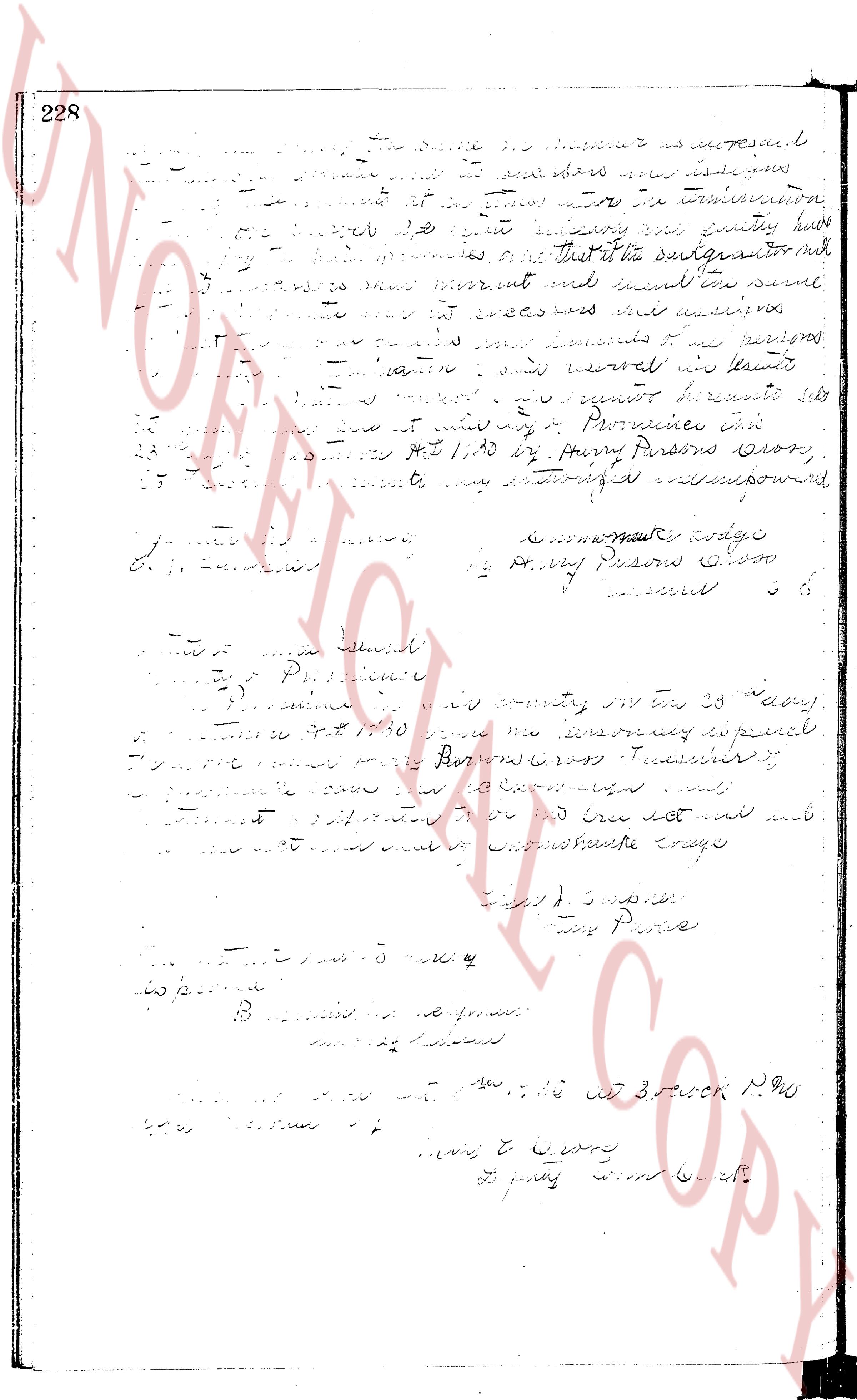
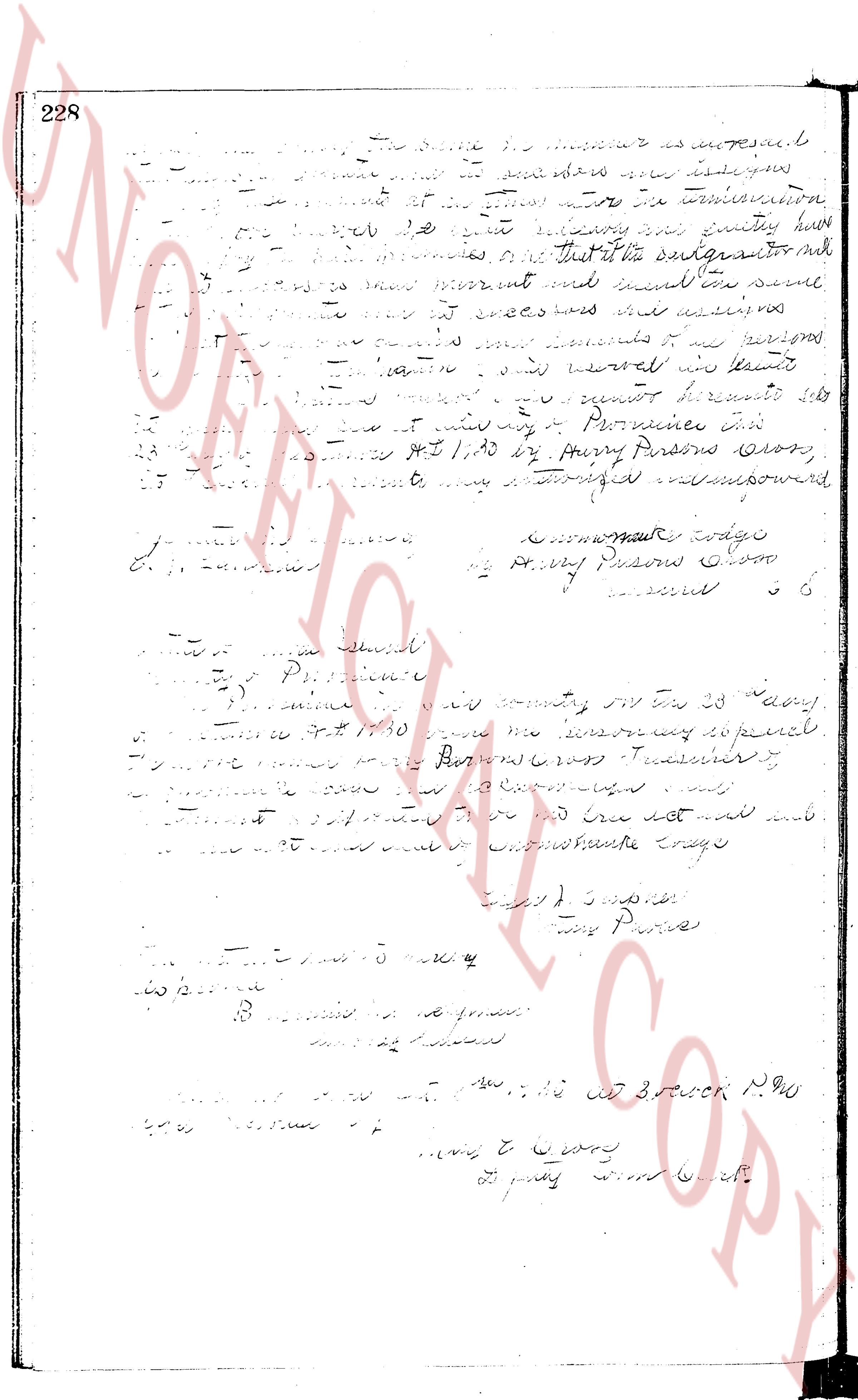
page 6
The image provided is a heavily faded, ghosted, or "bleed-through" page where the ink from the reverse side is visible, but the primary text on this side is almost entirely illegible. Due to the extreme lack of contrast and clarity, a transcription of the text is not possible.
The page as recorded