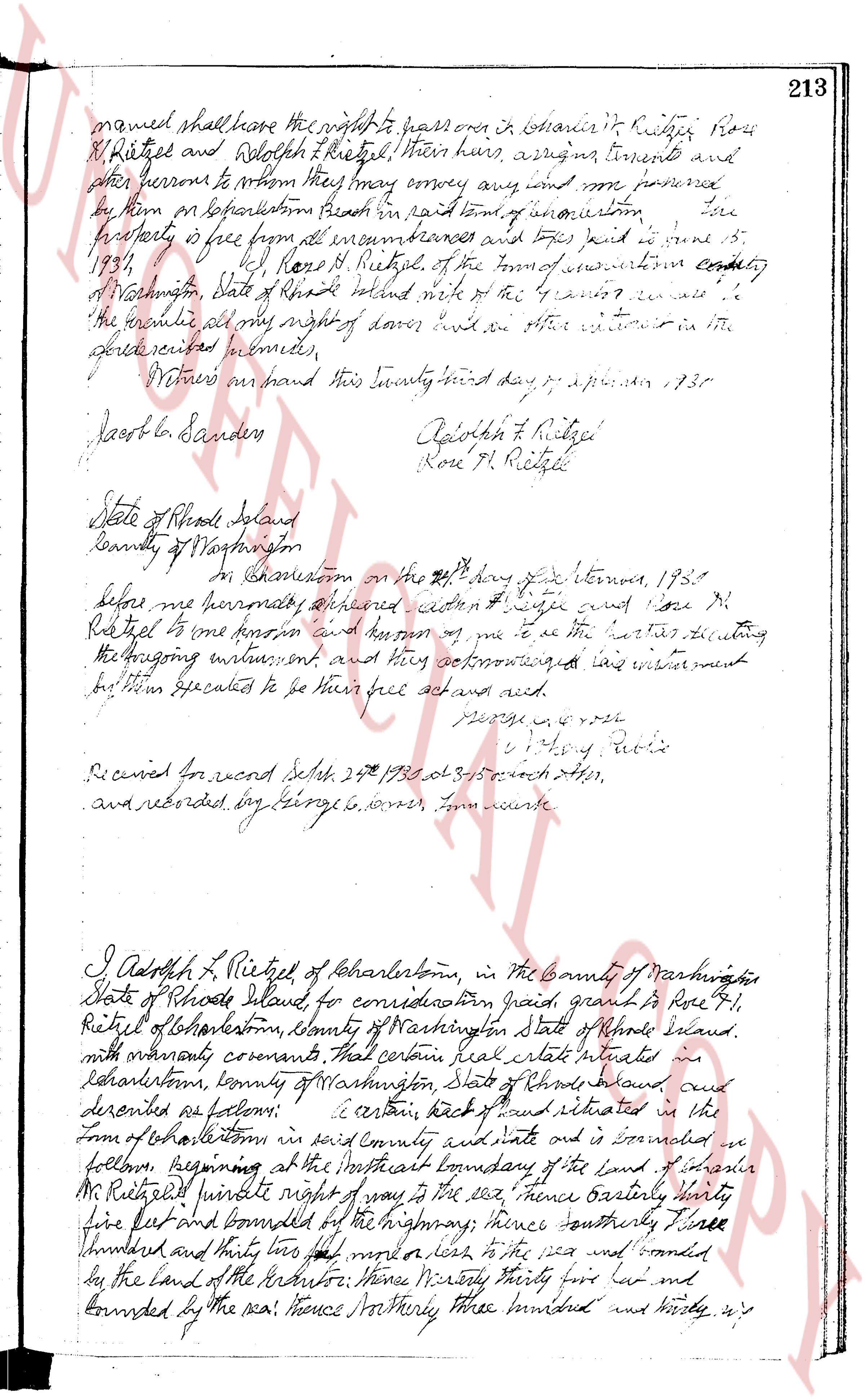
The instrument's own words
page 1
named shall have the right to possess ora in boundaries R. Kistner Rose
R. Ritelof and Rebekah K. Ritelof their heirs, assigns, tenements and
other persons to whom they may convey any and all improvements
by them on Charleston Beach in said town of Narragansett [?]
property is free from all encumbrances and taxes paid to 1931.
[Signed] Rose R. Ritelof of the town of Narragansett county
of Washington, State of Rhode Island in witness of the foregoing we
the parties add my right of dower and we other witnesses in the
presence subscribed below.
Witnessed our hand this twenty third day of April 1931
Jacob L. Sanders [Signed] Rebekah K. Ritelof
Rose R. Ritelof
State of Rhode Island
County of Washington
At Charlestown on the 23d day of April 1931
Before me personally appeared citizen [?] wife and Rose R.
Ritelof to me known and known of me to be the parties executing
the foregoing instrument and they acknowledged that said instrument
was their dedicated to be their free acts and deeds.
[Signature]
[Signature] Notary Public
Received for record Sept 29 1931 at 3/50 each fee,
and recorded by George G. own, town clerk
I, Adolph R. Ritelof of Charlestown, in the County of Washington
State of Rhode Island, for consideration paid, grant to Rose R. L.
Ritelof of Charlestown, County of Washington State of Rhode Island,
with warranty covenants, that certain real estate situated in
Charlestown, County of Washington, State of Rhode Island, called
and described as follows: Certain tract of land situated in the
Town of Charlestown in said County and State and is bounded as
follows: Beginning at the northeast boundary of the land of Sandra
M. Ritelof thence north eighty degrees zero zero zero east, thence easterly thirty
five feet and bounded by the highway; thence southerly three
hundred and thirty four feet more or less to the sea and bounded
by the land of the Ritelofs; thence westerly thirty four feet and
bounded by the sea; thence northerly three hundred and thirty [?]
page 2
214 fect more or less and bounded on the land "Private Right of Way
"is the va " of boundaries it: Rietgel to the place of beginning or border
"of premises bounded. The land is free from all encumbrances and
"forever to be mine 15, 1931.
(Signed) Adolph F. Rietgel of the town
of Charlestown in county of Washington, State of Rhode Island husband
of the grantor releases the grantee all my right of curtesy and
all other interest in the aforesaid premises.
Witness my hand this twenty second day of september 1930.
(Signed) Adolph F. Rietgel
rec'd a deed.
state of Rhode Island
county of Washington
On this twenty fourth on the 24th day of September, 1930 before
me personally appeared Adolph F. Rietgel who is known to me and is known
to me to be the party executing the foregoing instrument and due
acknowledgment had and made within himself’s free act and
deed and void.
(Signed) George A. Lorber
(Signed) George A. Lorber Notary Public
dated recorded Oct 24th 1930 at 3-15 o'clock P.M.
and recorded by george a lorber, from clerk.
I Adolph F. Rietgel of Charlestown in the County of Washington
and State of Rhode Island for consideration paid grant to Isaac
Mason of Richmond County of Washington, State of Rhode Island
with many warranty covenants that certain real estate situated in
Charlestown, County of Washington State of Rhode Island and described
as follows: a certain Lott of land situated in the Town of Charlestown
in said county and state, and is designated as Parcel in Private Right of Way
no number eleven or unnumbered "Private Right of Way" land
in the town of Charlestown, surveyed by Adolph F. Rietgel dated "
and 40th April 1927. & m. H. Holland, Civil Engineer" Said
land being living described in the Town books other than paid from
Charlestown, in which reference is made last and well known hereof,
for more minute and particular description of nearby boundaries
enumerated. The lot is bounded on the South by the Whitney a distance
of ten feet on the West it is number 11 of the Grantor a distance
of seventeen feet more or less to the North on the North by the land
"a distance to twenty feet more or less and on the East by the
The page as recorded