The instrument's own words
page 1
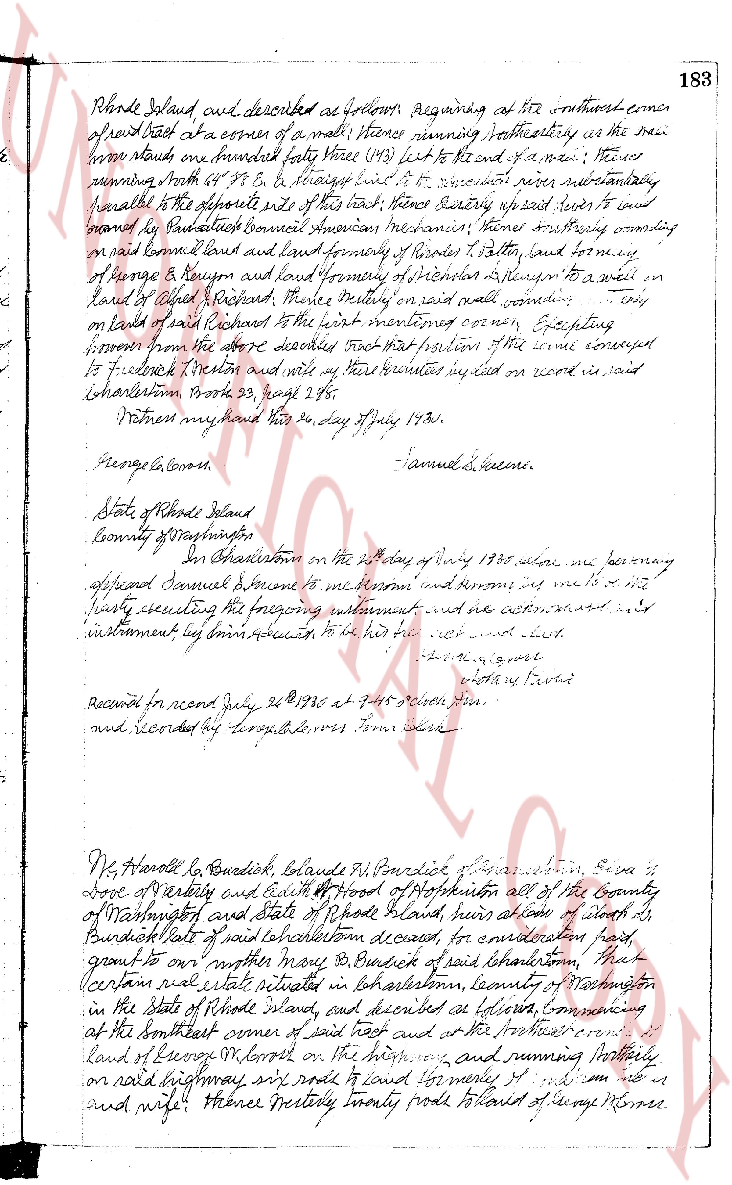
Rhode Island and described as follows: Beginning at the southwest corner
of said tract at a corner of a wall; thence running southeasterly as the wall
runs one hundred forty three (143) feet to the end of a wall; thence
running North 64° 58' E & straight line to the Woonasquatucket river running substantially
parallel to the opposite side of this tract; thence running easterly up said river to and
bounded by Paul Bassett Council American mechanicin, thence southerly bounding
on said bounded land and land formerly of Rhodes P. Potter, and bounding
of George & Reynold and land formerly of Stephen & Steven to a well on
land of Albert Richard, thence westerly on said wall bounding only
on land of said Richard to the first mentioned corner; Excepting
however from the above described tract that portion of the same conveyed
to Frederick Weston and all my heirs rights implied on wood in said
Charlestown, Book 23, page 28.
Witness my hand this 24 day of July 1835.
George Alcorn. Samuel S. Greene.
State of Rhode Island
County of Washington
In Charlestown on the 24th day of July 1835, before me personally
appeared Samuel Greene to me known and known to me to be the
party executing the foregoing instrument and acknowledged to me
instrument by his free act and deed to be his act and deed.
[Signature]
Notary Public
Recorded for record July 26 1835 at 11:45 o'clock a.m.
and Recorded by George Alcorn Town Clerk
Mr. Harold L. Burdick, Claude M. Burdick of Charlestown, Eva L.
Dove of Westerly and Edith P. Hood of Hopkinton all of the County
of Washington and state of Rhode Island, heirs alone of Albert L.
Burdick late of said Charlestown deceased, for consideration paid,
grant to our mother Mary B. Burdick of said Charlestown, that
certain real estate situated in Charlestown, County of Washington
in the State of Rhode Island, and described as follows, commencing
at the southeast corner of said tract and at the northwest corner of
land of George M. Morse on the highway, and running northerly
on said highway, six rods to land formerly of [illegible] and wife; thence westerly twenty rods to land of George Morse
page 2
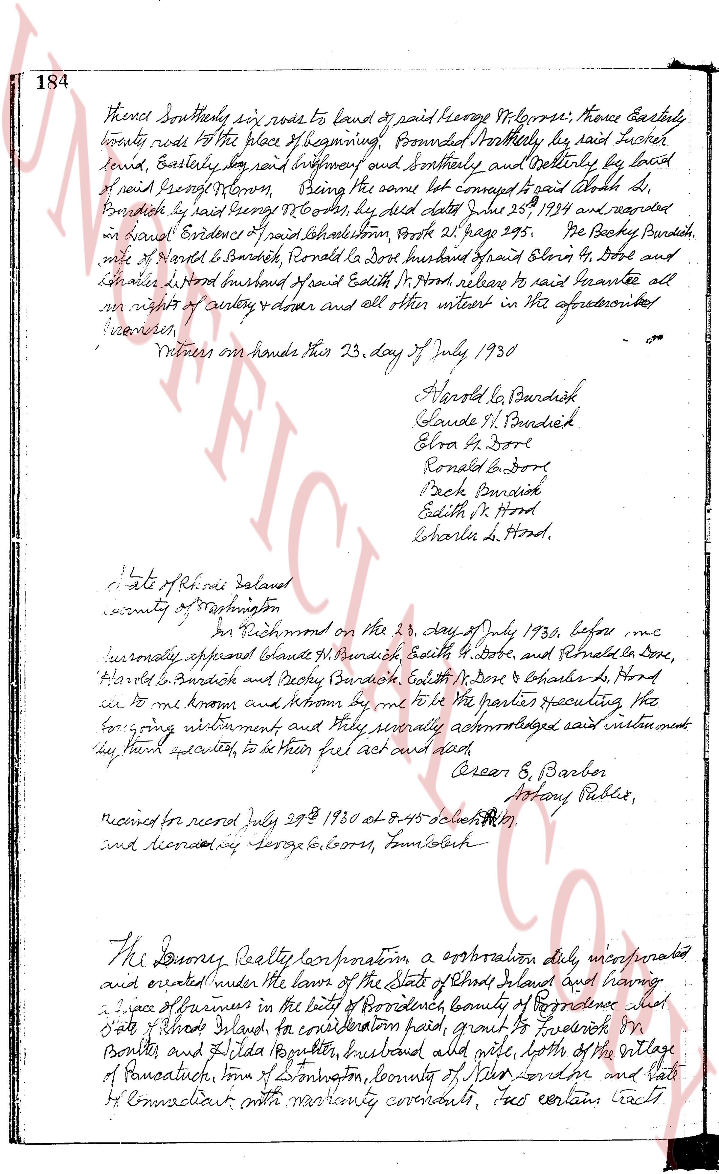
184 thence Southerly six rods to land of said George W. Cross; thence Easterly
twenty rods to the place of beginning; Bounded Northerly by said Tucker
land, Easterly by said instrument and Southerly and Westerly by land
of said George W. Cross, Being the same lot conveyed to said Edith H.
Burdick by said George W. Cross, by deed dated June 25th 1924 and recorded
in land Evidence of said Johnston, Book 211 page 295. We the Becky Burdick,
wife of Harold L. Burdick, Ronald G. Dore husband of Elva G. Dore and
Jonathan Clifford husband of said Edith M. Hood, release to said Grantee all
our right of entry & dower and all other interest in the aforementioned
premises.
Witness our hands this 23 day of July 1930
Harold L. Burdick
Claude H. Burdick
Elva G. Dore
Ronald G. Dore
Becky Burdick
Edith M. Hood
Charles L. Hood.
State of Rhode Island
county of Washington
in Richmond on the 23 day of July 1930, before me
personally appeared Claude H. Burdick, Edith M. Hood, and Ronald G. Dore,
Harold L. Burdick and Becky Burdick, Elva G. Dore & Charles L. Hood
to me known and known by me to be the parties executing the
foregoing instrument and fully severally acknowledged said instrument
they have executed, to be their free act and deed.
Arsen E. Barber
Notary Public.
recorded for record July 29th 1930 at 8.45 o'clock A.M.
and recorded by George W. Cross, Land Clerk
The Drury Realty Corporation, a corporation duly incorporated
and created under the laws of the State of Rhode Island and having a
piece of Farmland in the town of Providence, county of Providence in the
State of Rhode Island, for consideration paid, grant to Frederick M.
Bonfils and Hilda Bonfils, husband and wife, both of the village
of Panaschill, town of Farmington, county of Hartford and state
of Connecticut with warranty covenants, two certain tracts
The page as recorded