The instrument's own words
page 1
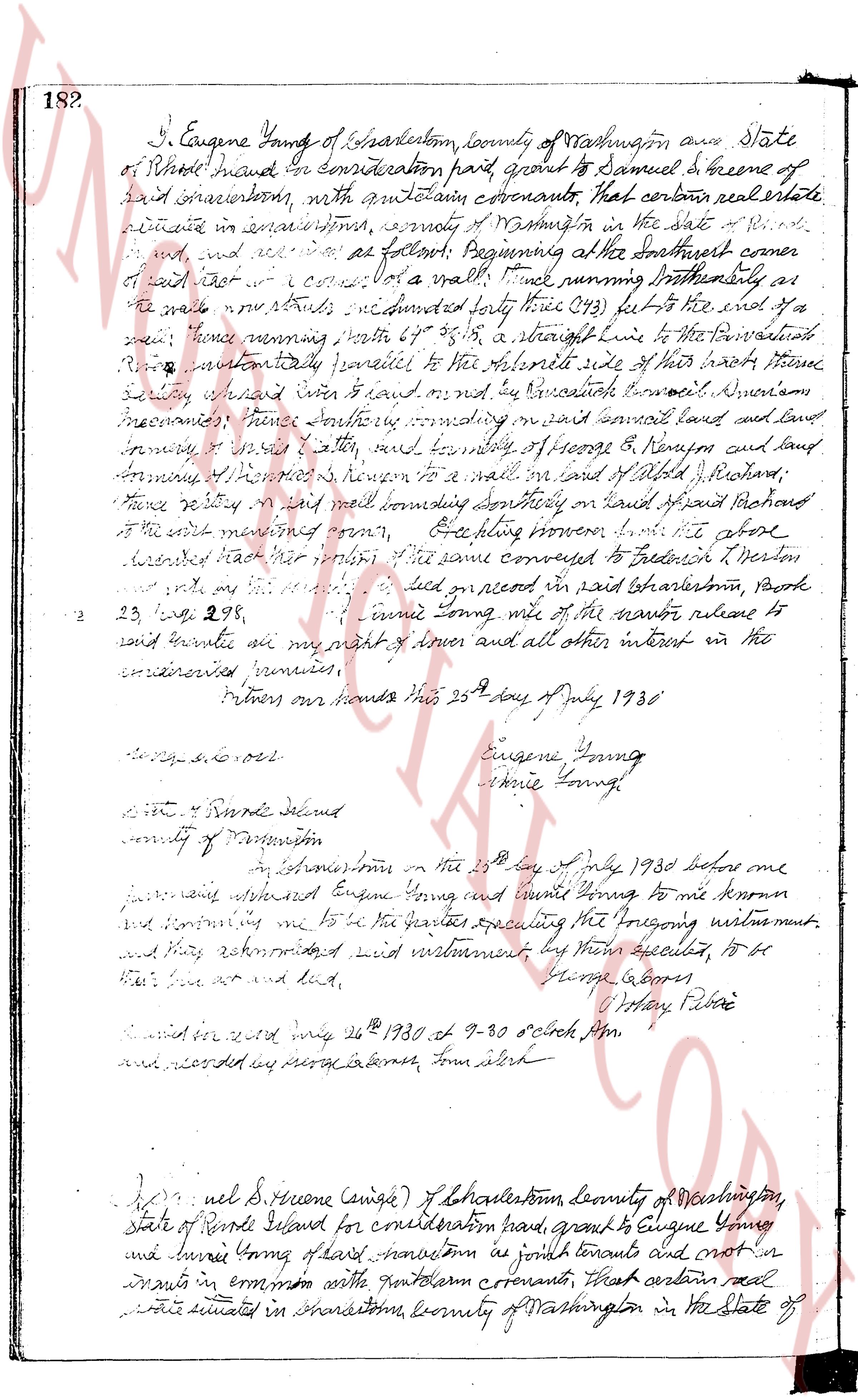
182.
I, Eugene Young of Charlestown, county of Washington and State
of Rhode Island have for consideration paid grant to Samuel S Greene of
said Charlestown, with certain covenants, that certain real estate
situated in said Charlestown, county of Washington in the state of R.
I. and all and appurtenances as follows: Beginning at the Southeast corner
of said lot now a wall thence North running boundary as
the wall now stands east 42 degrees north forty three (43) feet to the end of a
wall thence running north 39° 25' 35" a straight line to the center-line of a
road intentionally parallel to the Northwest side of their tract thence
southwest 67 degrees east 40 feet or by reference to boundary between
tenements thence southerly crossing in said parcel land and land
appurtenant to said loty, thence northerly of George B Kingman and land
forming of the same’s known to a wall in land of Olds Richard
thence easterly in a wall bounding southerly on land of said Richard
to the west starting point form. Excepting however the above
described tract her portion of the same conveyed to Frederick H Norton
recorded in said Charlestown, Book
23 page 298. I furthermore waive all the manor return to
said grantee as my right of dower and all other interest in the
aforementioned premises.
Witness our hands this 25th day of July 1930
Eugene Young
Annie Young
[Signature]
State of Rhode Island
county of Providence
In Charlestown from on the 25th day of July 1930 before me
justice appearing and Eugene Young and Annie Young to me known
and certifying me to be the parties executing the foregoing instrument
and they acknowledged said instrument by their accepted, to be
their free act and deed,
George Gabor
[Signature] Notary Public
Recorded in court Aug 26th 1930 at 9-30 o'clock p.m.
and recorded by peraga laters, town clerk
[New Entry]
Samuel S Greene (single) of Charlestown, county of Washington,
State of Rhode Island for consideration paid, grant to Eugene Young
and Annie Young of said Charlestown as joint tenants and not as ten
ants in common with certain covenants, that certain real
estate located in Charlestown, county of Washington in the State of
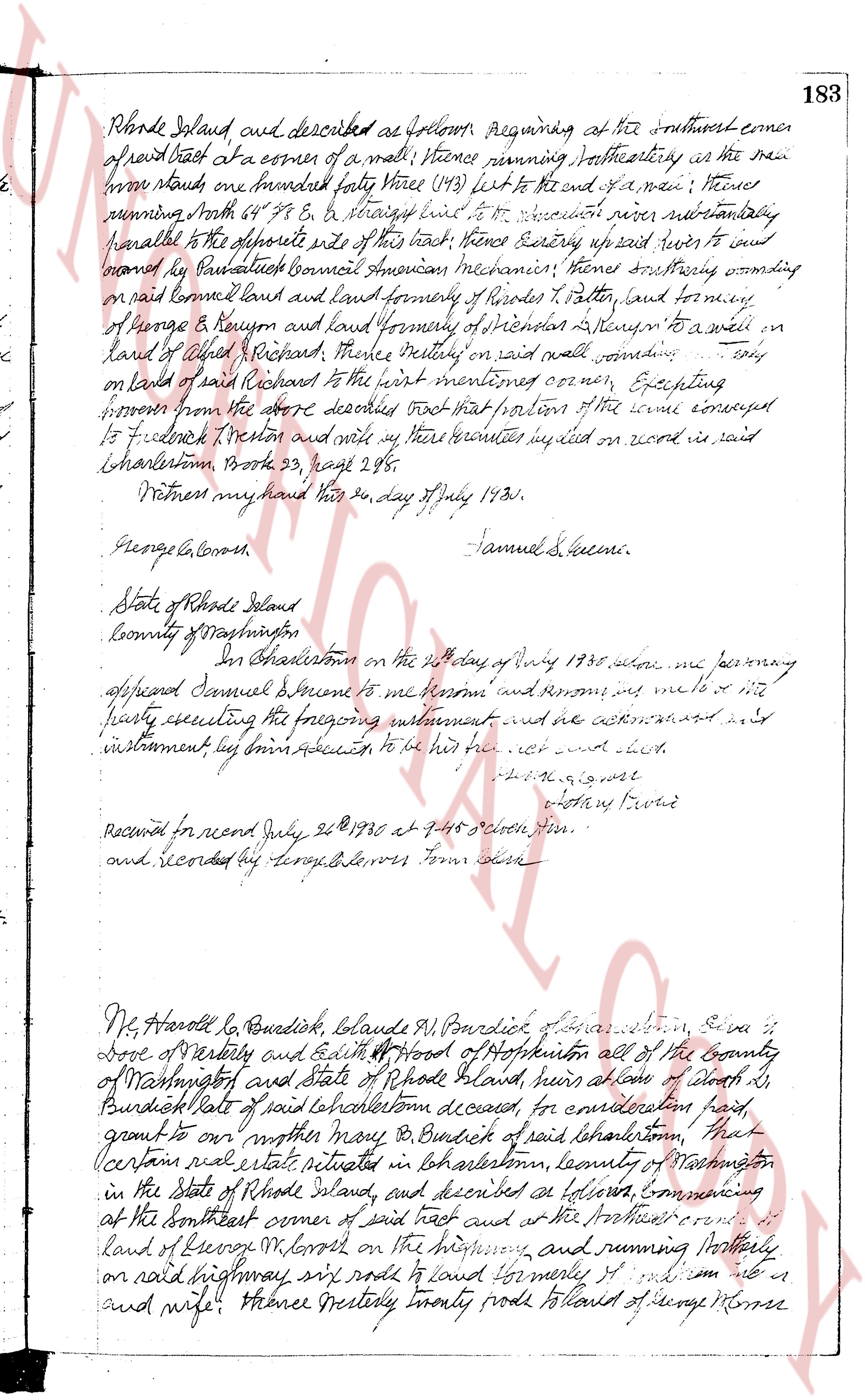
page 2
Rhode Island and described as follows, Beginning at the southwest corner
of said tract at a corner of a wall; thence running southeasterly as the wall
runs one hundred forty three (143) feet to the end of a wall; thence
running North 64° 58' E & straight line to the Woonasquatucket river running substantially
parallel to the opposite side of this tract; thence running easterly up said river to and
bounded by Paul Thrasher Council American mechanicin, thence southerly bounding
on said bounded land and land formerly of Rhodes P. Potter, land bounding
of George & Reynold and land formerly of Stephen & Steven to a well on
land of Albert Richard, thence westerly on said wall bounding only
on land of said Richard to the first mentioned corner; Excepting
moreover from the above described tract that portion of the same conveyed
to Frederick Weston and all my heirs rights implied on wood in said
Charlestown, Book 23, page 28.
Witness my hand this 24 day July 1830.
George Alcorn. Samuel S. Greene.
State of Rhode Island
County of Washington
In Charlestown on the 24th day of July 1830, before me personally
appeared Samuel Greene to me known and known to me to be the
party executing the foregoing instrument and acknowledged to me
instrument by his free act and deed to be his act and deed.
[Signature]
Notary Public
Recorded for record July 26 1830 at 4:45 o'clock p.m.
and Recorded by George Alcorn Town Clerk.
Mr. Harold L. Burdick, Claude M. Burdick of Charlestown, Eva L.
Dove of Westerly and Edith P. Hood of Hopkinton all of the County
of Washington and state of Rhode Island, heirs alone of Albert L.
Burdick late of said Charlestown deceased, for consideration paid,
grant to our mother Mary B. Burdick of said Charlestown, that
certain real estate situated in Charlestown, County of Washington
in the State of Rhode Island, and described as follows, commencing
at the southeast corner of said tract and at the northwest corner of
land of George M. Morse on the highway, and running northerly
on said highway, six rods to land formerly of [illegible] and wife; thence westerly twenty rods to land of George Morse
The page as recorded