The instrument's own words
page 1
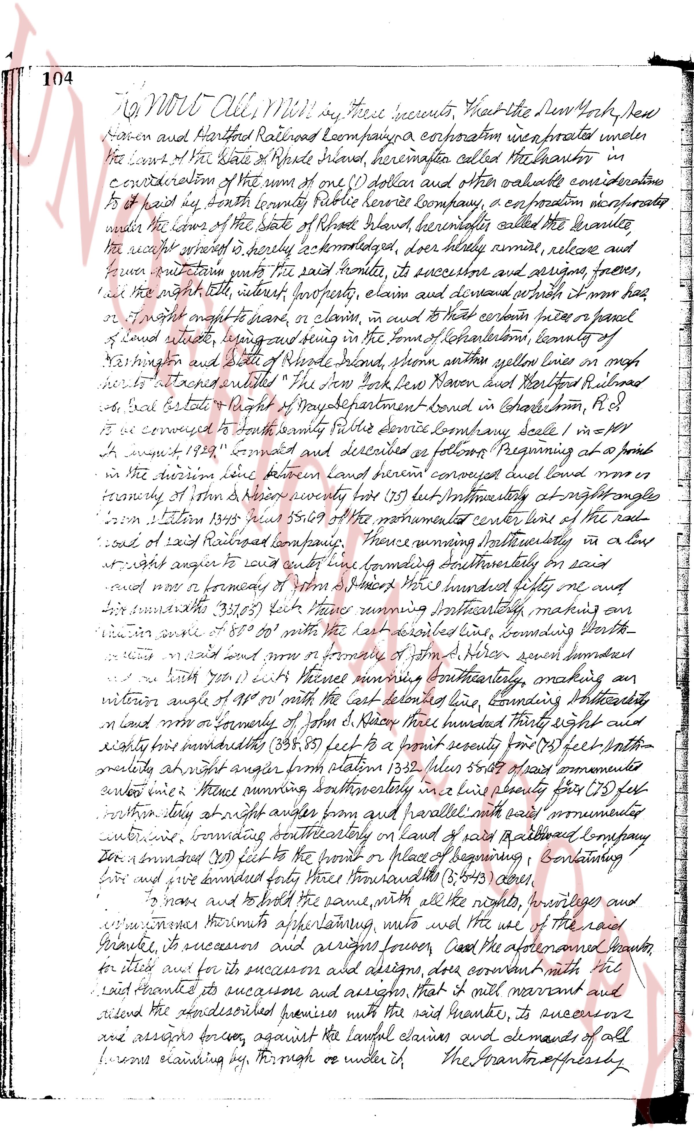
104 To All Men All Men who shall see these presents, that the Den New York New
Haven and Hartford Railroad Company a corporation incorporated under
the laws of the State of Rhode Island, hereinafter called the Grantor in
consideration of the sum of one (1) dollar and other valuable consideration
to it paid by North county Public Service Company, a corporation incorporated
under the laws of the State of Rhode Island hereinafter called the Grantee
the receipt whereof is hereby acknowledged, does hereby remise, release and
forever quitclaim unto the said Grantee, its successors and assigns, force,
and the right title, interest, property, claim and demand which it may have
or may be entitled to have, or claim in and to certain piece or parcel
of land situate, lying and being in the town of Johnston, county of
Providence and state of Rhode Island, shore within a yellow lines on a map
hereunto attached entitled "The New York New Haven and Hartford Railroad
co real estate map of North Development land in Johnston, R.I."
and it is conveyed to North county Public Service Company বলে [?] in = m+
August 1929" agreed and described as follows: Beginning at a point
on the northern line between land herein conveyed and land owned by
friendly of john d harris twenty forty (20.40) feet westerly at right angles
from station 137+55 89.09 of the monumented center line of the rail
road of said Railroad company. Thence running southeasterly in a line
at right angle to said cut line running southeasterly on said
and now a boundary of land owned by hundred fifty one and six
and seventy-three (151.73) feet Thence running northeasterly making an
interior angle of 88° 50' with the last described line, bounding North-
wise said rail road and now a boundary of land owned by seven hundred
and nine (709) feet Thence running southeasterly, making an
interior angle of 90° with the last described line, bounding Northeast-
ly and now boundary of john d harris three hundred thirty eight and
eighty three hundredths (338.83) feet to a point seventy five (75) feet south-
westerly at right angle from station 132 plus zero feet of said monumented
center line Thence running northeasterly in a line perpendicular (75) feet
northwesterly at right angle from and parallel with said monumented
center line, bounding southeasterly on land of said Railroad Company
then a straight (338.83) feet to the point of place of beginning Containing
five and one bounded lots five thousand three (5,003) acres.
To have and to hold the same, with all the rights, heritages and
appurtenances thereto appertaining, unto the said Grantee, its successors
and assigns forever, and the aforesaid Grantor, for itself and for its
successors and assigns, does covenant with the
said Grantee its successors and assigns, that it will warrant and
defend the aforesaid premises with the said Grantee, its successors and
assigns forever, against all lawful claims and demands of all
persons claiming by, through or under it. The Grantor expressly
page 2
afduties from their deed a grant or conveyance of any crossing, right of way, or
easement of any kind buried in superior, over or across the railroad location of the
same, which may at any time have been apportioned to the parcel or end
herein conveyed to said grantor; and said grantor by this acceptance covenants
and agrees for itself and its successors and assigns, that they shall
nor will not claim or assert any right to, or use and enjoy, unless by
virtue of this conveyance or otherwise, any crossing, right of way or easement
of any kind whatever, in whole, or one or across the railroad location of the grantor
for the purpose of access to the parcel of land herein conveyed.
In our presence, the said "The New York, New Haven and Hartford
Railroad Company" has caused these presents to be signed and its corporate
seal to be executed affixed this 18th day of December A.D. 1929.
Signed, sealed and delivered
in presence of
N. B. Parks
The New York, New Haven and
Hartford Railroad Company
By Arthur P. Russell
Executive Vice-President NS.
sworn and attested form, Brown, Clerk’s Office
Description approved 20th Eng. of Survey.
Commonwealth of Massachusetts, ss.
County of Suffolk
On Boston, on this 18th day of December 1929, before me
personally appeared the within named certain P. Russell, to me known,
to me the Executive Vice-President of the New York, New Haven and
Hartford Railroad Company, and the person sealing the foregoing
instrument, and acknowledged said instrument to be his free and voluntary act
and deed in his said capacity as Executive Vice-President and
free act and deed of the New York, New Haven and Hartford Railroad Company
Howard M. Jones
John P. Price, Not.
At a stated meeting of the Board of Directors of the New York, New Haven and
Hartford Railroad Company held pursuant to the regular notice in the city of
New York, N.Y., on Thursday December 18th 1929, the following resolutions were
adopted:
Whereas, the operating officers and the Chief Engineer of this Company
have certified that the land previously described is not required for railroad
purposes and Whereas in the opinion of this Board said land is no longer
required for railroad purposes and is not necessary for the maintenance,
operations or other purposes of this Company or of the New York, Providence and
Boston Railroad Company now merged with this Company; and Whereas
page 3
106 said land is not held for and used in the service of transportation and as
a carrying specified and assumed from the property conveyed by this company's
predecessor dated december 9, 1920, to the Providence & Just Company.
Resolved, that Mr. Shavonian of the Board Executive or the Executive
Committee and Mr. Browning is authorized, in the name and on behalf of this
company and under its corporate seal, to execute and deliver a quitclaim
deed conveying to the south county public service company of the state, Rhode
Island in the consideration of $1.00, that certain parcel of land in the town
of North Kingstown, more fully described in map entitled the New York New Haven
and Boston Railroad Survey Real Estate & Right of Way Department
Land in North Kingstown R.I., to be conveyed to South County Public Service
Company seal #1 = 100 ft august 1929, and bounded on diameter as
follows: Beginning at a point in the division line between land
owned by company and land or formerly of John H. Selway running south
17 1/2 degrees east a distance 54.08 ft from station 13408.869 of the
company center line of the railroad of this company, thence running
Southeasterly at a right angle straight away to said center line, bounding forthesterly
on said line and more or less boundary of John H. Selway, three hundred fifty one and
three tenths (351.3) ft, thence running Northeasterly making an obtuse
angle of 89° 00' with the last described line bounding northeasterly on said
land and more or less boundary of John H. Selway, one hundred and on South 19.1
feet, thence running Southeasterly making an obtuse angle of 89° 00'
with the last described line, bounding southeasterly on land more or formerly
of John H. Selway, three hundred ninety eight and eighty five hundredths
(398.85) ft back to a point seventy two (72) ft Northeasterly at right angle
from station 13327.59.09 of said monument center line, thence running
Southeasterly in a line seventy two (72) ft Northeasterly at right angle
from and parallel with said monument center line, bounding
forthesterly on said line of this company running one hundred (100) ft back to the
point of source or vertex bounding, containing five thousand four hundred forty three
and seventy five hundredths (5443.75) acres, said land is to contain the usual substratum and
mining rights over this company's railroad right of way.
Resolved, that the proceeds received from the sale of said land be
invested with the trustee Hanover Bank and Trust Company of New
York and the terms of the mortgage hereinafter mentioned, until such time
as our company is able to reimburse said proceeds as aforesaid.
Witness, the seal of the state of Connecticut as trustee under
the mortgage of the New York New Haven and Boston Railroad
company, to the treasurers of the state of Connecticut dated April 1st 1922
consented upon the written consent of the lender, Hanover Bank and
Trust company of New York to release said land from the lien and
operation of said mortgage.
- E. S. Eckert, Secretary of the New York New Haven and
page 4
Hartford Railroad Company do hereby certify that the foregoing is a true
copy of record, and in Testimony hereof I have hereunto set my hand and
affixed the seal of said Company this eleventh day of December, 1897,
A. E. Black, Secretary
Received for record May 14 1920 at 4:45 o'clock A.M.
and recorded by George Lawson, Town Clerk
Land now or formerly
John S. Hiscox
336 Rts Mon PC 1361+97.33
Lot now or formerly John S. Hiscox
200.0
Area 5.45 Acres
Mon 1349+24.42
E = 0.15' Left
Land of N.Y. N.H. & H. R.R. Co
Maintenance Center
Land now or formerly
John S. Hiscox
336.0
Township Line
SOUTH COUNTY PUBLIC SERVICE COMPANY
August 1924
Eugene M. Surveys
V S Map No 6
4158
page 5
107
Land now or formerly
John S Hiscox
338 ft
Mon PC 1361+97.33
To Providence
No 1533+59.80
Land now or formerly John S Hiscox
200.0'
Area 5.543 Acres
Mon 1549+24.42
$\pm$ 0.15 Left
Monumented Center Line
L $\frac{1}{8}$ E 700'
N 1° W
316 ft 143+66.63
Land now or formerly
John S Hiscox
151.08'
To New London
Approved
(Signature)
Engineer of Surveys
THE NEW YORK NY CONN & RHODE ISLAND R.R. HISTORICAL R.R. CO.
REAL ESTATE & RIGHT OF WAY DEPARTMENT
LAND IN CHARLESTOWN, R.I.
TO BE CONVEYED TO
SOUTH COUNTY PUBLIC SERVICE COMPANY
SCALE 1IN = 100FT AUGUST 1929
V.S. 36$\frac{1}{2}$ MoP 8
SR15-B
page 6
107
Land now or formerly
John S Hiscox
338 feet
Mon PC 1361+97.33
To Providence
No 1533+59.80
Land now or formerly John S Hiscox
200.0'
Area 5.543 Acres
Mon 1549+24.42
$\pm$ 0.15 Left
Monumented Center Line
Land of N.Y. N.H. & H. R.R. Co.
Sta 1543+65.63
To New London
Land now or formerly
John S Hiscox
151.08
Approved
(Signature)
Engineer of Surveys
THE NEW YORK NEW HAVEN & HARTFORD RAILROAD CO.
REAL ESTATE & RIGHT OF WAY DEPARTMENT
LAND IN CHARLESTOWN, R.I.
TO BE CONVEYED TO
SOUTH COUNTY PUBLIC SERVICE COMPANY
SCALE 1IN = 100FT
AUGUST 1929
V.S. 36 5/8" Map B
SR15-B
page 7
107
Land now or formerly
John S Hiscox
338 feet
Mon PC 1361+97.33
To Providence
No 1533+59.80
Land now or formerly John S Hiscox
200.0'
Area 5.543 Acres
Mon 1549+24.42
$\pm$ 0.15 Left
Monumented Center Line
Land of N.Y. N.H. & H. R.R. Co.
Sta 1543+65.63
To New London
Land now or formerly
John S Hiscox
151.08
Approved
(Signature)
Engineer of Surveys
THE NEW YORK NEW HAVEN & HARTFORD RAILROAD CO.
REAL ESTATE & RIGHT OF WAY DEPARTMENT
LAND IN CHARLESTOWN, R.I.
TO BE CONVEYED TO
SOUTH COUNTY PUBLIC SERVICE COMPANY
SCALE 1IN = 100FT
AUGUST 1929
V.S. 36 5/8" Map B
SR15-B
page 8
107
Land now or formerly
John S Hiscox
338.42' Mon PC 1361+97.33
To Providence
No. 1533+59.80'
Land now or formerly John S Hiscox
200.00'
Area 5.543 Acres
Mon 1349+24.42
$\pm$ 0.15' Left
Monumented Center Line
Land of N.Y. N.H. & H. R.R. Co.
Sta. 1433+68.63'
To New London
Land now or formerly
John S Hiscox
151.03'
Approved
(Signature)
Engineer of Surveys
THE NEW YORK NYH & H. HARFORD RAILROAD CO.
REAL ESTATE & RIGHT OF WAY DEPARTMENT
LAND IN CHARLESTOWN, R.I.
TO BE CONVEYED TO
SOUTH COUNTY PUBLIC SERVICE COMPANY
SCALE 1" = 100 FEET AUGUST 1929
V.S. 36 3/4° MoP 8
SR15-B
page 9
107
Land now or formerly
John S Hiscox
338 feet
Mon PC 1361+97.33
To Providence
No 1533+59.80
Land now or formerly John S Hiscox
200.0'
Area 5.543 Acres
Mon 1549+24.42
$\pm$ 0.15 Left
Monumented Center Line
Land of N.Y. N.H. & H. R.R. Co.
Sta 1543+65.63
To New London
Land now or formerly
John S Hiscox
151.08
Approved
(Signature)
Engineer of Surveys
THE NEW YORK NEW HAVEN & HARTFORD RAILROAD CO.
REAL ESTATE & RIGHT OF WAY DEPARTMENT
LAND IN CHARLESTOWN, R.I.
TO BE CONVEYED TO
SOUTH COUNTY PUBLIC SERVICE COMPANY
SCALE 1IN = 100FT
AUGUST 1929
V.S. 36 5/8" Map B
SR15-B
page 10
107
Land now or formerly
John S Hiscox
338 feet
Mon PC 1361+97.33
To Providence
No 1533+59.80
Land now or formerly John S Hiscox
200.0'
Area 5.543 Acres
Mon 1549+24.42
$\pm$ 0.15 Left
Monumented Center Line
Land of N.Y. N.H. & H. R.R. Co.
Sta 1543+65.63
To New London
Land now or formerly
John S Hiscox
151.08
Approved
(Signature)
Engineer of Surveys
THE NEW YORK NEW HAVEN & HARTFORD RAILROAD CO.
REAL ESTATE & RIGHT OF WAY DEPARTMENT
LAND IN CHARLESTOWN, R.I.
TO BE CONVEYED TO
SOUTH COUNTY PUBLIC SERVICE COMPANY
SCALE 1IN = 100FT
AUGUST 1929
V.S. 36 5/8" Map B
SR15-B
The page as recorded