The instrument's own words
page 1 · read by Gemma vision
653
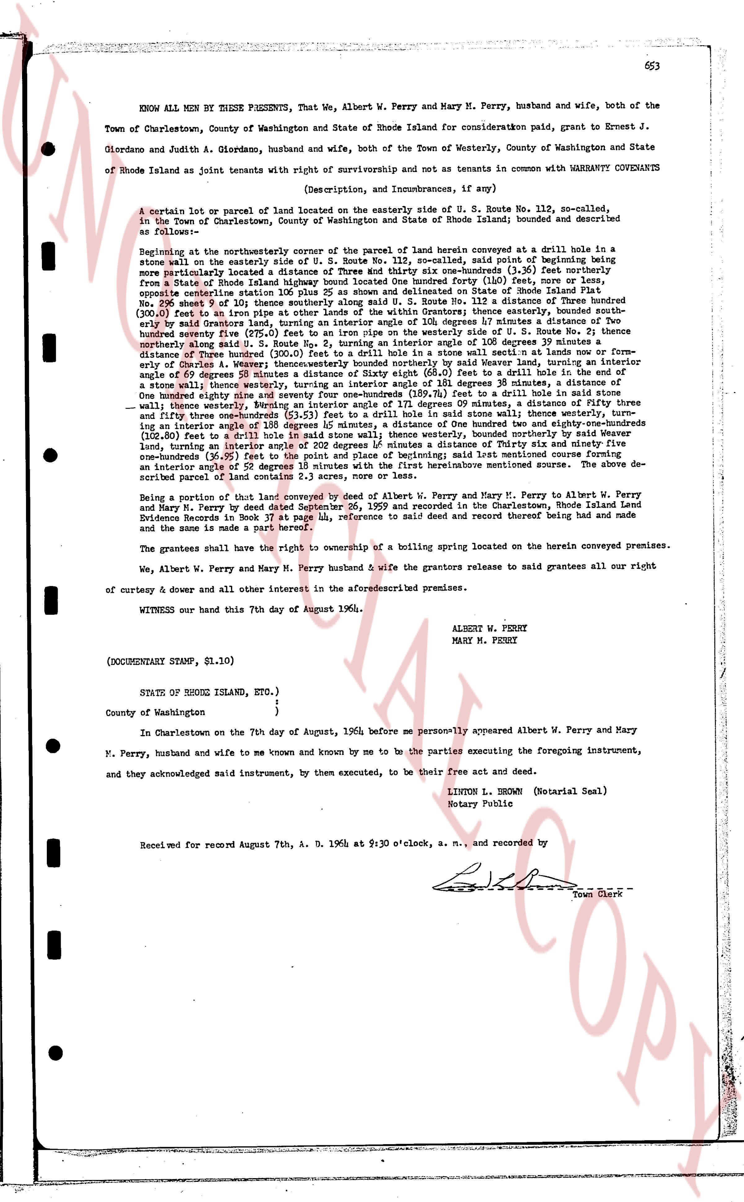
KNOW ALL MEN BY THESE PRESENTS, That we, Albert W. Perry and Mary M. Perry, husband and wife, both of the Town of Charlestown, County of Washington and State of Rhode Island for consideration paid, grant to Ernest J. Giordano and Judith A. Giordano, husband and wife, both of the Town of Westerly, County of Washington and State of Rhode Island as joint tenants with right of survivorship and not as tenants in common with WARRANTY CONVEYANTS
(Description, and Incumbrances, if any)
A certain lot or parcel of land located on the easterly side of U. S. Route No. 112, so-called, in the Town of Charlestown, County of Washington and State of Rhode Island; bounded and described as following:
Beginning at the northeasterly corner of the parcel of land herein conveyed at a drill hole boria in a stone wall on the easterly side of U. S. Route No. 112, so-called, said point of beginning being more particularly located a distance of 115.5 feet south of a drill hole monument (3 1/2 feet) in a stone wall from a State of Rhode Island highway bound stone One hundred forty one (141) feet, more or less, opposite centerline station 105 plus 24 as shown and delineated on State of Rhode Island Plat 196, sheet 24 and said point of beginning being a distance of 110.12 feet on the easterly side of boundary (300.0) feet to an iron pipe at other limits of the within Grantors; thence easterly, bounded south-easterly by a certain lot of land belonging to the within Grantors by stones at a distance of 180 degrees 32 minutes thirty seventy five (275.0) feet to an iron pipe on the westerly side of U. S. Route No. 112 the twenty ninety three (293.0) feet to a drill hole in a stone wall; thence southerly, by a distance of 180 degrees 12 minutes thirty distance of three hundred (300.0) feet to a drill hole in a stone wall situated in lands now or former ly owned by Albert W. Perry; thence westerly, bounded northerly by U. S. Route No. 112, the bearing being an angle of 69 degrees 58 minutes to a distance of Sixty eight (68.0) feet to a drill hole in one of the stone walls; thence westerly, turning an interior angle of 180 degrees 35 minutes to a distance of One hundred twenty eight (128.0) feet to a drill hole in a stone wall; thence westerly, turning an interior angle of 171 degrees 09 minutes, a distance of Thirty four feet and three inches (34.25) to a drill hole in a stone wall; thence northerly, turning an interior angle of 180 degrees 12 minutes, a distance of One hundred twenty eight and one-hundreds (128.01) feet to a drill hole in a stone wall; thence northerly, bounded northerly by lands of the within Grantors, turning an interior angle of 20 degrees 12 minutes a distance of Thirty six and ninety five hundredths (36.95) feet to a drill hole in a stone wall; thence westerly, turning an interior angle of 180 degrees 12 minutes, turning an interior angle of 52 degrees 18 minutes with the first hereinabove mentioned survey. The above described parcel of land contains 2.0 acres, more or less.
Being a portion of that lot of land conveyed by a deed dated September 26, 1959 from Albert W. Perry and Mary M. Perry to Albert W. Perry and Mary M. Perry by deed dated September 26, 1959 and recorded in the Charlestown, Rhode Island Land Evidence Records in Book 37 page 118, reference to said deed and record thereof having been had and made and the same is made a part hereof.
The grantees shall have the right to ownership of a boiling spring located on the herein conveyed premises.
We, Albert W. Perry and Mary M. Perry husband & wife the grantors release to said grantees all our right of curtesy & dower and all other interest in the aforesaid premises.
WITNESS our hand this 7th day of August 1964.
ALBERT W. PERRY
MARY M. PERRY
(DOCUMENTARY STAMP, $1.10)
STATE OF RHODE ISLAND, ETC.)
County of Washington )
}
In Charlestown on the 7th day of August, 1964, before me personally appeared Albert W. Perry and Mary M. Perry, husband and wife to me known and by me to be the parties executing the foregoing instrument, and they acknowledged said instrument, by them executed, to be their free act and deed.
LINTON L. BROWN (Notarial Seal)
Notary Public
Received for record August 7th, A. D. 1964 at 9:30 o'clock, a. m., and recorded by
[Signature]
Town Clerk
The page as recorded