The instrument's own words
page 1 · read by Gemma vision
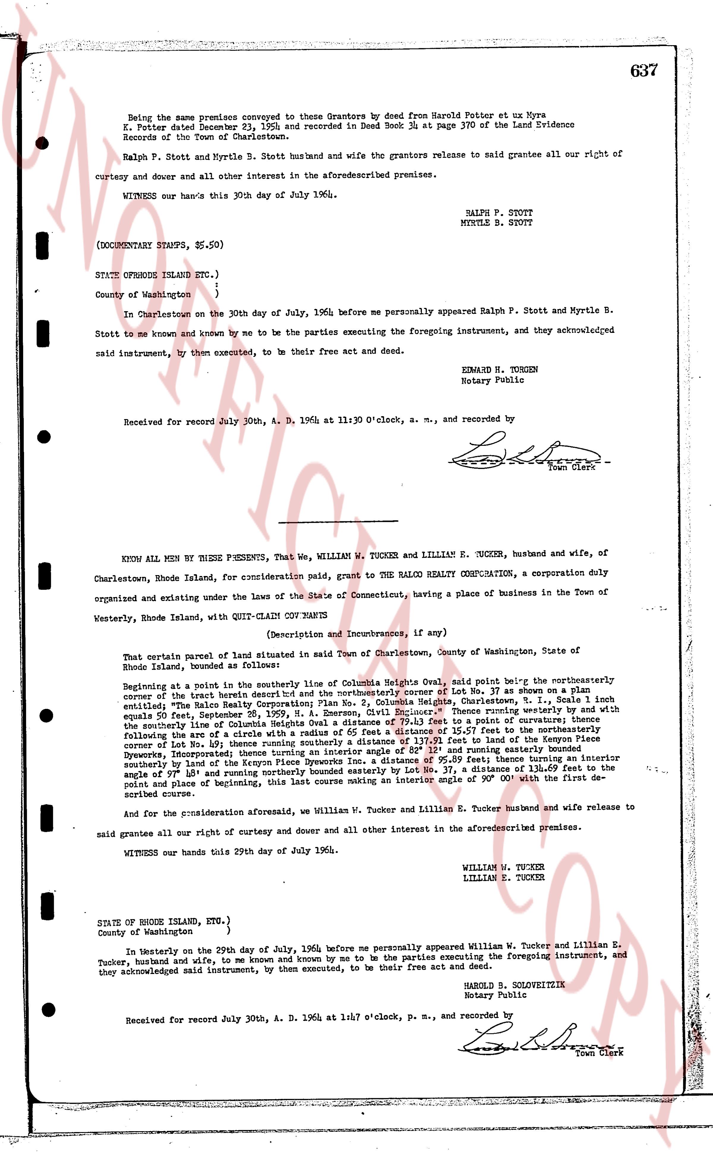
Being the same premises conveyed to Grantors by deed from Harold Potter et ux Myra
E. Potter dated December 23, 1926 and recorded in Deed Book 34 at page 370 of the Land Evidence
Records of the Town of Charlestown.
Ralph P. Stott and Myrtle B. Stott husband and wife the grantors release to said grantee all our right of
curtesy and dower and all other interest in the aforementioned premises.
WITNESS our hands this 30th day of July 1964.
RALPH P. STOTT
MYRTLE B. STOTT
(DOCUMENT STAMPS, $5.50)
STATE OF RHODE ISLAND ETC.,)
County of Washington )
}
In Charlestown on the 30th day of July, 1964 before me personally appeared Ralph P. Stott and Myrtle B.
Stott to me known and by known by me to be the parties executing the foregoing instrument, and they acknowledged
said instrument, by them executed, to be their free act and deed.
EDWARD M. TUCKER
Notary Public
Received for record July 30th, A. D. 1964 at 11:30 O'clock, a. m., and recorded by
[Signature]
Town Clerk
----
KNOW ALL MEN BY THESE PRESENTS, That we, WILLIAM W. TUCKER and LILLIAN E. TUCKER, husband and wife, of
Charlestown, Rhode Island, for consideration paid, grant to THE RALCO REALTY CORPORATION, a corporation duly
organized and existing under the laws of the State of Connecticut, having a place of business in the Town of
Westerly, Rhode Island, with QUIT-CLAIM COV ENANTS
(Description and Incumbrances, if any)
That certain parcel of land situated in Town of Charlestown, County of Washington, State of Rhode
Island, bounded as follows:
Beginning at a point in the northwest corner of Lot No. 37 as shown on a plan [?]
entitled "The Ralco Realty Corporation; Plan No. 2, Columbia Heights, Charlestown, R.I." [?]
equals 50 feet; thence running southerly a distance of 100 feet; thence running westerly by and with
the easterly line of Columbia Heights Oval a distance of 79.13 feet to a point of curvature; thence
running along the arc of a circle to a point of tangency a distance of 25.56 feet in the direction of the
corner of Lot No. 38 and thence southerly a distance of 117.13 feet to the end of the Known Piece
Dykerwoods; incorporating thence turning an interior angle of 90° and running easterly a distance of
[?] feet; thence running a distance of 95.00 feet; thence turning an interior
southerly by a distance of 100 feet; thence running easterly a distance of 37 feet, a distance of 118.37
the angle of 97° 15' and running northerly bounded easterly by Lot No. 37, a distance of 118.37 [?]
point place of beginning, this last course making an interior angle of 90° 00' with the first de-
scribed course.
And for the consideration aforesaid, we William W. Tucker and Lillian E. Tucker husband and wife release to
said grantee all our right curtesy and dower and all other interest in the aforementioned premises.
WITNESS our hands this 29th day of July 1964.
WILLIAM W. TUCKER
LILLIAN E. TUCKER
STATE OF RHODE ISLAND, ETC.,)
County of Washington )
}
In Westerly on the 29th day of July, 1964 before me personally appeared William W. Tucker and Lillian E.
Tucker, husband and wife, to me known and by me to be the parties executing the foregoing instrument, and
they acknowledged said instrument, by them executed, to be their free act and deed.
HAROLD B. SOLVEITZITZ
Notary Public
Received for record July 30th, A. D. 1964 at 1:47 o'clock, p. m., and recorded by
[Signature]
Town Clerk
The page as recorded