The instrument's own words
page 1 · read by Gemma vision
630
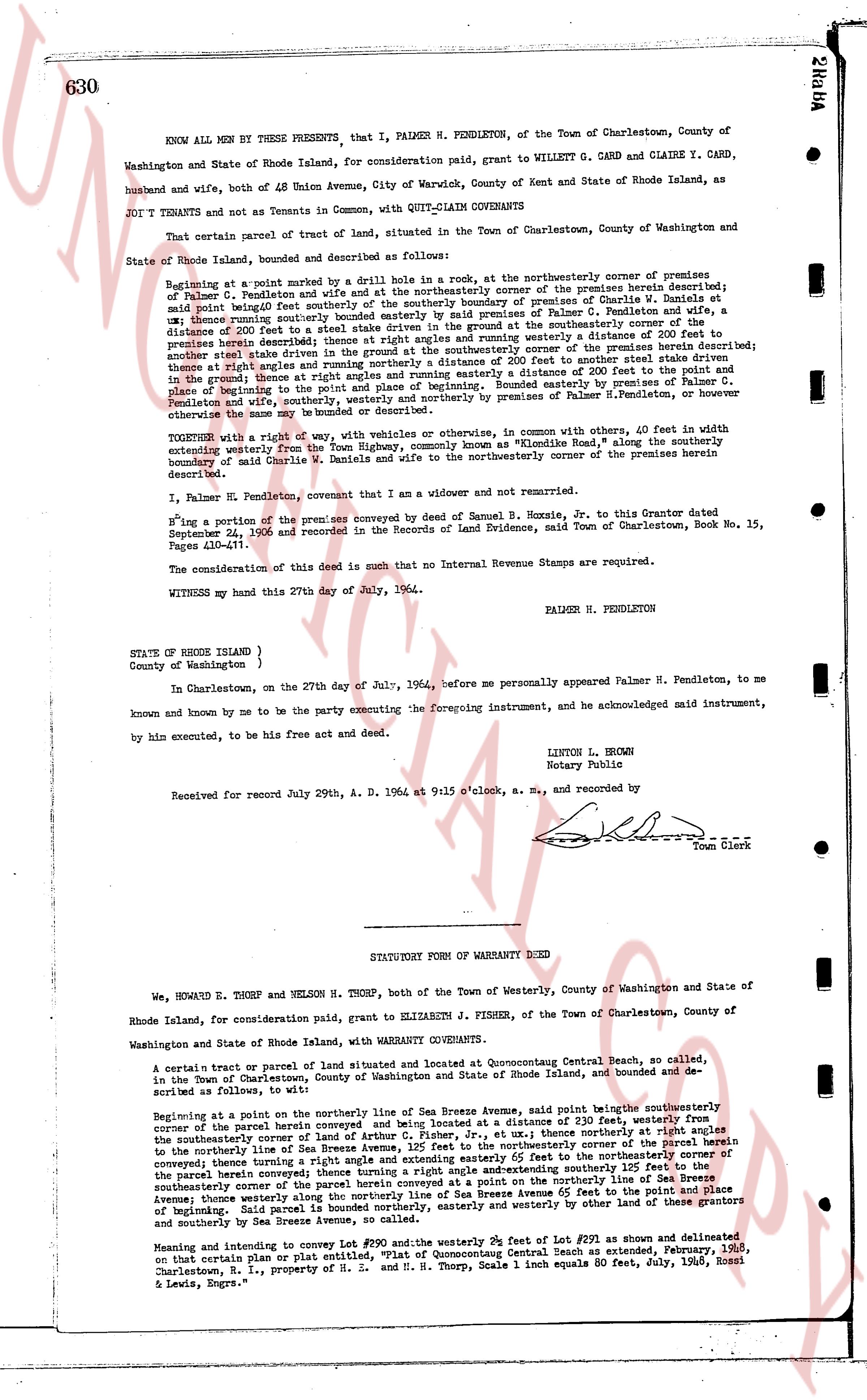
KNOW ALL MEN by THESE PRESENTS, that I, PALMER H. PENDLETON, of the Town of Charlestown, County of Washington and State of Rhode Island, for consideration paid, grant to WILLETT G. CARD and CLAIRE Y. CARD, husband and wife, both of 48 Union Avenue, City of Warwick, County of Kent and State of Rhode Island, as JOINT TENANTS and not as Tenants in Common, with QUIT-CLAIM COVENANTS
That certain parcel of tract of land, situated in the Town of Charlestown, County of Washington and State of Rhode Island, bounded and described as follows:
Beginning at a point marked by a drilled hole 1 inch in row, at the northeasterly corner of premises of Palmer H. Pendleton and wife and at the northeasterly corner of the premises herein described; thence running southeasterly along said boundary to the southerly boundary of premises of Charlie W. Daniels at said point being southerly bounded easterly by said boundary to a distance of 100 feet to a point in the boundary of Palmer H. Pendleton's premises, thence running southeasterly along said boundary at the ground southerly corner of the premises a distance of 200 feet to a point in the boundary of Palmer H. Pendleton's premises, thence running southeasterly along said boundary at the ground southerly corner of the premises herein described thence at right angles and running westerly a distance of 200 feet to meet other state driven stakes in the ground thence at right angles and running northerly a distance of 200 feet to meet other state driven stakes in the ground thence at right angles and running northerly a distance of 200 feet to meet other state driven stakes and place of beginning to write the point and place of beginning. Bounded easterly by premises of Palmer H. Pendleton and wife northerly by premises of Palmer H. Pendleton and wife, southerly by premises of Palmer H. Pendleton, or other owners of the same may be bounded or described.
TOGETHER with a right of way, with vehicles or otherwise, in common with others, 40 feet in width extending westerly from the Tone Highway, commonly known as "Rhode Island Rd," along the southerly boundary of said Charlie W. Daniels and wife to the northeasterly corner of the premises herein described.
I, Palmer H. Pendleton, covenant that I am a widower and not remarried.
Hiring a portion of the premises conveyed by deed of Samuel B. Hoxie, Sr. to this Grantor dated September 24, 1923 and recorded in the Records of Land Evidence, said Town of Charlestown, Book No. 15, Pages 410-411.
The consideration of this deed is such that no Internal Revenue Stamps are required.
WITNESS my hand this 27th day of July, 1964.
PALMER H. PENDLETON
STATE OF RHODE ISLAND )
County of Washington )
In Charlestown, on the 27th day of July, 1964, before me personally appeared Palmer H. Pendleton, to me known and by me to be the party executing the foregoing instrument, and acknowledged said instrument, by him executed, to be his free act and deed.
LINTON L. BROWN
Notary Public
Received for record July 29th A. D. 1964 at 9:15 o'clock, a. M., and recorded by
[Signature]
Town Clerk
----
STATUTORY FORM OF WARRANTY DEED
We, HOWARD E. THORP and NELSON M. THORP, both of the Town of Westerly, County of Washington and State of Rhode Island, for consideration paid, grant to ELIZABETH J. FISHER, of the Town of Charlestown, County of Washington and State of Rhode Island, with WARRANTY COVENANTS.
A certain tract or parcel of land situated and located at Quonochontaug Central Beach, so called, in the Town of Charlestown, County of Washington and State of Rhode Island, and bounded and described as follows, to wit:
Beginning at a point in the northerly line of Sea Breeze Avenue, said point being the southeasterly corner of the parcel herein conveyed and being located at a distance of 230 feet, westerly from the southeasterly corner of the parcel herein conveyed and being located at a distance of 145 feet northerly of the southeasterly corner of the Sea Breeze Avenue, 125 feet to the northeasterly corner of the parcel herein conveyed thence running a right angle and extending easterly 200 feet to the northeasterly corner of the parcel herein conveyed thence running a right angle and extending southerly 125 feet to the southeasterly corner of the parcel herein conveyed at a point on the southerly line of Sea Breeze Avenue thence running a right angle and extending westerly 200 feet to the point and place of beginning. said parcel is bounded northerly, easterly and westerly by other land of these grantors and southerly by Sea Breeze Avenue.
Meaning and intending to convey Lot #190 and the westerly 39 feet of Lot #291 as shown and delineated on that certain Platname or plan entitled "Plat of Quonochontaug Central Beach as extended, February, 1965, Charlestown, R. I.," property of H. S. and M. H. Thorp, Scale 1 inch equals 60 feet, July, 1963, Rossi & Lewis, Engrs."
The page as recorded