The instrument's own words
page 1 · read by Gemma vision
565
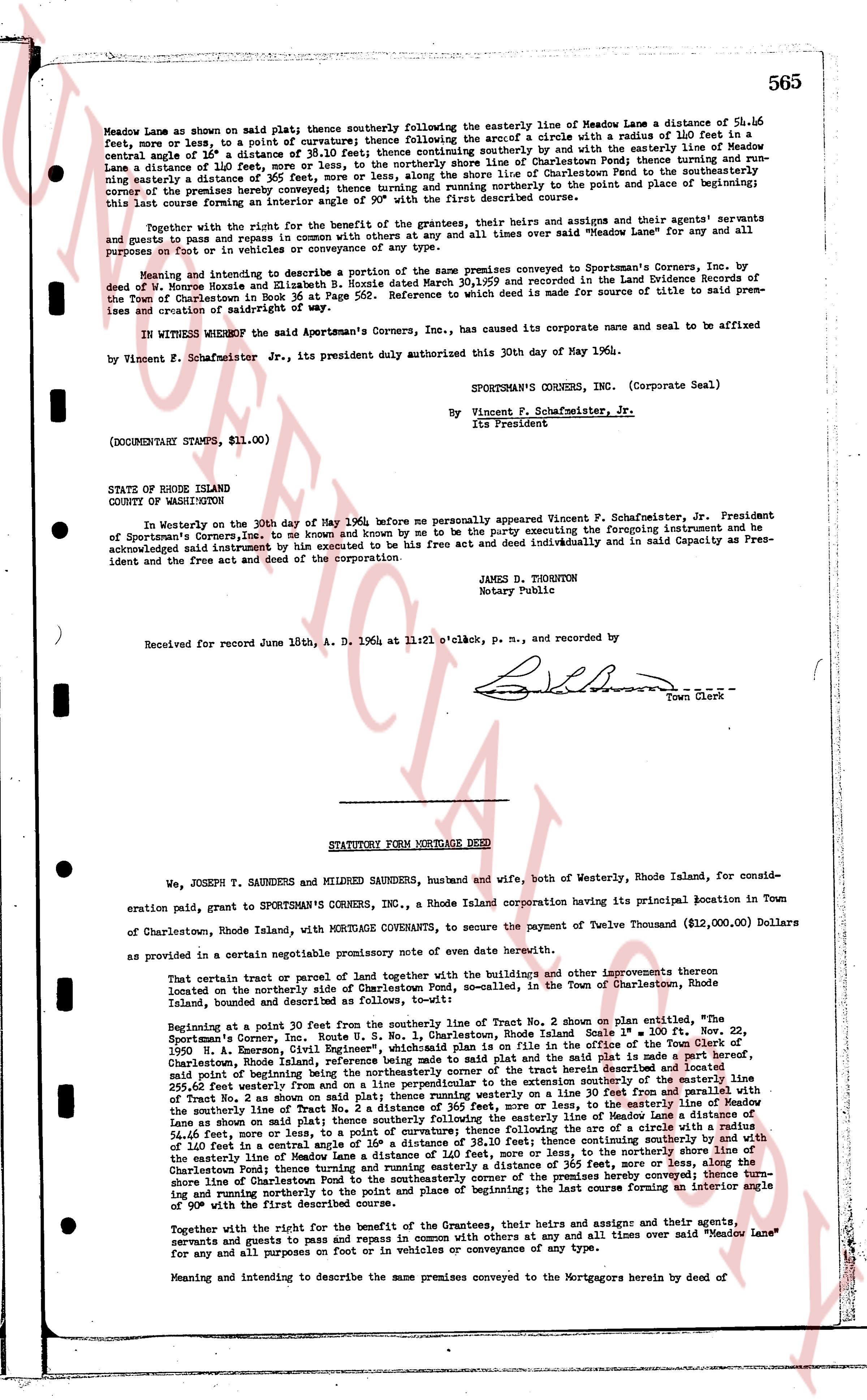
Meadow Lane as shown on said plat; thence southerly following the easterly line of Meadow Lane a distance of 56.16 feet, more or less; thence continuing southerly thence following the arc of a circle with a radius of 110 feet in a south easterly angle of 1/8 of a distance of 38.10 feet; thence continuing southerly by and with the easterly line of Meadow Lane a distance of 110 feet, more or less, to the northerly shore line of Charlestown Pond; thence turning and running a distance of 365 feet, more or less, along the northerly shore line of Charlestown Pond to the northwesterly corner of the premises hereby conveyed; thence turning and running northerly to the point and place of beginning; this last course forming an interior angle of 90 degrees with the first described course.
Together with the right for the benefit of the grantees, their heirs and assigns and their agents servants and guests to pass and repass by way of ingress and egress in common with others at any and all times over said "Meadow Lane" for any and all purposes on foot or in vehicles of conveyance of any type.
Meaning and intending to describe a portion of the same premises conveyed to Sportsman's Corners, Inc. by deed dated June 11, 1936 and recorded in the land Evidence book 30, page 565 and recorded in the Land Evidence Records of the Town of Charlestown in Book 36 at Page 562. Reference to such deed is made for source of title to said premises and creation of rightofway of said.
IN WITNESS WHEREOF the said Sportsman's Corners, Inc., has caused its corporate name and seal to be affixed
By Vincent F. Schafmeister Jr., its president duly authorized this 30th day of May 1960.
SPORTSMAN'S CORNERS, INC. (Corporate Seal)
By Vincent F. Schafmeister, Jr.
its President
(DOCUMENTARY STAMPS, $11.00)
STATE OF RHODE ISLAND
COUNTY OF WASHINGTON
In Westerly on the 30th day of May 1960, before me personally appeared Vincent F. Schafmeister, Jr. President of Sportsman's Corners, Inc., to me known and known by me to be the party executing the foregoing instrument and he acknowledged and instrument by him executed to be his free act and deed individually and in said Capacity as President and the free act and deed of the corporation.
JAMES D. THORNTON
Notary Public
Received for record June 18th, A. D. 1964 at 11:21 o'clock, p. m., and recorded by
[Signature] Town Clerk
----
STATUTORY FORM MORTGAGE DEED
We, JOSEPH T. SAUNDERS and MILDRED SAUNDERS, husband and wife, both of Westerly, Rhode Island, for consideration paid, grant to SPORTSMAN'S CORNERS, INC., a Rhode Island corporation having its principal location in Town of Charlestown, Rhode Island, with MORTGAGE COVENANTS, to secure the payment of Twelve Thousand ($12,000.00) Dollars as provided in a certain negotiable promissory note of oven date herewith.
That certain tract or parcel of land together with the buildings and other improvements thereon first located on the northerly side of Charlestown Pond, m.s.l., contained in the Town of Charlestown, Rhode Island, bounded and described as follows:
Beginning at a point 30 feet past the northerly line of Tract No. 2 shown on plat entitled, "the Sportsman's Corner, Route No. 1, Rhode Island, Charlestown Sole Ownership Map" dated Nov. 22, 1950 N. H. Emerson, Civil Engineer, which plat is filed and recorded in the office of the Town of Charlestown, Rhode Island Land Evidence Book 39 Page 565 and said plat is the said plat and the said plat is a part hereof, said point of beginning being the northwesterly corner of the tract herein conveyed turning southerly on the easterly line of Tract No. 2 shown on said plat thence turning westerly a running on the 30 feet line to the easterly line of Meadow Lane as shown on said plat; thence southerly following the easterly line of Meadow Lane a distance of 56.16 feet, more or less; thence continuing southerly thence following the arc of a circle with a radius of 110 feet in a south easterly angle of 1/8 of a distance of 38.10 feet; thence continuing southerly by and with the easterly line of Meadow Lane a distance of 110 feet, more or less, to the northerly shore line of Charlestown Pond; thence turning and running easterly a distance of 365 feet, more or less, along the shore line of Charlestown Pond to the northwesterly corner of the premises hereby conveyed; thence turning and running northerly to the point and place of beginning; the last course forming an interior angle of 90 degrees with the first described course.
Together with the right for the benefit of the Grantees, their heirs and assigns and their agents, servants and guests to pass and repass by way of ingress and egress in common with others at any and all times over said "Meadow Lane" for any and all purposes on foot or in vehicles of conveyance of any type.
Meaning and intending to describe the same premises conveyed to the Mortgagors herein by deed of
page 2 · read by Gemma vision
566 2Ra Ha
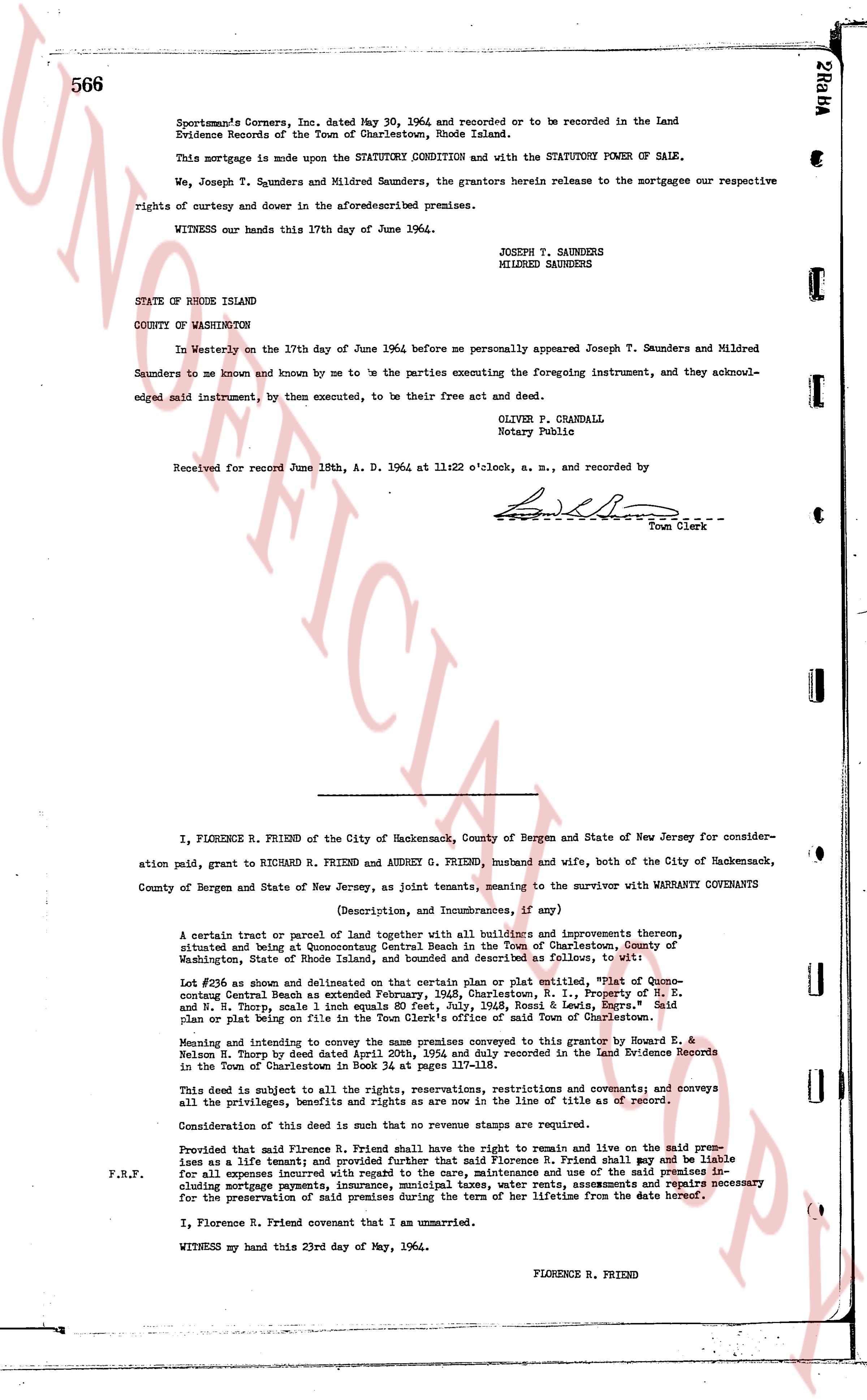
Sportsman's Corners Inc. dated May 30, 1964 and recorded or to be recorded in the Land Evidence Records of the Town of Charlestown, Rhode Island.
This mortgage is made upon the STATUTORY CONDITION and with the STATUTORY POWER OF SALE.
We, Joseph T. Saunders and Mildred Saunders, the grantors herein release to the mortgagee our respective rights of curtesy and dower in the aforementioned premises.
WITNESS our hands this 17th day of June 1964.
JOSEPH T. SAUNDERS
MILDRED SAUNDERS
STATE OF RHODE ISLAND
COUNTY OF WASHINGTON
In Westerly on the 17th day of June 1964 before me personally appeared Joseph T. Saunders and Mildred Saunders to me known and known by me to be the parties executing the foregoing instrument, and they acknowledged said instrument, by them executed, to be their free act and deed.
OLIVER P. CRANDALL
Notary Public
Received for record June 18th, A. D. 1964 at 11:22 o'clock, a. m., and recorded by
[Signature]
Town Clerk
----
I, FLORENCE R. FRIEND of the City of Hackensack, County of Bergen and State of New Jersey for consideration paid, grant to RICHARD R. FRIEND and AUDREY G. FRIEND, husband and wife, both of the City of Hackensack, County of Bergen and State of New Jersey, as joint tenants, meaning to the survivor with WARRANTY COVENANTS
(Description, and incumbrances, if any)
A certain tract or parcel of land together with all buildings and improvements thereon, situated and being at Quonocutong Central Beach in the Town of Charlestown, County of Washington, State of Rhode Island, housed and bounded as described and fullName as follows, viz:
Lot #28 as shown and delineated on that certain plan or plat entitled, "Plat of Quonocutong Central Beach as retained by owners Florence R. I. property of M. H. E. and W. N. Thory, scale 1 inch equals 80 feet, July, 1948, Ross & Lewis, Engrs." Said plan or plat being on file at the Land Evidence office of said Town of Charlestown.
Meaning and intending to convey the same premises conveyed to this grantor by Howard E. & Nelson M. Thory by deed dated April 20th, 1954 and duly recorded in the Land Evidence Records in the Town of Charlestown Book 34 Page 111.
This deed is subject to all the rights, reservations, restrictions and covenants; and conveys all the privileges, benefits and rights as are now in the line of title as of record.
Consideration for this deed is such that no revenue stamps are required.
Provided that said Florence R. Friend shall have the right to remain and live on the said premises as a life tenant; and provided further that said Florence R. Friend shall pay and be liable for all expenses including maintenance and use of the said premises including mortgage payments, insurance, municipal taxes, water rents, assessments and repairs necessary for the preservation of said premises during the term of her lifetime from the date hereof.
F.R.F.
I, Florence R. Friend covenant that I am unmarried.
WITNESS my hand this 23rd day of May, 1964.
FLORENCE R. FRIEND
The page as recorded