The instrument's own words
page 1 · read by Gemma vision
549
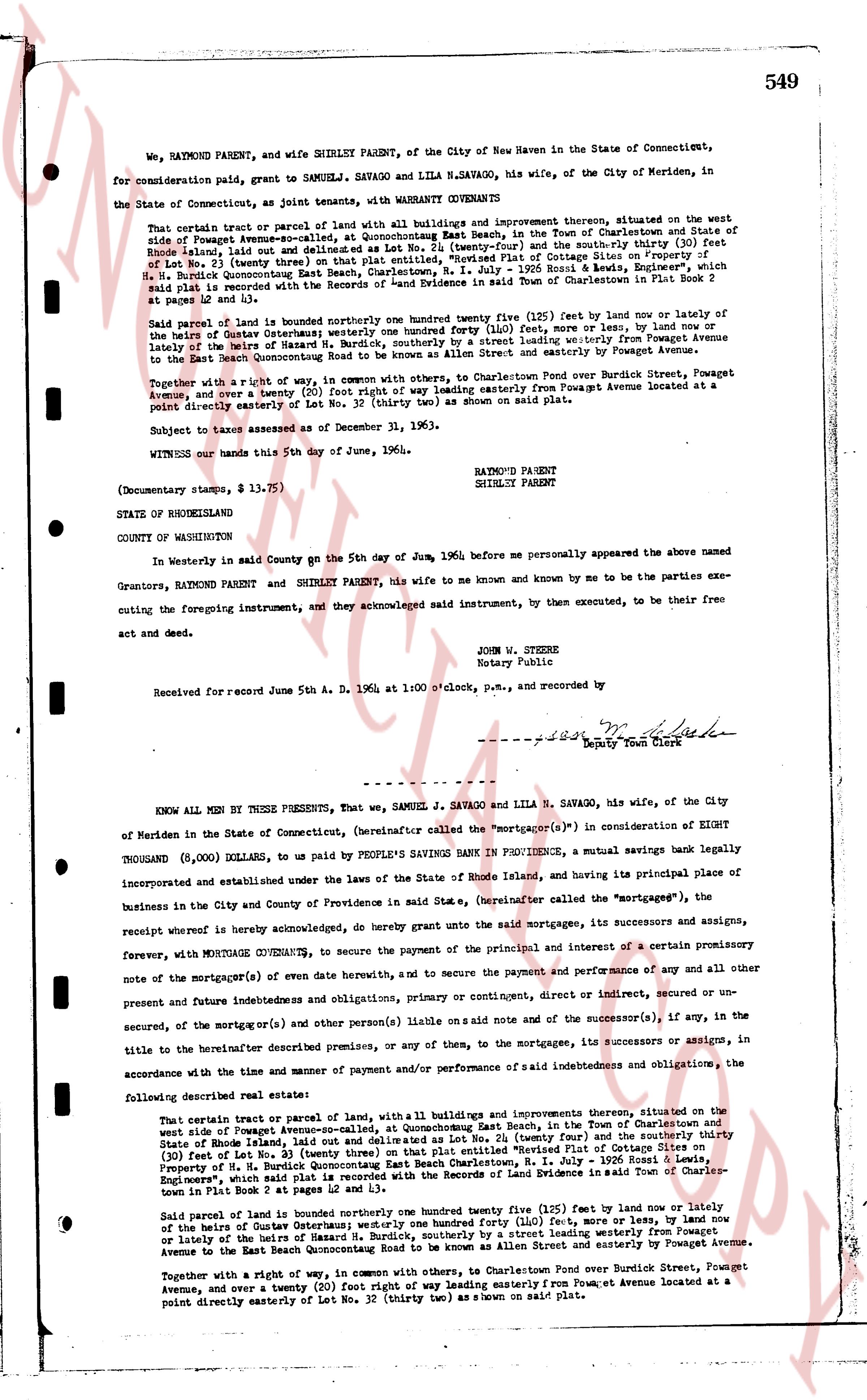
We, RAYMOND PARENT, and wife SHIRLEY PARENT, of the City of New Haven in the State of Connecticut, for consideration paid, grant to SAMUEL J. SAVAGO and LILA N. SAVAGO, his wife, of the City of Meriden, in the State of Connecticut, as joint tenants, with WARRANTY COVENANTS
That certain parcel or tract of land with all buildings and improvement thereon, situated on the west side of Powaget Avenue-ex-called, at Quonochontaug East Beach, in the Town of Charlestown and State of Rhode Island, laid out and delineated as Lot No. 24 (twenty four) and the south-by-thirty (30) feet of Lot No. 32 (thirty two) as shown on the recorded Plat of Cottage Sites on Property of H. N. Bardue Quonochontaug East Beach Charlestown, R.I. - July 1929 Essex R. Lewis, employed surveyor, which said plat is recorded in the land evidence records of the Town of Charlestown in Plat Book 2 at pages 42 and 43.
Said parcel of land is bounded northerly one hundred forty one (141) feet (bew) now or lately by the lands of Gutterman Osterman; westerly one hundred forty one (141) feet, more or less, by land now or lately of the heirs of Master H. N. Bardue, southerly by a street leading westerly from Powaget Avenue to the East Beach Quonochontaug Road to be known as Allen Street and easterly by Powaget Avenue.
Together with a right of way in common, with others, to Charlestown Pond over Burdick Street, Powaget Avenue, and over a twenty (20) foot right way leading easterly from Powaget Avenue located at a point directly easterly of Lot No. 32 (thirty two) as shown on said plat.
Subject to taxes assessed as of December 31, 1963.
WITNESS our hands this 5th day of June, 1964.
RAYMOND PARENT
SHIRLEY PARENT
STATE OF RHODEISLAND
COUNTY OF WASHINGTON
In Westerly in said County on the 5th day of June, 1964 before me personally appeared the above named Grantors, RAYMOND PARENT and SHIRLEY PARENT, his wife to me known and known by me to be the parties executing the foregoing instrument, and they acknowledged said instrument, by them executed, to be their free act and deed.
JOHN W. STEERE
Notary Public
Received for record June 5th A. D. 1964 at 1:00 o'clock, p.m., and recorded by
[signature] Deputy Town Clerk
----
KNOW ALL MEN BY THESE PRESENTS, That we, SAMUEL J. SAVAGO and LILA N. SAVAGO, his wife, of the City of Meriden in the State of Connecticut, (hereinafter called the "Mortgagor(s)") in consideration of EIGHT THOUSAND (8,000) DOLLARS, to be paid by PEOPLE'S SAVINGS BANK IN PROVIDENCE, a mutual savings bank legally incorporated and established under the laws of the State of Rhode Island, and having its principal place of business in the City and County of Providence in said State, (hereinafter called the "mortgagee"), the receipt whereof is hereby acknowledged, do hereby grant unto the said mortgagees, its successors and assigns, forever, with MORTGAGE COVENANTS, to secure the payment of the principal and interest of a certain promissory note of the mortgagor(s) or event date herewith, and to secure the payment and performance of any and all other one present and future indebtednesss and obligations, primary or contingent, direct or indirect, secured or un- secured, of the mortgagor(s) or one and other person(s) on said note and of the successors (s), if any, in the title to the hereinafter described premises, or any of them, to the mortgagees, its successors or assigns, in accordance with the time and manner of payment and/or performance of said indebtedness and obligations, the
following described real estate:
That certain tract or parcel of land, with a building and its improvements thereon, situated on the west side of Powaget Avenue-ex-called, at Quonochontaug East Beach, in the Town of Charlestown and State of Rhode Island, laid out and delineated as Lot No. 24 (twenty four) and the south-by-thirty (30) feet of Lot No. 32 (thirty two) as shown on the recorded Plat of Cottage Sites on Property of H. N. Bardue Quonochontaug East Beach Charlestown, R.I. - July 1929 Essex R. Lewis, employed surveyor, which said plat is recorded in the land evidence records of the Town of Charlestown in Plat Book 2 at pages 42 and 43.
Said parcel of land is bounded northerly one hundred twenty five (125) feet (bew) now or lately by the lands of Gutterman Osterman; westerly one hundred forty one (141) feet, more or less, by land now or lately of the heirs of Master H. N. Bardue, southerly by a street leading westerly from Powaget Avenue to the East Beach Quonochontaug Road to be known as Allen Street and easterly by Powaget Avenue.
Together with a right of way in common, with others, to Charlestown Pond over Burdick Street, Powaget Avenue, and over a twenty (20) foot right way leading easterly from Powaget Avenue located at a point directly easterly of Lot No. 32 (thirty two) as shown on said plat.
The page as recorded