The instrument's own words
page 1
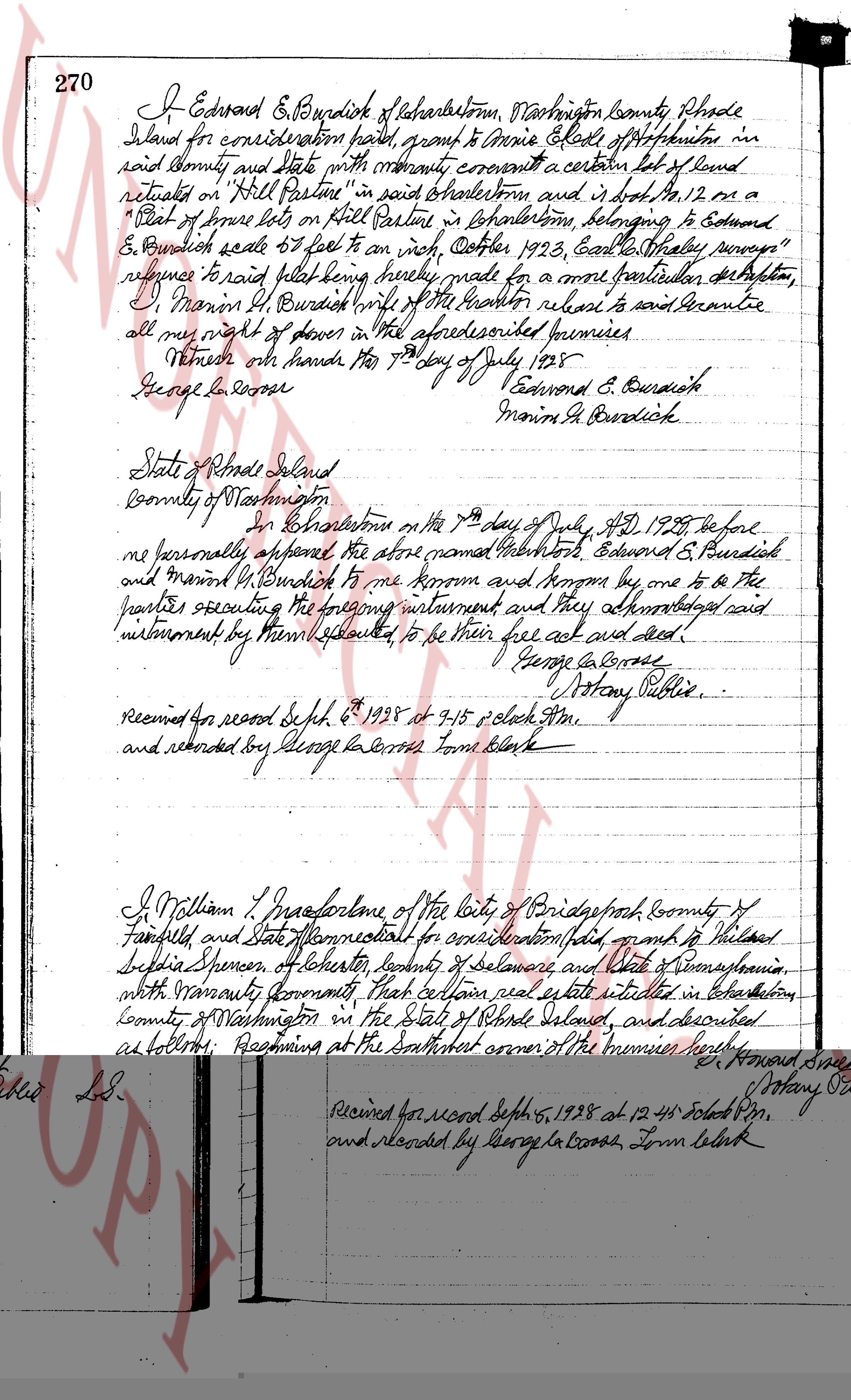
270 I Edward E. Burdick of Charlestown, Washington County Rhode
Island for consideration paid, grant to Annie Adele of Charlestown in
said County and state with warranty covenant a certain lot of land
situated on "Hill Pasture" in said Charlestown and is that Lot No. 12 or a
"Plot of three lots on Hill Pasture in Charlestown, belonging to Edward
E. Burdick scale 65 feet to an inch, October 1923, East Rhode Island survey"
reference to said plot being hereby made for a more particular description,
Marion F. Burdick wife of the grantor release to said grantee
all my right of dower in the aforesaid described premises
Witness our hands this 10th day of July 1925
George George
Edward E. Burdick
Marion F. Burdick
State of Rhode Island
County of Washington
In Charlestown on the 10th day of July A.D. 1925 before
me personally appeared the above named inhabitants Edward E. Burdick and
Marion M. Burdick to me known and being by me one to be the
parties executing the following instrument and they acknowledged said
instrument by them executed to be their free act and deed
George George
Antony Public
received for record Sept 6 1925 at 7.15 o clock P.M.
and recorded by George George Tom Blank
I William J. Franchell one of the City of Providence County of
Providence and State of Rhode Island for consideration paid, sell and to Willard
Sophia Spencer of Chester County of Delaware and State of Pennsylvania
with warranty covenant that certain real estate situated in Charlestown
County of Washington in the State of Rhode Island, and described
as follows: Beginning at the Southeast corner of the premises here by
conveyed at the junction of Connor Road and Lincoln Road; Thence
northerly said way and with Norton Road bounded westerly by the same
to the Northwest corner of Lot 10 at the junction of Norton Road and
Andrew Road; Thence easterly bounded northerly by Andrew Road
to the Southwest corner of lot L-11; Thence Southeasterly bounded easterly by
Lot L-11 to Lot L-8; Thence Southerly to Lincoln Road aforesaid bounded
Southerly by lot L-8; Thence Westerly by and with said Lincoln Road to
the point first and place of beginning. Meaning and intending to convey
page 2
Lots numbered L-9 and L-10 as shown and delineated on a certain plan or
plat entitled "Project bore, Narragansett, Rhode Island, Preliminary plan
for location of future lots and roads, Property of William T. Macfarlane,
Esquire, State and Water Works Architect"
Said plat being duly filed with the said County Records of said town of
Narragansett, the said grantor, his heirs, assigns, guests, heirs
and assigns, shall have the right to use the rights of way leading to
and from said premises over all alleys the aforesaid highways, streets
and lanes as shown and provided for in by said plan in plat
perpetuity furthermore, at the same as they are shown and delineated
or as they may be altered and changed, and any other lands which the
grantors have designated as reserved for community use or as mall
to any other area hereafter designated as "Set apart for Community Use".
This deed is given upon the express condition that the above granted
premises are to be used by the grantee, his heirs and assigns for
residential purposes. No vicious or ferocious animals shall be kept or
be permitted to keep on or about the premises or in the buildings
thereon. In a breach of a modification of this condition, the grantor, his
heirs or assigns may enter and retrieve premises themselves of the estate
thereby granted and all other rights and all other interests hereby conveyed
shall be forfeited and cease and terminate.
Witness our hands this 19th day July, 1928.
[Signature] W. T. Macfarlane L.S.
[Signature] Alice M. Macfarlane L.S.
State of Connecticut
County of Fairfield
On Bridgeport on the 19th day of July, 1928 before me personally
appeared William T. Macfarlane and Alice M. Macfarlane husband and
wife to me known and known by me to be the parties executing the
foregoing instrument and they acknowledged said instrument by
their hands to be their free act and deed.
[Signature] S. Howard Sinet
Notary Public L.S.
Received for record Sept 5, 1928 at 12.45 o'clock P.M.
and recorded by George W. Brooks, Town Clerk
The page as recorded