The instrument's own words
page 1 · read by Gemma vision
168
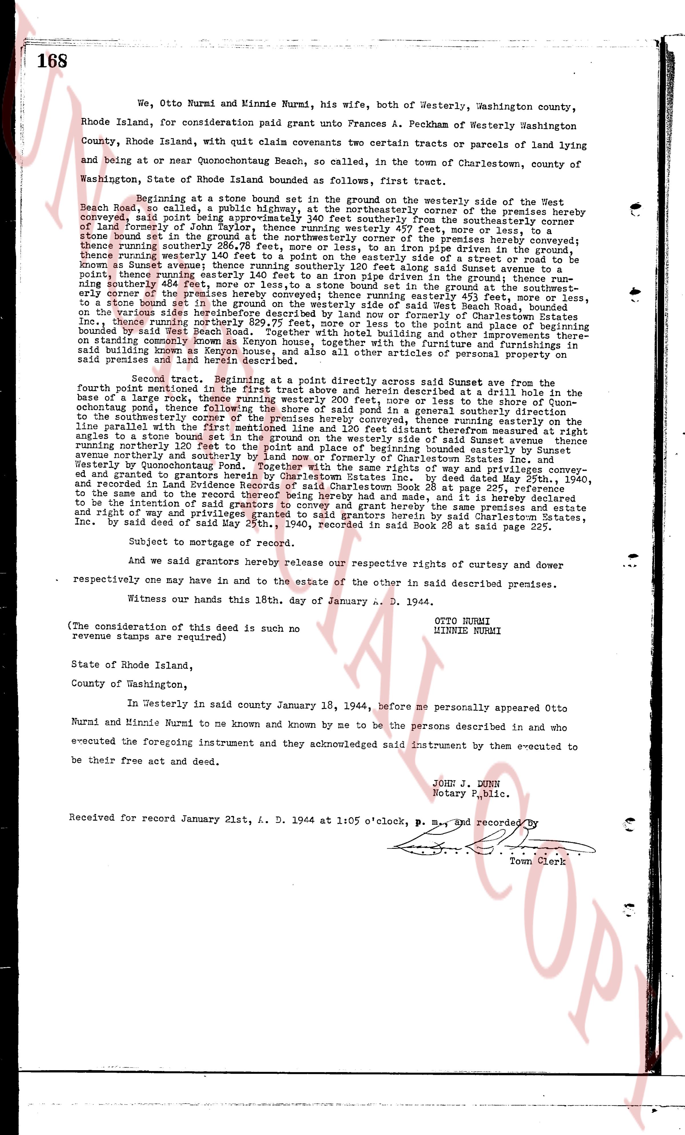
We, Otto Nurmi and Minnie Nurmi, his wife, both of Westerly, Washington county,
Rhode Island, for consideration paid grant unto Frances A. Peckham of Westerly Washington
County, Rhode Island, with quit claim covenants two certain tracts or parcels of land lying
and being at or near Quonochontaug Beach, so called, in the town of Charlestown, county of
Washington, State of Rhode Island bounded as follows, first tract.
Beginning at a stone bound set in the ground on the westerly side of the West
Beach Road, so called, a public highway, at the northeasterly corner of the premises hereby
conveyed, said point being a distance of 140 feet southerly from the southeasterly corner
of land of Farmer John Taylor, 140 feet southerly from the southeasterly corner
thence runs southerly in the ground at the northeasterly corner of the premises hereby conveyed
thence runs southerly 140 feet to an iron pipe driven in the ground; thence run-
ning easterly 140 feet to an iron pipe driven in the ground; said Sunset avenue running
thence running westerly 140 feet to a point on the easterly side of a street or road to be
known as Sunset avenue running north and south, said point being a distance of 140
point, thence running easterly 140 feet to an iron pipe driven in the ground; thence run-
ning northerly 140 feet to a point on the easterly side of the street or road known as Sunset
easterly corner of the premises hereby conveyed; thence running easterly 453 feet, more or less,
to a stone bound set in the ground on the easterly side of the road known as Sunset avenue
on the various sides heretofore described by land now or formerly of Charlestown States Inc.
thence running southerly 140 feet to a point on the easterly side of the road known as Sunset
bounded by said West Beach Road, together with hotel building and other improvements
standing thereon, together with all the rights, privileges, appurtenances and easements
said building known as Kenyon house, and also all other things of personal property now on
said premises run land hereby conveyed.
Second tract: Beginning at a point directly across said Sunset avenue from the
fourth point mentioned in the first tract above and herein described at a drill hole in the
sand, thence running westerly 140 feet, more or less, to the shore of Quon-
ochontaug pond, thence following the shore of said pond in a general southerly direction
to the southeasterly corner of the premises hereby conveyed, thence running easterly on the
line of the land of the Charlestown States Inc. 140 feet, thence running north eighty eight
angles to a stone bound set in the ground on the westerly side of said Sunset avenue thence
running northerly 140 feet to a point on the westerly side of Sunset avenue thence running
avenue northerly and southerly by land now or formerly of Charlestown States Inc. and
Westerly, Rhode Island, the same being a part of the way and right of way heretofore con-
ed and granted to grantors herein by Charlestown States Inc. by deed dated May 25th, 1940,
and recorded in the land evidence book 28 at page 227, the said way and right of way
to the same and to the record thereof being here by made and had, and it is hereby declared
be the same premises and estate
and right of way and privileges granted to said grantee by said Charlestown States,
Inc. by said deed of said May 25th, 1940, recorded in said Book 28 at said page 227.
Subject to mortgage of record.
And we said grantors hereby release our respective rights of curtesy and dower
respectively one may have in and to the estate of the other in said described premises.
Witness our hands this 18th, day of January A. D. 1944.
OTTO NURMI
MINNIE NURMI
(The consideration of this deed is such no
revenue stamps are required)
State of Rhode Island,
County of Washington,
In Westerly in said county January 18, 1944, before me personally appeared Otto
Nurmi and Minnie Nurmi to me known and known by me to be the persons described in and who
executed the foregoing instrument and they acknowledged said instrument by them to be executed
be their free act and deed.
JOHN J. DUNN
Notary Public.
Received for record January 21st, A. D. 1944 at 1:05 o'clock, P. M., and recorded by
[Seal]
Town Clerk
The page as recorded