The instrument's own words
page 1
168 and Florence A. Atke to one known and known by one to be the
parties executing this foregoing instrument and they acknowledged
said instrument by them executed, to be their free act and deed.
George G. Coons
Notary Public
Received for record March 15th 1928 at 9:45 o'clock this
and recorded by George G. Coons Town Clerk
(For Clearance of mortgage Mortgage Book 43 Page 210)
Megetie T. Bandick, widow, of Stamford, County of Fairfield, State of
Connecticut for consideration paid, grant to Golda D. Prudery of Bristol,
County of Hartford and State of Connecticut with quitclaim and warrants,
a certain tract of land situated at Summerpoint Beach in the town of
Charlestown, County of Washington and State of Rhode Island, bounded
and described as follows, to wit: Beginning at the southeasterly corner
of the premises hereby conveyed, said front being at the contractary
border of land of Samuel Long something north thence Both by west with the
Easterly line of said Long something north to a stone wall thence Easterly
by and with said stone wall thirty four (34) feet to the front of land of the
frontier Thence southerly bounded Easterly by other land of this grantor
to the shore of the Atlantic Ocean, thence westerly by and with the shore of
said Atlantic Ocean thirty (30) feet to the front and place of beginning,
Also the one sixteenth (1/16) undivided interest in the street running through
said tract from land once or formerly of Samuel H. Babcock and west to
the Ocean, said street being twenty the (20) feet wide and bounded on
the East by land of Phebe G. Branch and wife, and on the West by land of
Emma H. Bennett, and paid some D. Prudery for her dues and obligations shall
contribute for the one sixteenth (1/16) part of the expenses of preserving paid
street and the gate or gates erected therein in particular, Said grantor shall
permit Thomas H. Barker his heirs and assigns to pass and repass
peaceably at all times along the street laid out on said plat for the
common use of all the purchasers of lots upon said tract. The above
described premises being a portion of the premises conveyed to this grantor
from Anna H. Kenway by a deed dated June 11th 1879 Reference to said deed
and the record thereof being had and made, these premises are subject
to conditions and reservations as therein contained
Witness our hand this 2nd day of March 1928
Megetie L. Bandick L.S.
Helen Brinton
Sarah Rummes
State of Connecticut
County of Fairfield On Stamford on the 2nd day
page 2
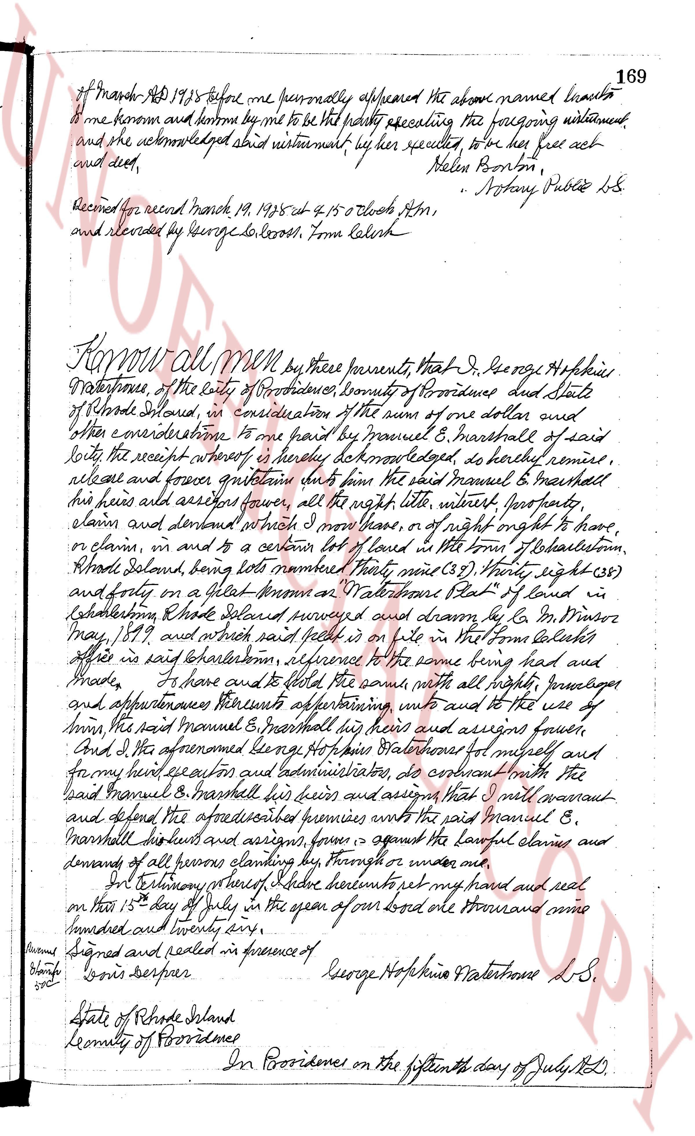
169
of March AD 1825 before me personally appeared the above named Sarah
Borton and known and known by me to be the party executing the foregoing instrument
and she acknowledged said instrument by her sealing to be her free act
and deed, Helen Borton,
" Notary Public L.S.
Recorded for record March 19, 1825 at 4 15 o'clock PM,
and delivered by George L. Corliss, from Kelch
Know all men by these presents, That I, George Hopkins
Waterstone, of the city of Providence, county of Providence and State
of Rhode Island, in consideration of the sum of one dollar and
other considerations to me paid by Manuel E. Marshall of said
city, the receipt whereof is hereby acknowledged, do hereby remise,
release and forever quit claim unto him the said Manuel E. Marshall
his heirs and assigns forever, all the right title interest profits,
claim and demand which I may have, or of right ought to have,
or claim in, or any part of a certain lot of land located in the town of Johnston,
Rhode Island, being lots numbered Three nine (39), Twenty eight (28)
and forty on a sheet marked "A" Platbook of Land in
Johnston, Rhode Island, surveyed and drawn by G. W. Winsor
May, 1817, and which said plat is on file in the Town Clerk's
office in said Johnston, reference to the same being had and
made, I have and do hereby grant and release the same with all rights privileges
and appurtenances thereunto appertaining unto and to the use of
him, the said Manuel E. Marshall his heirs and assigns forever,
And I the aforesaid George Hopkins Waterstone for myself and
for my heirs executors and administrators do covenant with the
said Manuel E. Marshall his heirs and assigns that I will warrant
and defend the aforesaid premises unto the said Manuel E.
Marshall his heirs and assigns from against all lawful claims and
demands of all persons claiming the same through or under me.
In Testimony hereof, I have hereunto set my hand and seal
on this 15th day of July in the year of our lord one thousand nine
hundred and twenty seven,
Signed and sealed in presence of
George Hopkins Waterstone L.S.
Louis Berriper
State of Rhode Island
County of Providence
In Providence on the fifteenth day of July 1827
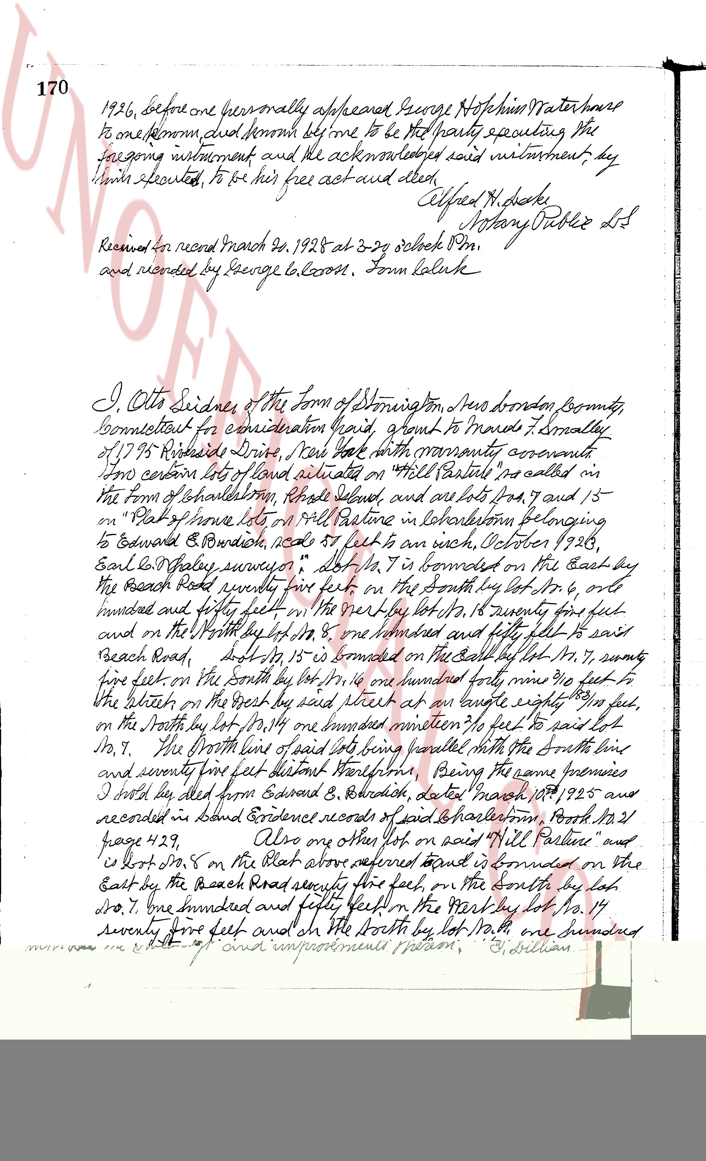
The page as recorded