The instrument's own words
page 1
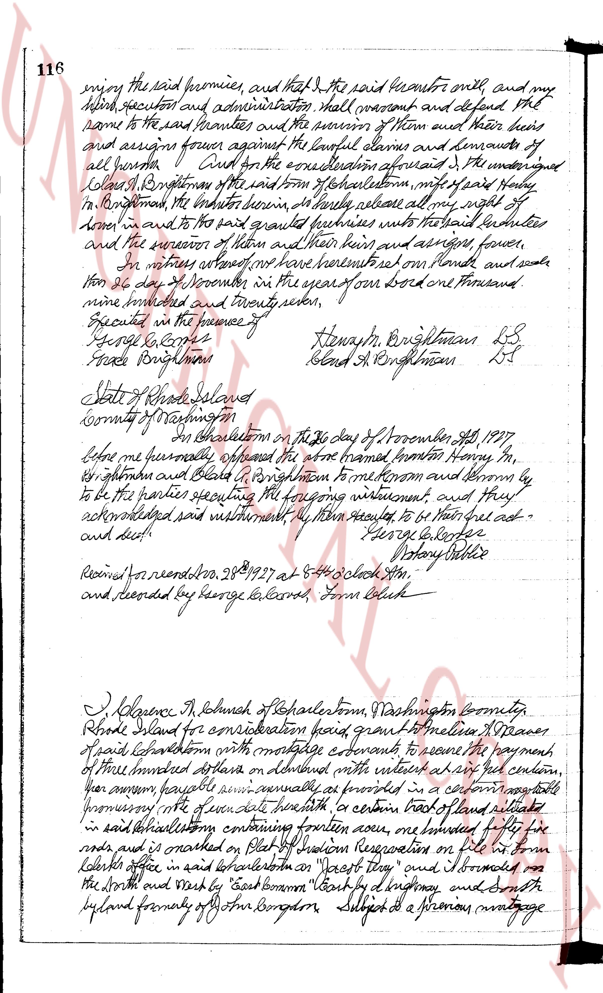
116 enjoy the said premises, and that I the said grantor only, and my
heirs, executors and administration shall warrant and defend the
same to the said grantees and the successor of them and their heirs
and assigns forever against all lawful claims and demands of
all persons. Quit claim for the consideration aforesaid, I the undersigned
Lewis B Brightman of Charlestown, mfs of said town
in Brightman, the grantor herein, do hereby release all my right of
tenure in and to the said granted premises unto the said grantees
and the successor of them and their heirs and assigns, forever.
In witness whereof we have hereunto set our hands and seals
this 26 day of November in the year of our Lord one thousand
nine hundred and twenty seven.
Executed in the presence of
George L Carter Hlewash B Brightman LS
Freda Brightman Blend A Brightman LS
State of Rhode Island
County of Washington
In Charlestown on the 26 day of November A.D. 1927
before me george l carter appeared the above named Henry M,
B Brightman and Blend A Brightman to me known and known by
to be the parties executing the foregoing instrument, and they
acknowledged said instrument to be their free act and
deed. George L Carter
Notary Public
Received for record Nov 28th 1927 at 4.45 o clock AM,
and deposited by George L Carter, Form Collect
I, Lawrence H Schuhnk of Charlestown, Washington County,
Rhode Island for consideration paid, grant to melissa H Weaver
of said Charlestown with mortgage covenants to secure the payment
of three hundred dollars on demand with interest at six per centum,
per annum payable semi annually as provided in a certain negotiable
mortgage note of date herewith "a certain tract of land situated
in said Charlestown containing fourteen acres, one hundred and fifty
rods and is marked on Plot of Tuckton Reservation on file in town
clerk's office in said Charlestown on "Forest Twp" and bounded on
the North and West by "East Common" Court by d highway and South
by land formerly of John Longdon Subject to a previous mortgage
page 2
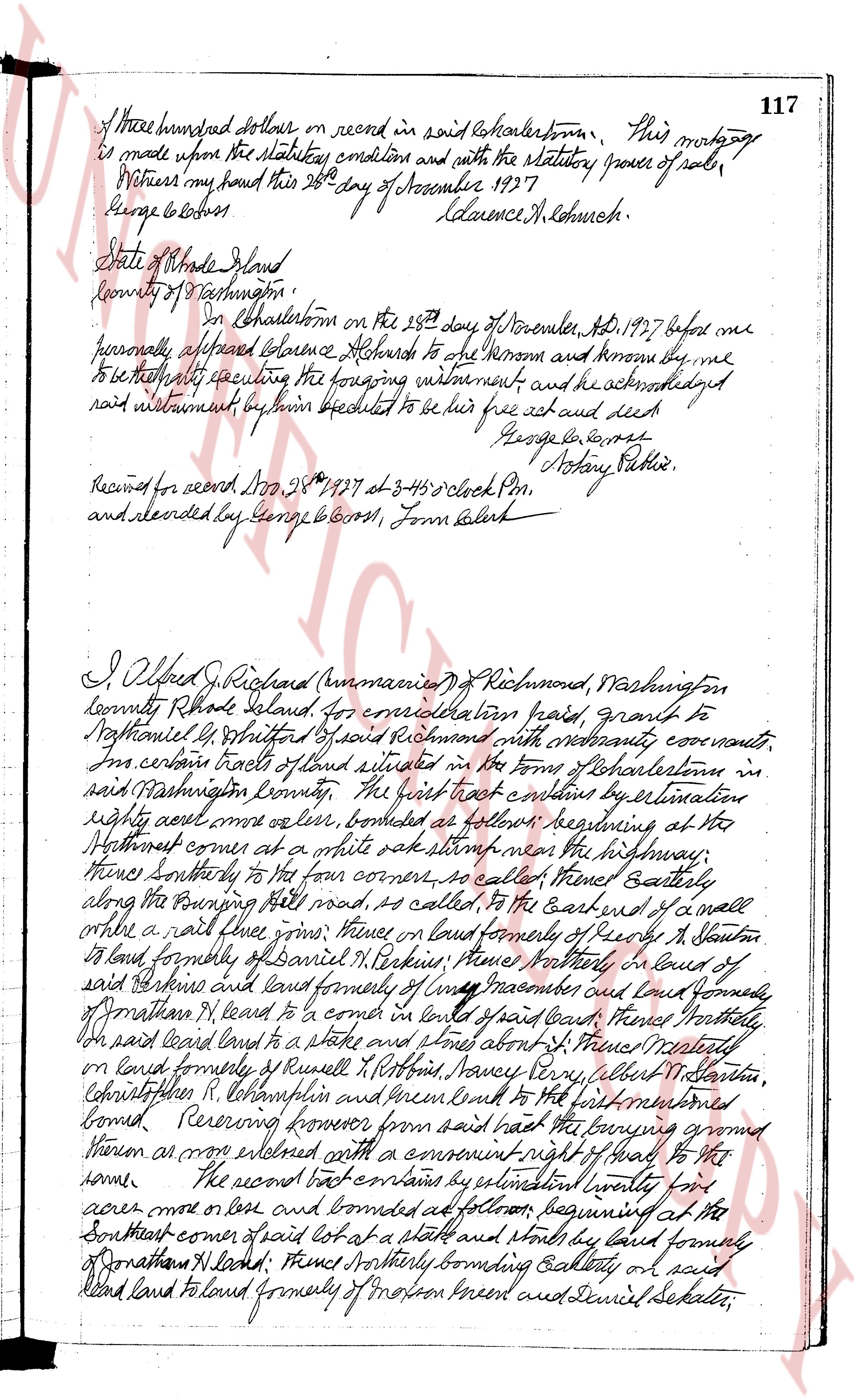
117
of three hundred dollars on record in said Charlestown, This mortgage
is made upon the statutory condition and with the statutory power of sale,
Witness my hand this 28th day of November 1927
George E Cross Clarence H Hutchins.
State of Rhode Island
County of Washington,
On Charlestown on the 28th day of November, A.D. 1927 before me
personally appeared Clarence Hutchins to me known and known by me
to be the party executing the foregoing instrument and he acknowledged
said instrument by him executed to be his free act and deed
George E Cross Notary Public.
Received for record Dec 28th 1927 at 3:45 o'clock P.M.
and recorded by George E Cross, Town Clerk
I Alfred J Richard (unintelligible) of Richmond, Washington
County Rhode Island, for consideration paid, grant to
Nathaniel G Whitford of said Richmond with moderately covenants,
In certain tracts of land situated in the Town of Charlestown in
said Washington County. The first tract contains by estimation
eighty seven acres more or less, bounded as follows: beginning at the
Southeast corner of at a white oak stump near the highway,
thence Southerly to the far corner of cakes, thence Easterly
along the farming hill road, so called, to the East end of a wall
or a rail fence grove, thence North land formerly of Ruby H Stanton
to land formerly of Daniel W Perkins, thence Northerly in lines of
said Perkins and land formerly of Lucy Mascone and land formerly
of Jonathan H Leand, to a corner of land of said land, thence Northerly
on the said land land to a stake and stones about 1 ft. thence Westerly
on land formerly of Russell H Robbins, Nows Navy firm, Albert M Stanton,
Christopher H R Lohampston and then land to the first mentioned
corner. Reserving from said land the farming ground
known as mow extended with a convenient right of way to this
home. The second tract contains by estimation twenty four
acres more or less and bounded as follows: beginning at the
Southeast corner of said lot at a stake and stones by land forming
of Jonathan H Leand, thence Northerly bounding Gallery on said
land land land to land formerly of Morton forest and Daniel Sekatru
The page as recorded