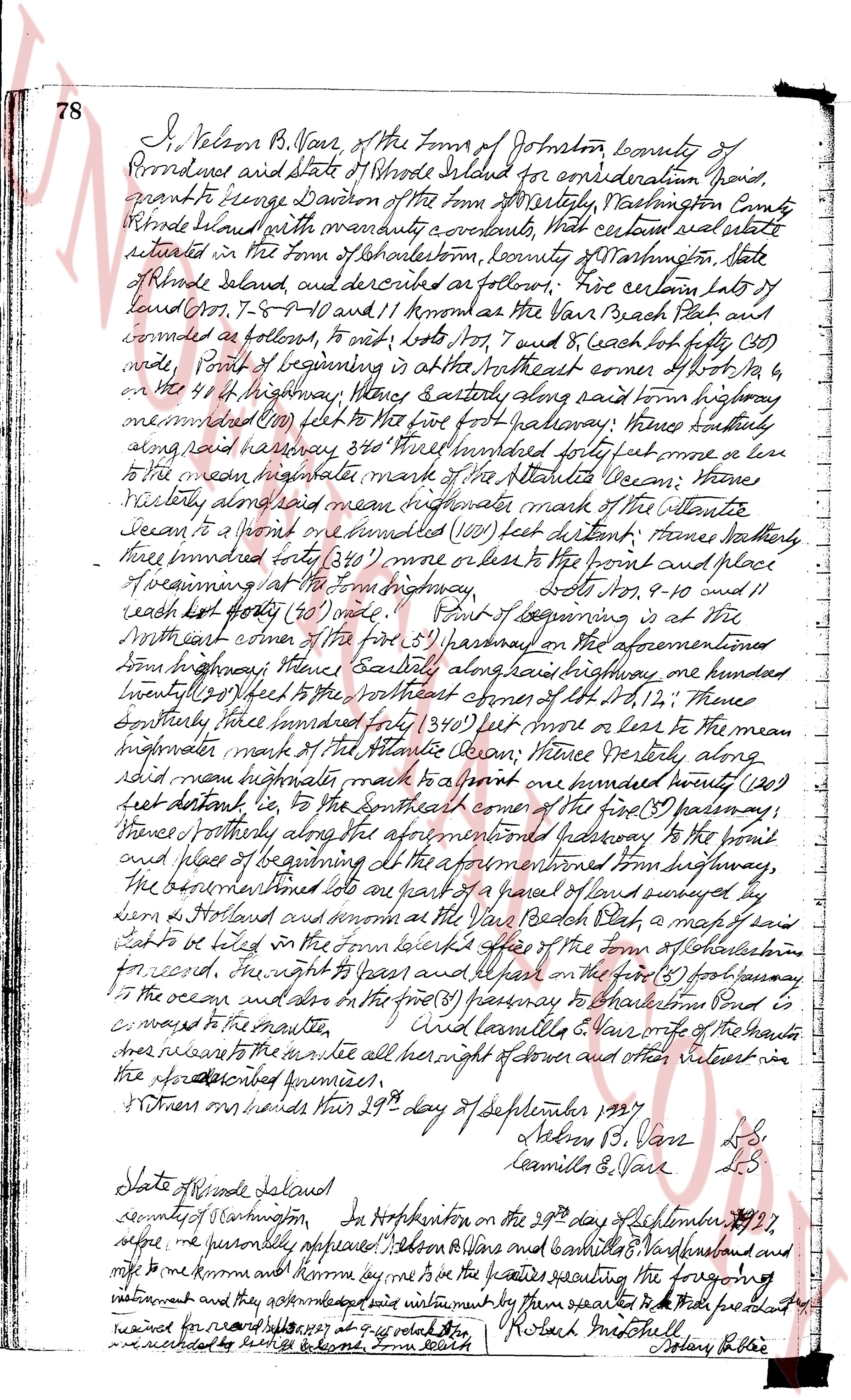
The instrument's own words
page 1
78 I, Nelson B. Vans, of the Town of Johnston, county of
Providence and State of Rhode Island for consideration paid,
grant to George Davison of the Town of Westerly, Washington County
Rhode Island with warranty covenants, that certain real estate
situated in the Town of Charlestown, county of Washington, state
of Rhode Island and described as follows: Viz certain Lots of
land known 7, 8, 9, 10 and 11 known as the Van Beach Plot and
bounded as follows, to wit, lots 7, 8 and 9 each lot fifty (50)
wide, Point of beginning is at the Northeast corner of Lot 7, on
the 44 ft Highway, thence Easterly along said town highway
memorized 680 feet to the five foot halfway; thence southerly
along said highway 346 feet hundred forty four feet or less
to the mean highwater mark of the Atlantic Ocean; thence
vertically along said mean highwater mark of the Atlantic
Ocean to a point one hundred (100) feet distant; thence
westward east forty thirty (340) more or less to the point and place
of beginning at said town highway, Lots 10, 9, 10 and 11
each lot fifty (50) wide, Point of beginning is at the
Northwest corner of the first (1st) passageway on the aforementioned
town highway, thence Easterly along said highway one hundred
twenty (120) feet to the northeast corner of the 1st passageway,
thence southerly hundred forty (340) feet more or less to the mean
highwater mark of the Atlantic Ocean; thence vertically along
said mean highwater mark to a point one hundred twenty (120)
feet distant, ie to the southeast corner of the first (1st) passageway,
thence northerly along the aforementioned passageway to the point
and place of beginning at the aforementioned town highway,
the before mentioned lots are part of a piece of land surveyed by
someone as Hollands and known as the Van Beach Plot, a map of said
lot is to be filed in the town clerks office of the town of Charlestown
for record, the right to years and all the first (1st) passageway
to the ocean and also on the first (1st) passageway to Charlestown Pond is
a way to the mountain
and easements to Nelson B. Vans owner of the haunts
trees adjacent to the mountain all her right of owner and other titles vest in
the aforementioned premises.
Witness our hands this 29th day of September 1897
Nelson B. Vans LS
Camilla E. Vans LS
State of Rhode Island
county of Washington In Hopkinton on the 29th day of September 1897,
before me personally appeared Nelson B. Vans and Camilla E. Vans and and
said to me known and known me by the persons executing the foregoing
instrument and they acknowledged said instrument by them executed to be their free act and deed
recorded for record 1897 at a quo total 100 Robert M. Stoddell Notary Public
In witness whereof I have hereunto set my hand
The page as recorded