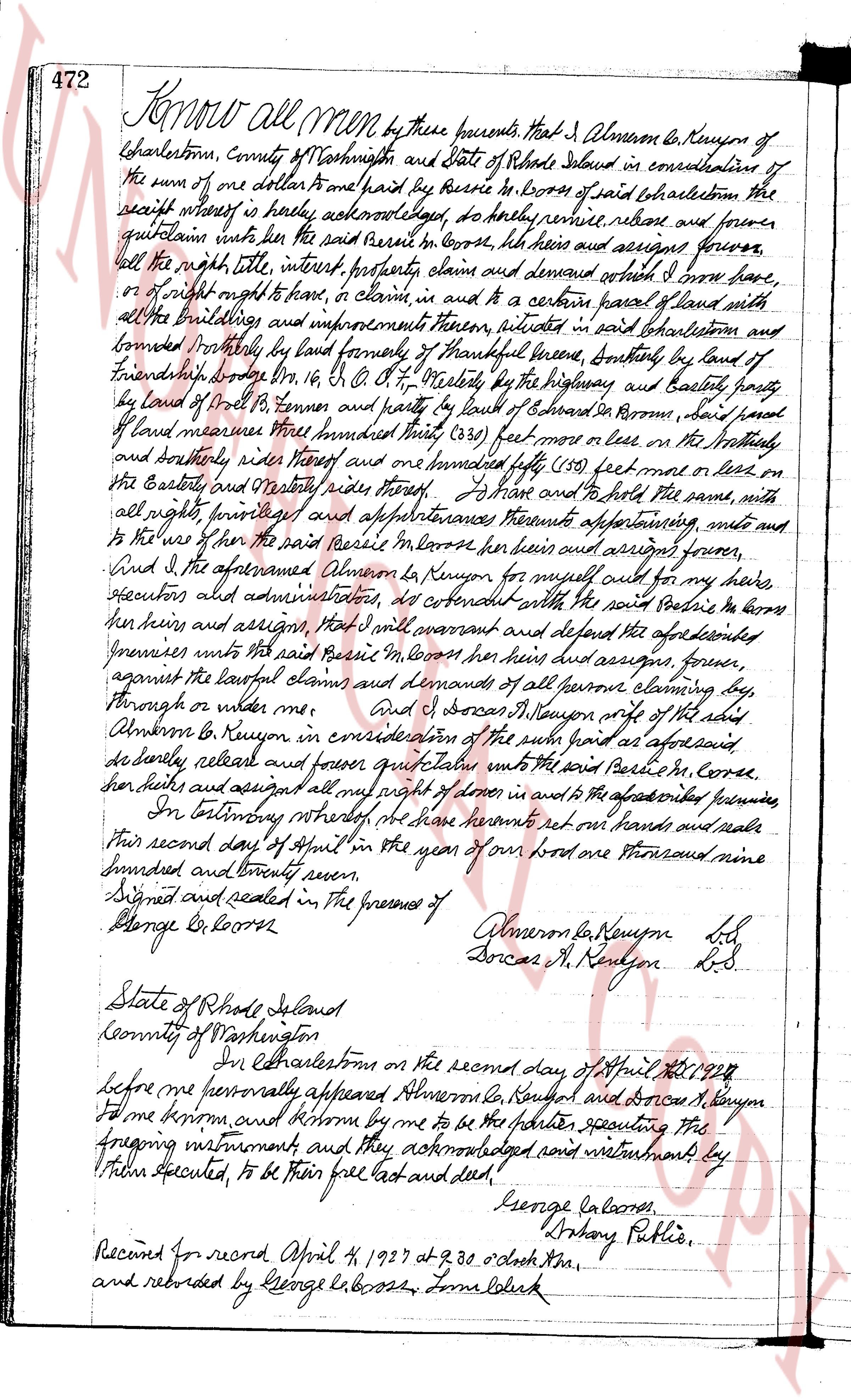
The instrument's own words
page 1
472 Know all men by these presents that I Alverson E. Kenyon of
Charlestown, County of Washington and State of Rhode Island in consideration of
the sum of one dollar and paid by Boris R Booss of said Charlestown the
receipt whereof is hereby acknowledged, do hereby remise, release and forever
quitclaim unto the said Boris R Booss, his heirs and assigns forever,
all the right, title, interest, property, claim and demand which I have,
or of right ought to have, to claim, in and to a certain parcel of land with
all the buildings and improvements thereon, situate in said Charlestown and
bounded Northly by land formerly of Thankful Greene, Southly by land of
Friendship [?] [?] no 16, C. O. P. [?], westerly by the highway and baselly part
by land of David B. Barnes and partly by land of Edward R Brown, said parcel
of land measures Three hundred thirty (330) feet more or less on the Northly
and Southerly sides thereof and one hundred forty fifty (150) feet more or less on
the Easterly and Westerly sides thereof. To have and to hold the same, with
all rights, privilege and appurtenances thereunto appertaining unto me and
to the use of the said Boris R Booss, his heirs and assigns forever,
And I the aforesaid Alverson E. Kenyon for myself and for my heirs
executors and administrators, do covenant with the said Boris R Booss
his heirs and assigns, that I will warrant and defend the aforementioned
premises unto the said Boris R Booss his heirs and assigns, forever,
against the lawful claims and demands of all persons claiming by,
through or under me.
And I Doris R Kenyon wife of the said
Alverson E. Kenyon in consideration of the sum paid as aforesaid
do hereby remise, release and forever quitclaim unto the said Boris R Booss,
his heirs and assigns all my right of dower in and to the aforementioned premises
In witness whereof we have hereunto set our hands and seals
this second day of April in the year of our Lord one thousand nine
hundred and twenty seven.
Signed and sealed in the presence of Alverson E Kenyon L.S.
George R Booss Doris R Kenyon L.S.
State of Rhode Island
County of Washington
In Charlestown on the second day of April A.D. 1927
before me personally appeared Alverson E Kenyon and Doris R Kenyon
who known by me to be the parties executing the
foregoing instrument and they acknowledged said instrument by
their signatures executed, to be their free act and deed.
George R Booss
Anthony Public Notary
Record for record April 4 1927 at 9.30 o'clock A.M.
and recorded by George R Booss Town Clerk
The page as recorded