The instrument's own words
page 1 · read by Gemma vision
166
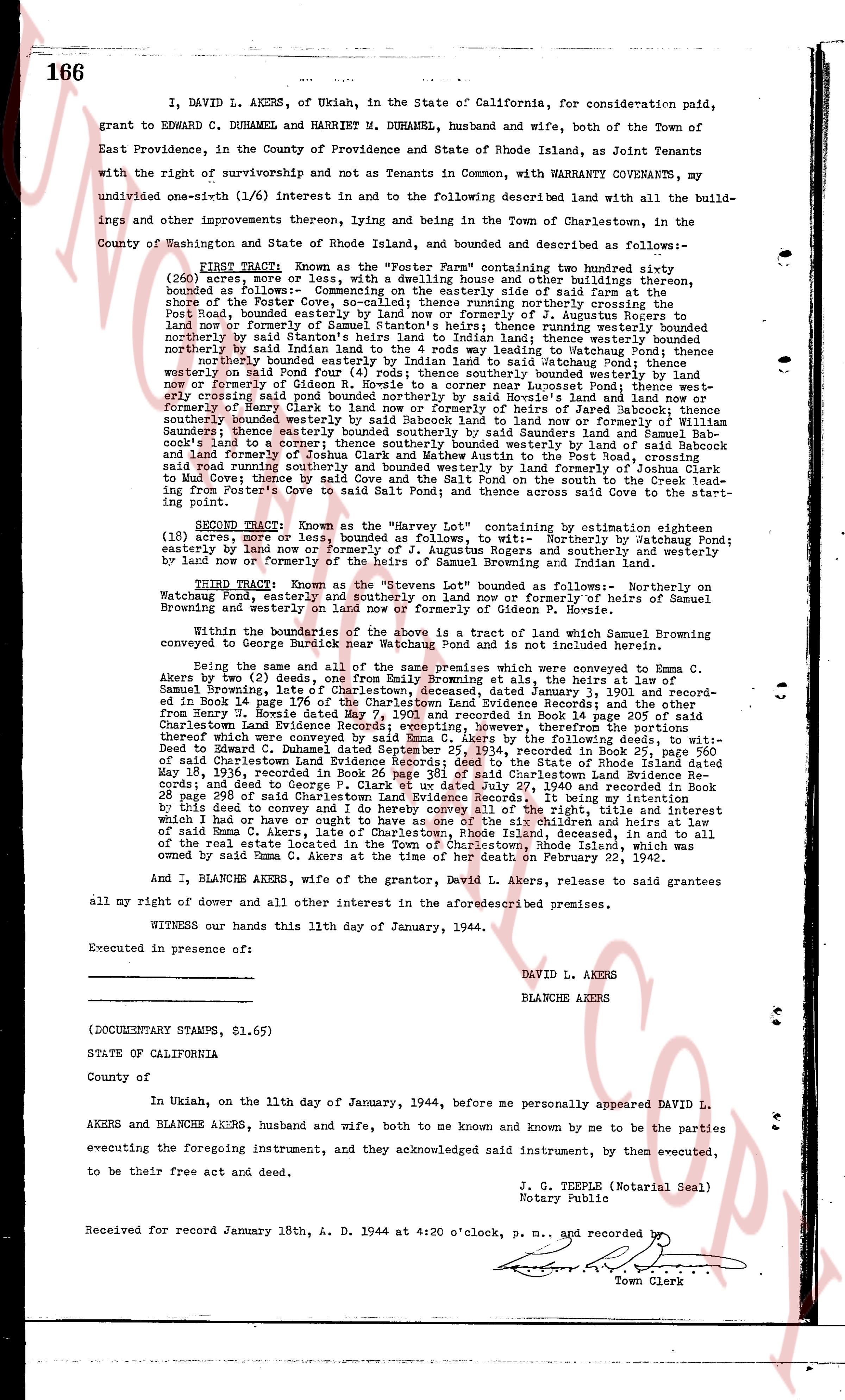
I, DAVID L. AKERS, of Ukiah, in the State of California, for consideration paid, grant to EDWARD C. DUHAMEL and HARRIET M. DUHAMEL, husband and wife, both of the Town of East Providence, in the county of Providence and State of Rhode Island, as Joint Tenants with the right of survivorship and not as Tenants in Common, with WARRANTY COVENANTS, my undivided one-sixth (1/6) interest in and to the following described land with all the buildings and other improvements thereon, lying and being in the Town of Charlestown, in the County of Washington and State of Rhode Island, bounded and described as follows:
FIRST TRACT: Known as the "Porter Farm" containing two hundred eighty, (280) acres, more or less, with a dwelling house and other buildings thereon, bounded as follows: cornering on the south side of the road at the shore of the Porter Cove, so-called; thence running northerly crossing Porter's Cove and running northerly to the shore of the pond now or formerly of Augustus Rogers to land now or formerly of Samuel Stanton; thence running easterly bounded northerly by said Stanton's heirs to land adjoining land; thence westerly bounded northerly by said Stanton's heirs to land adjoining land; thence easterly bounded northerly on said Porter's Cove to land adjoining land; thence southerly bounded northerly bounded easterly on said Porter's Cove to land adjoining land; thence southerly bounded easterly on said Porter's Cove to land adjoining land; thence southerly bounded easterly on said Porter's Cove to a corner nearer Lonsdale Point; thence westerly crossing said Porter's Cove to land adjoining land; thence southerly bounded easterly by Henry Clark to land now or formerly of heirs of Jared Babcock; thence southerly bounded easterly by said Babcock's heirs to land now or formerly of heirs of Samuel Saunders; thence easterly bounded southerly by said Saunders land and Samuel Babcock's land to a corner on the road; thence northerly bounded easterly by land now or formerly of Joshua Clark and Mathew Austin to the Post Road, crossing said Road and running easterly bounded southerly by land now or formerly of Joshua Clark to Mud Cove; thence by said Cove and the Salt Pond from the south line to the north line running from Porter's Cove to said Salt Pond; and thence across said Cove to the starting point.
SECOND TRACT: Known as the "Harvey Lot" containing by estimation eighteen (18) acres, more or less, bounded as follows, to wit: Northerly by Watchung Pond; easterly by land now or formerly of the heirs of Saunders and southerly and westerly by land now or formerly of the heirs of Samuel Browning and Indian Lake.
THIRD TRACT: Known as the "Stevens Lot" bounded as follows: Northerly on Watchung Pond; easterly by land now or formerly of heirs of Samuel Browning and westerly on land now or formerly of Gideon P. Bovise.
Within the boundaries of the above is a tract of land which Samuel Browning conveyed to George Bostic in 1831, and which is not included herein.
Being the same and all of the same premises which were conveyed to Emma C. Akers by my (2) deeds, one from Emily Browning, ali Emma heirs, by the law at Salem C. Browning, dated January 3, 1901 and recorded Book 14 page 176 of the Charlestown Land Evidence Book; and another from Henry J. Esposito dated May 7, 1901 and recorded in Book 14 page 205 of said Charlestown Land Evidence Book; and thereafter the remainder of the interest thereof which were conveyed to said Emma C. Akers by the following deeds, to wit: deed to Mabel C. Clark dated June 1, 1911 and recorded in Book 17 page 110 of said Charlestown Land Evidence Book; deed to the State of Rhode Island dated May 19, 1924, recorded in Book 21 page 110 of the Charlestown Land Evidence Book; and deed to George P. Clark et ux dated July 27, 1940 and recorded in Book 24 page 288 of said Charlestown Land Evidence Book. I be now owner of the interest of said Emma C. Akers, late of Charlestown, Rhode Island, deceased, and in to all of the real estate lots of said Emma C. Akers in the Town of Charlestown, Rhode Island, which was owned by said Emma C. Akers at the time of her death on February 27, 1943.
And I, BLANCHE AKERS, wife of the grantor, David L. Akers, release to said grantees all my right of dower and all other interest in the aforesaid described premises.
WITNESS our hands this 11th day of January, 1944.
Executed in presence of:
DAVID L. AKERS
BLANCHE AKERS
(DOCUMENTARY STAMPS, $1.65)
STATE OF CALIFORNIA
County of
In Ukiah, on the 11th day of January, 1944, before me personally appeared DAVID L. AKERS and BLANCHE AKERS, husband and wife, both to me known and known by me to be the parties executing the foregoing instrument, and they acknowledged said instrument, by them executed, to be the free act and deed their own.
J. S. TERPLE (Notarial Seal)
Notary public
Received for record January 18th, A. D. 1944 at 4:20 o'clock, p. m., and recorded by [?]
Town Clerk
The page as recorded