The instrument's own words
page 1
388 Know all Men by these presents That I & Alfred Bourdick
(indemn) of the Town of Charlestown, in Washington County and State of
Rhode Island hereinafter called the Grantor, in consideration of ten dollars
and other considerations to me paid by Joseph Lawton of Alton Washington
County and State of Rhode Island hereinafter called the Grantee, the
receipt whereof is hereby acknowledged, do hereby give, grant bargain
sell and convey always with the said Grantee and his heirs and assigns
forever, a certain Watch or piece of land lying and being in said Town
of Charlestown, Washington County and State of Rhode Island and is known
as lot number eighteen eight only (18) on plan of Braddock's Beach lots
owned by J Alfred Bourdick Charlestown, R.I. surveyed by Hon Holcomb E.E.
said plan filed in the Town Clerk's office in Charlestown, R.I. said
lot is bounded and described as follows: Beginning at the Southeast
corner of the premises hereby conveyed at bound at the corner of
Splash Avenue and Ocean Beach Street thence running in a northeasterly
direction along said Ocean Beach Street a distance of fifty (50) feet to a
bound on said lot of mine thereafter running in a northerly direction
along this boundary line a distance of one hundred (100) feet to a bound
at South Street thence running in an easterly direction along said
South Street a distance of fifty (50) feet to a bound on the north side of
Dune Avenue thence running in a southerly direction along said
Dune Avenue a distance of one hundred (100) feet to the front south and place of
beginning. I have and I hold the above designated premises
with all the rights privileges appurtenances and advantages thereunto belonging
unto and to the use of the said Grantee and his heirs and assigns
forever, and I the said Grantor do hereby assert for myself and for
my heirs executors and administrators covenanted with the said Grantee
with his heirs and assigns that I and lawfully seised in fee simple
of the said grantor premises that the same be free from all incumbrances
whatever that I have good right full power and lawful authority to
sell and convey the same in manner as aforesaid that the said Grantee
and his heirs and assigns shall by these presents at all times hereafter
peaceably and quietly have and enjoy the said premises and that I
the said Grantor will and my heirs executors and administrators shall
warrant and defend the same to the said Grantee and his heirs and
assigns against the lawful claims and demands of all human beings
of what naturesoever I have hereunto set my hand and seal this
22nd day of October in the year of our lord one thousand nine hundred
and twenty six.
Executed in the presence of
William A. Storey
Albert H. Martin
J Alfred Bourdick b.s.
page 2
389
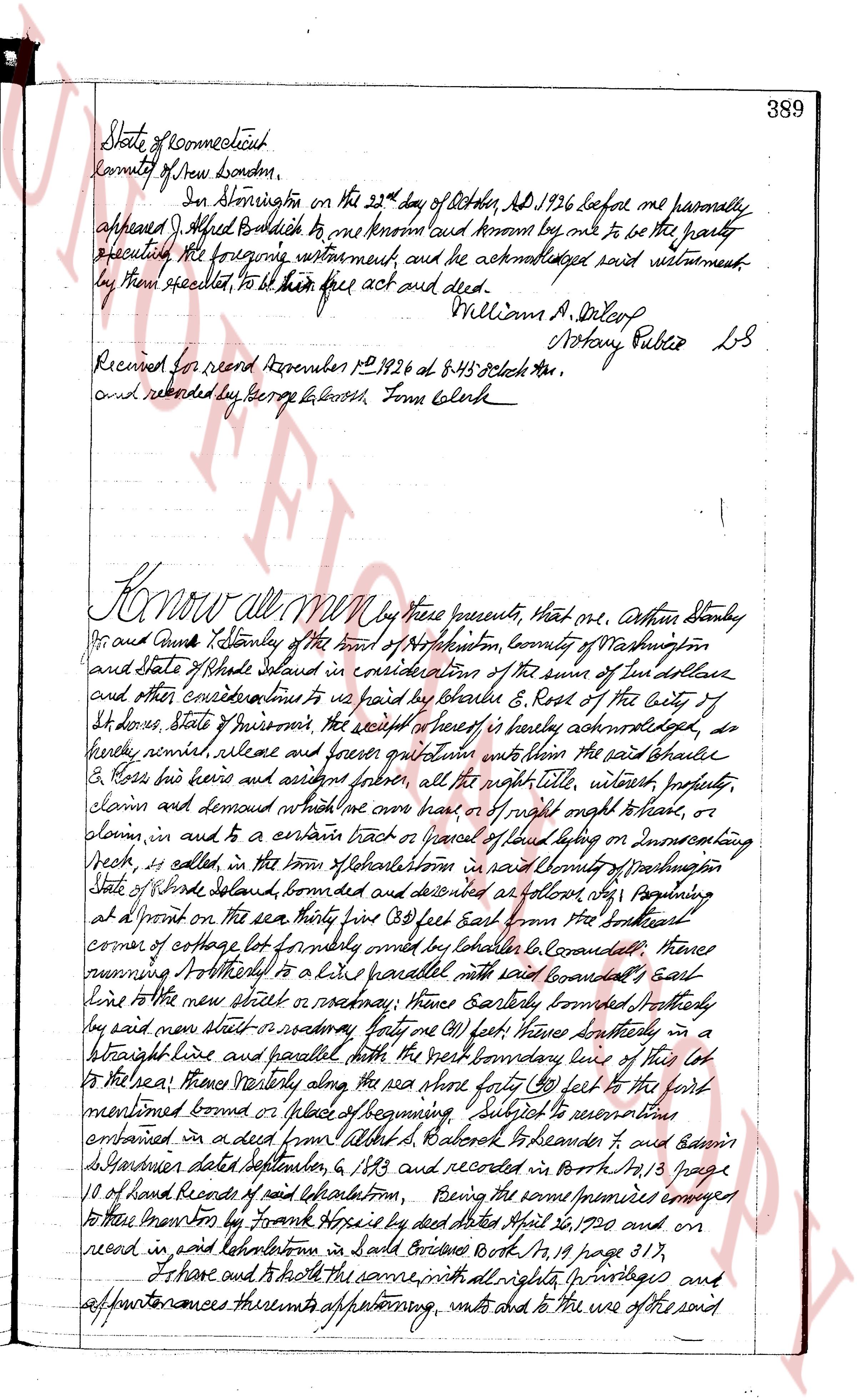
State of Connecticut
County of New London,
In Administration on the 23rd day of October, AD 1926 before me personally
appeared J. Alfred Bullwich to me known and known by me to be the party
executing the foregoing instrument and he acknowledged said instrument
by them executed, to be their free act and deed.
William A. Slocum
Notary Public LS
Received for record November 1st 1926 at 8:45 o'clock AM.
and recorded by George L. Lowery Town Clerk
Know all men by these presents, that we, Arthur Stanley
his and Jane T. Stanley of the town of North Kingston, County of Washington
and State of Rhode Island in consideration of the sum of ten dollars
and other considerations to us paid by Charles E. Ross of the City of
St. Louis, State of Missouri, the receipt of which is hereby acknowledged, do
hereby remise, release and forever quit claim our title within the said premises
& Ross his heirs and assigns forever, all the right title, interest property,
claim and demand which we have or had of right ought to have, or
claim, in and to a certain tract or parcel of land lying on or intersecting
Road, is called in the town of North Kingston in said County of Washington
State of Rhode Island, bounded and described as follows, that beginning
at a point on the sea shore fifty (50) feet east from the southeast
corner of a lot formerly owned by Charles Le Conardee, thence
running Northerly in a line parallel with said boundary's east
line to the new street or roadway, thence Easterly bounded Northly
by said new street extending forty (40) feet, thence Southerly in
a straight line and parallel with the west boundary line of this lot
to the sea, thence Westerly along the sea shore forty (40) feet to the point
mentioned above or place of beginning Subject to reservations
contained in a deed from Gilbert S. Baker & Alexander & and Edwin
S. Baker's dated September 6, 1863 and recorded in North 19, 18 page
10 of land Records of said Kingston, being the same premises conveyed
to their ancestors by Frank Hope's by deed dated April 26, 1820 and on
record in said North Kingston in said Bridges North 19, 18 page 317,
of and to both the same with all rights, privileges and
appurtenances thereunto appertaining, unto and to the use of the said
The page as recorded