The instrument's own words
page 1
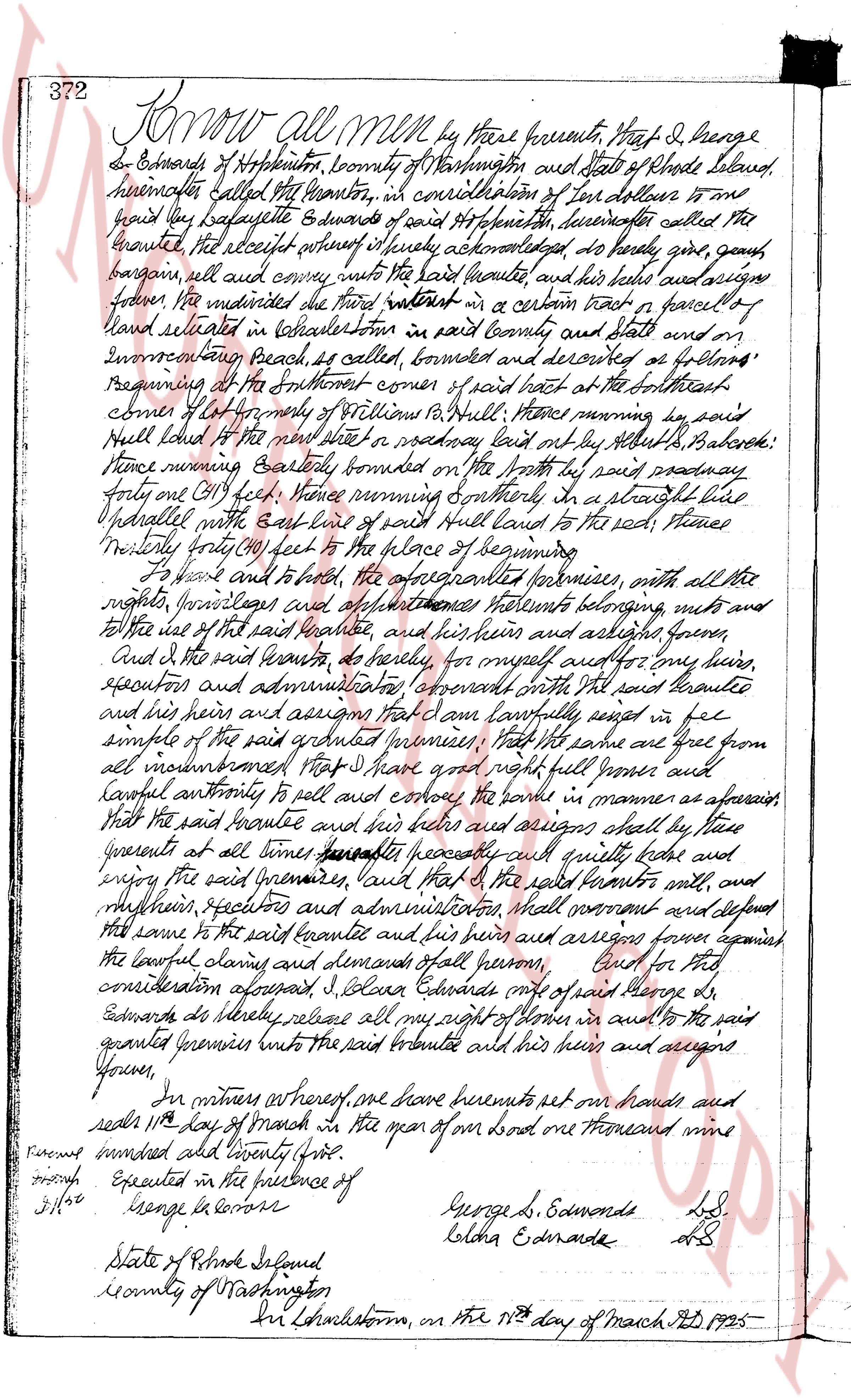
372 Know all Men by these presents, That I, George
G. Edwards of Hopkinton, County of Washington and State of Rhode Island,
hereinafter called the Grantor, in consideration of Four dollars to me
paid by Lafayette Edwards of said Hopkinton, hereinafter called the
Grantee, the receipt whereof is hereby acknowledged, do hereby give, grant,
bargain, sell and convey unto the said Grantee and his heirs and assigns
forever, the undivided three fourths interest in a certain plot or parcel of
land situated in Charlestown in said county and state and on
Inventary beach as called bounded and described as follows:
Beginning at the southeast corner of said part of said tract at the southeast
corner of lot No 4 of the will of William Pell, thence running by said
pell line to the next stake in a roadway leading east by the saltmarsh, Babcock:
thence running Easterly bounded on the North by said roadway
forty one (41) feet, thence running Southerly in a straight line
parallel with the east line of said Pell land to the said Place, thence
Northwesterly forty (40) feet to the place of beginning.
To have and to hold, the aforementioned premises, with all the
rights, privileges and appurtenances Hereto belonging, unto
the said Grantee and his heirs and his assigns forever.
And I the said Grantor, do hereby, for myself and my heirs,
executors and administrators, covenant with the said Grantee
and his heirs and assigns that I am lawfully seized in fee
simple of the said granted premises, that the same are free from
all encumbrances that I have right full Power and
lawful authority to sell and convey the same in manner as aforesaid
that the said Grantee and his heirs and assigns shall by these
presents at all times hereafter peacefully and quietly hold and
enjoy the said premises, said that the said Grantor will, and
my heirs, executors and administrators shall warrant and defend
the same to the said Grantee and his heirs and assigns against
the lawful claims and demands of all persons. And for this
consideration aforesaid I, George Edwards omit of said George G.
Edwards do hereby release all my right of tenure in and to the said
granted premises into the said Grantee and his heirs and assigns
forever.
In witness whereof, one have hereunto set our hands and
seals this 11th day of March in the year of our lord one thousand nine
hundred and twenty five.
Executed in the presence of
George G. Edwards L.S.
Lelha Edwards L.S.
State of Rhode Island
County of Washington
Sworn to Charlestown, on the 11th day of March AD 1925-
page 2
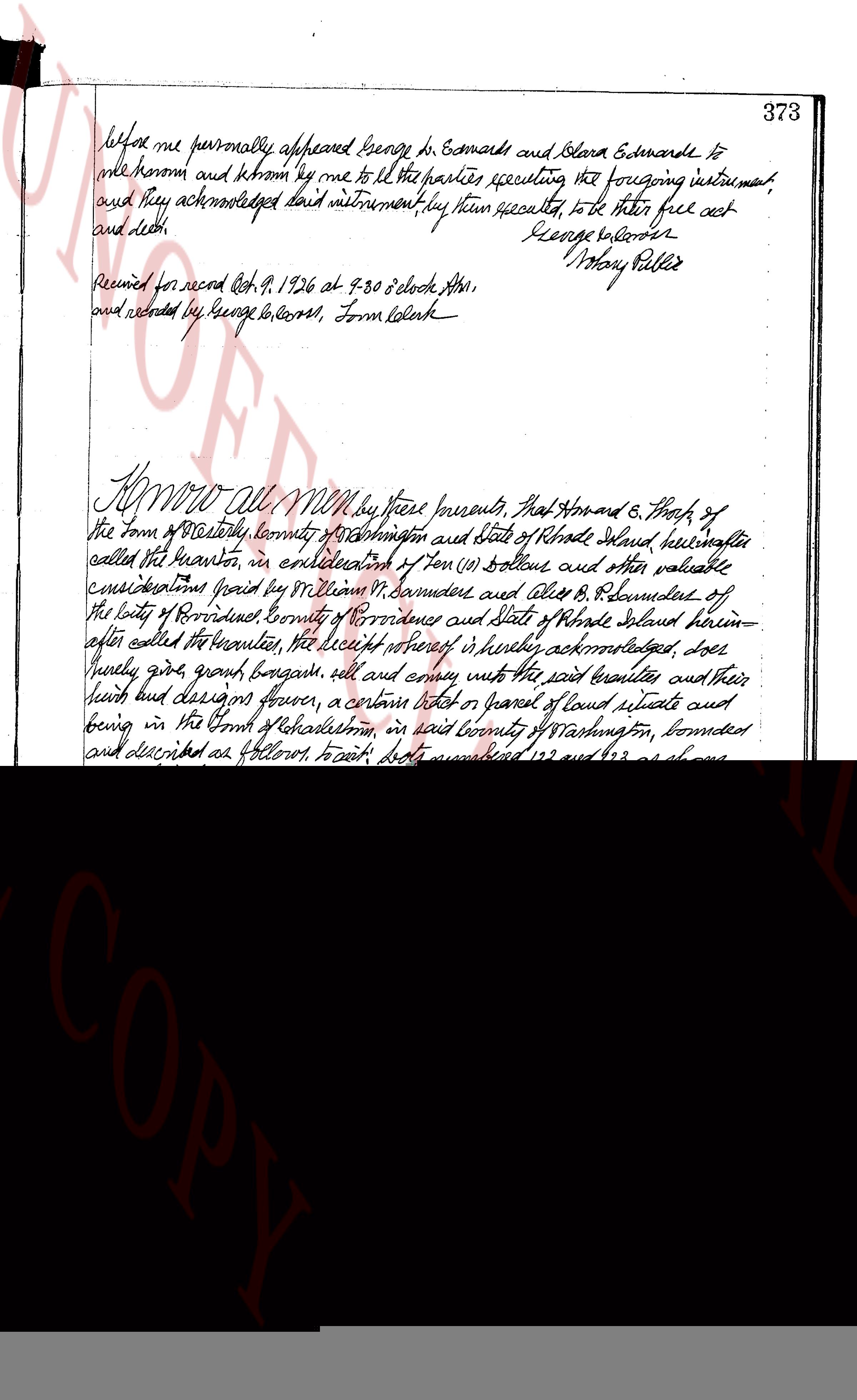
before me personally appeared George B. Somers and Clara E. Somers to
me known and known by me to be all the parties executing the foregoing instrument,
and they acknowledged said instrument, by them executed, to be their free act
and deed. George B. Somers
Notary Public
Received for record Oct 9, 1926 at 8:30 o'clock A.M.,
and recorded by George B. Somers, Town Clerk
KNOW ALL MEN by these presents, That Arnold C. Thorp, of
the town of Westerly County of Washington and state of Rhode Island hereinafter
called the grantor, in consideration of ten ($10) Dollars and other valuable
considerations paid by William H. Vanderveer and Alice B. Vanderveer of
the city of Providence County of Providence and state of Rhode Island herein-
after called the grantees, the receipt whereof is hereby acknowledged, does
hereby give, grant, bargain sell, and convey unto the said grantees and their
heirs and assigns forever, a certain piece or parcel of land situate and
lying in the town of Westerly in county of Washington, bounded
and described as follows tract, being numbered 122 and 123 on shorey
and delineated in a certain plan or plat entitled "Plan of Unimproved
land near Beach, Westerly, R.I." Thorp's lanes, runs easterly eighty feet
to the north, October 29, 1924, corner Nov 10, 1925, runs south and then east, "
said plan or plat being on file in the Town clerk's office in said town of
Westerly. the said grantees their heirs and assigns shall have the
right to hunt and fish and refuse to admit any person from and to said lot or
visit on foot or otherwise over, on and across there certain rights of way
or road as shown on said plan or plat leading to the public highway and
as well the rights of way leading to the beach and also the right of way
leading from the road to the public water front and any other of those
portions of said plat which might be obligatory for Public use. the said
grantor, for himself their heirs and assigns, hereby covenant and
agrees to and with the said grantees their heirs and assigns, that the
said grantees their heirs and assigns, will and shall pray to the said
grantor, his heirs and assigns, on or before the first day of August each
year hereafter, the sum of five ($5) Dollars on each lot hereby conveyed
and sum to be funded and applied by the said grantor his heirs and
assigns, in his own and their unrestricted direction to the care and
maintenance of the roads and other portions that may be designated
for Public use, and the said sums agreed to be paid are hereby
The page as recorded