The instrument's own words
page 1
197
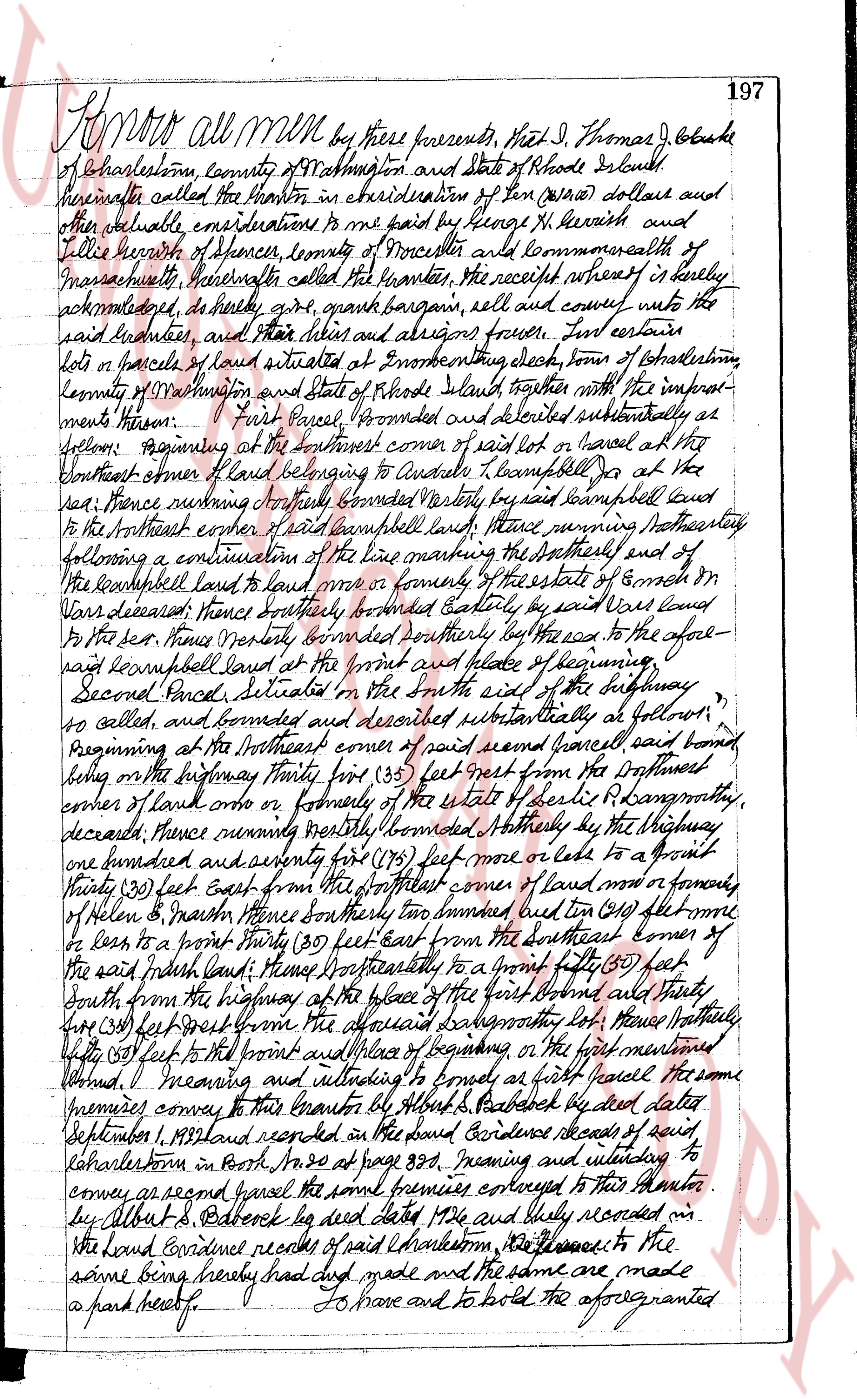
Know all men by these presents, That I, Thomas J. Olukie
of Charlestown, county of Washington and State of Rhode Island
hereinafter called the Grantor in consideration of ten (10) dollars and
other valuable considerations to me paid by George H. Kerrish and
Tellie Kerrish of Spencer, county of Worcester and commonwealth of
Massachusetts, hereinafter called the grantees, the receipt whereof is hereby duly
acknowledged, do hereby give, grant bargain, sell and convey unto the
said grantees, and their heirs and assigns forever, Two certain
lots or parcels of land situated at Enumerating Neck, town of Charlestown,
county of Washington and State of Rhode Island together with the improv-
ments thereon. First Parcel, bounded and described substantially as fol-
lows: Beginning at the southeast corner of said lot or parcel at the
southeast corner of land belonging to Alexander J. Campbell Joe at the
red road; thence running northeasterly bounded westerly by said Campbell land
to the northeast corner of said Campbell land; thence running northeasterly
following a continuation of the line marking the southeasterly end of
the Campbell land to land once or formerly of the estate of Enoch On-
yans deceased; thence southerly bounded easterly by said Vans land
to the red road; thence westerly bounded southerly by the road to the afore-
said Campbell land at the point and place of beginning.
Second Parcel, situated in the south east of the highway
so called, and bounded and described substantially as follows:
Beginning at the southeast corner of said second parcel said bound
being on the highway thirty five (35) feet from the southeast
corner of land once or formerly of the estate of Ellis & Langdon more
deceased; thence running northeasterly bounded easterly by the highway
one hundred and seventy five (175) feet more or less to a point
thirty (30) feet East from the northeast corner of land once or formerly
of Helen & Martin thence southeasterly two hundred ten (210) feet more
or less to a point thirty (30) feet East from the Southeast corner of
the said print land; thence southeasterly to a point fifty (50) feet
South from the highway at the place of the first bound and thence
four (4) feet west from the aforesaid Langdon lot; thence northerly
fifty (50) feet to the point and place of beginning on the first mentioned
bound. I meaning and intending to convey to said first parcel the same
premises conveyed to this grantor by Albert S. Beddock by deed dated
September 1, 1933 and recorded in the Land Evidence records of said
Charlestown in Book No. 20 at page 383; meaning and intending to
convey as second parcel the said premises conveyed to this grantor
by Albert S. Beddock by deed dated 1926 and duly recorded in
the Land Evidence records of said Charlestown 10, 355 and to the
same being hereby had and made and the same are made
a part hereof by
To have and to hold the aforegranted
page 2
198
premises, with all the rights, privileges and appurtenances thereunto
belonging, unto and to the use of the said scuttle and their heirs
and assigns, forever. And I the said grantor, do hereby, for
myself and for my heirs, executors and administrators covenant
with the said grantees and their heirs and assigns that I am
lawfully seized in fee simple of the said granted premises; that
the same are free from all incumbrances that I have good
right, full power and lawful authority to sell and convey the same
in manner as aforesaid; that the said grantees and their heirs
and assigns shall by these presents at all times hereafter peaceably
and quietly have, and enjoy the said premises, and that I, and the
said grantor well and truly heirs, executors and administrators
shall warrant and defend the same to the said grantees and
their heirs and assigns forever against the lawful claims and
demands of all persons. And for the consideration
aforesaid I, Mary Alea Clarke wife of the aforesaid Thomas J.
Clarke do hereby release all my right of dower in and to
the said granted premises unto the saidFebruaries and their heirs
and assigns forever.
In witness whereof, we have hereunto set our hands and
seals this 7th day of May in the year of our lord one thousand
nine hundred and twenty six.
Executed in the presence of
Howard E. Thorp
Thomas J. Clarke L.S.
Mary Alea Clarke L.S.
State of Rhode Island
County of Washington
In Providence on the 7th day of May, A.D. 1924
before me personally appeared Thomas J. Clarke and Mary
Alea Clarke, husband and wife, to me known and known by
me to be the parties executing the foregoing instrument and
they acknowledged said instrument by them executed to be
their free act and deed.
Howard E. Thorp
Henry Piles
Received for record May 7th 1926 at 1-30 o'clock P.M.
and recorded by George W. Moore. Tom Clarke
The page as recorded