The instrument's own words
page 1
177
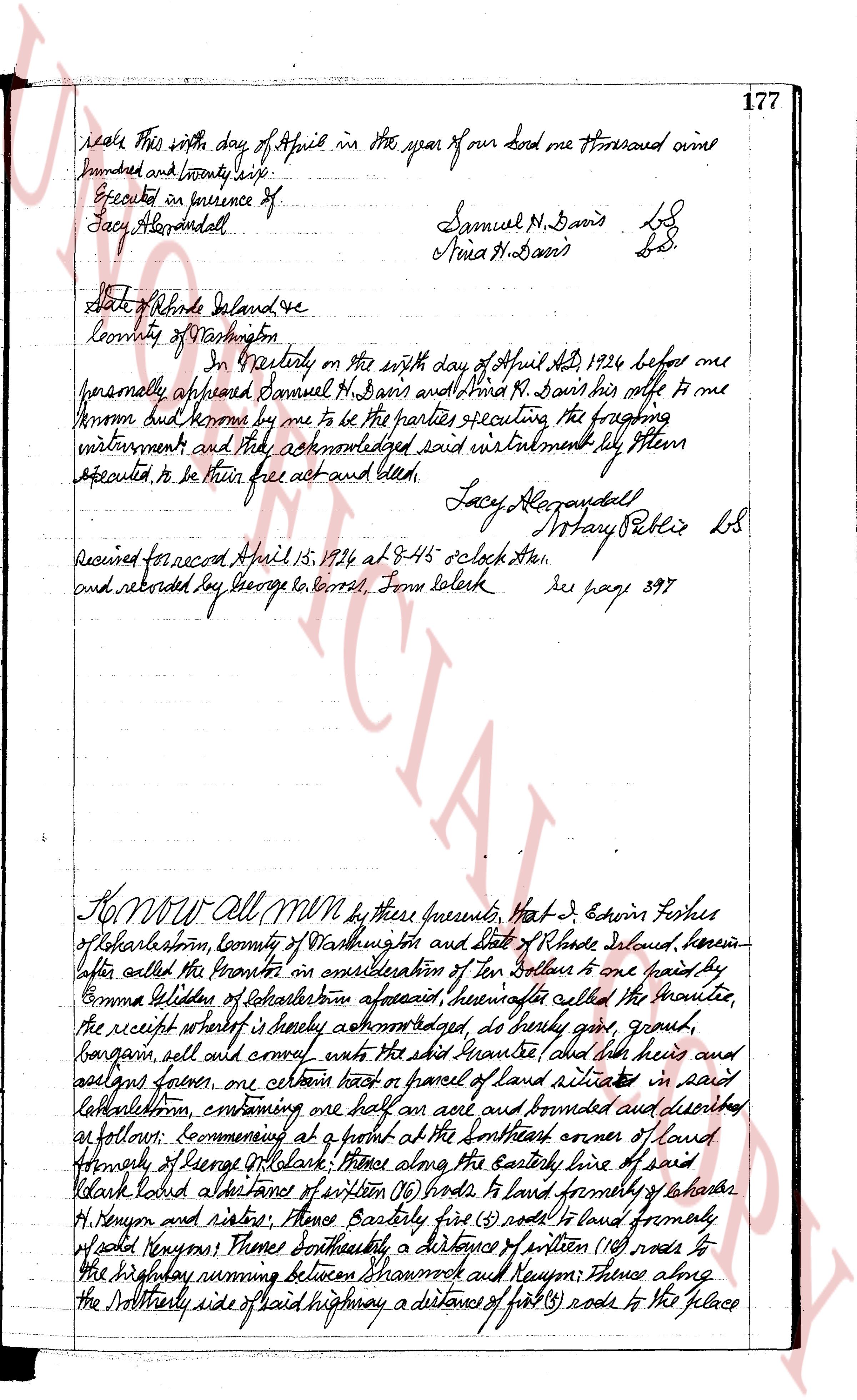
seal this 6th day of April in the year of our lord one thousand nine
hundred and twenty six.
Executed in presence of
Lacy Albrandall
Samuel N. Davis LS
Anna N. Davis LS.
State of Rhode Island
County of Washington
I the Notary on the sixth day of April Act 1924 before me
personally appeared Samuel N. Davis and Anna N. Davis his wife to me
known but known by me to be the parties executing the foregoing
instrument and they acknowledged said instrument by them
executed to be their free act and deed.
Lacy Albrandall Notary Public LS
Received for record April 15 1924 at 9:45 o clock A.M.
and recorded by George W. Carrs, Town Clerk rec page 397
KNOW All MEN by these presents, That J. Edwin Forbes
of Charlestown, County of Washington and State of Rhode Island, herein
after called the Grantor in consideration of Ten Dollars to one paid by
Emma Miller of Charlestown aforesaid, hereinafter called the Grantee,
the receipt whereof is hereby acknowledged, do hereby grant, ground,
bargain sell and convey unto the said Grantee and her heirs and
assigns forever, one certain lot or parcel of land situated in said
Charlestown, containing one half an acre and bounded and described
as follows: Commencing at a point at the Southeast corner of land
formerly of George W. Clark; thence along the easterly line of said
Clark land southeast ten feet of written (10) rods to land formerly of Shadrach
H. Kenyon and sister; thence Easterly five (5) rods to land formerly of
said Kenyons; thence Southeasterly a distance of written (10) rods to
the highway running between Sharonock and Kenyon; thence along
the Northerly side of said highway a distance of five (5) rods to the place
page 2
178
of beginning, bounded Northerly and Easterly by land formerly of
said Kennecott, now of William E. Tuffs, Southerly by said highway
and Westerly by land formerly of said George W. Black. Being the
same tract conveyed to the heirs of William M. Burnside
by deed dated April 28th 1891 and on record in said Charlestown in
said boundary records page 202. To have and to
hold the aforesaid premises, with all the rights, privileges and
appurtenances to the presents belonging, unto said
grantee, her heirs and assigns forever. And I the said grantor,
do hereby, for myself and for my heirs, executors and administrators,
covenant with the said grantee and her heirs and assigns that
I am lawfully seized in fee simple of the said granted premises;
that the same are free from all encumbrances, that I have good
right full power and lawful authority to sell and convey the same
in manner as aforesaid; that the said grantee and her heirs and
assigns shall by these presents at all times hereafter peaceably and
quietly have and enjoy the said premises, and that I, the said
grantor will and my heirs, executors and administrators, shall
warrant and defend the same to the said grantee and her heirs
and assigns forever against the lawful claims and demands
of all persons.
In witness whereof I have hereunto set my hand and
seal this 19th day of April in the year of our Lord one thousand
nine hundred and twenty four
Executed in the presence of
George LeCrosse
Edwin Fisher LS
State of Rhode Island
County of Washington
On Charlestown on this 19th day of April, AD
1924 before me personally appeared Edwin Fisher to me known
and known by me to be the party executing the foregoing instrument
and he acknowledged said instrument, by him sealed to be
his free act and deed.
George LeCrosse
Notary Public
received for record April 19th 1924 at 4-30 o'clock PM
and allowed by George LeCrosse Town Clerk
The page as recorded