The instrument's own words
page 1
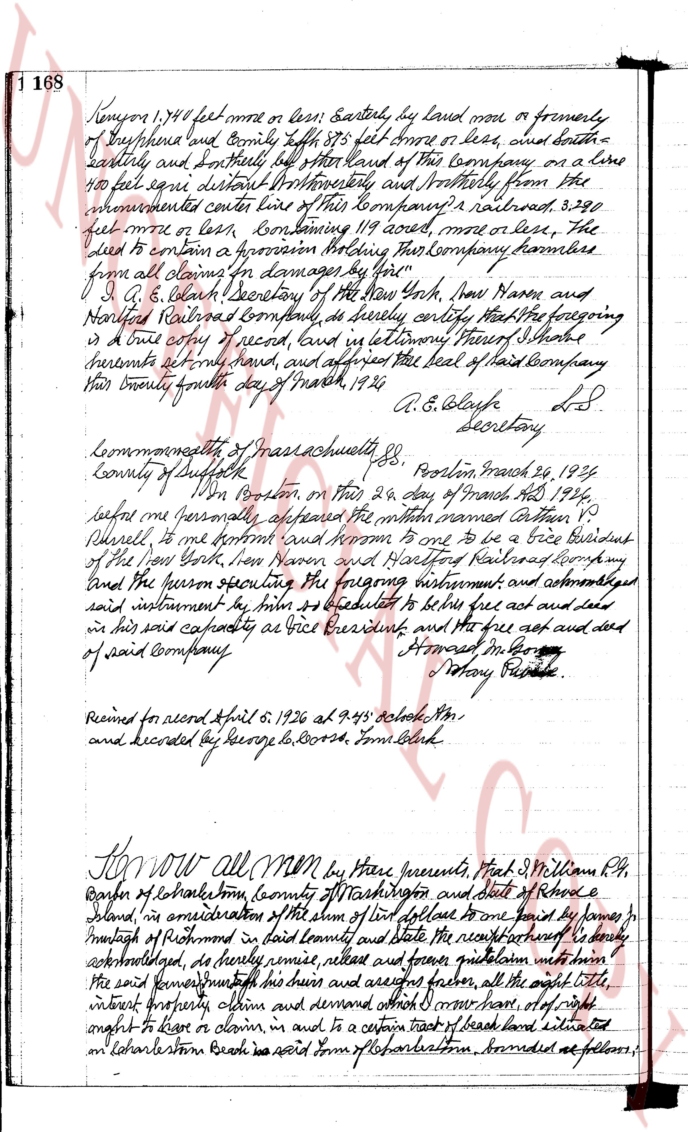
1 168 Kenyon 1,740 feet more or less; Easterly, by land now or formerly
of Shepherd land and Company south 85° 875 feet more or less, then north
easterly and Southerly, by other land of this Company, on a line
100 feet square distant Northwesterly and Northeasterly from the
aforementioned center line of this Company's railroad, 3,290
feet more or less, containing 119 acres, more or less, the
deed to contain a provision stating this Company harmless
from all claims for damages by you"
I, A. E. Blake, Secretary of the New York, New Haven and
Hartford Railroad Company, do hereby certify that the foregoing
is a true copy of record, and in testimony thereof I have
hereunto set my hand, and affixed the seal of said Company
this twenty fourth day of March, 1924.
A. E. Blake L.S.
Secretary
Commonwealth of Massachusetts, SS. Boston, March 24, 1924
County of Suffolk
In Boston, on this 24 day of March AD 1924,
before me personally appeared the within named Arthur V.
Russell, to me known and known to me to be a Vice President
of the New York, New Haven and Hartford Railroad Company
and the person executing the foregoing instrument, and acknowledged
said instrument to be his act and deed to be his free act and deed
in his said capacity as Vice President, and the free act and deed
of said Company.
Howard M. Co
Notary Public
Received for record April 5, 1926 at 9.45 o'clock AM
and recorded by George B. Cozza, Town Clerk
Know all MEN by these presents, That J. William P. H.,
Barber of Charlestown, County of Washington and State of Rhode
Island, in consideration of the sum of one dollar to payed by James
Murphy of Richmond in said County and State the receipt whereof is hereby
acknowledged, do hereby remise, release and forever quitclaim unto the
said conveyor and his heirs and assigns forever, all the right title,
interest property claim and demand which I now have, or of right
ought to have or claim, in and to a certain tract of land situated
on Charlestown Beach in said Town of Charlestown, bounded as follows:
page 2
169
Beginning at an iron post set in a concrete base at the southeast corner of this
vault and the southeast corner of land of said Wallace, thence northerly bounding
easterly by land of said Wallace to the highway to an iron post set in a concrete
base, thence northerly bounding westerly by said highway forty six feet more
in a line to an iron post set in a concrete base, thence southerly bounding
westerly by the east line of the grantor's land to an iron post set in a concrete base
which is the southeast corner of this tract, thence easterly fifty feet more or
there about to the place of beginning. Including also the beach lying between the land
hereby described and the ocean. The grantor and grantee for themselves their
heirs and assigns agree that there be set on the west side of the granite post first
mentioned and also but of the east side of the grantor's land from the highway
to the ocean shall be used as a passageway for the accommodation of the owners
of said lots and to be kept and maintained jointly by them, their heirs and
assigns. To have and to hold the same, with all rights, privileges
and appurtenances thereunto belonging, reverting, and unto the use of the said
grantee James J. McIntosh his heirs and devises forever. And the aforementioned
William P. G. Barber for himself and for his heirs, executors and administrators
do covenant with the said James J. McIntosh his heirs and assigns that they
shall warrant and defend the aforementioned premises unto the said
James J. McIntosh his heirs and devises forever, against the lawful
claims and demands of all persons claiming by, through or under
me and my heirs.
And I Estelle Barber wife of the said William P. G. Barber
in consideration of the sum of one dollar paid to me hereby release and
forever quitclaim unto the said James J. McIntosh his heirs and assigns
all my right of dower in and to the aforementioned premises.
In testimony whereof, we have hereunto set our hands and seal
this 24th day of September in the year of our Lord one thousand nine
hundred and twenty five.
Signed and sealed in the presence of
George La Corbe
M. P. G. Barber L.S.
Estelle Barber L.S.
State of Rhode Island
County of Providence
On this twenty fourth day of September A.D. 1925
before me personally appeared William P. G. Barber and Estelle Barber
to me known by me to be the parties executing the foregoing
instrument, and they acknowledged said instrument by them executed,
to be their free act and deed.
George La Corbe Notary Public
Received for record April 7, 1926 at 2-45 o'clock P.M.
and entered by George La Corbe from deed.
page 3
180
This 14th day of October in the year of our lord one thousand nine
hundred and twenty five.
Executed in the presence of
Williams A. Milfort
Albert H. Martin
James A. Burdick S.S.
State of Connecticut
County of New London
ss.
In Stonington on this 14th day of October, AD 1925
appear before me personally appeared James A. Burdick to me known
stamp and known by me to be the party executing the foregoing instrument
seal and he acknowledged said instrument, but tenure executed to
be his free act and deed.
Williams A. Milfort
Notary Public S.S.
Received for record April 30, 1936 at 8.10 o'clock AM.
and Recorded by George G. Moore, Town Clerk
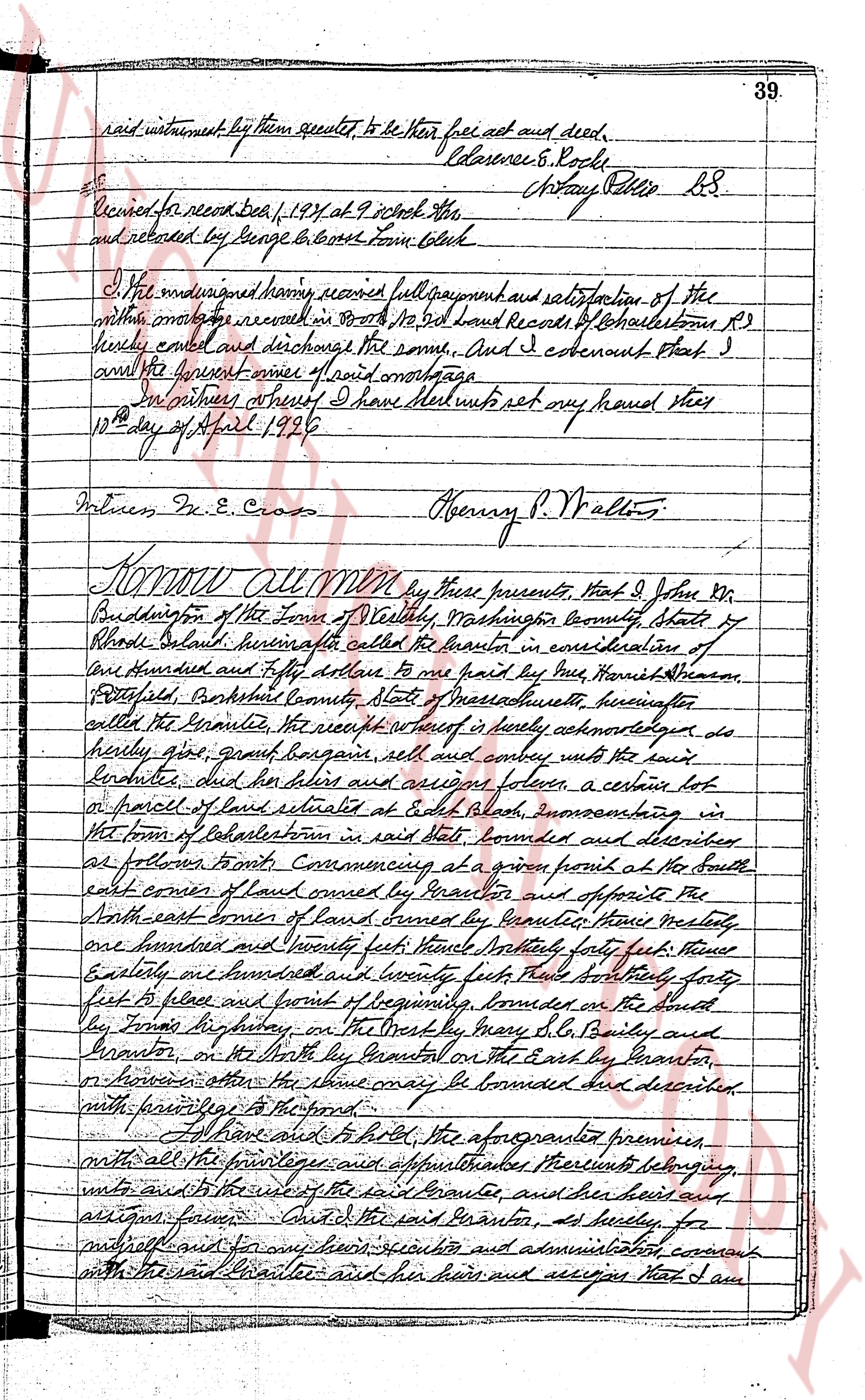
KNOW ALL MEN by these presents, That I, Walter S. Miller
(citizen) of Charlestown, County of Washington and State of Rhode Island, Delaware,
hereinafter called the Grantor in consideration of Ten dollars and other
considerations to me paid by Leland Land Company of said Charlestown
hereinafter called the Grantee, the receipt of hereof is hereby acknowledged,
do hereby give, grant, bargain sell and convey unto the said Grantee and
his heirs and bargains forever, a certain piece of land situated in said
Charlestown, bounded and described as follows: Beginning at the Full
Road at the southeast corner of land of Henry H. Hopson; Thence easterly,
bounding Northerly by said First Road to the Bark Ambler Road, as
called, Thence southerly by said Ambler Road or wall and fence
to a stone post at the end of said fence in bounding brook; Thence westerly,
across said bog to a stone post at the fence at the southeast corner of
unity lot, so called, on a hill due west thence extending southerly along
said fence to a stone post her foremost and unity foot from the north
Ambler Road; Thence westerly, more or less, bounded with said South Road and his
bounded and fully foot from the north to a stone post at land of Henry H.
Hopson about one hundred and sixty six feet from West Ambler Road;
Thence easterly bounding Northerly by said house lands to the corner of a
point farward and one half road from the line of land owned by Sharon
S. Skeren; Thence Southarly or Southerly parallel with said Green
The page as recorded