The instrument's own words
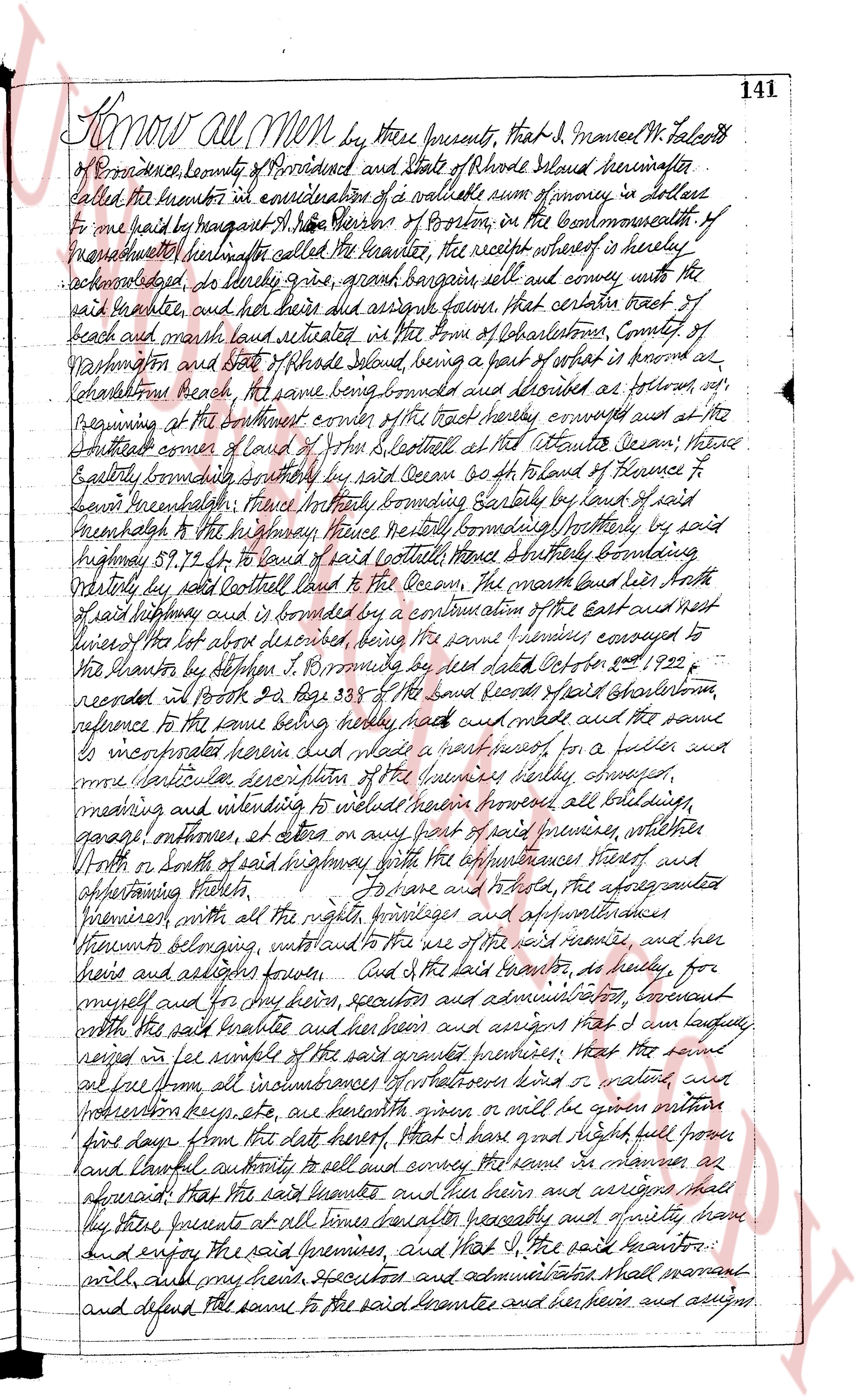
page 1
Know all Men by these presents, that I, Samuel W. Falcott
of Providence County of Providence and State of Rhode Island hereinafter
called the grantor in consideration of a valuable sum of money in lettuce
one paid to me by augusta M. S. Bisson of Boston, on the Commonwealth of
Massachusetts hereinafter called the grantee, the receipt whereof is hereby
acknowledged, do hereby grant, bargain sell and convey unto the
said grantee, and her heirs and assigns forever, that certain tract of
beach and marsh land situated in the Town of Charlestown, County of
Washington and State of Rhode Island, being a part of what is known as
Charlestown beach, the same being bounded and described as follows: Beginning
at the southeast corner of the tract hereby conveyed and at the
southeast corner of land of S. G. Scott at the Atlantic Ocean; thence
Easterly bounding southerly by said Ocean to a fourth of distance to Florence P
thence northwesternly, thence northeasterly bounding Easterly by land of said
Florence P to the highway, thence northeasterly bounding northerly by said
highway 57.92 ft to land of said Scott thence Southerly bounding
Westerly by said Scott continued land to the Ocean, the Marsh land lies North
of said highway and is formed by a continuation of the East and West
lines of the lot above described being the same boundaries conveyed to
the grantor by Stephen J. Bromfield by a deed dated February 2nd 1822 &
recorded in book 24 page 338 of the said records of said Charlestown,
reference to the same being hereby made and meant and the same
is incorporated herein and meant a part hereof for a fuller and
more particular description of the premises hereby conveyed,
meaning and intending to include herein all buildings since erected all buildings
garages outhouses et cetera on any part of said premises, whether
North or South of said highway with the improvements thereof and
appertaining thereto. To have and to hold, the aforesaid granted
premises with all the rights privileges and appurtenances
therunto belonging, unto and to the use of the said grantee, and her
heirs and assigns forever. And I the said grantor, do hereby, for
myself and for my heirs, successors and administrators, covenant
with the said grantee and her heirs and assigns that I am lawfully
seized in fee simple of the said granted premises; that the said
land free from all incumbrances whatsoever kind or nature, and
prohibitions keep etc etc are herewith given or will be given matter
from this day off the debt hereof, that I have good and Right full power
and lawful authority to sell and convey the same in manner as
aforesaid; that the said grantee and her heirs and assigns shall
that these presents at all times hereafter peaceably and quietly have,
and enjoy the said premises, and that I, the said grantor, :
will and my heirs, Executors and administrators shall warrant
and defend the same to the said grantee and her heirs and assigns.
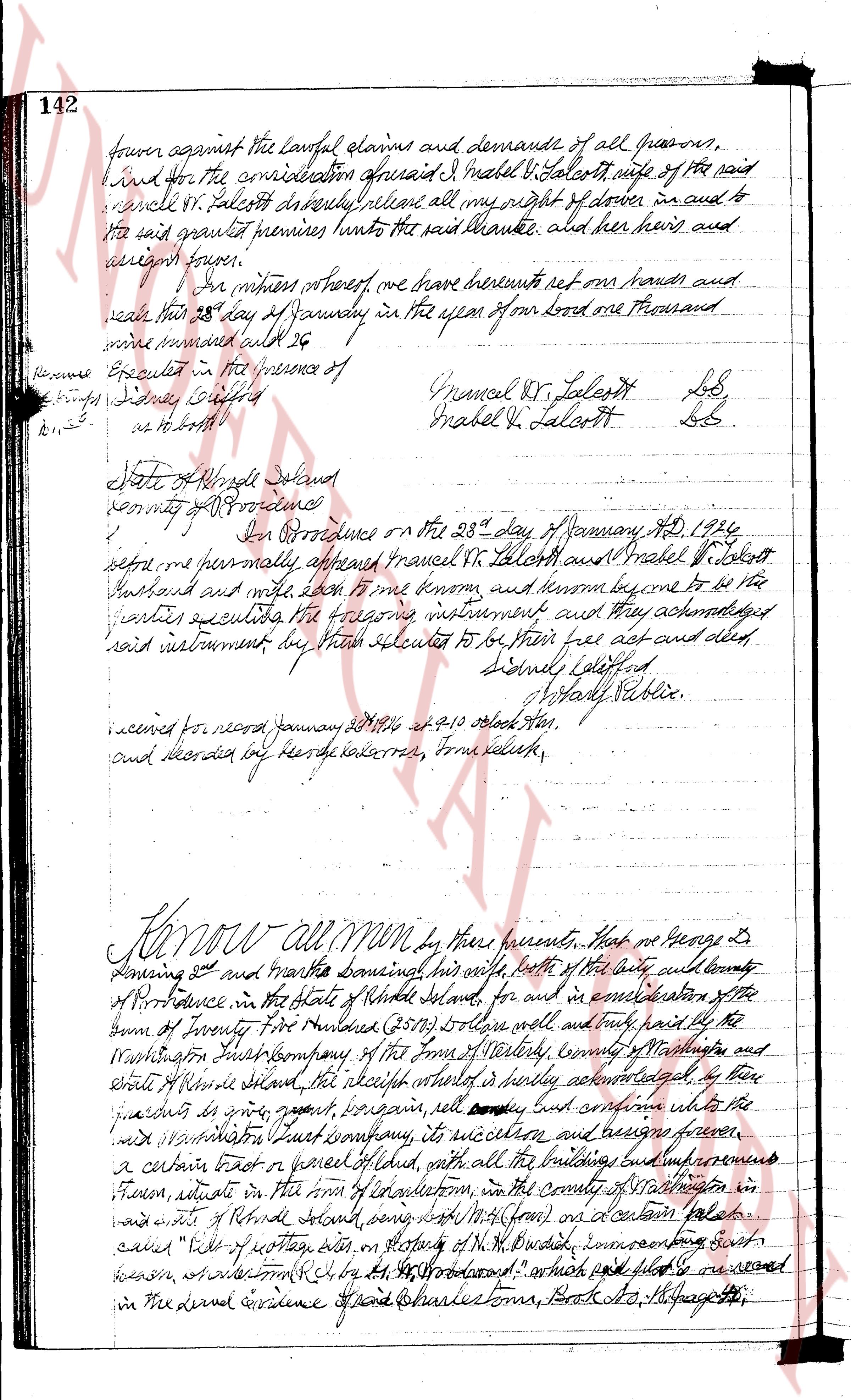
page 2
142
four against the lawful claims and demands of all persons.
And I, for the consideration aforesaid I, Mabel V. Talcott wife of the said
Samuel V. Talcott hereby release all my right of dower in and to
the said granted premises unto the said Samuel, and her heirs and
assigns forever.
In witness whereof we have hereunto set our hands and
seals this 28th day of January in the year of our Lord one thousand
nine hundred and 26
Executed in the presence of
[Signature]
[Signature]
Samuel V. Talcott L.S.
Mabel V. Talcott L.S.
State of Rhode Island
County of Providence
On this Providence on the 28th day January A.D. 1926
before me personally appeared Samuel V. Talcott and Mabel V. Talcott
husband and wife each of them being known to me and known to be the
parties executing the foregoing instrument and they acknowledged
said instrument by their hands executed to be their free act and deed.
Samuel V. Talcott
Mabel V. Talcott
[Signature] Public Notary
received for record January 28/1926 at 9:10 o'clock A.M.
and recorded by George H. Carran, Town Clerk.
Know all men by these presents, that we George G.
Dewing and Martha Dewing survival his wife, both of the city and county
of Providence in the state of Rhode Island, for and in consideration of the
sum of Twenty Five Hundred ($2500) in cash well and truly paid by the
Washington Trust Company of the town of Warwick, county of Washington
and state of Rhode Island the receipt whereof is hereby acknowledged, by
their fractures do grant, bargain, sell, convey buy and conform unto the
said company its successors and assigns forever,
a certain tract or piece of land with all the buildings and improvements
thereon, situate in the town of Charlestown, in the county of Washington in
said state of Rhode Island among other things [illegible] on a certain lake or
called "Pills of rotten egg", on property of M.H. Duval, encompassing about
seven acres, adjacent to Rly by N, S, E, W, bound: which more or less is enclosed
in the deed evidence of said Charlestown, Book 17, Page 238 etc.
page 3
181
land and four and one half rods from the same southern rods; thence South-
easterly four and one half rods to the line of said green land; thence South westerly
bounding South westerly by land of said Poul B. House to the place of beginning,
granting unto the said braunte his heirs and assigns all rights of way
granted to the brauntes and his late husband Isaiah Wright in a deed from
Thomas L. Arnold to him or successor in said land at Jamestown Land Evidence Book
No 10 page 87; Also releasing and quitting the said Braunte any claim I may
have under the clause in said deed in relation to the sale of any lots from
the strip of land on South Constable Road. To have and to hold the
aforementioned premises, with all the rights privileges and appurtenances there-
unto belonging, unto and to the use of the said braunte and his heirs and
assigns forever. And I the said braunte, do hereby for myself and for
my heirs executors and administrators, covenant with the said braunte
and his heirs and assigns that they are lawfully seized in fee simple of the said
granted premises; that the same are free from all encumbrances that I have good
right full power and lawful authority to sell and convey the same in manner
as aforesaid; that the said braunte and his heirs and assigns shall by these
premises at all times hereafter peaceably and quietly have and enjoy the said
premises; and that I the said braunte and my heirs executors and admini-
strators, shall covenant and defend the same to the said braunte and his heirs
and assigns against the lawful claims and demands of all persons.
In witness whereof I have hereunto set my hand and seal this 17th day of April
in the year of our lord one thousand nine hundred and twenty six.
Executed in the presence of
George E. Coorse Hattie L. Mills LS
Whereas in the foregoing deed the Grantor Hattie L. Mills has released all claims
she might have in the sale of lots on the strip of land on South Constable Road, I
hereby agree with said Cleveland Land Company to give him one quarter of the
net amount realized by me in one of the sale of any and all lots from the strip
of land on said South Constable Road.
Thomas L. Arnold.
Witness, George E. Coorse.
State of Rhode Island
County of Newport
On this seventeenth, on the 17th day of April AD 1926 before me personally
appeared Hattie L. Mills and Thomas L. Arnold to me known and known by me
to be the parties executing the foregoing instrument and they acknowledged
said instrument be their free act and deed.
George E. Coorse
Notary Public
received for record April 20, 1926 at 10.30 o'clock ten
and recorded by George E. Coorse Town Clerk
The page as recorded