The instrument's own words
page 1
133
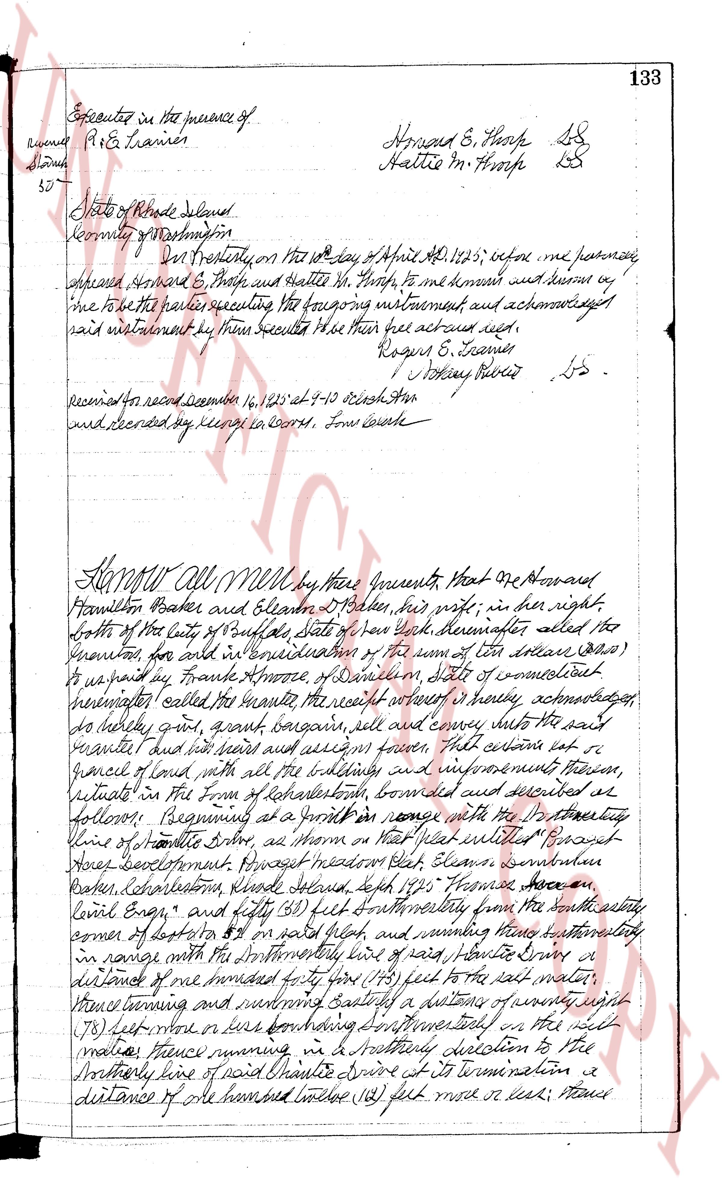
Executed in the presence of
R. E. Framer
Howard E. Sharp LS
Hattie M. Sharp LS
State of Rhode Island
County of Providence
On this present day the 12th day of April, 1825, before me personally
appeared Howard E. Sharp and Hattie M. Sharp, to me known and known by
me to be the parties executing the foregoing instrument and acknowledged
said instrument by their signatures to be their act and deed.
Rogers E. Framer
[Signature] LS
Received for record December 16, 1825 at 9-10 o'clock am
and recorded by me Deputy in Record, John Cozzens
Know All Men by these Presents, That one Howard
Hamilton Baker and Eleanor D Baker, his wife, in her right,
both of the city of Providence, State of New York, hereinafter called the
Grantors, for and in consideration of the sum of ten dollars ($10)
to us paid by Frank Ambrose, of Danbury, State of Connecticut
hereinafter called the Grantee the receipt whereof is hereby acknowledged
do hereby grant, convey, sell and convey entire unto the said
grantee and his heirs and assigns forever That certain lot of
ground with all the buildings and improvements thereon,
situate in the town of Johnston, bounded and described as
follows: Beginning at a point in range with the North easterly
line of Shantie Drive, as shown on the plat entitled "Providence
Acre development" [Signature] Meadow Plot, Eleanor D Baker
Baker, Johnston, Rhode Island, said 1825 Frank Ambrose a
levied Engr" and fifty (50) feet Southeasterly from the North easterly
corner of lot 50 on said plat, and running through authorization
in range with the North easterly line of said Shantie Drive a
distance of one hundred forty five (145) feet to the salt water,
thence running and running Easterly a distance of twenty eight
(28) feet more or less bordering Southeasterly on the salt
water thence running in a Southerly direction to the
Southerly line of said Shantie Drive at its termination a
distance of one hundred twelve (112) feet more or less; thence
page 2
134 bearing and running Northwesterly bounding Northeasterly on
said Wantastic Ave a distance of fifty (50) feet to the first
mentioned and starting from said premises are subject
to the following restrictions. First, any dwelling house
that may be erected on the granted premises shall be used
exclusively as a residence for a private family, that no buildings,
except the necessary out buildings requisite for the convenient
use and enjoyment of said dwelling house, and which shall
be used exclusively for domestic purposes, shall be erected thereon,
it being expressly understood that a private garage building may
be erected upon said premises for use only as a garage, and
not in any way intended nor used for domestic purposes,
and provided further that no building or dwellings erected on
said premises shall be located nearer than ten feet to the lot
line facing on any street avenue or any private road, and
also provided that any dwelling house or garage so constructed
on said premises shall be of a cost of less than $5,000,
and both sufficiently designed. That said premises or any
part thereof, or dwelling or building thereon shall at no time
be used for carrying on any mechanical or manufacturing
business or public trading of any kind, nor for the purpose of
tenements, prostitution, illegal gaming, or other illegal purposes
whatsoever, nor shall any structures, installations or machinery be
of any kind made, sold or held for sale thereon or therein.
Third, on lots facing situated on the easterly location,
no building shall be erected or placed thereon within ten feet of
the South line beginning and including lot no. 3 and 4.
On lots facing situated on the westerly location, no building
shall be erected or placed within ten feet of the South line beginning
and including lot no. 1. Fourth, no board fence to be
erected on said lot, and no fuel of any kind exceed four feet
in height. Fifth, it is understood and agreed that the said
grantee his heirs and assigns, shall build a cess pool and shall
keep the same in proper sanitary condition at all times, and that
no outhouse shall be built or placed on said premises. Sixthly,
that no swine, cows, horses poultry or other animals shall be
kept on said premises. To have and to hold the aforementioned
premises with all the privileges and appurtenances thereunto belonging,
unto and to the use of the said grantee, his heirs and assigns forever,
And we the said grantor do hereby covenant for ourselves and
for our heirs, executors and administrators, warranting with the said
grantee and his heirs and assigns that we are lawfully seised in
fee simple of the said granted premises, that the same are free
page 3
135
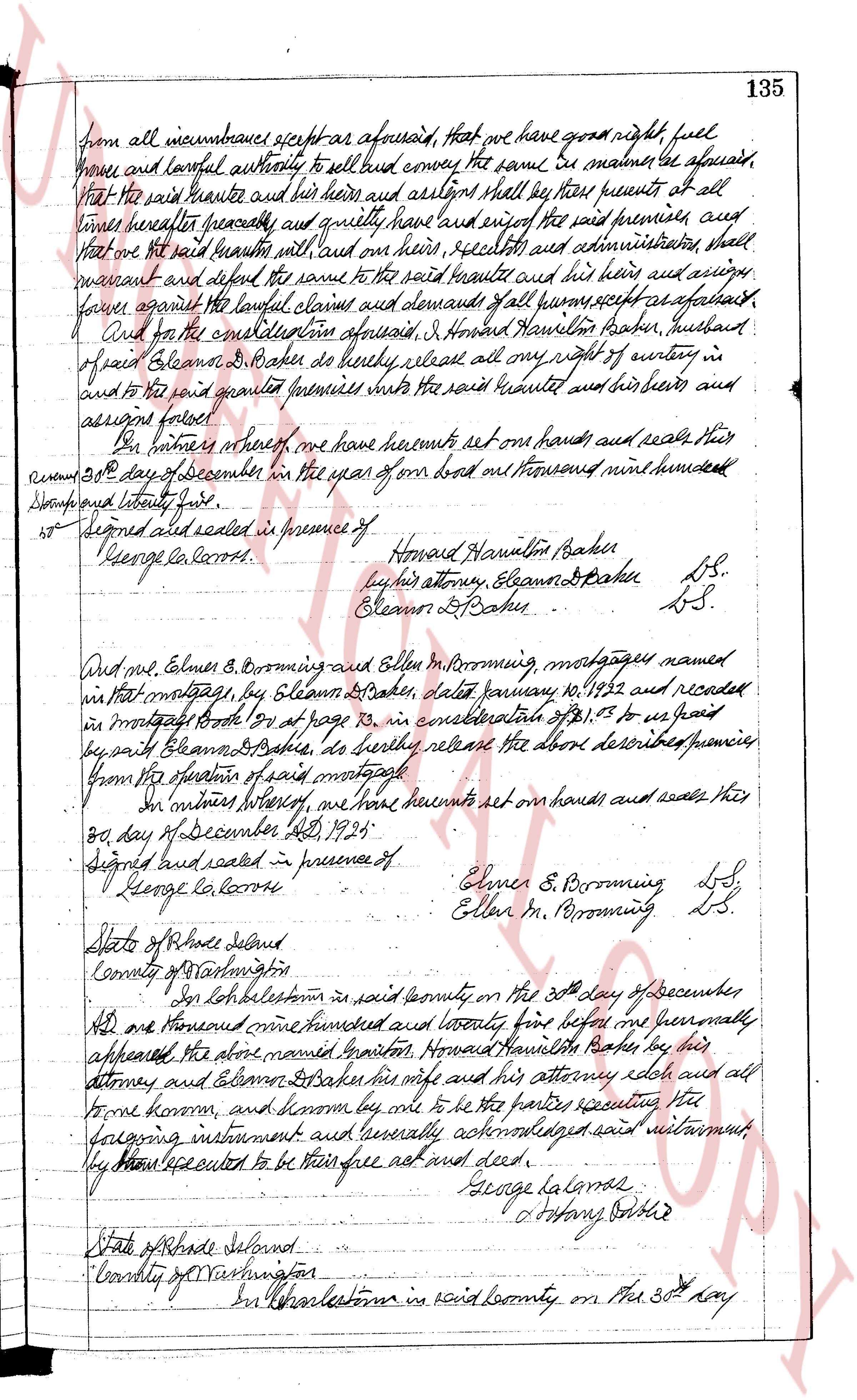
from all incumbrances except as aforesaid, that we have good right, full
power and lawful authority to sell and convey the same. Be it therefore agreed,
That the said hunter and his heirs and assigns shall by these presents at all
times hereafter peaceably and quietly have and enjoy the said premises, and
that the said sellers will and their heirs, executors and administrators shall
warrant and defend the same to the said hunter and his heirs and assigns
against the lawful claims and demands of all persons except as aforesaid.
And for the consideration aforesaid, I Howard Hamilton Baker, husband
of said Eleanor B. Baker do hereby release all my right of dower in
and to the said granted premises unto the said hunter and his heirs and
assigns forever.
Our witness hereof, we have hereunto set our hands and seals this
30th day of December in the year of our lord one thousand nine hundred
twenty four.
Signed sealed and delivered in presence of
George la carro
Howard Hamilton Baker
by his attorney, Eleanor B Baker L.S.
Eleanor B. Baker L.S.
And we, Elenor S. Brooming and Ellen M. Brooming, mortgagees named
in that mortgage, by Eleanor B Baker, dated January 10, 1922 and recorded
in mortgage book 189 at page 13, in consideration of $1.03 to be paid
by and to Eleanor B Baker, do hereby release the above described premises
from the operation of said mortgage.
Our witness hereof, we have hereunto set our hands and seals this
30th day of December AD, 1924.
Signed sealed and delivered in presence of
George la carro
Elenor S. Brooming L.S.
Ellen M. Brooming L.S.
State of Rhode Island
County of Washington
Ss.
In Charlestown in said county on the 30th day of December
AD one thousand nine hundred and twenty four before me personally
appeared, the above named grantor, Howard Hamilton Baker, by his
attorney and Eleanor B Baker his wife and his attorney each and all
fore known, and known by me to be the parties executing the
foregoing instrument and personally acknowledged said instrument
they had executed to be their free act and deed.
George la carro
& notary public
State of Rhode Island
County of Washington
Ss.
In Charlestown in said county on this 30th day
page 4
136
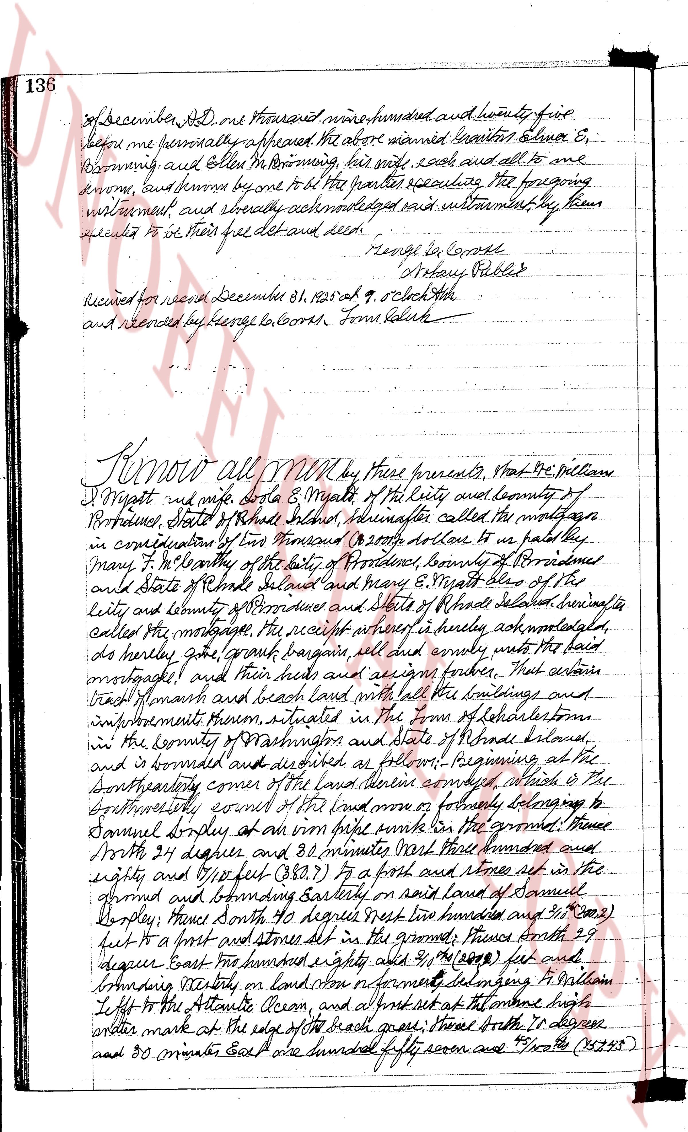
of December AD one thousand nine hundred and twenty five
before me personally appeared the above named grantors Elmore E.
Browning and Ellen M. Browning, his wife, each and all to me
known, and each personally to be the grantor executing the foregoing
instrument, and thereby acknowledged said instrument, by them
executed to be their free act and deed.
George own Corts
Notary Public
Received for record December 21, 1925 at 9 o'clock AM
and recorded by George own Corts Town Clerk
Know all men by these presents, That We Wm William
T Wright and wife dorta E Wright of the city and county of
Providence, State of Rhode Island hereinafter called the mortgagor
in consideration of Two Thousand (2000) dollars to us paid by
Mary F. T Connolly of the city of Providence, county of Providence
and state of Rhode Island and Mary E Wright also of the
city and county of Providence and state of Rhode Island hereinafter
called the mortgagee, the receipt whereof is hereby acknowledged,
do hereby give grant bargain sell and convey unto the said
mortgagee and their heirs and assigns forever, That certain
tract of marsh and beach land with all the buildings and
improvements thereon, situated in the Town of Colelton
in the county of Washington and state of Rhode Island,
and is bounded and described as follows: Beginning at the
Southeasterly corner of the low tide line along which is the
Northwesterly coast of the beach more or formerly belonging to
Samuel Dorley at an oak stake sunk in the ground; Thence
North 24 degrees and 38 minutes West three hundred and
eighty and 7/100 (380.70) feet to a post and stones set in the
ground and bounding Eastly on said land of Samuel
Dorley; Thence North 40 degree West two hundred and 2/100 (200.02)
feet to a post and stones set in the ground; Thence South 29
degree East three hundred eighty and 2/100 (380.02) feet and
bounding Northerly on land now or formerly belonging to William
Loffo to the Atlantic Ocean, and at first set at the above high
water mark at the edge of the beach graze; Thence South 10 degree
and 30 minutes East one hundred seventy seven and 7/100 (177.07)
The page as recorded